Feeds:
Posts
Comments

Posts Tagged ‘kayaking’

“You’ll be bored.” “You’ll be back to work in no time.” “What will you do to keep busy?”

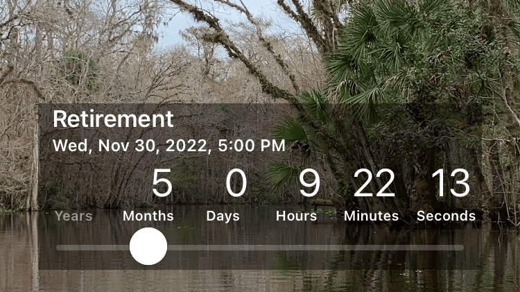
I have begun my countdown to retirement! Five months to go from today—and these are the questions and comments I get.

I am excited—and scared! However, I will never be bored.

So, what will I do? In addition to having a beautiful family and fabulous friends to hang with, my list goes something like this:

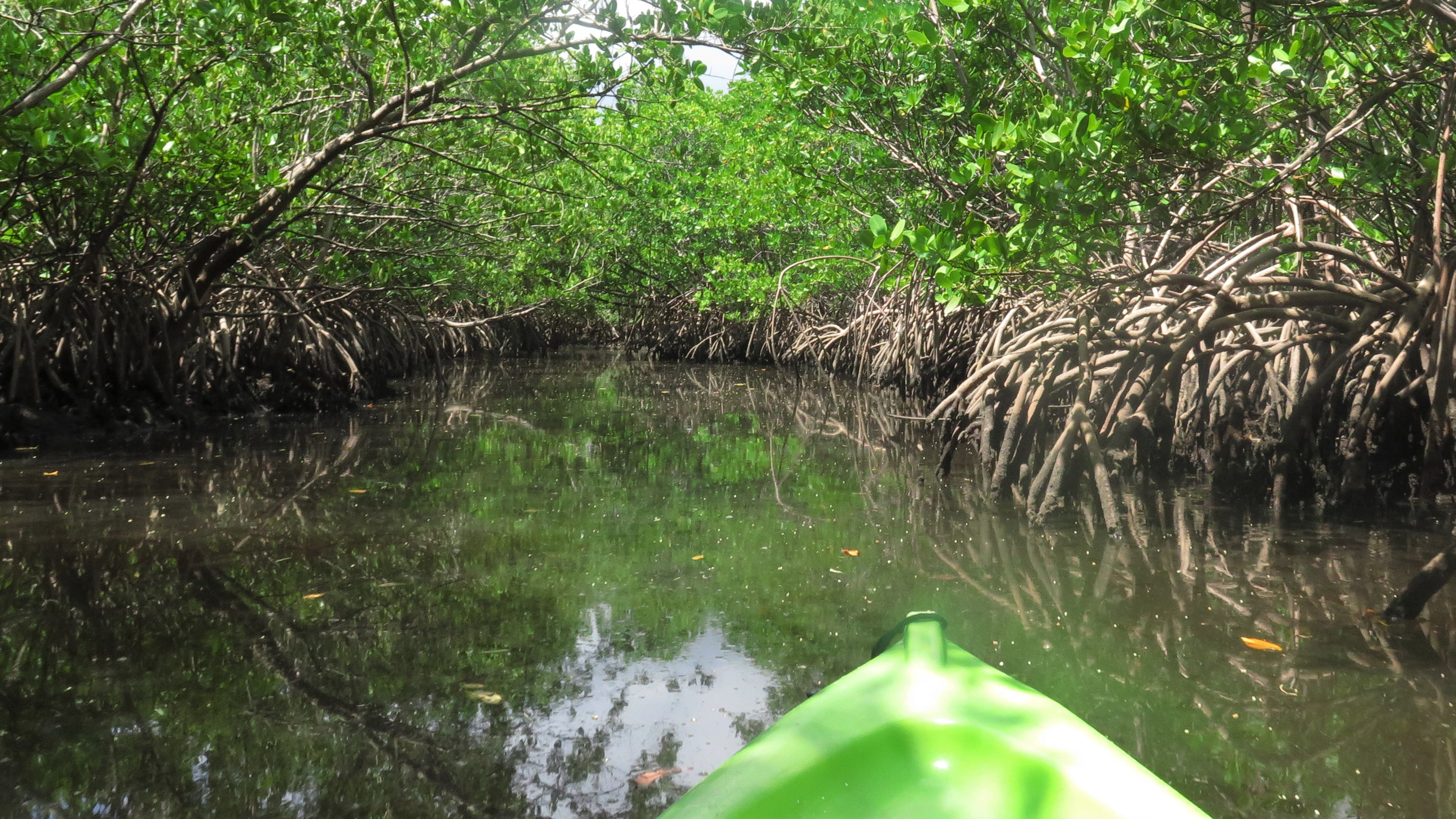
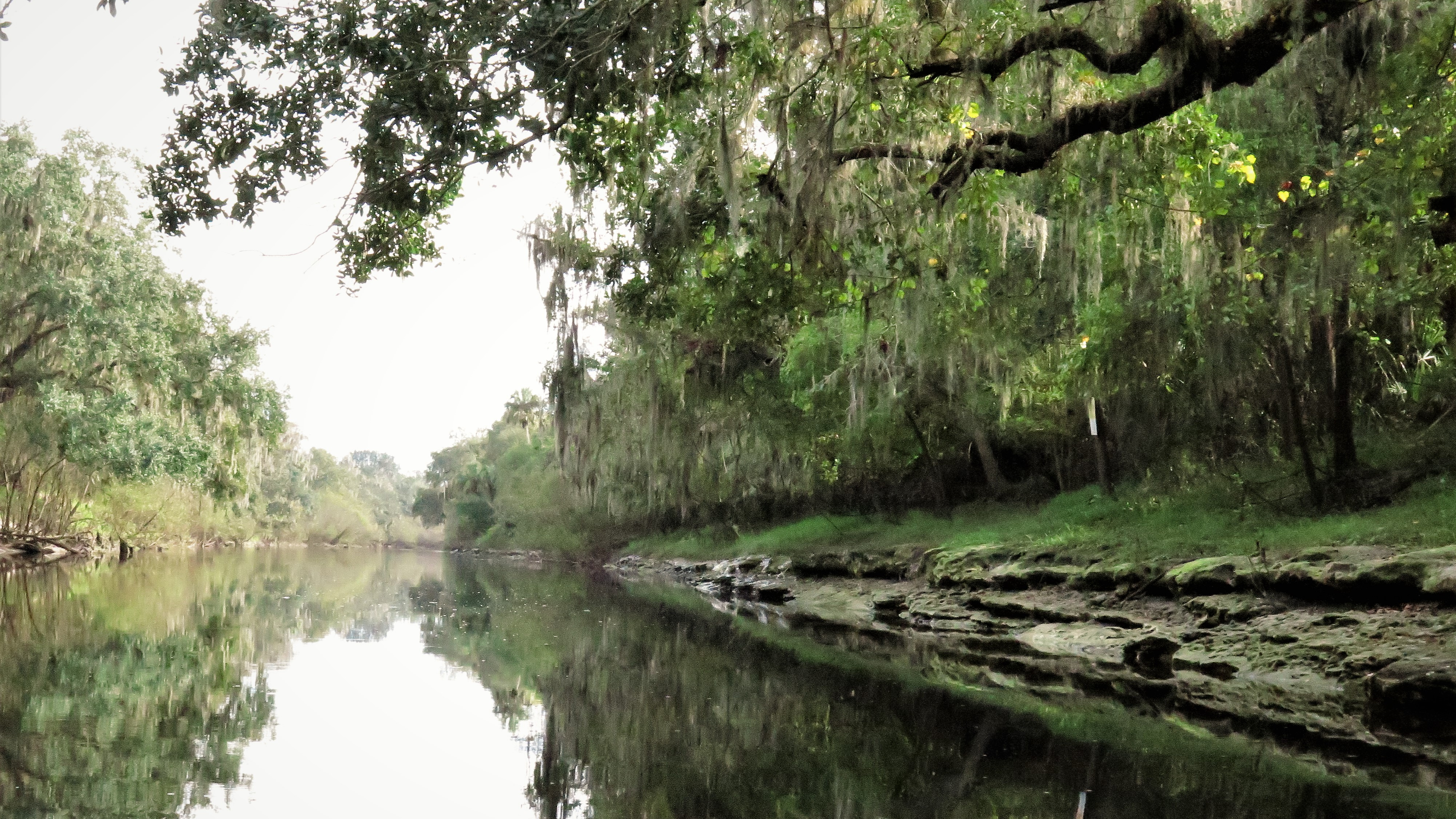
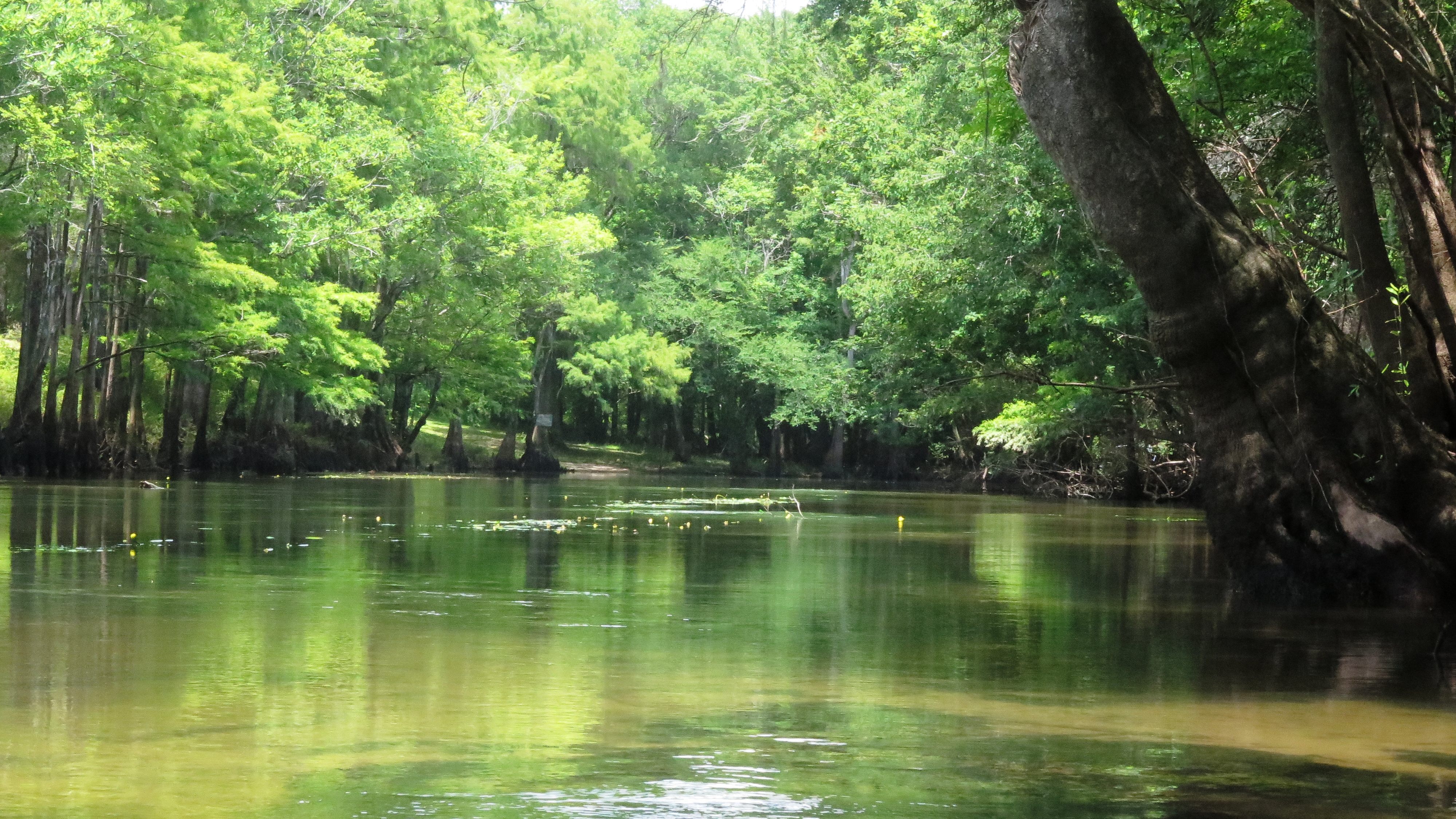
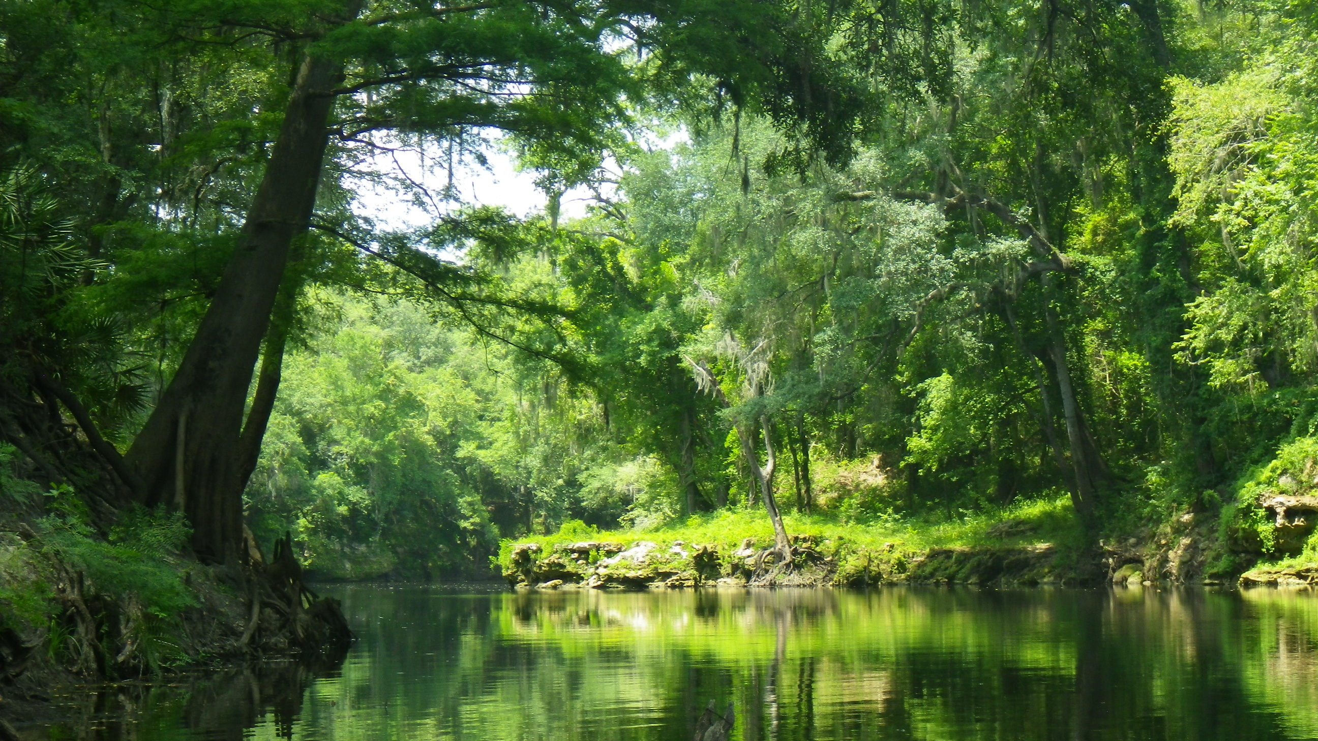
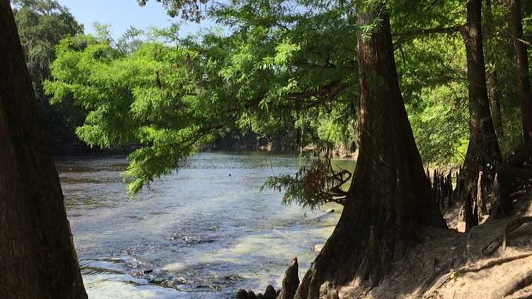
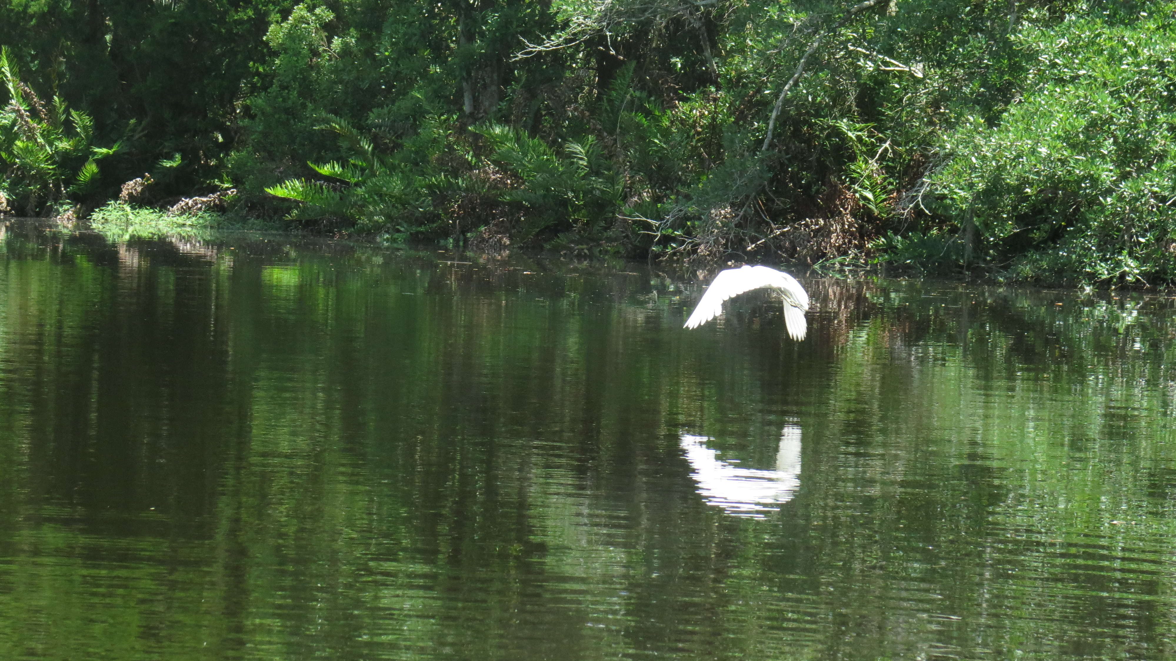
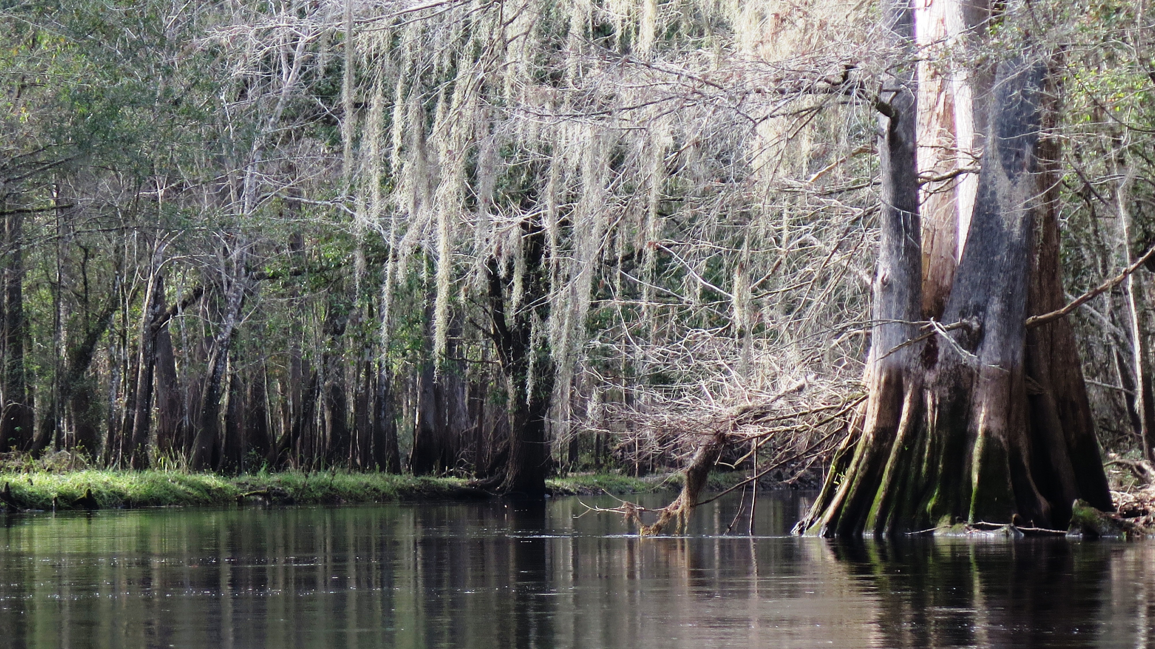
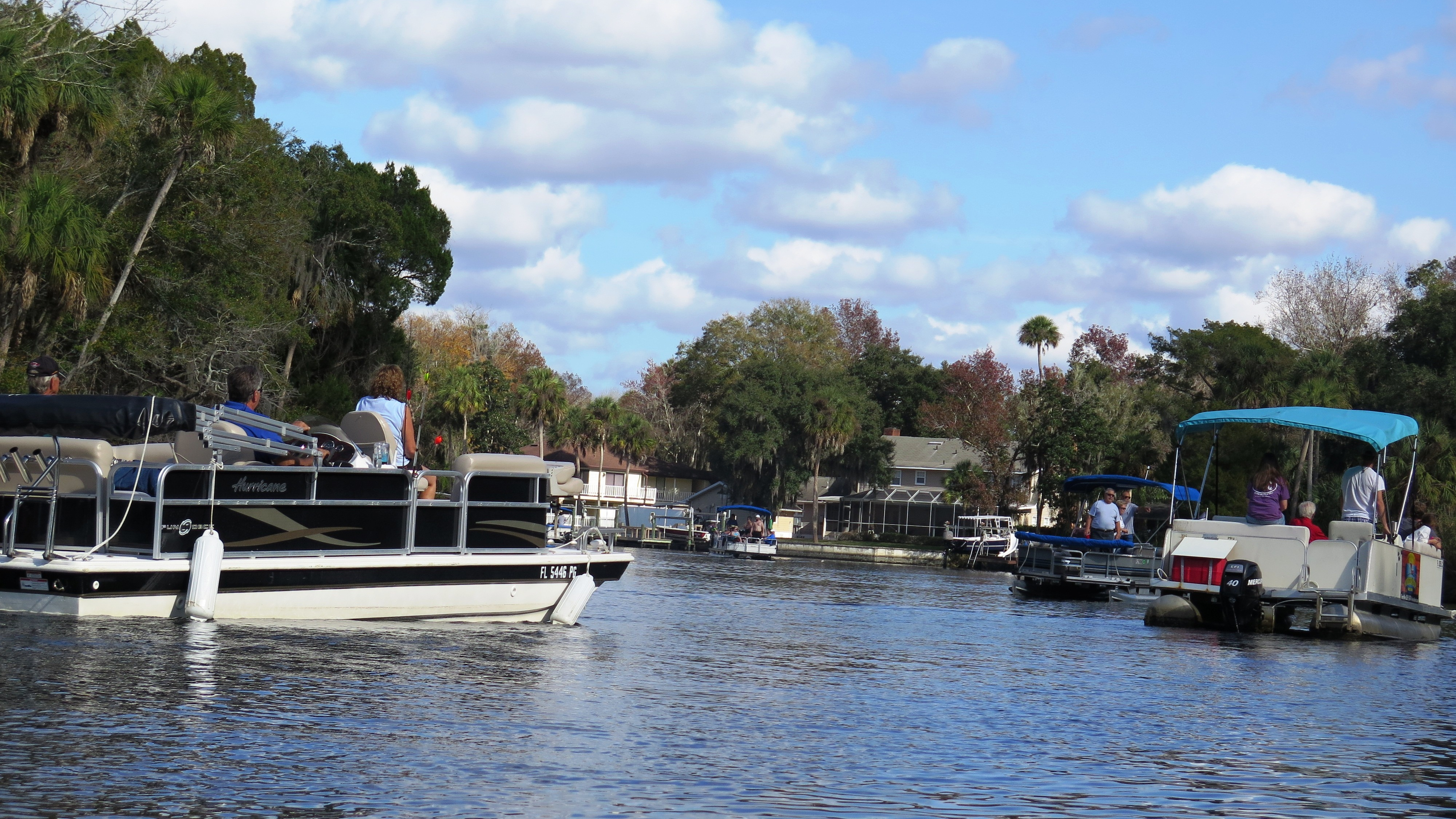
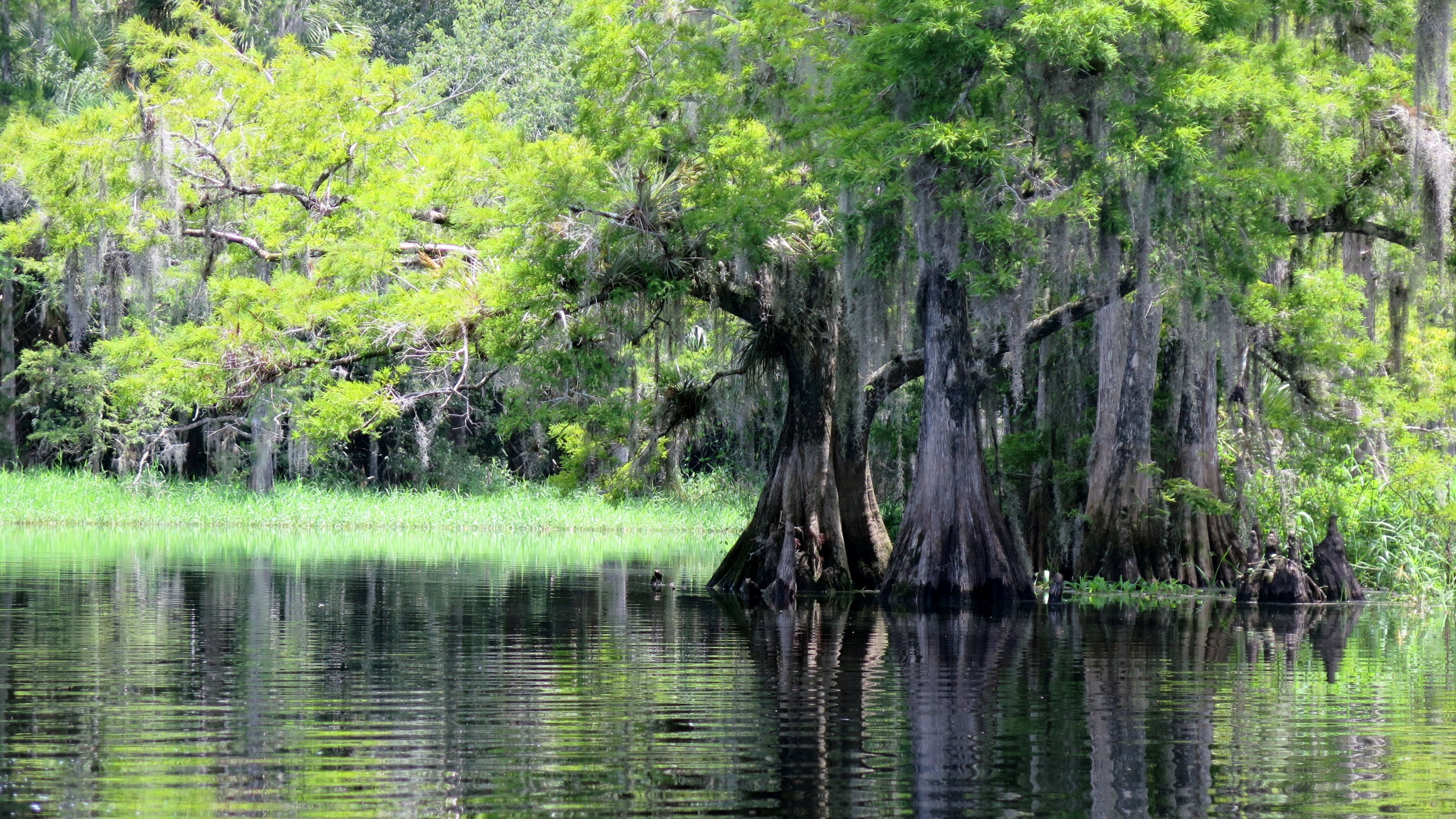
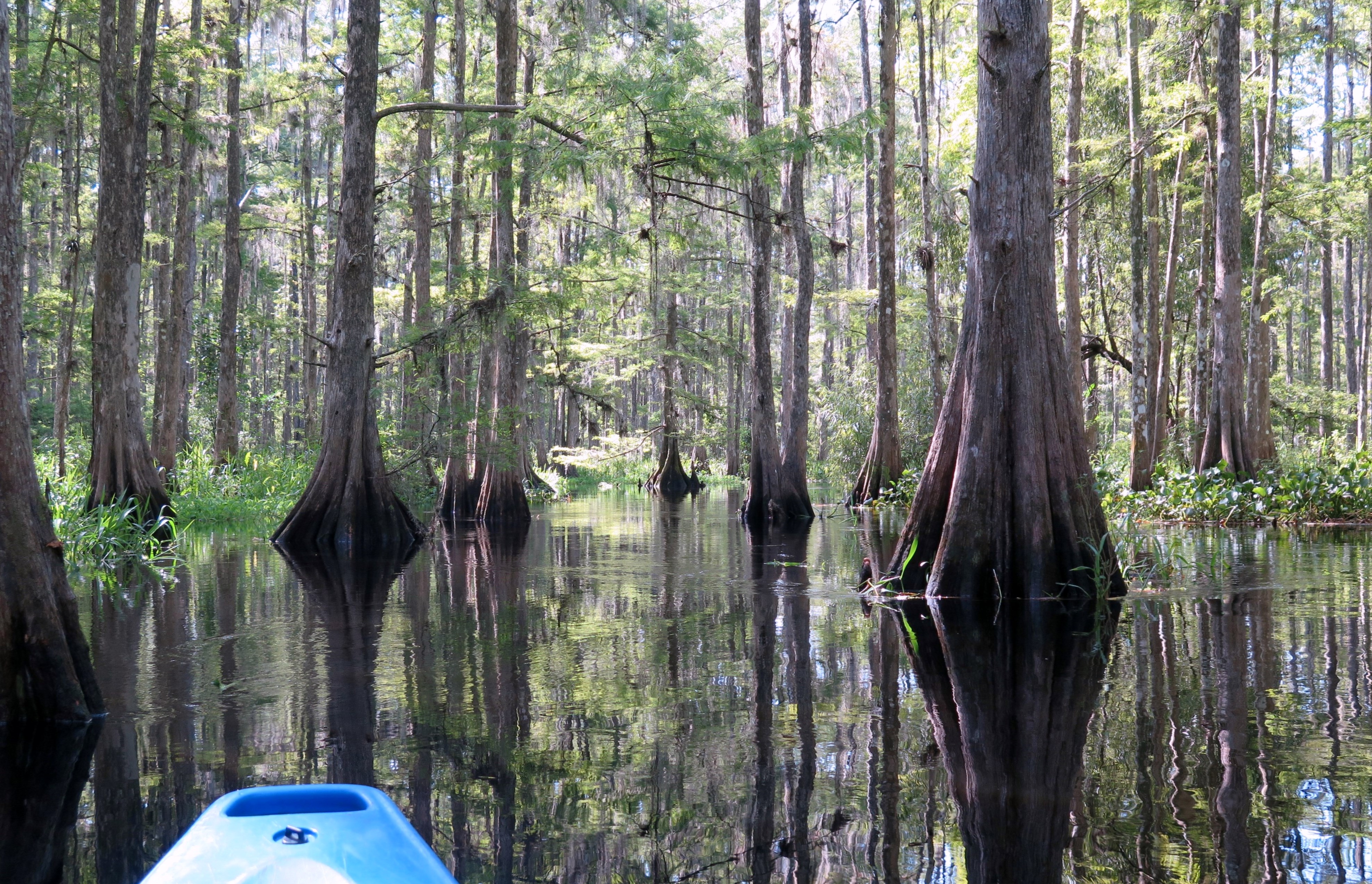
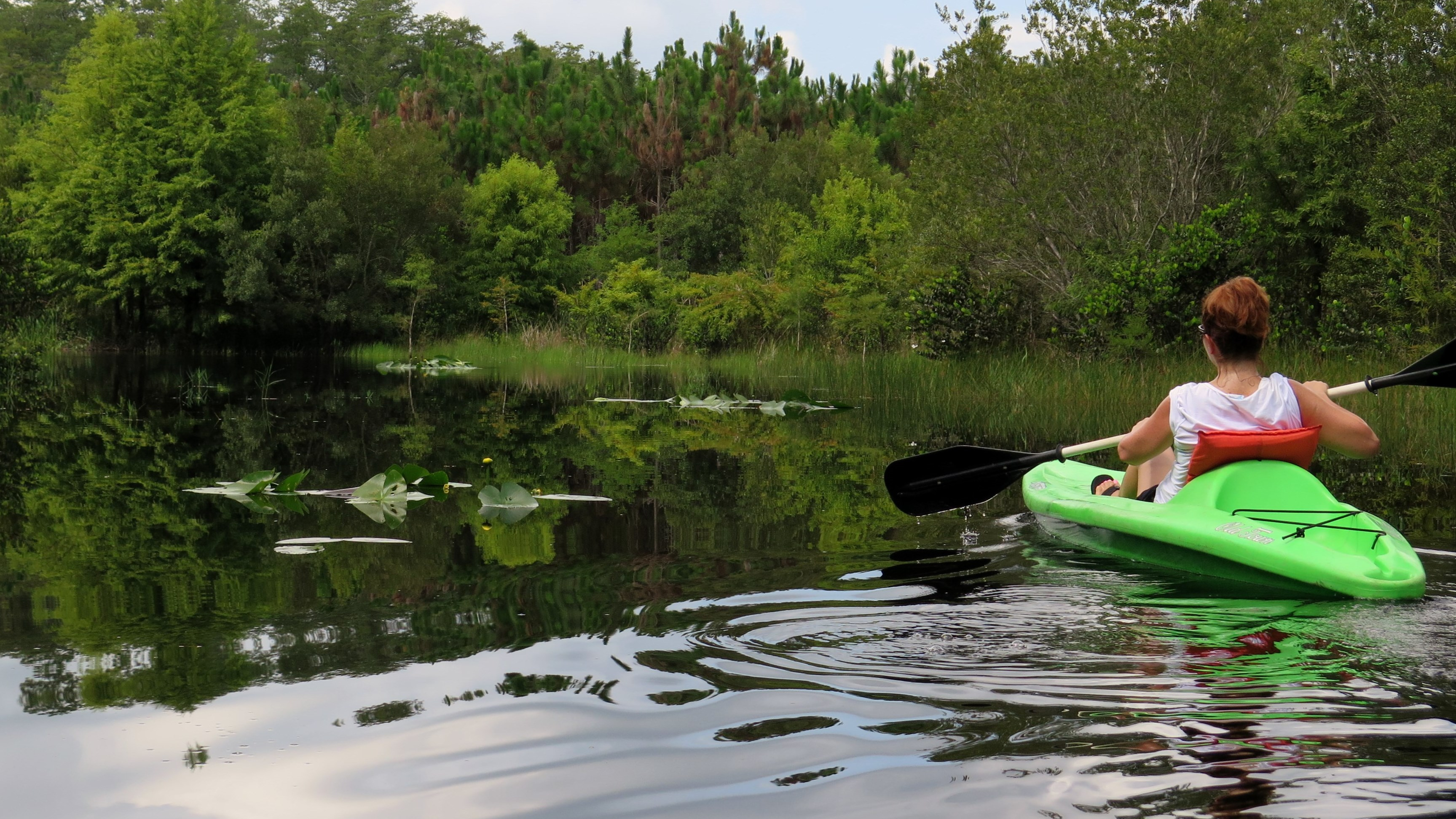
  • Finish kayaking the Florida rivers—and return to my favs!
  • Visit all the Florida State parks—hike the trails. They are fabulous! (Check them out: https://www.floridastateparks.org/.
  • Bike the Coast-to-Coast Florida trail—all 220 miles. (Check it out: https://floridadep.gov/parks/ogt/content/florida-coast-coast-trail.)
  • Hike the Florida Trail—and try to avoid the gators and snakes. (Seriously, this trail is 1,265.1 miles. Check it out: https://floridatrail.org/.)
  • Take a train ride…somewhere, anywhere!
  • Learn to play golf, play tennis, cook, and take great photos.
  • Continue to hike the Appalachian Trail. (I start in Georgia in September 2022.)
  • Go Glamping.
  • Learn to apply false eyelashes. (Ha ha… Just checking to see if you are still reading.)
  • Sip delicious wine in beautiful surroundings.
  • Adventure. Enjoy life. Appreciate nature.

This is just a start—and mostly local! Chances are, I will add to this list. I haven’t even begun to venture far from Florida yet. And yes, I realize this list is ambitious and perhaps impossible to complete before this sixty-plus year old body decides it’s had enough, but dang! I sure will have fun trying.

Me bored? Hardly. Watch me. 🙂

Read Full Post »

Another hot, sunny summer day in South Florida, and I had not been kayaking for over six months. Determined to paddle, I checked my list of rivers not yet paddled

and found one within an hour’s drive—Whiskey Creek. Honestly, I hadn’t even known it existed.

Heading South on Whiskey

I love when I find these unexpected treasures in Florida. A Florida Designated Paddling Trail, Whiskey Creek flows through the Dr. Von D. Mizell-Eula Johnson State Park in Dania Beach, dividing a stretch of land situated between the Intracoastal Waterway and the Atlantic Ocean. A tidal waterway, its water levels fluctuate with the tides. At low tide, the water level is too low to paddle the entire creek without getting out at some point to pull the kayak. This creek has so much history behind it. That which I find most interesting—during Prohibition times, it was these very same shallow waters that made the perfect escape for the rum-runners when the Coast Guard was in pursuit.

The morning I paddled, low tide was 8:18 a.m., and high tide was at 2:34 p.m. I arrived shortly after 10:00 but waited until 11:15 to put in to ensure the water level was high enough. I put in at the BG Whiskey Creek Hideout, the outfitter inside the park and at the north end of the creek. I paddled south, possibly the same route the rum-runners once took. Mangroves lined the right side of the waterway and sand dunes and sea grapes lined the left. Just over the dunes on the east side, 2.5 miles of Dania Beach welcomed tourists to its warm sands. Planes from the nearby Ft. Lauderdale airport flew overhead, a constant reminder of the city nearby.

Into the Mangroves

The thing about paddling mangrove waterways, there is little or no shade unless you paddle into the mangroves. So, I took my time and paddled the tea-stained waterway, moving in and out of the mangroves, enjoying both the shade and the quiet of nature. Herons (blue, tri-colored, black crowned night), ibis, and brown pelican found comfort in the same shade as I. Tiny crabs scuttled up huge mangrove root systems as I paddled by them.

The creek runs just under two miles to the south and connects with the Intracoastal Waterway. A paddler can paddle south to the Dania Marina and return on the same route or paddle the loop. I chose the loop and exited the creek just after the Dania Beach Pier, paddling to the Intracoastal and north to loop back to my put in—a total trip of about 3.8 mil

The loop took me about 3.5 hours to paddle, a long time for a 3.8 mile trip. However, I spent a lot of time discovering the mangroves and was slowed down by the waves of the Intracoastal on my return. I know I’ve said it before, but although the open waters are not my favorite paddle—I love the shaded, canopied waterways—there is never a bad day on a Florida waterway. I felt exhilarated.

I left the creek, exhausted from the sun and paddle and very thankful. We are so fortunate that the State of Florida has preserved these natural environments for us to enjoy.

(BG Whiskey Creek Hideout. 6503 N. Ocean Drive, Dania Beach, FL 33004 https://www.whiskeycreekhideout.com. (954) 929-4970)

Read Full Post »

After this political season, the Peace River seemed an obvious escape from the constant debating, bickering, posting and tweeting of the last few months. I needed to leave Facebook and Twitter behind and return to a place of solitude and serenity.

Peace River in the Fall

I had paddled the southern portion of the Peace River from Brownville to Arcadia (8 miles) on New Year’s Day 2011. I wanted to paddle another section this time, and I decided on a northern section from Paynes Creek State Park in Bowling Green to Pioneer Park in Zolfo Springs, an 11-mile paddle.

Jace, from Peace River Paddle Sports and Adventures, met me at the park and dropped me at the SR 664 Bridge about 11:30 a.m. I paddled away, looking forward to the next five hours of tranquility on the river. My first thought as my paddle sliced the water–“Aaahhhhhhh….”

What a beautiful sunny fall day! There is something mystic and wonderful about being the only person on the river. Just nature and me. A slight fall breeze kept me cool under the clear blue sky. I paddled the dark water, staying to the edges and the shade of the tall cypress and oaks. The cypress had already begun their preparation for winter, brown foliage cloaked in moss. The low water level had left the sloping banks with roots and limestone exposed. Cypress knees pointed to the sky. Welcoming sand bars tempted me to pause in my paddle and stick my toes in the sand.

I enjoyed an easy paddle on the waterway—with the exception of a few “woo-hoo” moments when I passed over small rapids formed by the low water passing over limestone shale beneath me. Noisy birds (herons, ibis, egrets, vultures, hawks) called from the trees and banks—enjoying the weather as much as I. Ibis strutted along the banks, curved beaks dipping in the sand. Vultures gathered around their decaying treasures. Two wood storks sat on a tree branch, taking it all in, turning towards each other as if making snarky remarks about the others.

Limestone Banks on the Peace

Several hours passed before I saw or heard anything other than the birds and the rhythmic sound of water hitting the side of my kayak. I paddled past a man who stood on a sandbar in the middle of the river sifting for fossils. A while later, I came upon a small family fishing on the bank. Then, as I neared Zolfo Springs, a kayaker passed me, and finally some campers appeared on the banks.

I floated back to where I had parked my car just before 4:30 p.m.


(Peace River Paddle Sports and Adventures. 207 Illinois Avenue, Wauchula, FL 33873. (863) 832-2102)

Read Full Post »

Olli and Robert pulled my kayak to the edge of the creek at Cotton Landing, just north of Cypress Springs. I looked to the south, at the winding waterway, shaded by cypress and oaks.

“Is the entire paddle like this?” I asked. Beautiful.

A Beautiful Paddle on Holmes Creek

I’m not sure why it surprised me, but it did. And now, knowing that this would be a great paddle helped make up for the port-a-potty, my only restroom option. A quick stop, and I finished packing my gear into the kayak, secured my cooler, and climbed in. Olli gave me a shove into the water, and I paddled away, smile on my face.

I had almost missed this one, Holmes Creek. For some reason, it seemed insignificant on the map. It originates a few miles north of the Florida- Alabama border. Its length includes about 20 miles of State Designated Paddling Trail between Cotton Landing and Live Oak Landing before it flows into the Choctawhatchee River. I’m not even certain that the portion I paddled from Cotton Landing is part of the official paddling trail. I often see paddles beginning a few miles south, around Vernon.

I paddled, taking in the beautiful forest of cypress, oak, tupelo, and sweet gum which seemed to snuggle and curve around the river. I had seen the water described as “emerald green,” but today it was cloudy and murky; I could not see the bottom of the creek. Robert had explained that recent rains had churned it up. The trees around me were…noisy! The sounds of the birds grew louder as I paddled. “She’s coming! She’s coming!” they seemed to scream.

Ten minutes into my paddle, I spotted the orange dot painted on a tree and paddled to the right towards Cypress Springs (as instructed). Beautiful clear blue-green water and a white sandy beach greeted me. People swam about in the springs, and kids swung from a rope tied to a tree. Others sat atop of a kayak or small boat enjoying the sun. I chatted with some of the locals. Bud and Missy sat in low chairs in the sand, bratwurst cooking in a smoker at the end of their small boat. They let me use a raft, flippers, and homemade viewer to paddle over the vent and get a better look at the springs.

Cooling Off at Cypress Springs

Missy and Larry talked about the history of the springs. Larry said that it is a man-made springs, dynamited and then connected to the creek. (I need to check this out.) I paddled around the springs for a bit, a perfect spot on a hot day.

From the springs, I had about a 3-mile paddle back to the outfitter—1.5 hours. I passed an occasional kayaker or small boat, but the creek remained peaceful. Although the current was light, it required little effort to paddle. My paddle was scenic and lovely. I attempted to find Becton Springs and paddled up another small waterway. Somehow, I managed to miss the orange dot and lost my way for a bit, never seeing the springs. Oh well, a good reason to return someday!

(Old Cypress Canoe Rentals. 2728 Traverse Drive, Vernon, FL 32462. (850) 388-2072. Dana/Olli/Robert)

Read Full Post »

Yippee for summer vacation! I headed to North Florida to paddle a few rivers. I had selected three: the Withlacoochee River North, the Wacissa, and Holmes. I stayed two nights in Live Oak, a very tiny town—and apparently “recently wet.” (a new term I learned from a bartender at what I believe was the only restaurant that sold liquor in Live Oak)

Lush Green on the Withlacoochee River North

Sunday morning, I headed to Withlacoochee River North, renting a kayak from Lucas at the Suwannee River Canoe Rental. Lucas dropped me at Blue Spring about 10:30 a.m.—not nearly early enough to beat the many families already splashing around in the clear cool water. Where else would one go on such a hot day? It was in the 90s, but it would feel in the 100s by mid-afternoon. Lucas would pick me up at the Suwannee River State Park—a 12-mile paddle from here (longer than usual for me!). It would take me about 6 hours—did I mention how hot it was?

There are two Withlacoochee Rivers in Florida. I have paddled the Withlacoochee River South—which originates in the Green Swamp—twice. I loved it. The Withlacoochee River North originates in Georgia. Its black waters flow about 70 miles in Georgia and then another 32 miles in Florida before the river finally flows into the Suwannee River. I would be paddling the final 12 miles of the river.

Lucas had told me that given the choice, most people chose the Suwannee over the Withlacoochee. He explained that the Suwannee has higher limestone banks and more sandy beaches for paddling picnics. I paddled the Suwannee a few years ago, and although beautiful, I had been surprised at the amount of trash along the river. The price of being popular, I suppose.

I paddled south and took in the “Withs” limestone banks, etched out by the movement of the water over the years which created beautiful designs and little caverns. The surrounding green forest of cypress, oak, maple and tupelo trees shaded the edges of the river, giving me a little break from the hot sun. Moss hung from the trees as if stretching to reach the river. Dark green ferns poured down the banks. This picturesque scene only needed a plantation to complete it. What a beautiful river!

Shoals on the Withlacoochee

Large fish jumped around me as I paddled. I laughed, thinking one would land in my kayak. Herons, hawks, turkey vultures, ducks and turtles braved the heat. I passed only an occasional paddler or flat-bottom boater along the way. I stopped by other springs, smaller than Blue: Pott, Tanner, and Suwanacoochee.

I heard the shoals before I saw them. Seriously, I thought I was approaching a sizeable water fall! But alas, most of the shoals were quite harmless. The final two shoals were much more fun, and the last one included a little white water as well! The small soaking I received helped to cool me down. Just after the last shoal, I spotted a deer on the west bank that had come to the river for a sip of cool, spring water.

As much as I loved paddling the Withlacoochee, after six and a half hours, I was happy to see the Suwannee River. Lucas was already there waiting for me.

(Outfitter: Suwannee River Canoe Rental. U.S. Highway 90, 4404 193rd Drive, live Oak, GL 32060. https://www.suwanneerivercanoerental.com/. (386) 364-4185. Lucas)

Read Full Post »

Spring term at the College had ended, and I desperately needed a get away! Don’t get me wrong; I love my job. However, the time had come to pull out my river guide books and my map and find a new paddle destination. I selected the Pithlachascotee River on the west coast.

A Quiet Day on the Cotee

It has taken me several years to get around to paddling the Pithlachascotee River—or the “Cotee” as those who know it well refer to it. I love the winding, twisting, secluded rivers—drop me in the swamp with no humans for miles around, and I’m happy. Much of the Cotee is an urban river, flowing through the town of New Port Richie—with the houses and busy boat traffic that accompany a wider, urban river. Thus, the delay.

So, I paddled the Cotee on a Friday morning, and I managed to avoid human contact almost completely. I put in at the James E. Grey Preserve–renting a kayak from Gill Dawg Marina (They dropped off and picked up!). I headed east, towards the river’s source, curious to see how far I could paddle before the fallen trees forced me to turn around.

The blackwaters of the Cotee flow about 25 miles from its source to the Gulf. The five-mile paddle from the Rowan Road Bridge to the Francis Avenue City Park is the official canoe trail. I planned to travel from the Preserve, east to Rowan Bridge and beyond, and then turn around and paddle west past my put in to the Francis Avenue City Park, and then, back to the Preserve.

I found the portion from my put-in at the Preserve to the bridge (east) and beyond, challenging—but lots of fun! I made the bridge in about 20 minutes and was able to paddle for another 30 minutes before I was forced to turn around. Along the way, the trees and brush dusted me with twigs and webs as I scrapped between fallen branches. I got stuck on submerged logs several times, and I was grateful to be in a sit-on-top kayak and able to hang my legs outside the kayak to shove myself off (a pretty picture, I know!).

A Heron on the Cotee

I saw little wildlife as I paddled—an occasional heron and a few turtles sunning themselves. Fish jumped around me in the murky waters. Heading west, the canopy disappeared, and the river widened and took on an estuarine quality, tall sea grasses lining the banks. Once I reached the Francis Avenue City Park, I made my turn and paddled back to the Preserve.

(Outfitter: Gill Dawg Marina. 5419 Treadway Drive, Port Richey, FL 34668. https://www.gilldawg.com/get-on-the-water/. (727) 842-1070)

Read Full Post »

For the New Year, I chose Withlacoochee River South as my “old” river—one which I had previously paddled. Coincidentally, I had paddled this river for the first time two years ago on the same day—December 28. I love, love, love this river; this is a “must paddle” river for anyone who enjoys nature, peaceful serenity, and paddling.

Bare Cypress Adorned with Moss

Withlacoochee is a Native American term that means, “little big water” or “crooked river.” When I paddled the “With” two years ago, the water level was low—a “little water.” Although Jacqui, operator of the RV

Park, dropped me as close as she could to the river’s source, the Lacoochee Park put-in, I had wanted to be closer. This time, with the water level higher, a “big water,” she dropped me deeper into the forest, at the High Bluff put in—closer to the river’s source but still about a two-hour paddle away. From High Bluff, I expected at least a 3-hour paddle back to the RV Park, so I decided not to paddle deeper into the swamp before heading west and back to the outfitter.

On the drive to High Bluff, Jacqui pointed out the site where the Cummer Sons Cypress Company sawmill once stood. The Cummer brothers built the mill in 1922, and for nearly four decades until the mill closed in 1959, Lacoochee prospered and grew (East Pasco Historical Society) —at the expense of the cypress, of course.

So, I paddled away from the High Bluff put-in. I wore an orange vest as I did two years earlier; it was hunting season (hogs and deer). It felt like winter on the river. Tall cypress, now bare except for moss that hung like tinsel on last year’s Christmas trees, surrounded me. I felt grateful that the Cummer brothers had left some cypress for me to enjoy. What a beautiful river!

Lost in the river’s magic and to the outside world, I moved with the swift, gentle current. The high waters had flooded over many banks and into the trees, leaving me to wonder, at times, whether I was still on the river or had floated into the watery forest. Dark bands around tree trunks revealed to me that this “little big river” could get bigger still. High waters had forced the wading birds (cormorants, egrets, and ibis) deeper into the woods, and the river remained quiet with the exception of the occasional splash of a gator’s belly flop.

An Occasional Bird Appears

The river was awesome, and I was awestruck. Old wood-framed houses began to pop up as I neared the outfitter—way earlier than I expected. I arrived at the outfitters in less than two hours from my put-in.

(Withlacoochee RV Park and Canoe Rental. 39847 State Road 575, Lacoochee, FL. (352) 583-4778)

Read Full Post »

In the spirit of the New Year fast approaching, it seemed appropriate to select two rivers to paddle–one new river (one which I have never paddled) and one old river (one which I had previously paddled). I chose the Homosassa River in Homosassa, Florida, as my “new” river.

A Busy Homosassa River

The Homosassa River originates at the Homosassa Springs in Citrus County. From there, the river travels about 8 miles westward before emptying into the Gulf. The Homosassa Springs State Wildlife Park sits at the river’s headwaters. I toured the park this past summer and even visited the underwater viewing room to watch the fish and manatee from below. Pretty cool. The Homosassa is designated as an Outstanding Florida River, and by Florida Statute, it is “worthy of special protection because of [its] natural attributes” (Florida DEP).

From where I put in at Riversport Kayaks, I could see the considerable development along the river with homes and businesses. Small motor boats and pontoon boats filled with sightseers watching for manatees crowded the river heading east towards the springs. The sounds of puttering motors and country music filled the air, and there was no question that this would be a fun, rather than serene, paddle.

It was afternoon, and I paddled away under a beautiful, sunny sky with a light breeze—perfect weather for paddling. Kayakers and paddle boarders enjoyed the lazy afternoon keeping to the shoreline. I followed the crowd and paddled toward the springs as well, catching my first whiff of gas fumes just as a manatee ducked beneath the surface in front of me.

Outside the protected springs area, snorkelers swam in groups, hoping to make friends with a manatee. I paddled among the boats and then ventured into a couple of the river’s little nooks hoping to glimpse a bit a nature unaffected by all the commotion. I took a detour to the north and paddled under a bridge onto the Halls River, leaving the boats and country music behind on the Homosassa. Halls is a spring-fed tributary of the Homosassa, only about 3.5 miles long. It’s surrounded by tall marshy grasses. I explored a more shaded and narrower branch of the river for a while, and then I headed back to the outfitter—not spending near enough time on this river. Perhaps I will return to this river next year for a paddle to the springs.

(Riversport Kayaks. 5297 S. Cherokee Way, Homosassa, FL. https://www.riversportkayaks.com/. Email: rskkirk@gmail.com. (352) 621-4972 )

Read Full Post »

I’ve been paddling Florida rivers about four years now, and there’s no question that I would give Fisheating Creek four stars as one of my favorite paddles. I first paddled Fisheating in October 2011 with a friend—and what an awesome experience! Only a two-hour drive from home, I chose this as my next “re-paddle destination.”

Beautiful Cypress on Fisheating Creek

I rented my kayak from Fisheating Creek Outpost in Palmdale, and Mike dropped me—along with eight others—at the Burnt Bridge put-in around 9:30. This is the same paddle I did three years earlier, about 8 miles, 4 hours. On the way to the put-in, we passed through two locked gates and over the Lykes Brothers’ property. Mike pointed out a crested caracara sitting atop an old tree. He told us to watch for panthers in the fields as several had been spotted recently. I listened to the folks traveling with me as they chatted about snakes they’ve encountered on their paddles, and I cursed that I had left my snake knife in the car. We arrived at the put-in and piled out of the van, but stood aside while Mike first scooted a couple small gators away from the beach!

Fisheating Creek flows into Lake Okeechobee, apparently the only free-flowing tributary that does. Paddling it, it seemed three different waterways to me. At the Burnt Bridge put-in, the creek was wide, tall cypress dripping with Spanish moss and air plants on each side. Within 30 minutes, I paddled into the cypress swamp and twisted and turned around the cypress and their knobby knees, trying to follow the swift tannin-colored flow. When I emerged from the swamp, I entered a creek, smaller than the original but with a more definite path than the swamp trail. Now, I paddled around grass islands. For the next few hours, my paddle continued in this manner with the ever-changing waterway.

Entering the Cypress Wonderland

I love that Fisheating feels so wild! There are no homes along the banks, just beautiful tall cypress. Much of the creek lies within the Fisheating Creek Wildlife Management Area, purchased from the Lykes Brothers years ago. I heard few sounds other than the ibis honking loudly from the swamp floor. I paddled under the hot sun, appreciating the occasional cloud that gave me shade. A crested caracara flew overhead; a few small gators bobbed in the water as I passed; an anhinga stood on a log, scouting for lunch. Life was good.

I just love Fisheating Creek—still an awesome paddle!

(Fisheating Creek Outpost. 7555 US Highway 27 North. Palmdale, FL 33944. https://fisheatingcreekoutpost.com/. (863) 675-5999)

Read Full Post »

Having spent the last two months moving and renovating my new condo, I have not had time to take my usual summer paddling vacation to the far corners of Florida. However, I have made a couple return trips to some of my favorite paddling destinations closer to me—one of them Loxahatchee River in Jupiter, Florida. This time, I brought along a good friend, Barb.

Barb Paddles Riverbend Park

We’ve had a rainy summer in Florida this year, and the rain started as Barb and I drove I-95 to get to the park. We vowed then to paddle rain or shine! Magically, the sun poked through by the time we arrived at the park, and the rain stayed away for the next few hours. All this South Florida rain did have its benefits, though, as the Riverbend trip is not always open at the park as it relies on the higher water level.

What I like best about the Riverbend paddle (besides the beautiful scenery and safe location) is that the scenery changes every few minutes. It’s a 5.5 mile paddle that begins and ends in the Loxahatchee River but travels through various sections of the park in between. It passes through fun-sounding places such as Picnic Loop, East Slough, Cow Pond, West Lake, Hunters Run and South Pond. Within the paddle are two portages—easy enough. Along the way, we spotted bikers, walkers, and even a painter! We stopped along West Lake for a stretch and a snack before moving on. I had looked forward to our paddle through the large culverts and the cypress knees, but dang if we made a wrong turn somewhere and ended our trip without passing through them!

Even without the culverts and the knees, we had a great paddle and a fun day at Riverbend. We ended our outing with lunch at Guanabanas in Jupiter—what could be better?

(Outfitter: Riverbend Rentals in Riverbend Park. 9060 W. Indiantown Road, Jupiter, FL 33478. https://www.jupiteroutdoorcenter.com/riverbend-park/rentals/. (561) 746-7053).

Read Full Post »

Older Posts »

%d bloggers like this: