Feeds:
Posts
Comments

Posts Tagged ‘paddle’

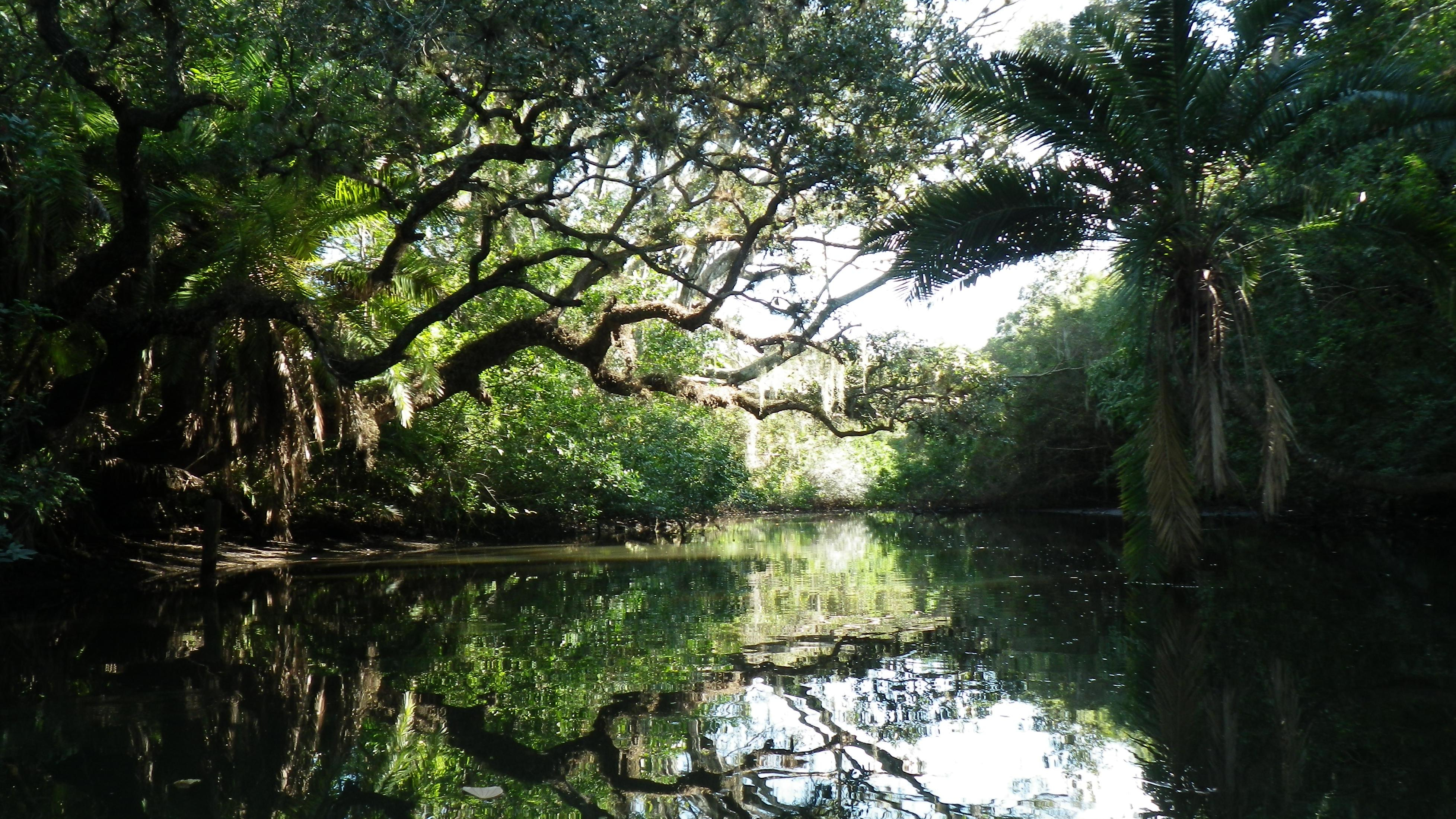
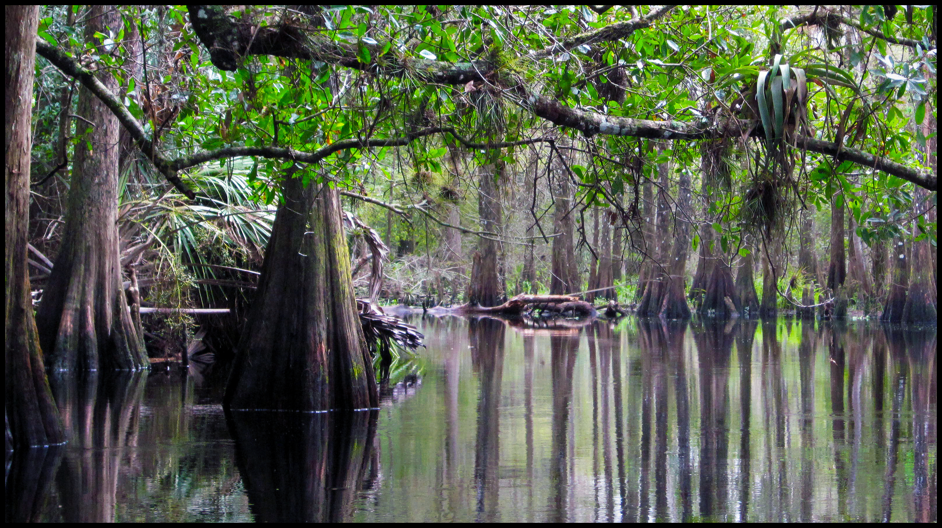
Olli and Robert pulled my kayak to the edge of the creek at Cotton Landing, just north of Cypress Springs. I looked to the south, at the winding waterway, shaded by cypress and oaks.

“Is the entire paddle like this?” I asked. Beautiful.

A Beautiful Paddle on Holmes Creek

I’m not sure why it surprised me, but it did. And now, knowing that this would be a great paddle helped make up for the port-a-potty, my only restroom option. A quick stop, and I finished packing my gear into the kayak, secured my cooler, and climbed in. Olli gave me a shove into the water, and I paddled away, smile on my face.

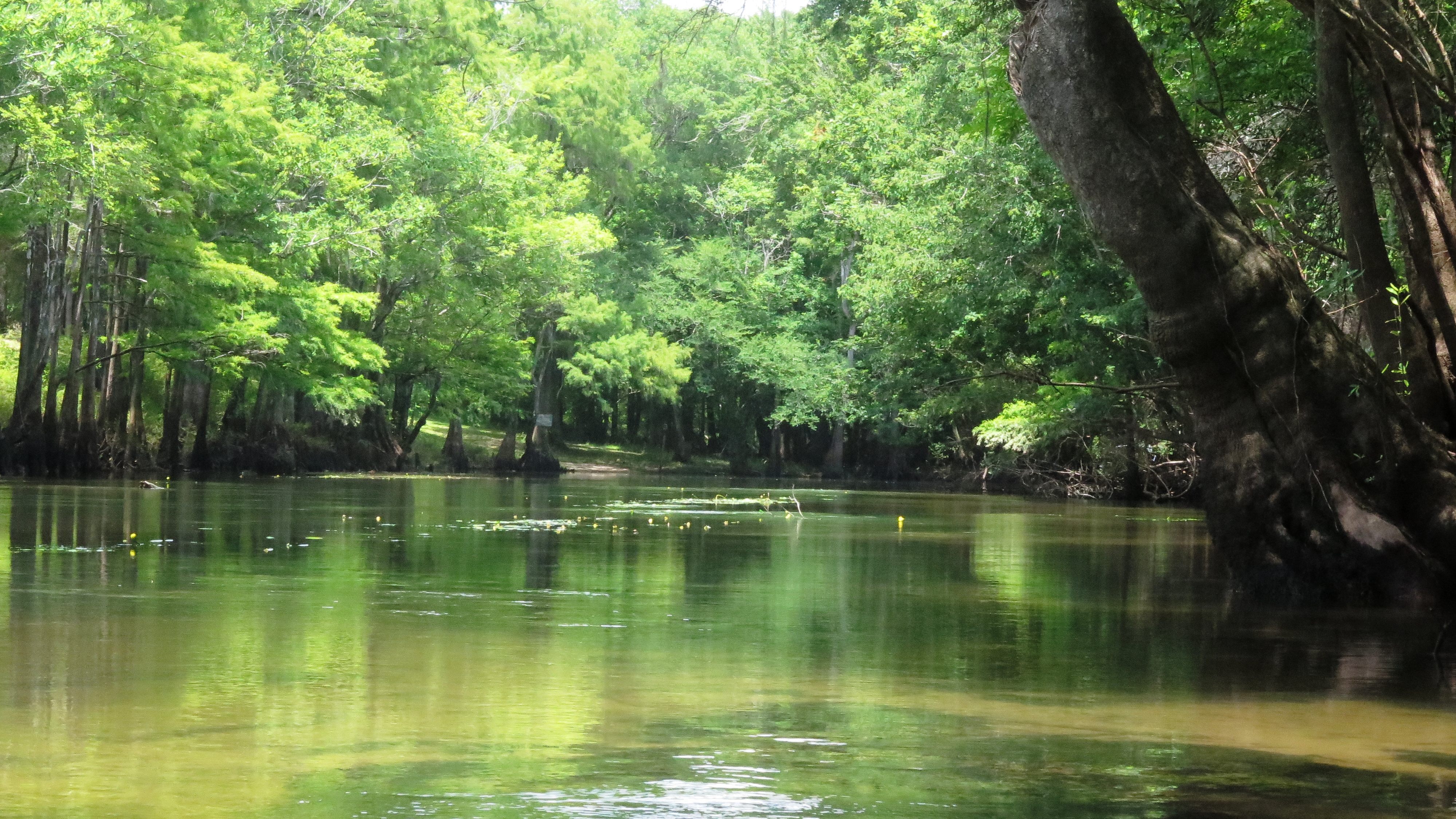
I had almost missed this one, Holmes Creek. For some reason, it seemed insignificant on the map. It originates a few miles north of the Florida- Alabama border. Its length includes about 20 miles of State Designated Paddling Trail between Cotton Landing and Live Oak Landing before it flows into the Choctawhatchee River. I’m not even certain that the portion I paddled from Cotton Landing is part of the official paddling trail. I often see paddles beginning a few miles south, around Vernon.

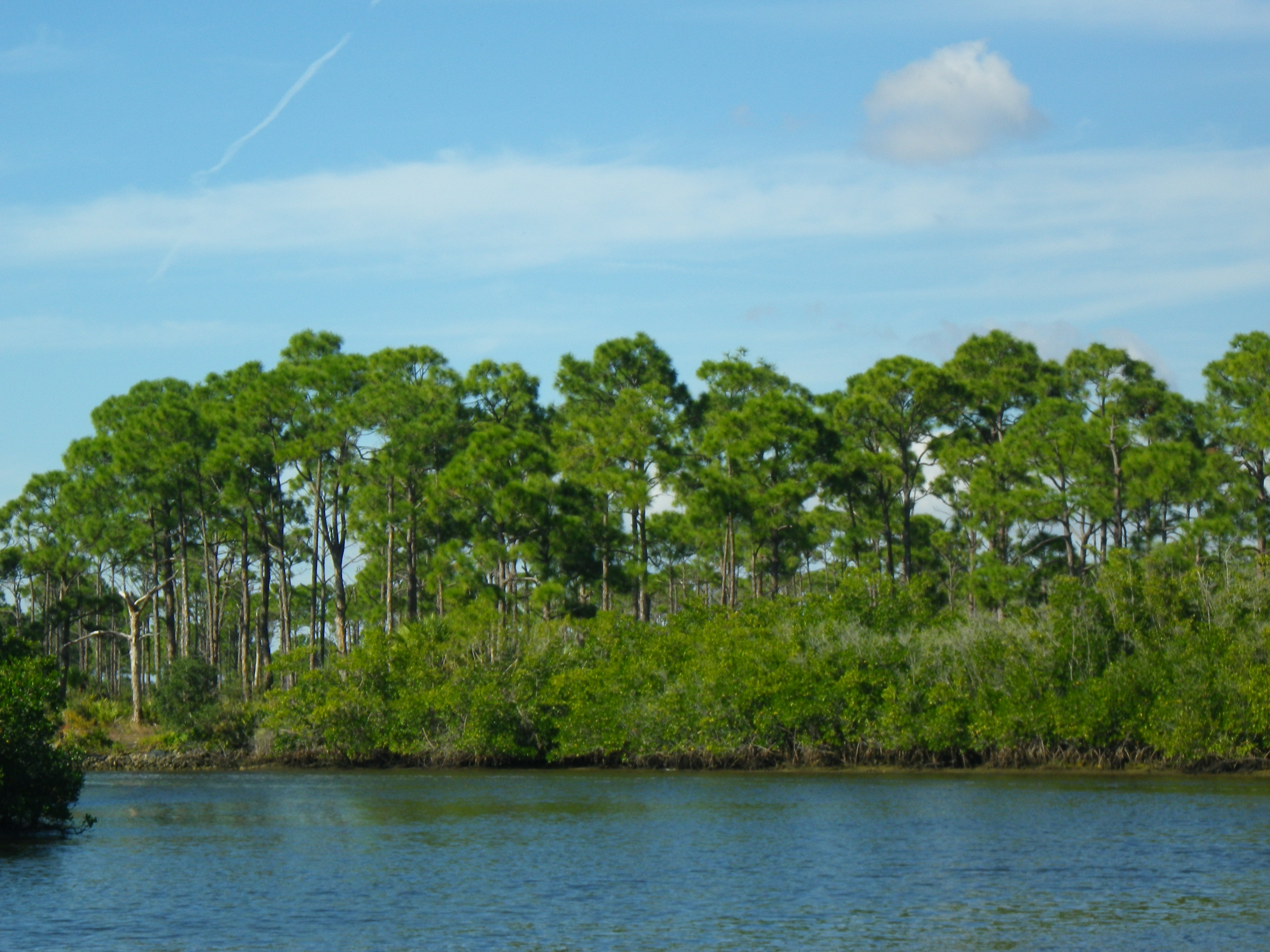
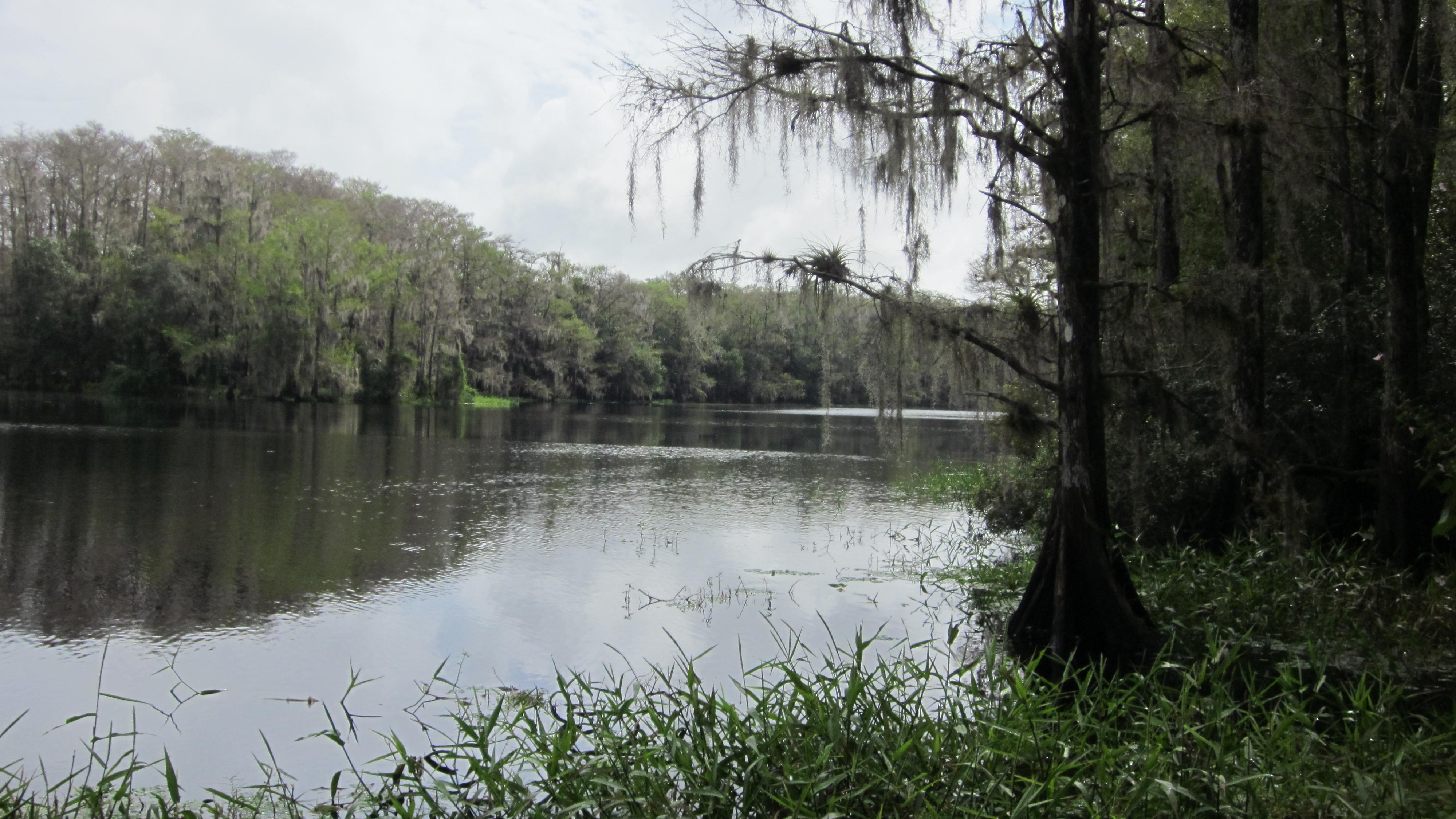
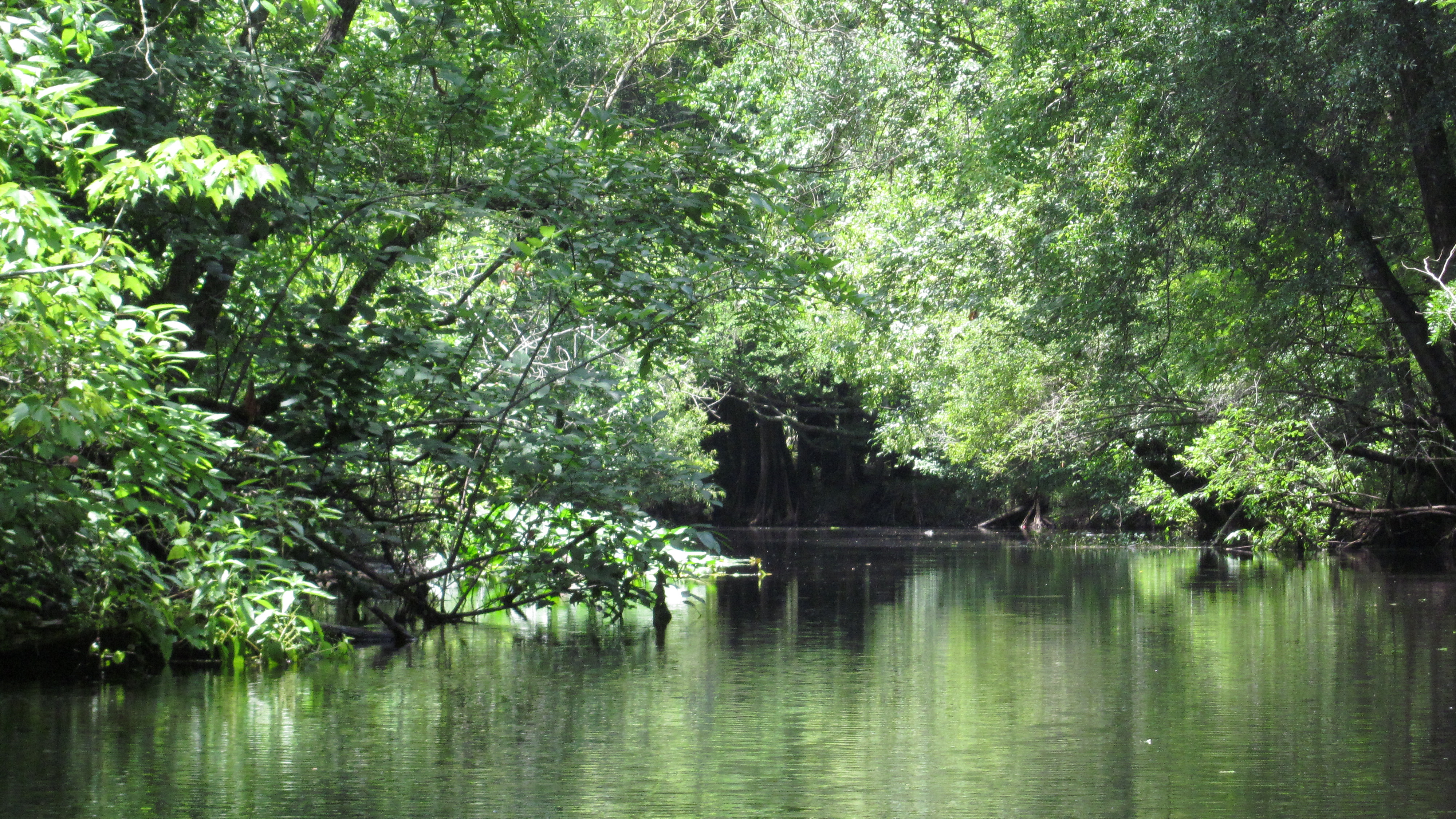
I paddled, taking in the beautiful forest of cypress, oak, tupelo, and sweet gum which seemed to snuggle and curve around the river. I had seen the water described as “emerald green,” but today it was cloudy and murky; I could not see the bottom of the creek. Robert had explained that recent rains had churned it up. The trees around me were…noisy! The sounds of the birds grew louder as I paddled. “She’s coming! She’s coming!” they seemed to scream.

Ten minutes into my paddle, I spotted the orange dot painted on a tree and paddled to the right towards Cypress Springs (as instructed). Beautiful clear blue-green water and a white sandy beach greeted me. People swam about in the springs, and kids swung from a rope tied to a tree. Others sat atop of a kayak or small boat enjoying the sun. I chatted with some of the locals. Bud and Missy sat in low chairs in the sand, bratwurst cooking in a smoker at the end of their small boat. They let me use a raft, flippers, and homemade viewer to paddle over the vent and get a better look at the springs.

Cooling Off at Cypress Springs

Missy and Larry talked about the history of the springs. Larry said that it is a man-made springs, dynamited and then connected to the creek. (I need to check this out.) I paddled around the springs for a bit, a perfect spot on a hot day.

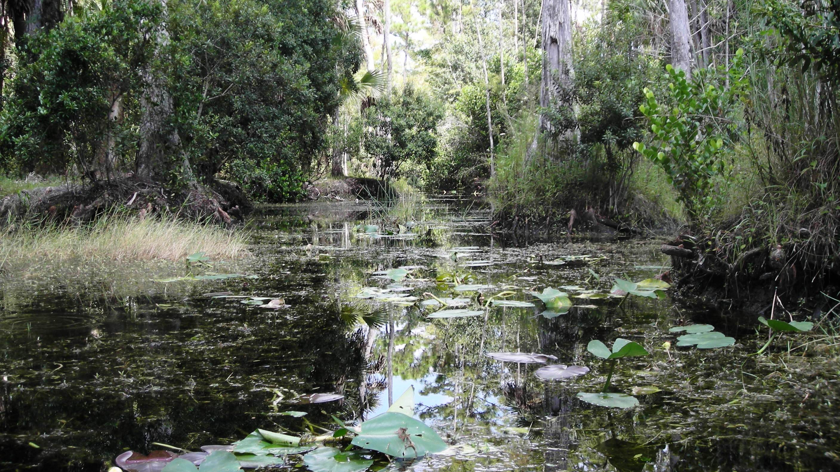
From the springs, I had about a 3-mile paddle back to the outfitter—1.5 hours. I passed an occasional kayaker or small boat, but the creek remained peaceful. Although the current was light, it required little effort to paddle. My paddle was scenic and lovely. I attempted to find Becton Springs and paddled up another small waterway. Somehow, I managed to miss the orange dot and lost my way for a bit, never seeing the springs. Oh well, a good reason to return someday!

(Old Cypress Canoe Rentals. 2728 Traverse Drive, Vernon, FL 32462. (850) 388-2072. Dana/Olli/Robert)

Read Full Post »

The more time I spend on Florida rivers, the more I’ve come to feel that the river cannot be rushed, that the longer the paddle, the better.  However, with this paddle, I discovered that when time does not allow for a long, leisurely paddle, a “quickie” paddle can still satisfy the senses—at least for the moment. 

The Picturesque Spruce Creek

My sister, Missy, and I paddled Spruce Creek in Port Orange on a Sunday morning in May.  Now, although my guidebooks recommend putting in at the eastern end of the creek, near Strickland Bay and Spruce Creek Park, we opted for a location closer to us, and we put in on the upper, western end, renting our tandem kayak from Cracker Creek Canoes in the privately-owned Spruce Creek Preserve.

Spruce Creek originates not far from this point, in the freshwaters of the cypress swamps.  To the west, there is less than a mile of waterway that can be navigated.  To the east, it’s less than 8 miles to Strickland Bay.  We didn’t want to miss the wild section of the river, so we began our paddle by heading west on the narrow, winding blackwater stream.   

It didn’t take long to realize why this little creek is both an Outstanding Florida Waterway and a Florida Designated Paddling Trail.  We gazed upon the picturesque creek, shaded by overhanging oaks, maples and cypress reflecting in the dark water.  On the left, high banks led up to wooded areas and one, maybe two homes tucked away.  To the right, the water spread out, seeping into the low cypress wetlands.  Deep in the woods, the birds called to each other from the trees.  

The further west we paddled, the more we had to skirt around or duck under fallen trees.  It took us less than 30 minutes to reach a point where the narrowing creek and downed trees forced us to turn around and paddle back east.  

Now, heading east, past our put in, the creek widened.   Two great blue herons greeted us, flying up the river.  A cormorant sat atop of a pole in the water, seemingly unbothered by the company.  Woodpeckers tapped away, busy at work on an overhanging tree.  We could see and hear the mullet jumping around us, close enough to get us wet as they flopped gracelessly out of the water.  We saw schools of them below us, swimming in the dark water.

If we had paddled further, we would have noticed even more of a change in the creek.  As it nears Strickland Bay, the creek and its surroundings become more estuarine with grass flats, salt marshes, and mangrove forests.  But, alas, our time was up!  We turned around and headed back to our put in.

(Outfitters: Cracker Creek Canoes, Port Orange, FL 32128. http://crackercreek.com/. (386) 304-0778)

Read Full Post »

New Years Day turned out to be a perfect day, bright and sunny, not too hot.  I paddled the Estero River in Fort Myers, expecting to see a different landscape, as this river has a tidal influence.  The river’s flow begins as trickles on the west side of the Corkscrew Swamp in Naples.  As it travels west, it picks up more water, and eventually empties into the Estero Bay. Only about six miles of this coastal river can be paddled. (Boning)

Up River on the Estero

I put in at Estero River Tackle and Canoe Outfitters off of South Tamiami Trail in Estero.  By the way, I have never seen such a huge selection of kayaks to rent and buy!  I opted for the upgraded hard plastic model that supposedly moves faster in the water.

Before heading west to the bay, I took a quick paddle up river, and was treated to a narrowed river shaded by draping oaks, cool and quiet.  Heading down river, toward the bay, the river widened and the landscape changed from draping oaks to mangroves and spartina grass.  The influence of the tidal changes became evident.

Within the first mile, I passed the Koreshan State Historic Site on the south side.  Shortly thereafter, civilization emerged, and I passed a trailer park and another small development on the north side.  Along the banks, small motor boats and pontoons were lined up at docks like trinkets on a necklace.

Admittedly, I was disappointed with the development along the river.  At the same time, I was intrigued by much of the flora that I typically did not see, and I found myself wishing I could identify more.  Although the mangrove swamps dominated the landscape as I neared the bay, I also saw various pines and palms, bamboo, leather ferns, sea grapes, and swamp lilies (not yet in bloom).

Mangrove Swamps along the Estero

I imagine that the traffic on the river—small motor boats, pontoons, jet skiers., and, of course, kayakers—kept the wildlife away.   I saw only a few birds—little blue herons, great blue herons, and swallow-tailed kites.  An osprey sat on top of his nest observing the buzz below.  Signs warned boaters to slow down for manatees, but they eluded me; I saw none.

It did get a little confusing close to the mouth of the river.  I headed down a couple small waterways only to find that they dead ended, and I had to turn around and come back.  One time, I paddled up to the bank and asked a homeowner which way to the bay!  I thought afterwards that it would have been wise to time my out and back with the tide and paddle this river on a quiet weekday.  This is a river where one should take his/her time and meander around the mangroves, observing the scenery and looking for wildlife.  Apparently, there is a lot of history in this area and some interesting sites at the river’s mouth and into the bay.  Orr and Carmichael report that there is a population of exotic squirrel monkeys along the river as well.

(Outfitters: Estero River Outfitters. 20991 South Tamiami Trail, Estero, FL 33928. https://www.esteroriveroutfitters.com/. (239) 992-4050)

Read Full Post »

It was 11/11/11, and with prophecies of both gloom and doom and enlightenment casting about, I opted for the spiritual enlightenment and headed for the Myakka River in Sarasota.

Gator on the Myakka River

The Myakka River is a brown water river that originates in Manatee County and travels southwest to eventually empty into the Gulf, a 66-mile journey.  In 1985, Florida designated 34 miles of the Myakka  a “Wild and Scenic River;”  14 of these miles pass through the Myakka River State Park, one of the more desirable and easily -accessed locations for kayaking and canoeing (Huff).

I arrived at the outpost in the Myakka State Park on this windy, chilly morning only to be told by RJ that they weren’t renting kayaks due to the weather.  You see, from this point on the south end of the Upper Myakka Lake, one would paddle south a few miles –with the current—and return north—against the current—and on this morning, against the wind.  In the end, I was able to convince RJ to rent me a kayak—knowing that I would pay an extra fee if he had to come get me.

Shortly after putting and beginning my paddle south, I portaged around a dam at the end of the lake.  I thought RJ had told me to portage right, but apparently, I thought wrong. To the right was “Gatorland”—seven or eight gators sunning on the river bank, surrounded by 30 or more vultures.  So, I was up and over to the left and on my way.

Tall grasses and low muddy banks flanked me right and left, as I paddled through this marshy, plain-like landscape, so unlike the canopied, winding Alafia and Hillsborough Rivers.  Further south, the landscape changed some, as cabbage palms and oaks appeared on one side, offering some shade, and sometimes, a break from the wind.

Huff cautions readers about the Myakka gators, no scaredy cats here!  These gators were more active and a bit more intimidating than those in other rivers, and when the river narrowed to 10 feet, having gators on both sides of me became…only a little uncomfortable.  They seemed curious, and often left the banks and slithered into the water as I neared, coming out to greet me, or so it seemed.   However, they always stayed a distance, perhaps swimming parallel to me or crossing in front of me and then disappearing below the surface.

The birds often amused me, like the happy cormorant that flapped his wings as his feet skipped across the water, a prized fish in his mouth.  Some amazed me, such as the great herons that first crouched and then pushed themselves into the air for flight and the large wood storks that somehow managed to look graceful gliding on the thermals. 

The Adorable Black-Necked Stilts

The banks were alive with the “hunk, hunk” of the ibises and the grunting of the roseate spoonbills and about 20 other birds including egrets (snowy, great), red-shouldered hawks, cormorants, anhingas, herons (great blue, great white, little blue, tricolor), wood storks, vultures, ospreys, and the adorable black-necked stilts.

I paddled to the first bridge and back…less than six miles.  With the wind and the current on my return (and pausing now and then for pictures), it took me four hours.  I passed only a few other kayakers along the way and a few gator spectators along the banks, and I walked away with some added serenity.   I’d love to return someday.  Then, I would put in at SR 72 and paddle south into the park wildness preserve to Lower Myakka Lake and the Deep Hole, a 150-foot deep sinkhole.

(Outfitter: Myakka Outpost in the Myakka River State Park. 13207 SR 72, Sarasota FL, 33241. https://myakkaoutpost.com/. (941) 923-1120)

Read Full Post »

Even the name sounds intriguing—Fisheating Creek.  The Seminoles called it Thlothlopopka-Hatchee, “the creek where fish are eaten” (Boning) long before it  was paddled for recreation.  I’ve wanted to kayak this creek for some time.  After  all, Carter et al. gives it an A+ for scenery; I knew it would be amazing.  However, I found that during the dry season, the water level was too low for paddling—unless of course, I didn’t mind carrying my kayak for much of the trip!  So, I waited for the rain, and then, I waited for the rain to stop. Finally, I decided to paddle Fisheating Creek, rain or shine.

The Shimmering Fisheating Creek

Originating in a swamp in Highlands County, Fisheating Creek flows south, then east, for 48 miles.  It passes through the cypress swamps, much within the state-owned Fisheating Creek Fish and Wildlife Management Area, and then this tea-colored creek eventually empties into Lake Okeechobee (Boning).

On this Sunday morning, I paddled with a new friend, Rick Murphy, who hails from the Hendry County area.  We rented kayaks from Fisheating Creek Outpost, and they dropped us at Burnt Bridge about 11:00.  We would have an 8-mile paddle downstream to the Outpost in Palmdale which would take us about four hours.

The sun had just peaked from beneath the clouds, promising us a good paddle.  The creek was wide at the put-in.  Tall cypress trimmed its edges—brown and bare this time of year—but cloaked in air plants and Spanish moss which shimmered silver in the sunlight.  During the four-hour trip, the sun was in and out as were our rain covers.  During the last 30 minutes of our paddle, the rain drenched us!

The creek and surrounding scenery awed us.   One moment we paddled in open waters, the creek, 40 feet or wider, and in the next moment, the dark waters took us swiftly, twisting and turning through the cypress swamp.

Wood storks and ibis dominated this Florida wonderland, but we also spotted various herons, blackbirds, vultures, anhingas, egrets, and even a turkey. We became accustomed to the alligators that often crossed in front of us or that sunned on the sand banks as we passed.

Cypress Reflections on Fisheating Creek

We owned the creek for nearly the entire paddle, and neither the occasional rain nor the humongous spider that slipped down my shirt as we put in dampened our spirits.  Fisheating Creek is an amazingly authentic, awe-inspiring Florida wilderness experience.

(Fisheating Creek Outpost. 7555 US Highway 27 North. Palmdale, FL 33944. https://fisheatingcreekoutpost.com/. (863) 675-5999)

Read Full Post »

The rain came in torrents the night before, and I woke to partly cloudy skies and a chance of more rain.    I called Canoe Escape in Thonotosassa for a weather report, and I was a bit surprised when the guy on the other end chirped, “Skies are clear here!”  So, off I went to discover the Hillsborough River.

The Wild Hillsborough River

Originating in the Green Swamp, the Hillsborough is a black water river and largely spring fed by the waters of Crystal Springs (south of Zephyrhills), accounting for its clarity—even after a hard rain.  Along its 54-mile journey, several tributaries feed into it before it empties into the Tampa Bay.  Throughout the years, this river has had  several names, but it was finally named Hillsborough River by the British in 1769 after the Earl of Hillsborough who served as colonial secretary of state (Boning).

On this Sunday morning, I rented a sit-inside kayak from the Canoe Escape outfitters and was dropped at Sargeant Park, where I had an option of paddling two hours downstream to Morris Bridge Park or four hours to Trout Creek Park.  I opted for the four-hour paddle, and was rewarded with a journey through a river wonderland.  This river was absolutely beautiful—an A+–with water often clear enough for me to see not only the eel grass swaying along the sandy bottom, but many bass, gar, and sucker fish as well.

And there were many, many alligators.  Within my first 30 minutes on the river, I  had already sighted 20 gators.  It appears that alligators are to the Hillsborough what turtles are to the Santa Fe.  By the end of my paddle, I had seen somewhere between 50 and 100.  It was obvious that these gators were at home in their habitat, and although they were not aggressive, they weren’t moving from their favorite spot just because I was there, either.

Beautiful, serene, and wild.  My paddle was—AWEsome.  I was in the midst of a bird paradise with a sweet symphony playing in the trees as the water pulled me gently along like a ride at Disney.  A great egret turned toward me, looking silly with white sand on the end of his bill, having just dug for some treasure.  A momma limpkin enjoyed a day at the river with her two young ones. Anhingas spread their wings to dry them in the sun.  Egrets, herons, limpkins, roseate spoonbills, woodpeckers, wood storks, and ibis were plentiful.  At one point in the journey, I passed Nature’s Classroom, and hundreds of vultures, seemingly wicked as they flapped their wings and congregated along the bank, took it all in.

The river was shaded, canopied for much of the trip by oaks, red maples, cypress, and an occasional sweetgum.  At times, the river was narrow and twisted and turned.  (I thought I had made a wrong turn at one point.)  When the river widened, water lilies and hyacinths decorated its edges.

It was impossible to see it all.  Watching a gator slither into the water to my left, I heard a huge splash to my right and turned just as an osprey lifted himself from the water.  An otter frolicked in the water, finally emerging with his hair slicked back, looking ready to don his smoking jacket.  The harmony and balance of nature amazed me.

I paddled just two small sections of this river, but there is so much more to it.  Other sections include a six-mile run from Crystal Springs to Hillsborough State Park (not for the beginner; there are three Class II drops/rapids and many portages in this section.)  The section from Hillsborough State Park to Sargeant Part where I put in, contains the Seventeen Runs with numerous deadfalls and carryovers. At this time of year with the low water levels, the Seventeen Runs section is closed.  However, for anyone interested, Canoe Escape takes a group out once a year in September.

Another beautiful Florida river, the Hillsborough is a wonderfully and surprisingly scenic and serene escape.

Outfitter: Canoe Escape. 9335 East Fowler Avenue, Thonotosassa, FL 33592. https://www.canoeescape.com/. (813) 986-2067)

Read Full Post »

The Loxahatchee River was the first of two Florida rivers designated as a Wild and Scenic River (the second being the Wekiva River), a well-deserved designation.  Its name comes from an old Indian name which means, “river of turtles.”  This area has historic relevance.  During the Second Seminole War in 1838, the Battle of Loxahatchee was fought in the area now known as Riverbend Park.  I saved the Loxahatchee River for a Sunday in September because I wanted to paddle the Riverbend Park section which had been closed in August due to the low water level.

The Lovely Loxahatchee River

From the beginning, I knew this would be a fun paddle.  The man at Canoe Outfitters pulled out a map–which had been copied way too many times–and with a line forming behind me, he very quickly outlined the five mile run.  It went something like this: “After you put in, go to the left and paddle about three quarters of a mile.  You’ll see a small sandy beach on your left where you need to drag your kayak out and to the other side.  From there, you will turn right and head toward West Lake.  On the south side of West Lake you exit to Hunter’s Run which will take you under Reese’s Bridge to South Pond.  Continue on Hunter’s Run to the East Grove Bridge.  You’ll see a spot where you can beach and stretch your legs, and from there you will paddle to Cow Pond Lake and exit to Gator Slough run.  Here, you will paddle through the cypress knees and then reach a portage where you will have to drag your kayak up and over the path again.  After paddling through two culverts, you will exit to your right…” you get the picture.  I felt as if I was embarking on an obstacle course!

So, I headed south as directed, paddling along the slow moving, tannin river, yellowed lily pads floating atop the water.  The Loxahatchee was the narrowest river I had kayaked to this point.  I had to keep paddling to keep from drifting into the sawgrass along the side.  One moment I was in the wilderness, preparing myself for an alligator or wild cat sighting, and then suddenly, I floated under a walkway, a reminder that civilization was nearby.  I spied an occasional turtle, great blue herons, hawks, and anhingas.  Cabbage palms and cypress were plentiful.  I continued my paddle along the edge of a small, marshy lake, tree islands testing my skills until I came back to the narrow twisty river.  With the low level of the water and the thick grasses on the bottom of the river, I found myself, at times, pushing my way through the water.  And just as quickly, I was back in the open, paddling across a lake, the wind challenging me.  My trip ended with a zig and a zag through the cypress knees and a paddle through the culverts.

(Outfitter: Riverbend Rentals in Riverbend Park. 9060 W. Indiantown Road, Jupiter, FL 33478. https://www.jupiteroutdoorcenter.com/riverbend-park/rentals/. (561) 746-7053)

Read Full Post »

%d bloggers like this: