Feeds:
Posts
Comments

Archive for the ‘Southeast’ Category

In retrospect. It would have been smart to park at Lake Okeechobee and hike to Dupuis WEA, but being so familiar with Dupuis, I didn’t even think of it until I was already on the trail, looking back at the smoke from the prescribed burn.

Prescribed Burn East of Dupuis WEA

I drove through Gate 1 at Dupuis WEA and shortly noted there was a controlled burn going on east of Dupuis. It appeared distant, so I parked on the west side of Dupuis Grade Road just south of where the OTL crosses over, and I headed to the trail.

With the prescribed burn to the east of me, I headed west and was on the trail by 11:30 a.m. I hiked 4.5 miles to the lake and back for a total of about 9 miles. The first mile took me through a lovely pine forest, and I expected (hoped) to see some wildlife that may have been fleeing from the burn. My hopes were dashed as the only wildlife I saw on the ground was one very large wild turkey.

About three quarters of the hike was along dirt roads—probably used mostly by the farmers.  The last mile was a somewhat busy and very sandy/dusty road frequented by large trucks that sent clouds of dust and sand into the air and all over me.

OTL Ends Here–Lake Okeechobee

Although I did not enjoy the dust, I did enjoy hiking past the freshly plowed fields and new crops sprouting up; it felt very springlike. And the cows—I enjoyed our chat. (I love cows.) I arrived at Lake Okeechobee a bit dusty, but happy. I found a piece of shade next to the kiosk to sit (a bench or picnic table would be very nice here!) and have lunch before heading back.

By the time I returned to my car, the burn had moved westward. Driving the six to seven miles out on Dupuis Grade Road, parts of east side of the road were sizzling and swirls of smoke rose from the bushes. At one spot, a hot wind tunnel crossed the road in front of me.

Although this was not my favorite section of the trail, there were parts that were beautiful and certainly worth the hike.

Read Full Post »

Determined to see some wildlife this time (other than birds), I began my hike in the afternoon and was on the trail at 1:20 pm. This time, I parked at the Cypress Boardwalk parking area, about seven miles inside Gate 1. I hiked just over a mile to loop 4 and the OTL Trail. (The OTL runs along the west side of loops 3 and 4 and then leaves the loops to head towards Corbett Wildlife Management Area.)

Tall Grasses Frame the Trail

The spring flowers were just beginning to bloom, and I found myself alone on the trail with the exception of the many birds, and towards the end, many wild boars! The sounder of boar I came upon were in various shades of brown, tan, and black and went about their business digging holes on the side of the trail as I passed.

I paused for a snack and a rest at a campsite at the southern end of the loop for about thirty minutes. The campsite had two picnic tables, two fire pits, several benches, and lots of room for tents. Tall pine shaded the area—a welcomed relief from the sun!

Dupuis Loop 4

My hike was over seven miles total, so the loop itself was about five miles. As I drove from the nature area and across the OTL trail, I was reminded how close I was to the lake. My next hike would be an out and back from Dupuis to Lake Okeechobee—about nine miles.

Read Full Post »

The third loop—Happy Valentine’s Day to me! I had hiked the first two loops of the Dupuis Wildlife Management Area during the summer and fall of 2023, and I wanted to hike the last two before the hot summer weather and daily rainstorms arrived.

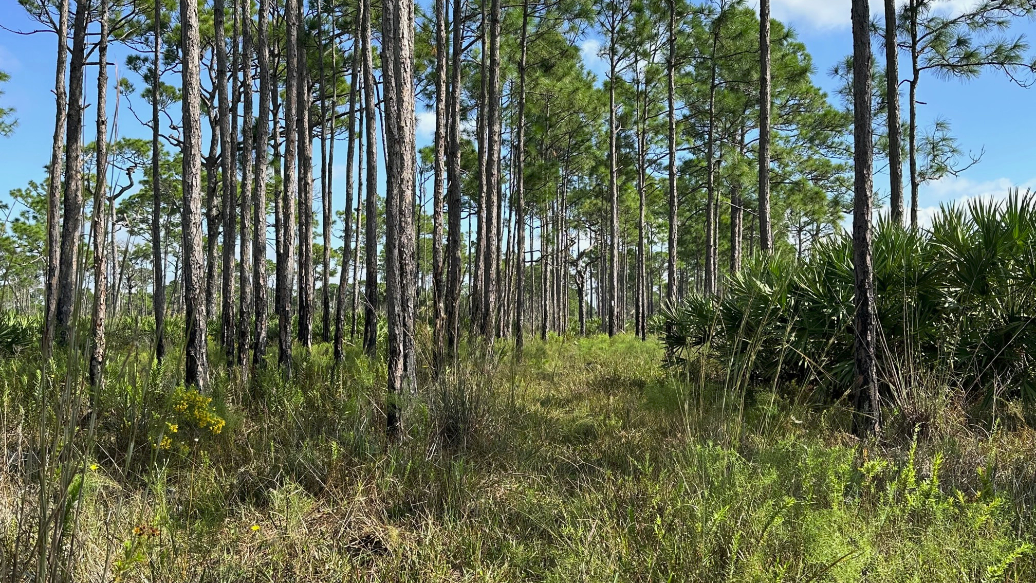
Saw Palmetto and Slash Pines Along the Trail

With help from some Facebook folks (Florida Trail Lox Chapter), I knew where to park to access loop 3. I arrived at 9:15 a.m. and parked west of the loop on the Grade Road accessed through Gate 1—just past where the OTL Trail crosses over the road. I hiked one mile to connect with loop 3.

What a gorgeous day! About 60 degrees with a slight breeze and a few clouds when I started on the trail, the weather couldn’t have been nicer. I was thrilled to see maintenance had been completed on the trail and all was dry. With the exception of some wild boar activity, it was an easy hike.

Tall Pines Silhouette the Sky

Alone on the trail, I enjoyed my surroundings of tall slash pine, vivid green saw palmetto, and wax myrtle. The birds kept me company—red shouldered hawks, red bellied woodpeckers, and cardinals. I appreciated the benches along the way—if only to use for a stretch. When I exited the trail onto the OTL trail, it surprised me how close I was to the lake, only 5.5 miles from where the OTL connects to Loop 3.

Next stop—loop 4!

Read Full Post »

Jonathan Dickinson State Park is my “go to” park, when I don’t have time to travel far. I returned to JD State Park to hike the 7.5 mile White Loop for my third state park in the new year. This is where I had spied the Florida Panther the previous New Year’s Day, and I hoped to see one again.

Saw Palmetto Among the Pines

I began my hike in a clockwise direction and made the same mistake I did the first time I hiked it. About one mile in, after going over the little bridge and around the water, I became overconfident being on the service road and missed the right turn onto a smaller trail. My AllTrails app gave me a “heads up” that I was off trail about a block later.

Sixty-five degrees with a slight breeze! Perfect hiking weather. For the remainder of the trail, I came upon water from time to time, but never to the point where it flowed into my shoes. I was thrilled to see they had built small boardwalks around the deeper water.

I love that this trail has a couple of rest spots with benches. The first is about 3.5 miles into the trail. I passed only a couple of hikers heading in the opposite direction as I, and I saw one hiker come off the OTL Trail in the distance (This distraction may have caused my missed trail.).

Loggerhead Shrike to Keep Me Company

The moist sand from a recent rain made for easy track identification—wild boar, raccoon, and then some I could not identify. The trail had very little boar activity until the last mile.

Only the birds kept me company—loggerhead shrike, red-shouldered hawk, yellow-rumped warbler. Alas, no panther to be seen.

Although there is next to no shade on this trail, it’s always a great trail to hike.

Read Full Post »

Finally, some cooler hiking weather—sunny and 70 degrees with a light breeze! What could be better than that? I drove to Gate 2 at Dupuis Wildlife Management Area, and I stepped onto the trail at 9:00 a.m.—destination, Loop 2 this time.

Beautiful (but overgrown) Dupuis Trail

The first part of this hike was familiar to me—I had hiked Loop 1 this summer, and you have to hike most of Loop 1 to get to Loop 2. But wow! What an overgrown trail! I arrived at the picnic tables about 20 minutes later, and my legs were covered with burrs—so glad I wore pants. The grass was dewy, and the ground a bit damp.

Pretty Images on the Trail

At one point during the first mile, something quickly passed in front of me on the trail—about the size of a small to medium-sized dog, reddish brown in color. I have no clue what it was. Other than that, I came upon lots of turkeys, but no humans.

It was a beautiful day to be on the trail—regardless of its unkept state. (I saw on Facebook that volunteers worked on Loop 1 the very next day.) At times, it was difficult to find the trail, and I was happy I had apps to stay on track when the path was uncertain. Walking in tall grass with no path—accounts for the burrs and the tick that rode back home with me. 

Hog Heaven on Dupuis

Apparently, the wild boars have found a home and had spent much time digging up the trail. The torn-up ground made my hike more challenging at times. Lots of evidence, but not a boar in sight!

With a couple of breaks, I completed the 7.5 mile loop in four hours and arrived back at my car around 1:00.

Read Full Post »

I am so excited about returning to the Appalachian Trail this fall to complete the Georgia section. Last fall, I tried a slackpacking trip and stayed at Above the Clouds Hostel to complete the first 52.5 miles, ending at Unicoi Gap. This fall, I will return with my friend and trail sister, Robyn, (trail name “Buster”) to complete Georgia and start into North Carolina—32.5 miles. The big difference is that this will be my very first time camping on the trail which also means carrying a heavier pack!

Rainbows Over Dyer Park

I have always worked out, and even with the heat and rain, I have gotten out on the (flat and wet) Florida trails this summer—typically with a pack weighing between 15 and 17 pounds. My goal for September is to increase my pack weight, moving to my larger pack, and to find some elevated trails for training. I planned to be ready! I found a local park—Dyer Park—with a 2.5 mile mountain bike trail with elevation I can use–it’s amazing what the county did with a dump site. During September, I will “hike” this trail a dozen times or so, increasing my pack weight to at least 25 pounds.

MBT at Dyer Park

Read Full Post »

After my experience navigating the Kitching Creek Loop, I needed to get back out there and try again. I had heard that the Dupuis Wildlife and Environmental Area was dry, and I was determined to get on the trail earlier in the day, before it got too hot. Although easy to find, it took an hour to drive to the location. I arrived around 8:30 a.m.—the only car in the small parking lot.

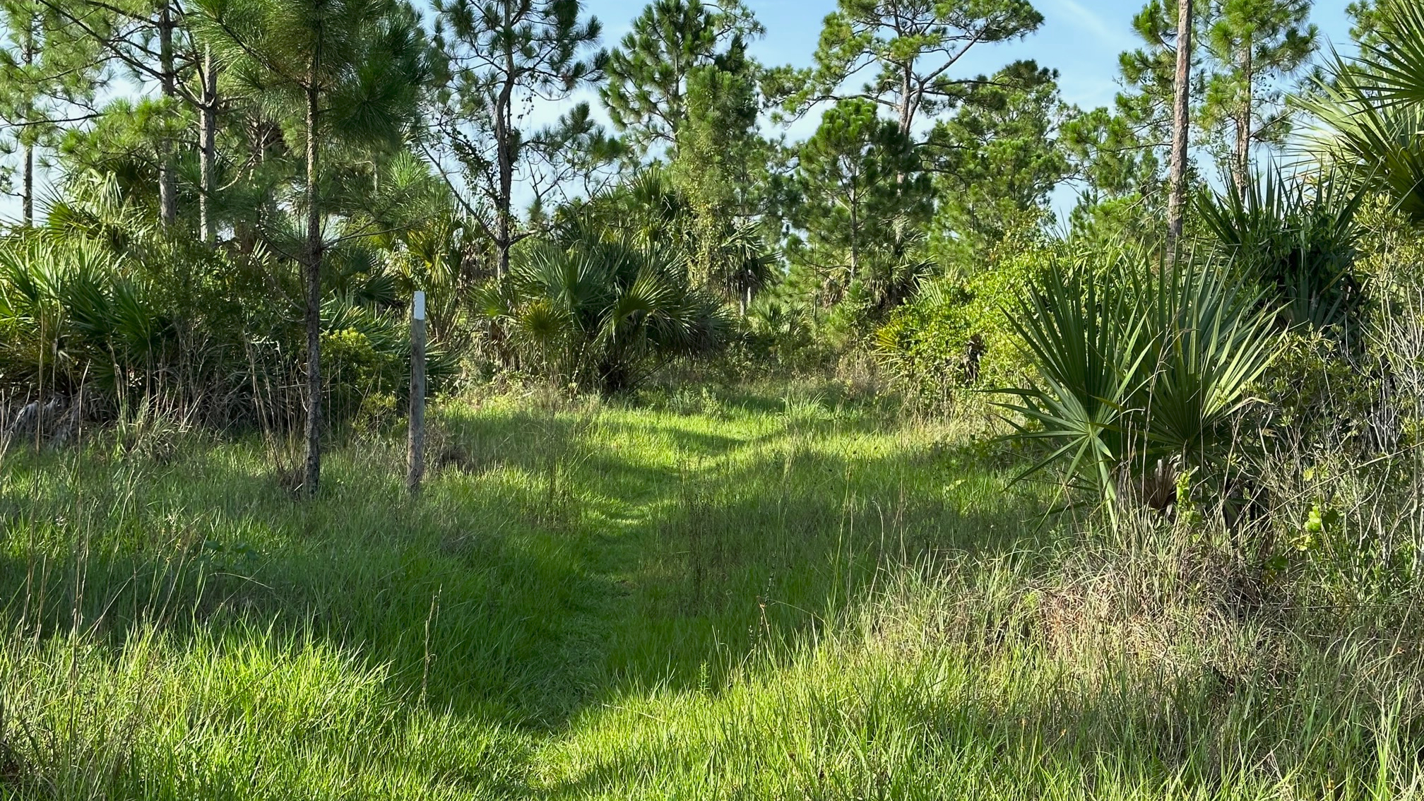
Grassy Path of the Dupuis Trail

I entered the trail at 8:45 a.m. under clear, hot skies. I opted for the shorter hike, Loop One, about 5.5 miles, and considering the heat, happy I did so. Shortly into my hike, I paused briefly at the picnic tables, taking in a few moments of shade before the next five miles. I enjoyed the well-marked grassy trail., and I did not see another soul in the three hours I hiked. Just the birds and me.

Green Pines on the Dupuis Trail

If fall ever arrives in Florida, I will return to Dupuis and hope to hike the longer loops.

A Promise of Shade

Read Full Post »

My AllTrails hates me.

The map at the kiosk showed the Kitching Creek Loop to be a one-hour walk with a thirty-minute hike along Wilson Creek to get there. I plugged the trail into my app, and four and a half hours after leaving my car in the parking lot, I arrived back to it. This hike—a definite do-over. Funny.

Scenic View from the Trail

It was hot as heck, and the mosquitos and horseflies feasted on me through the seat of my pants. I came across water on the trail pretty quickly, but I was able to get around it—at first. The more I walked, the more water there was and the more difficult it was to avoid. I passed over the Kitching Creek Bridge and the outlook—which was closed. At this point, the water became deeper and wider, and I concentrated more on getting around the water than where I was heading. I had gone a bit past my turn before my AllTrails suggested that I may have missed it. (“Oops! Did you get off the trail?”) By then, I was facing a shallow pond of water and decided to turn back anyway.

Deep Water on the Trail

Of course, no one else attempted this trail at this time of day. Even the animals and birds stayed away—with the exception of an ibis or two.  I headed back to my car with little guidance from my AllTrails guy—who seemed to think my hike was over and had already ended it.

Most of the Florida trails I’ve hiked have been well blazed. I had difficulty finding signs on this trail. I read that the trail was no longer maintained but did not see an explanation. I’m not certain that is true.

This trail is definitely a do-over—but I’ll wait until the trail is dry. 

A definite do-over!

Read Full Post »

Every time I step onto a Florida trail, I wonder, “What will I see this time?”

I passed through part of the Loxahatchee Slough Loop Trail when I completed my third section of the Ocean to Lake (OTL) Trail. The Loxahatchee Slough is part of Palm Beach County’s protected natural areas which are maintained mostly by the Environmental Resources Management. How fortunate we are to have these natural protected areas. (For a list of Palm Beach County multi-use trails: https://discover.pbcgov.org/erm/Pages/JeagaWildways.aspx)

Flowers Decorate the Loxahatchee Trail

With easy parking at 11885 Beeline Highway, I arrived just as a 10K run completed. County staff, still on site from the run, showed me the trails on a map and explained trail conditions. Water had flooded a section of the last leg of the return on the Loxahatchee Slough Loop, so I opted for a longer hike on an extended loop to stay dry. I also included the out and back to the observation tower which I found was just steps away from the OTL trail section I had hiked from Riverbend Park to Beeline Highway. The same county staff member also hooked me up with a new trail app, Avenza Maps. This app displays the maps in pdf format but also shows your location on the map. I found this very helpful!

I began the trail by 9:45 a.m., hiking clockwise around the loop. Another hot Florida day—already! I stopped at the restroom about a half mile in (clean and roomy) and changed into my shorts, quite happy I remembered them this time. There was a bench just outside the restroom next to the water. This, and the picnic table at the tower, were the only rest spots on the trail. I would have welcomed a couple more benches—especially along the last section. Once again, I found myself sitting on the roadside in the shade of a pine tree for a snack and rest.

Water Along the Trail

With the exception of the blazing hot sun, the trail, a dirt road with lovely surroundings, was easy to hike. I passed sand pine, wax myrtle, saw palmetto, cabbage palms, tall grasses and remnants of spring flowers. With recent rains, water approached the trail on both sides. My only company were the Ibis and butterflies until about one mile from the finish when I passed a man headed in the opposite direction.

I enjoyed the beauty of my 5.5-mile hike, completing it in less than three hours with my two breaks. With the exception of the sounds coming from the Beeline Highway on the last portions of the trail, it was a quiet, peaceful hike.

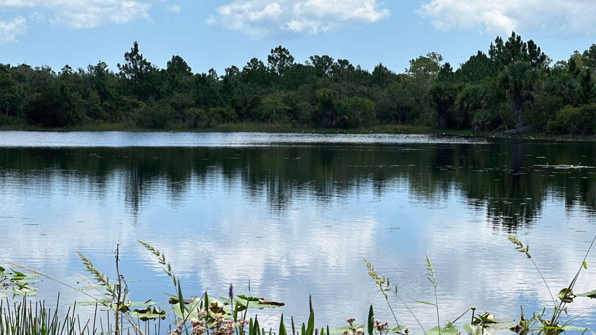
Beautiful Reflections on Loxahatchee Slough

(Loxahatchee Slough Natural Area. 11855 Beeline Highway Palm Beach Gardens, FL. https://discover.pbcgov.org/erm/NaturalAreas/Loxahatchee-Slough.aspx)

Read Full Post »

Having learned (the hard way) that Uber will not drop off or pick up in these remote areas, the logistics of my next hike became my priority. In the end, my daughter dropped me at the South Gate to the Corbett Wildlife Management Area at 2:45 PM—yes, a late start, but it stays light until after 8:00 now. I thought I might get some late afternoon clouds and see some wildlife.

Hot Open Hiking Path

I hiked north to connect to the Beeline Highway where I had ended my previous hike on the OTL—a five-mile hike—and then an additional one and a half miles to the parking lot at the Loxahatchee Slough Natural Area by way of the Loxahatchee Loop Trail where I had left my car.  

I didn’t know what to expect and wore my usual long pants and long-sleeved SPF top to protect me from sun, sand, bushes, and critters. The trail, which appeared to be a service road for the wildlife area, was wide open with little or no shade—with the exception of one mile along Beeline Highway and the short distance to get to the Loxahatchee Loop Trail to the parking lot. It was a HOT hike.

New Growth After Controlled Burn

My first stop was just over three miles into my hike, and with not a bench or log in site, I sat on the ground in a tiny piece of shade under a sand pine. No doubt I would have appreciated this trail much more on a cool, fall day. I had forgotten the pair of shorts I typically pack “just in case,” and I came very close to using my knife to cut the legs off my pants. It was that hot.

Complaints aside, the beauty of my surroundings awed me—saw palmetto, sand pine, cocoplum, flowers, and tall grasses. Ahead of me, three dark animals hurried across the trail—perhaps wild boar, as there was some evidence. Scrub jays, woodpeckers, herons, cardinals, swallow tailed kite, red shoulder hawk flew from tree to tree.

Beautiful and Scenic Hike

Around mile four, my hope for clouds arrived along with strong winds and a downpour of rain. Be careful what you wish for. However, there is something mysterious and beautiful about rain in nature. I found a little protection from the wind and rain on the side of a large saw palmetto. I arrived at Beeline a soggy hiker, trying to avoid the splash of the cars and trucks as I crossed the small bridge. On the other side, God rewarded me for my patience with a gorgeous rainbow.

This was my third section of OTL and my least favorite so far—although I had a beautiful and scenic hike for the first four miles. I arrived at the parking lot about 6:15 PM—about 3.5 hours—soaking wet and happy I had thought to throw a sweatshirt and pair of sandals in my car (reminder: next time, add sweat pants!).

Rainbow on the Beeline Highway

Read Full Post »

Older Posts »