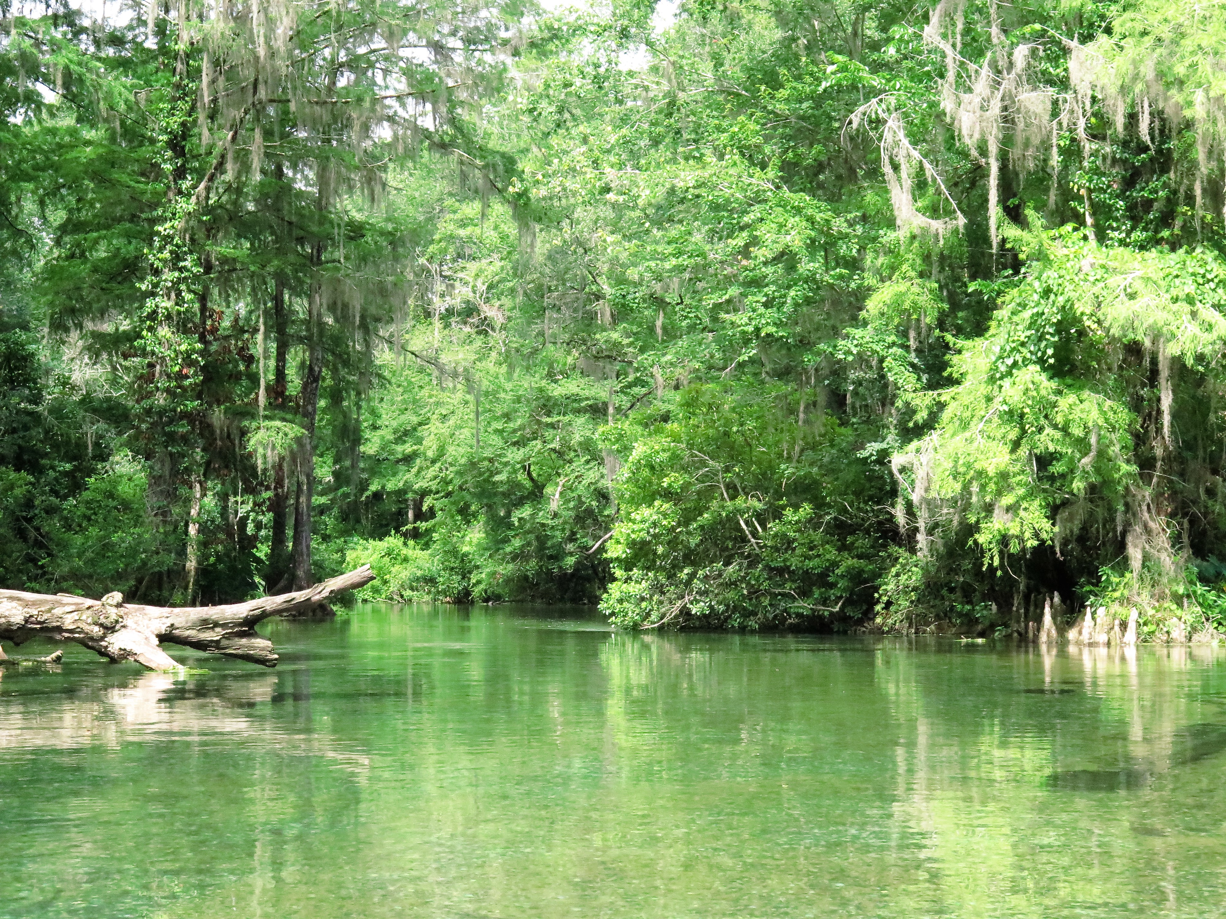
Ed Watts, known affectionately as Naked Ed in the High Springs area, has lived on the Santa Fe River for 24 years. He is the caretaker of the piece of property that surrounds Lily Springs, and he doesn’t wear clothes. I was warned of him at the Santa Fe Outfitters where I rented my kayak, but I already knew about him from my guidebooks and the restaurant in town. The restaurant, The Great Outdoors, sells Naked Ed beer. He has become quite famous in these parts!
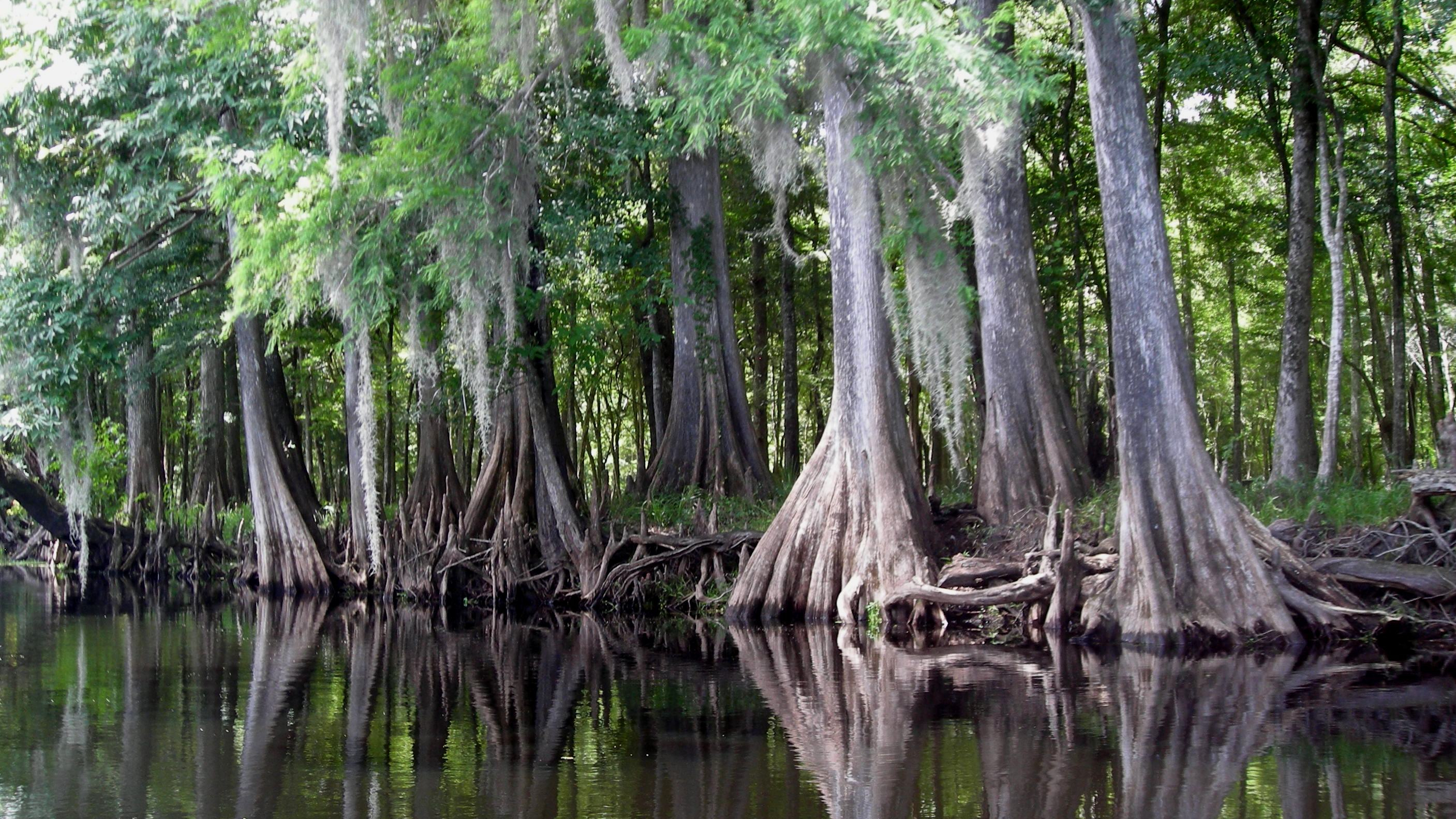
Cypress on the Santa Fe
I did get a chance to meet Naked Ed. I had stopped in the shade on a bank near the springs, and Ed walked toward me on the opposite bank, just a few yards away. He did, in fact, have a towel wrapped away his waist. He explained that he always does this when he approaches someone. He told me I was welcome to go further into this cove to see the springs, but he warned me that he would be naked.
It turned out that Naked Ed is very nice and quite harmless. We chatted for about half an hour. He loves visitors, and he loves to talk. I had to watch the time as I was told that to make my pick up, I would need to leave Naked Ed no later than 2:30. I felt a bit like Cinderella! What a twist to the story.
If you happen to be floating down the Santa Fe River and have the time, be sure to stop by to see Naked Ed.
A common greeting among yakers on my Silver River trip was, “Have you seen any monkeys?” Everyone seemed to be looking for the elusive rhesus monkeys. I heard stories of large groups (bands? herds?) of these monkeys jumping from tree to tree or lining the river, staring (daring?) at the paddlers. However, I saw nary a one.
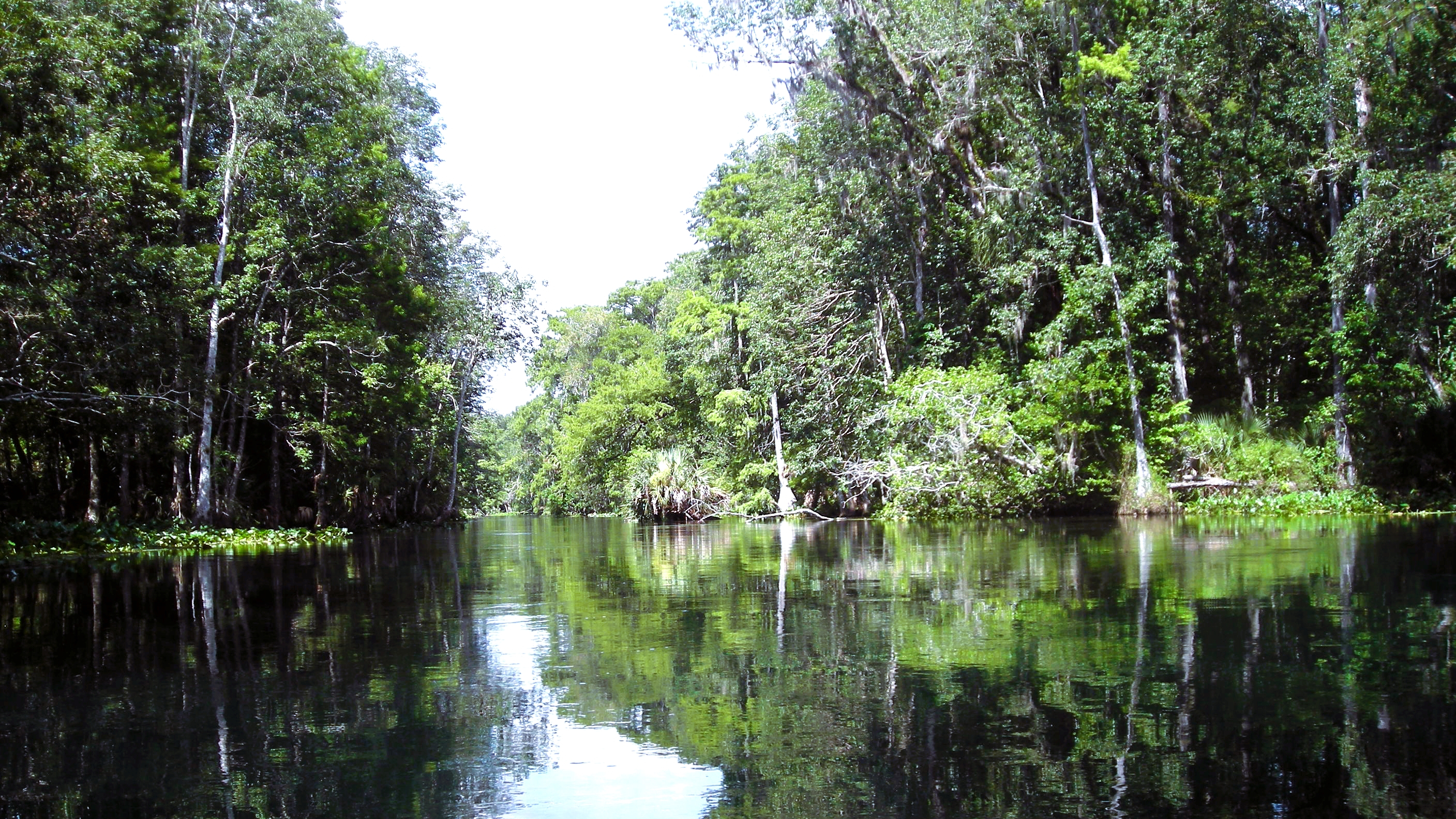
Silver River
There have been several explanations for the existence of the rhesus monkeys in this area. Boning writes that the population of these monkeys may date back to the 1930s when the operators of a sightseeing boat released several monkeys. Huff repeats three monkey theories: one, that they began as escapees from a medical research lab; two, that they were purposely populated for the tourists; and three, that they were part of the old Tarzan movies filmed on the river in the mid 1900s. Ohr writes that there is an unconfirmed report of escapees from the Ross Allen attraction that may have added to this monkey business.
Florida rivers are amazingly beautiful, mystical, and fun, and after paddling them for over ten years, I feel a touch of guilt selecting favorites. However, I admit it! There are those to which I would return more quickly than others. So, here goes.
Fisheating Creek. I have paddled Fisheating Creek more than any other river—at least four times. If you want an awesome Florida wilderness paddling experience, Fisheating Creek is your waterway. It originates in a swamp in Highlands County and flows south, then east, into Lake Okeechobee.
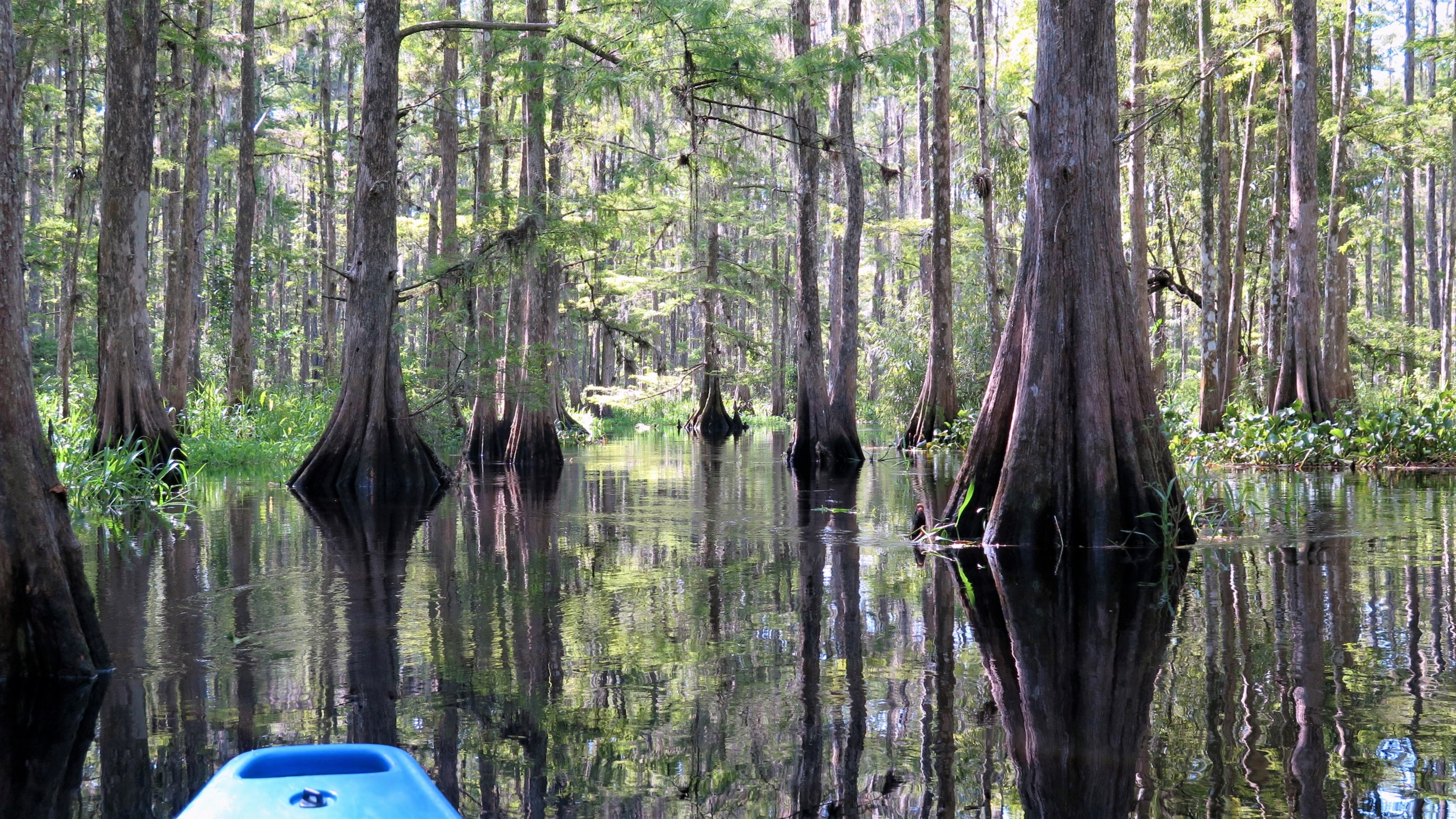
Entering the Cypress Swamp
I paddled from Burnt Bridge, a four-hour (eight miles) ever-changing paddling experience, and ended at the Fisheating Creek Outpost. (Longer trips are available.) The paddles begins in the wide river, tall cypress dripping with Spanish moss and air plants on each side, but within thirty minutes, you are lured into the cooler, darker waters of the swamp, twisting and turning through the cypress trees and their knobby knees as you pass gators, herons, egrets, anhinga, and so much more! Then, just as quickly, you emerge from the swamp into the river of grassy banks. If the water is low enough, you may even be able to pull up on a sand bank for a stretch and a snack before heading into the swamp once again.
My go-to outpost for Fisheating Creek was the Fisheating Creek Outpost with friendly faces, great attitudes, but kayaks that could use some attention. However, they are happy to drop you with your own kayak if you choose.
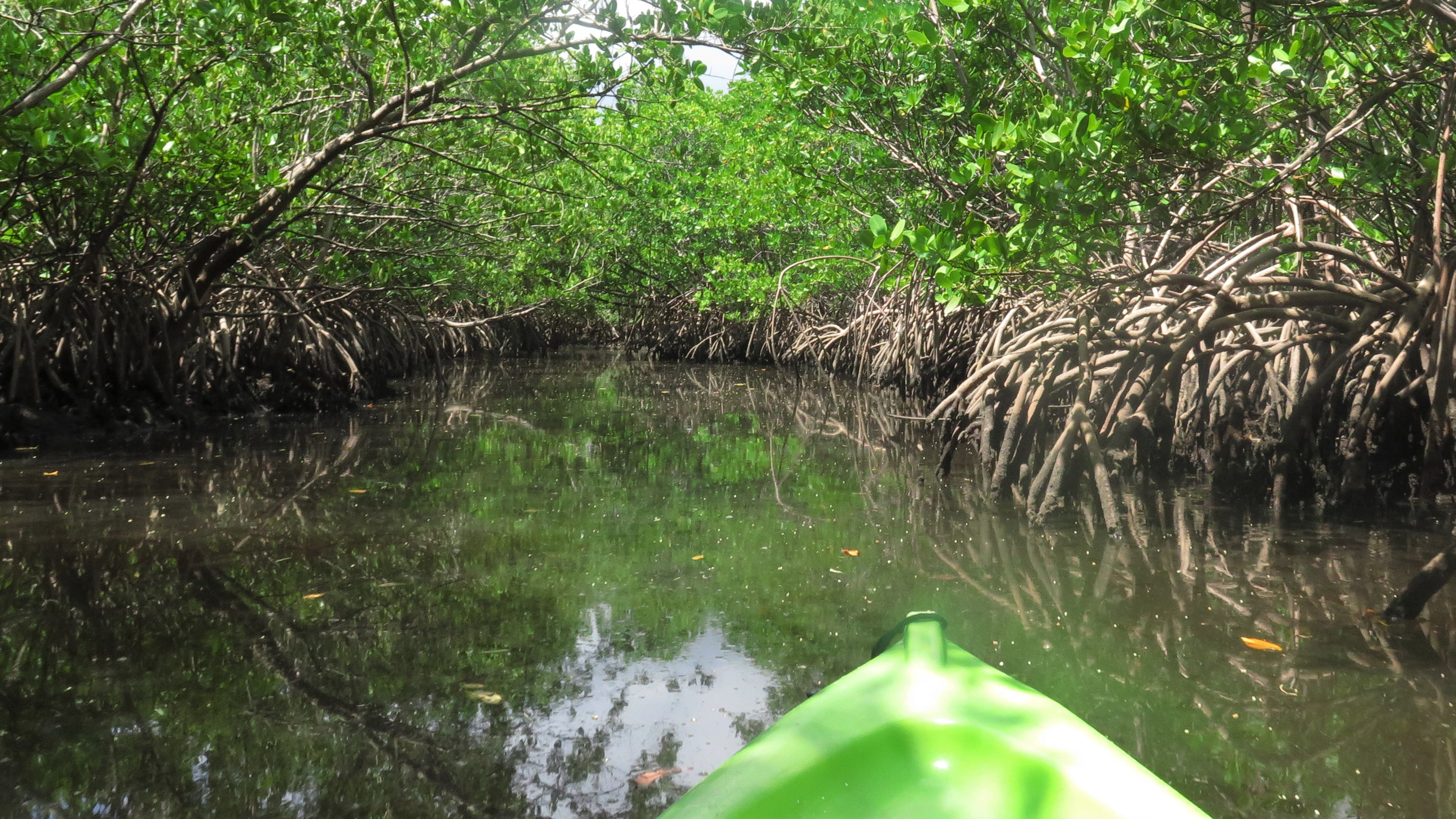
Withlacoochee River South. I love Withlacoochee River South and wish it was closer to me. A Native American term, Withlacoochee means “little big water” or “crooked river.” I have experienced both the little and the big of it—paddling it twice, once during the dry and once during the rainy season. I started from two different locations, but basically the same route—just one further into the swamp.
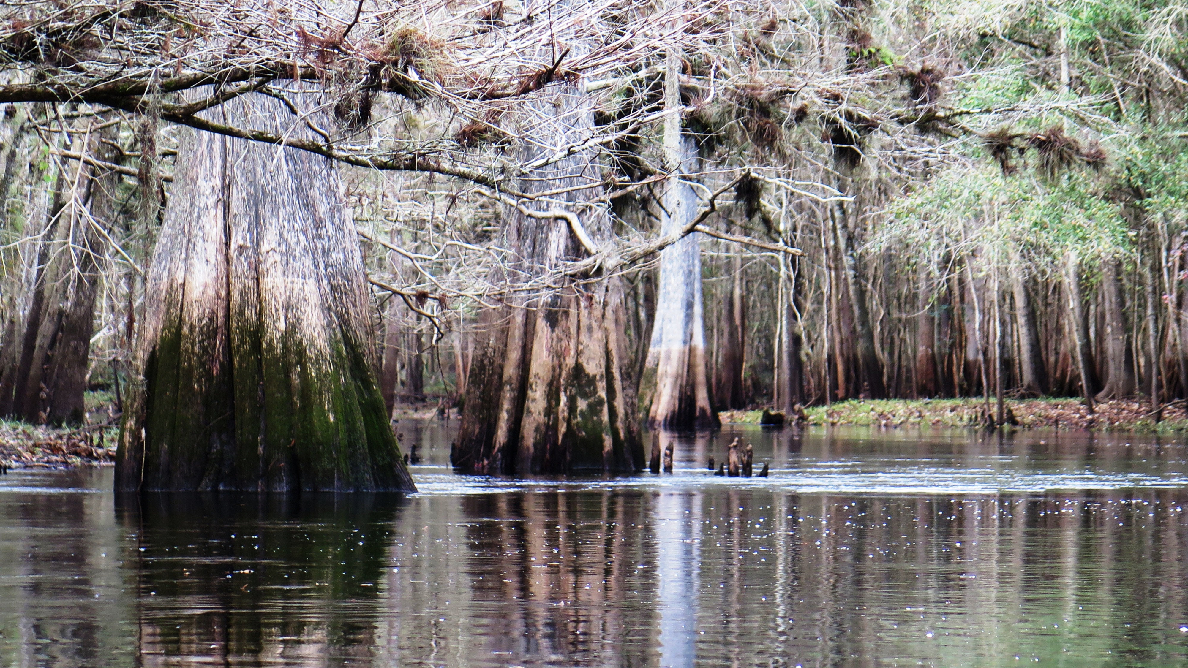
The Withlacoochee Dressed in Browns and Grays
This waterway is a “must paddle” if you haven’t yet. Picture yourself paddling down these dark, cool waters—beautiful cypress, red maple, and live oak along the riverbanks providing shade from the hot Florida sun. The water quietly twists and turns as it moves slowly from the Green Swamp to the Gulf. You hear nothing except the occasional splash of a turtle or gator or the calling of a bird. During low water levels, you spy ibis, vultures, herons, anhinga, cormorants, and egrets along the banks, as they enjoy the tranquil waters and their only slightly interrupted day with you floating by. During the rainy season, the water floods into the forest and through the trees creating magical, picturesque reflections, a beautiful backdrop to your serene paddle.
My go-to outpost for Withlacoochee River South was Withlacoochee RV Park and Canoe Rental.
Hillsborough River. When I describe my most amazing river paddles to people, I always include the Hillsborough River—which is why I find it unbelievable that I have paddled it only once. Why???
Clear Waters of the Hillsborough
Like the Withlacoochee, the Hillsborough originates in the Green Swamp. Its clear waters, fed largely by Crystal Springs, twist and turn for fifty-four miles west to empty into Tampa Bay.
This river is awesome! If awards were given for the most gator and bird sightings, Hillsborough would win. Picture this: in a four-hour paddle between Sargeant Park and Trout Creek Park (other trips available), you spy somewhere between fifty and one hundred gators—all looking very comfortable in their environment regardless of the intrusion. You feel as if you have entered a bird paradise, spotting more species of birds on this river than any other—egrets, herons, limpkins, roseate spoonbills, woodpeckers, wood storks, and ibis. Osprey dive; otters frolic; turtles sun, and you float through it all like a smooth ride at Disney World. Nature is in harmony, your paddle serene, peaceful, and delightful.
My go-to outpost for the Hillsborough River was Canoe Escape in Thonotosassa.
It seems pretty clear with my three favs that I am a bit of a swamp girl. I do love the seclusion and wildness of these cool, twisting waterways, but heck, after paddling more than fifty Florida rivers, there isn’t one that I would not return to. They are all pretty “awe”-some.
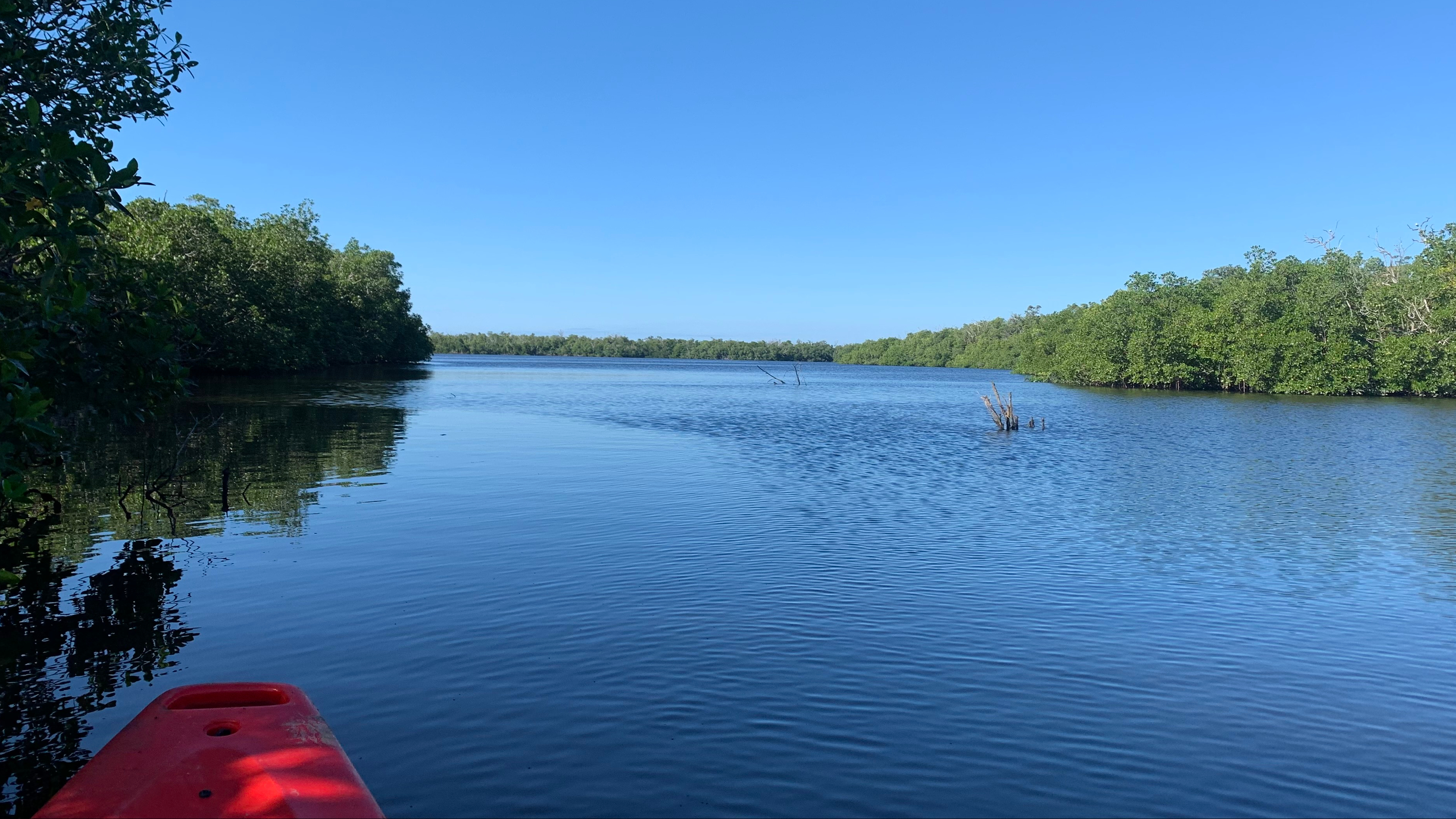
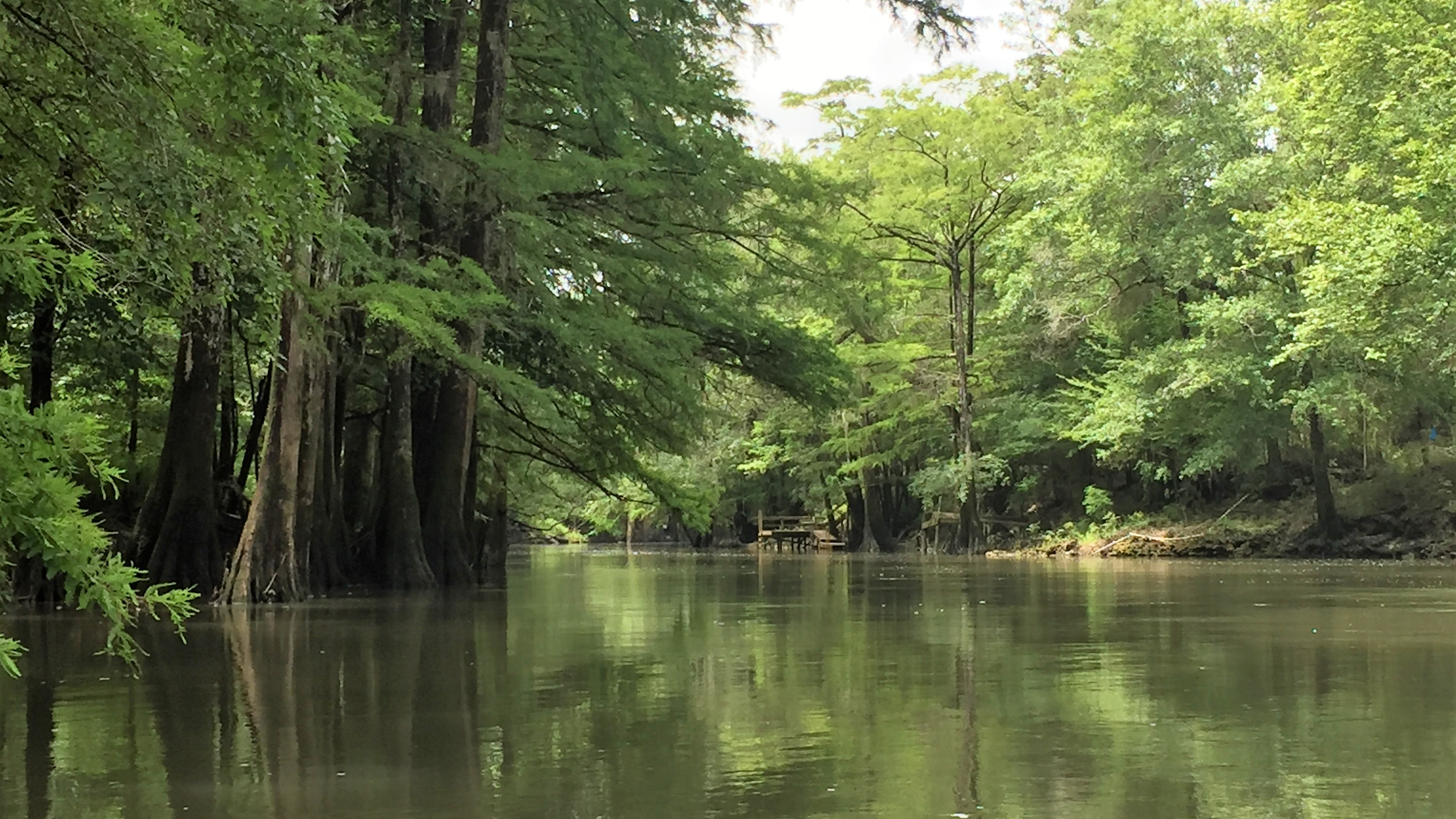
COVID disrupted all our lives this past year, mine included, but I could not let the year end without a paddle. I wanted to challenge myself and paddle someplace new. I focused on the Everglades area, as I have not paddled any of these waterways yet. I looked at several: the Blackwater River and Royal Palm Hammock Paddling Trail, Nine-Mile Pond Canoe Trail, Noble Hammock Canoe Trail, Mud Lake Loop Trail, Halfway Creek Canoe Trail, and Turner River Canoe Trail. I also looked at the Everglades National Park and Wilderness Waterway, but I wasn’t sure I could work out the ninety-nine miles unless there were overnight stopping points along the way that did not involve a tent. 🙂
Paddling to Mud Bay from Channel Marker 47
After calling some outfitters, I decided on the first on my list, the Blackwater River, not knowing what to expect. When I arrived at the concession in the Collier Seminole State Park, Collier Seminole Nature Tours, I told Matt that I needed a kayak for the day, as I wanted to paddle the entire 13.5 mile loop. He suggested that I might want to paddle a shorter trail to Mud Bay and back. In the past few months, only one group paddled the entire loop; they had faster kayaks, and it took them six hours. Matt, challenge accepted!
I put in at the park launch at 9:30 a.m. on a rented Jackson Riviera sit-on-top. The first hour of paddling was peaceful and canopied—and sometimes jungle-like. What a beautiful day to paddle—sunny but not too hot! I arrived at channel marker 47 in fifty minutes having passed only one couple on a short out and back paddle. The loop begins at marker 47, and here I made the right turn and headed towards Mud Bay. I spent the next four hours paddling through the three bays: Mud Bay, Palm Bay, and finally, Blackwater Bay.
From marker 47, it took me about fifteen minutes to reach Mud Bay. Mud Bay was larger than I expected. I could feel and see the tidal current. Low tide would be at 3:45 p.m. The wind had picked up, and paddling became harder. At one time, something massive emerged on my left creating a large brown wave, scaring the hell out of me and rocking my kayak; I assume it was a manatee.
At one time, something massive emerged on my left creating a large brown wave, scaring the hell out of me and rocking my kayak.
I continued my paddle, now along the Royal Palm Hammock Creek, for about thirty minutes, to the Grocery Place Campsite (my one and only “stretch my legs and pee” stop), relieved to see the sign and know I was on track. I later read that the two concrete structures I saw on this site are cisterns remaining from the late 19th and early 20th centuries. Lots of history here.
Looking out from the campsite, I saw mangroves to the left but mostly water to the right. A great heron flew overhead, and a small raccoon scurried into the woods. I hopped back on my kayak, heading, I hoped, to Palm Bay, and wondering (briefly) whether I should turn around and head back before the tide started to head out.
The Trail to Palm Bay
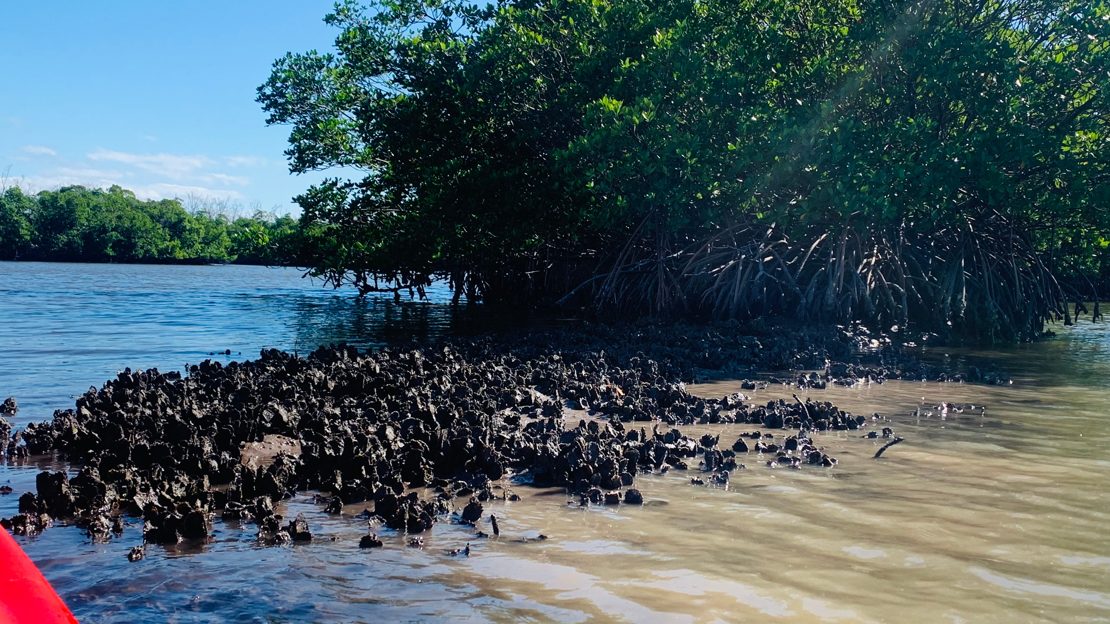
I paddled into Palm Bay staying close to the mangroves to my left and eventually exited to Blackwater Bay about forty-five minutes later. The wind, stronger now, forced me to keep my head down to keep my hat on. I paddled even harder, passing lots of mangrove islands decorated with shell beds. Blackwater appeared to be the largest of the three bays and the most confusing. I pictured just me on this large waterway, a tiny dot on a map. I now understood what Matt meant when he cautioned me about getting lost here. I had no clue where I was going, and the many mangrove islands and lack of signage made navigating even more difficult. I just kept paddling, trying to keep the mangrove forest to my left. Did I mention that my phone battery was dying and my charger wasn’t working? I had just begun to wonder what I would do if I couldn’t find my way out of this massive waterway, (Could I sleep in the Bay on my kayak?), when I spied two fisherman on a boat (Thank you, God). I gave a wave and a hoot and paddled over. The lovely man who had just pulled in a fish, pointed just ahead of me; I was less than fifteen minutes from the beginning of the markers. Relief for sure!
Shell Beds on the Mangrove Islands
With the uncertainty behind me, I relaxed for the last two hours of paddling, enjoying the cool, dark waterway and the beautiful mangroves. Six hours in, I came upon marker 47 once more and a family hanging out on a low-tide sand bar in the middle of the waterway. I called over to see if I could join them for a few and had an opportunity for a chat and a final stretch before heading into the canopied path and the last hour of my paddle. I arrived back out the outfitter, tired and with very sore arms, seven hours after leaving. Matt had not left at 4:00 as he said he would earlier. He had waited for my return. I think he was nearly as happy as I that I had completed the entire paddle!
I arrived at the Ocklawaha Canoe Outpost and Resort in time to check into my cabin and unpack before jumping on the shuttle to the
drop at Gores Landing. This would be my second paddle on the Ocklawaha and my first stay in the cabins. My adventurous spirit moved me to stay two nights along the river, rather than making a reservation at the closest Holiday Inn. I took in my temporary “home”—a bit tight, but with enough room for 4 or 5 with the bunk beds—plus the loft.
A Soothing Paddle on the Ocklawaha…Aaahhhh
Since my first visit nine years ago, the Outpost had been sold; the new owners were Lance and Theresa. At noon, Lance drove me—along with a party of eight—to the drop off. On the drive over, he gave us a bit of the river’s history, describing how in the late 19th and early 20th century, steamboats, filled with sightseers, traveled up and down the river to Silver Springs. Sadly, the steamboats disappeared sometime after the arrival of the railroad.
We arrived at Gores Landing shortly before one o’clock, and Lance was kind enough to put me in first, ensuring a peaceful paddle ahead of the large party. The Gores Landing trip is 8 miles. I expected it to be about a four-hour paddle. I paddled alone on the river until near the end when I passed two small motor boats—guys out fishing.
Theresa, at the Outpost, had warned me when I made reservations the week before that the river was in the midst of a draw down. Apparently part of the river’s restoration plan proposed by the Department of Environmental Protection includes a phased draw down of the river to historic levels to flush the river and its banks of aquatic weeds and to help the floodplain re-vegetate. I expected the level to be lower than normal, but instead, it was higher due to recent rains, flowing into the trees and keeping the wading birds and wildlife deeper into the woods.
Floating on the Dark Waters
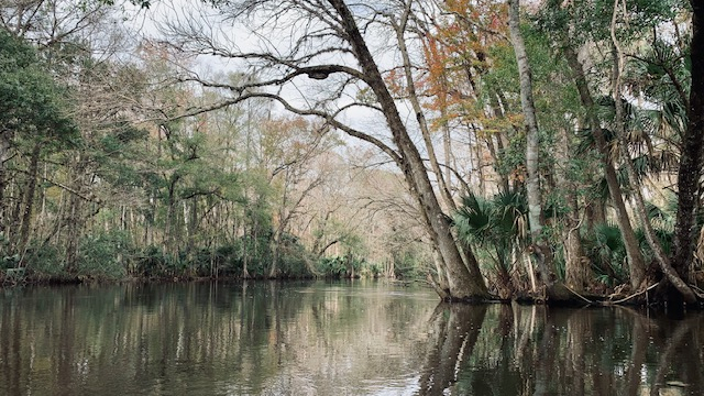
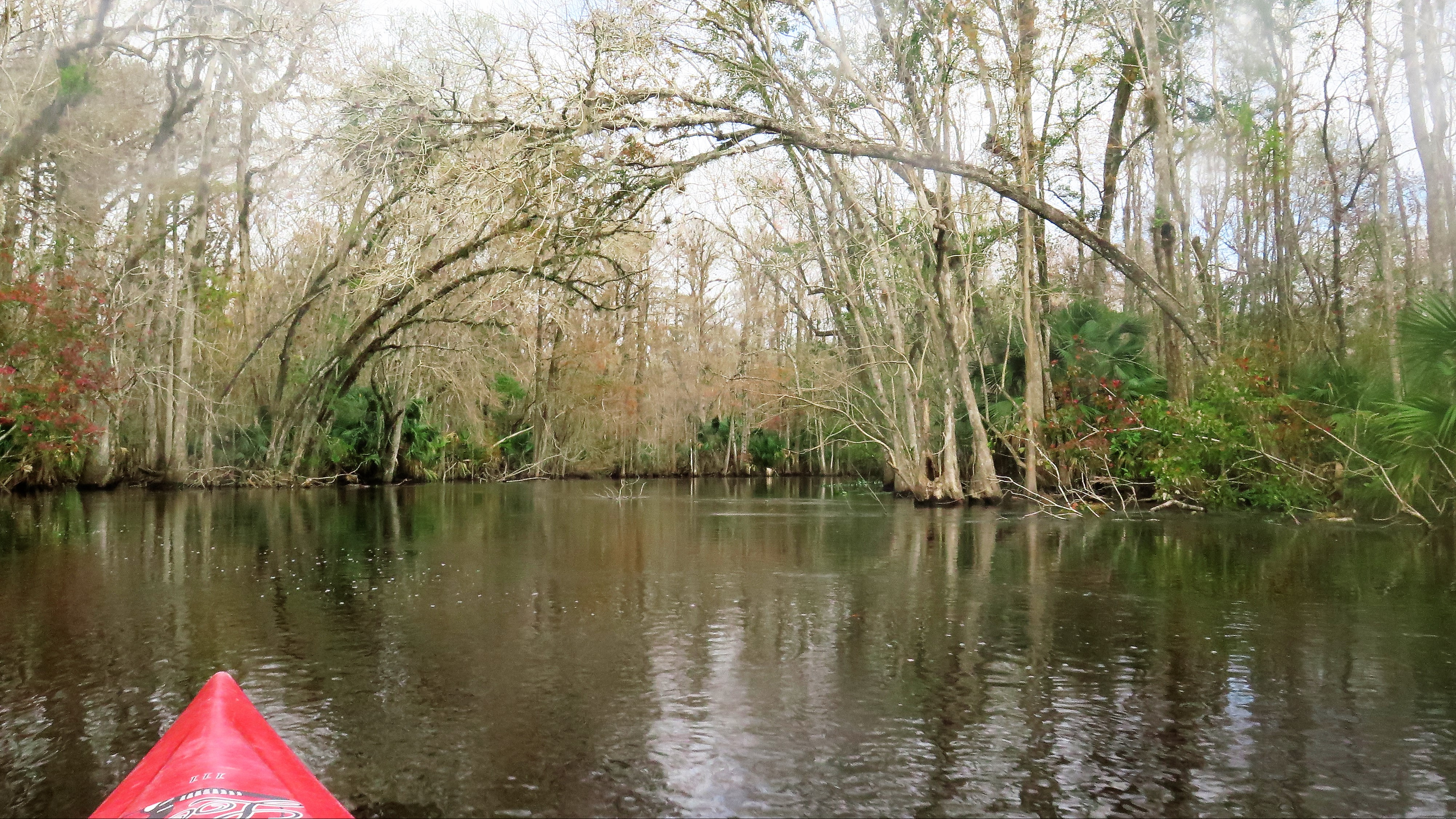
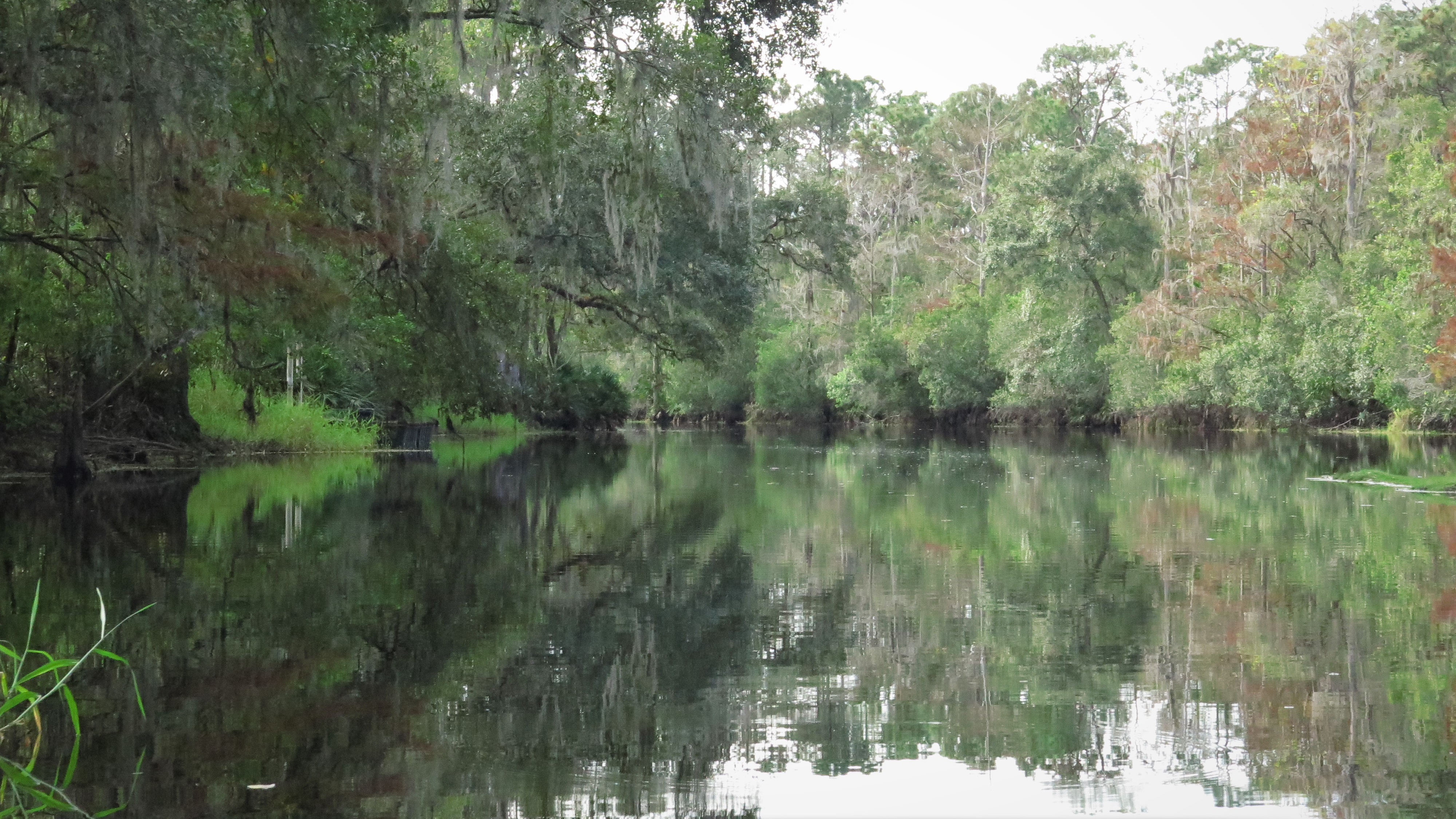
The Ocklawaha River was one of my very first river paddles—way back on July 14, 2010. I have always remembered it as one of my favorite rivers. At that time, the river was dressed in the bright greens of summer. This time, the river had dressed down in various shades of brown and gray for the winter holidays.
The overcast sky and high 60s temps made for the perfect paddling experience. I paddled north with the steady flow of the dark river, following its many twists and turns. I spied lots of gators—many of them juniors, only a month or so old. I sighted a few birds—ibis, herons. An owl called from deep in the woods. I searched for monkeys but spied none.
I paddled onto the Outpost boat ramp 3 hours and 45 minutes after my put in, feeling refreshed and relaxed. I had a lovely stay in my cabin the next two days, sitting next to a beautiful campfire each night and waking to the quiet. What a lovely way to end the year!
(Ocklawaha Canoe Outpost and Resort. 15260 NE 152nd Place, Fort McCoy, FL 32134. https://outpostresort.com/. (352) 236-4606)
Another hot, sunny summer day in South Florida, and I had not been kayaking for over six months. Determined to paddle, I checked my list of rivers not yet paddled
and found one within an hour’s drive—Whiskey Creek. Honestly, I hadn’t even known it existed.
Heading South on Whiskey
I love when I find these unexpected treasures in Florida. A Florida Designated Paddling Trail, Whiskey Creek flows through the Dr. Von D. Mizell-Eula Johnson State Park in Dania Beach, dividing a stretch of land situated between the Intracoastal Waterway and the Atlantic Ocean. A tidal waterway, its water levels fluctuate with the tides. At low tide, the water level is too low to paddle the entire creek without getting out at some point to pull the kayak. This creek has so much history behind it. That which I find most interesting—during Prohibition times, it was these very same shallow waters that made the perfect escape for the rum-runners when the Coast Guard was in pursuit.
The morning I paddled, low tide was 8:18 a.m., and high tide was at 2:34 p.m. I arrived shortly after 10:00 but waited until 11:15 to put in to ensure the water level was high enough. I put in at the BG Whiskey Creek Hideout, the outfitter inside the park and at the north end of the creek. I paddled south, possibly the same route the rum-runners once took. Mangroves lined the right side of the waterway and sand dunes and sea grapes lined the left. Just over the dunes on the east side, 2.5 miles of Dania Beach welcomed tourists to its warm sands. Planes from the nearby Ft. Lauderdale airport flew overhead, a constant reminder of the city nearby.
Into the Mangroves
The thing about paddling mangrove waterways, there is little or no shade unless you paddle into the mangroves. So, I took my time and paddled the tea-stained waterway, moving in and out of the mangroves, enjoying both the shade and the quiet of nature. Herons (blue, tri-colored, black crowned night), ibis, and brown pelican found comfort in the same shade as I. Tiny crabs scuttled up huge mangrove root systems as I paddled by them.
The creek runs just under two miles to the south and connects with the Intracoastal Waterway. A paddler can paddle south to the Dania Marina and return on the same route or paddle the loop. I chose the loop and exited the creek just after the Dania Beach Pier, paddling to the Intracoastal and north to loop back to my put in—a total trip of about 3.8 mil
The loop took me about 3.5 hours to paddle, a long time for a 3.8 mile trip. However, I spent a lot of time discovering the mangroves and was slowed down by the waves of the Intracoastal on my return. I know I’ve said it before, but although the open waters are not my favorite paddle—I love the shaded, canopied waterways—there is never a bad day on a Florida waterway. I felt exhilarated.
I left the creek, exhausted from the sun and paddle and very thankful. We are so fortunate that the State of Florida has preserved these natural environments for us to enjoy.
I put in mid-morning, three days after Christmas, under overcast skies in chilly (brrrrr…60 degrees!), breezy weather. Winter had arrived in Florida! My location, the Chassahowitzka River Campground—probably the best, if not the only put-in on the “Chaz.”
Paddling Over One of Seven Sisters
It took me some time just to be able to pronounce the name of this river—Chassahowitzka—and I’m still not certain I have it right. The Chaz is an Outstanding Florida Waterway. The river is wide, wide enough for boats, but shallow in many areas, keeping bigger boats away. It’s about six miles from the river’s source, just east of my put-in, to the Gulf. (See map.)
I had delayed my paddle on the Chassahowitzka expecting little shade from the hot sun during the summer months. However, I learned that what makes this waterway so special are the many spring runs along it—which are narrow and shaded and full of sweet surprises.
Jesse put me in at 10:30 a.m., securing my snake knife and cooler. (Others had told me there were many snakes on the river. However, I did not see one.) I paddled away, the water below me clear, heading just east to the Seven Sisters Spring. I passed a few small houses at the entrance to the spring and paddled into the little cove and over each of the seven sisters, all easy to see just below the clear surface.
Exiting the springs, I paddled west along the wider river, spying schools of fish scurrying about below me. I later discovered that they were most likely mullet or mangrove snapper. Cypress, oaks, palms, and river grasses stood tall along the banks, bending slightly with the breeze. I saw tents pitched along the north side, smelling the campfires even before I saw the campers.
Jesse had described two “must see” areas that would provide me a peak at nature along the river, and that’s where I headed, eventually paddling into a narrower loop to the right toward Salt Creek. I spent an hour or so here, paddling up each of four narrow waterways, feeling rewarded when I spotted a raccoon couple making its way to the water, searching for a late breakfast. Birds huddled along the shallow banks and on branches—anhingas, small herons, egrets, and ibis. Wood ducks paddled along the water’s edge.
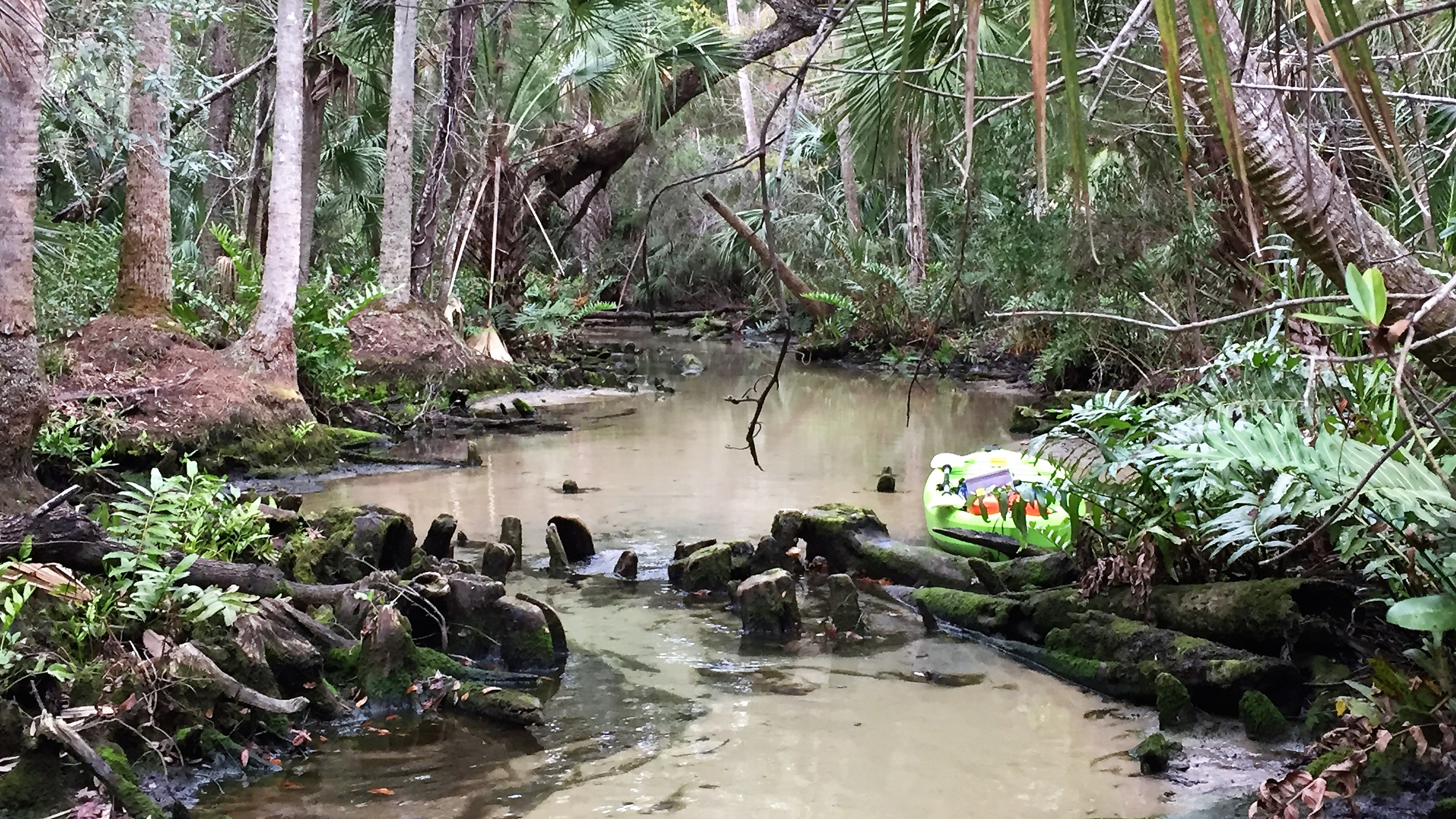
Forced to Portage on Baird Creek
Time went by quickly on the waterway—over two hours had already passed. I felt the refreshing cold on my face, the kind that turns your nose and cheeks red. I headed back towards the outfitter and up another spring run on the south side of the river, Baird Creek. I came upon a wood stork on the side of the narrow creek, searching for food, not bothered by my presence at all. I paused as I watched a playful otter dipping in and out of the water around the stork and my kayak. No fear. I carefully paddled around them, and continued until the waterway widened over Blue Spring. A bit further, and I was once more in a narrow, shallow waterway and was forced to get out and portage until a downed tree finally stopped me. From here, I sloshed about 150 feet through ankle deep water until I arrived at a clear pool of aqua water and the Crack.
In all, I was in the river four hours and never got far from my put in. On my return to the outfitter, I was treated to three colorful mallard ducks dipping in the water. A light rain began just as my trip ended.
(Chassahowitzka River Campground. 8600 W. Miss Maggie Drive, Homosassa, FL 34448. (352) 382-2200)
Originally from New England, I find that Florida often surprises me with its knack of squeezing beautiful glimpses of nature in among the hub of civilization. Shingle Creek is one of these surprising glimpses.
Entering Shingle Creek
I took exit 242 off the turnpike and drove west through the Kissimmee sprawl on US 192 for several miles. Finally, my phone nagged me that Shingle Creek was just ahead on my left. “You’re kidding me, right?” I responded, not believing. I must have entered the address wrong. However, I made a U-turn at the light and took a right as directed, driving down a short, cypress-lined driveway to the outfitter and put in.
Considered the “headwaters of the Everglades,” Shingle Creek originates around Orlando and travels about 23 miles before it empties into Lake Tohopekaliga, (Ten of the 23 miles are part of the Florida’s Designated Paddling Trail system.) The creek makes up a portion of the Kissimmee basin—the waters that eventually flow into Lake Kissimmee and then the Kissimmee River. The Kissimmee River drains into Lake Okeechobee which flows into the Everglades and the Gulf. (Shingle Creek Regional Park)
I rented a kayak from The Paddling Center at Shingle Creek and pushed away from the shore on the small, still creek, heading south towards the lake. At the point of my put-in at Steffee Landing, I would only be able to navigate two to three miles of the creek (north and south of my put-in), a three-hour paddle at the most.
I paddled the creek, dead leaves fallen from overhanging trees floating on top the cool water. Although sounds of traffic and the local Kissimmee airport seemed to compete with the calming, rhythmic sounds of nature on the waterway, the wildlife appeared undisturbed. Birds sang from the trees and waded along the banks. Turtles sunned themselves on downed trees. I put my head back looking up to the clear sky, breathed in deeply, and decided to ignore civilization as well. I focused on my surroundings—the dark water below me and the cypress, pine, and oaks along the creek’s banks.
Paddling Among the Cypress
Hurricane Irma had left the waterway a bit haggard here and there with downed trees and dead brush, while the Florida winter had stripped the trees of much of their foliage. However, the creek was lovely. Ten minutes into my paddle, I passed the banks of the Shingle Creek Regional Park on my left. I continued my southern paddle as the creek narrowed, and soon I was paddling among the cypress trees. Ahhhh…
Nearing the end of the clear trail, a posted sign warned me to stop and turn around. I admit I ignored the sign and paddled another 15 minutes. The trail, now winding among the cypress trees narrowed further while the flow of the water picked up a bit. Another sign warned me that it was unsafe to continue—perhaps due to downed trees in the path. I paddled just a wee bit further before turning around, seeing the path blocked ahead.
On my return paddle going north, I passed the outfitter and under the US 192 bridge. The creek widened here but was still bordered by tall cypress. A shorter paddle this time, I eventually came to another outfitter sign instructing me to go no further. I continued until the creek became impassable—just a short distance.
Shingle Creek turned out to be a pleasant surprise and the perfect getaway—a two-hour paddled stretched into three for me. I found beautiful pieces of nature in the least likely place. I left reluctantly, spying the walkways and bike trails through the woods as I loaded my car, wishing I had time to linger.
(The Paddling Center at Shingle Creek. 4266 W. Vine Street, Kissimmee, FL 34741 (407) 343-7740)
Having spent the majority of a four-hour paddle in the rain the day before, I opted for a shorter paddle on Wednesday. Ricky drove me to the Spring Creek spillway on US 90, shoving me off (Woo-hoo!) about 10:00 a.m., just as the sun pushed through the clouds.
Clear Waters on Spring Creek
I paddled away on the clear, shallow waterway, the spillway and Mill Pond to my back. From this point, I had a two-mile paddle to Chipola River and then another two miles to the outfitter where I had left my car. (See page 2, map).
What a sweet paddle! If I lived close by, Spring Creek would be my “after work before it gets dark” paddle. This is how I would de-stress from a crazy day. (I never think about work while paddling.) Recent rains had pushed the water over the low banks of the creek and into the woods. However, it remained clear and low enough that the sandy, shell-covered bottom was within an arm’s reach. Fish scurried by below me while egrets waded in the shallows along the banks, searching for a tasty snack. The many fallen trees along this twisting, turning waterway created comfy spots for turtles to sun themselves. Birds sang cheerfully in the trees as I paddled by.
Back on the Chipola River
Less than an hour into my paddle, I saw the very distinct line where the clear waters of Spring Creek met the murky Chipola River. I had passed this point when I paddled the Chipola the day before. The sun still shone, and I was disappointed that the end of the creek had come so soon! I completed the entire trip—about four miles—in less than two hours.
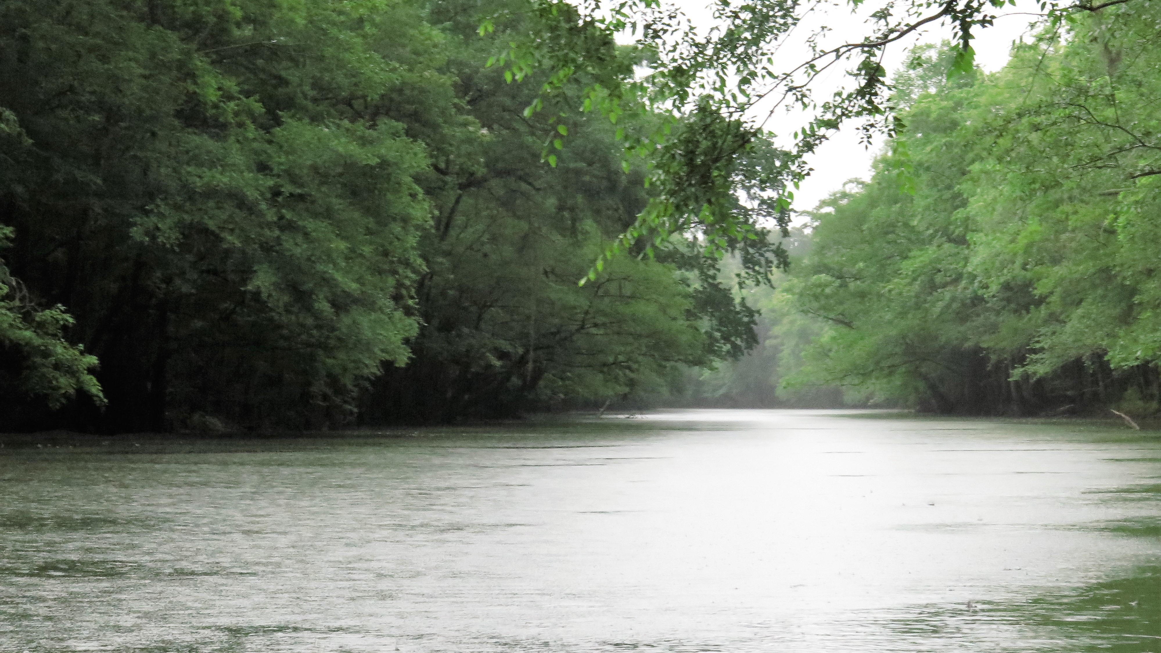
We had not quite reached Yancey Bridge when the first raindrops hit the windshield. Ricky, my ride to the river and Bear Paw owner, glanced at me encouragingly, “Even a bad day on the river is
better than …” He didn’t need to finish. “Of course,” I agreed.
Raining Hitting the Chipola
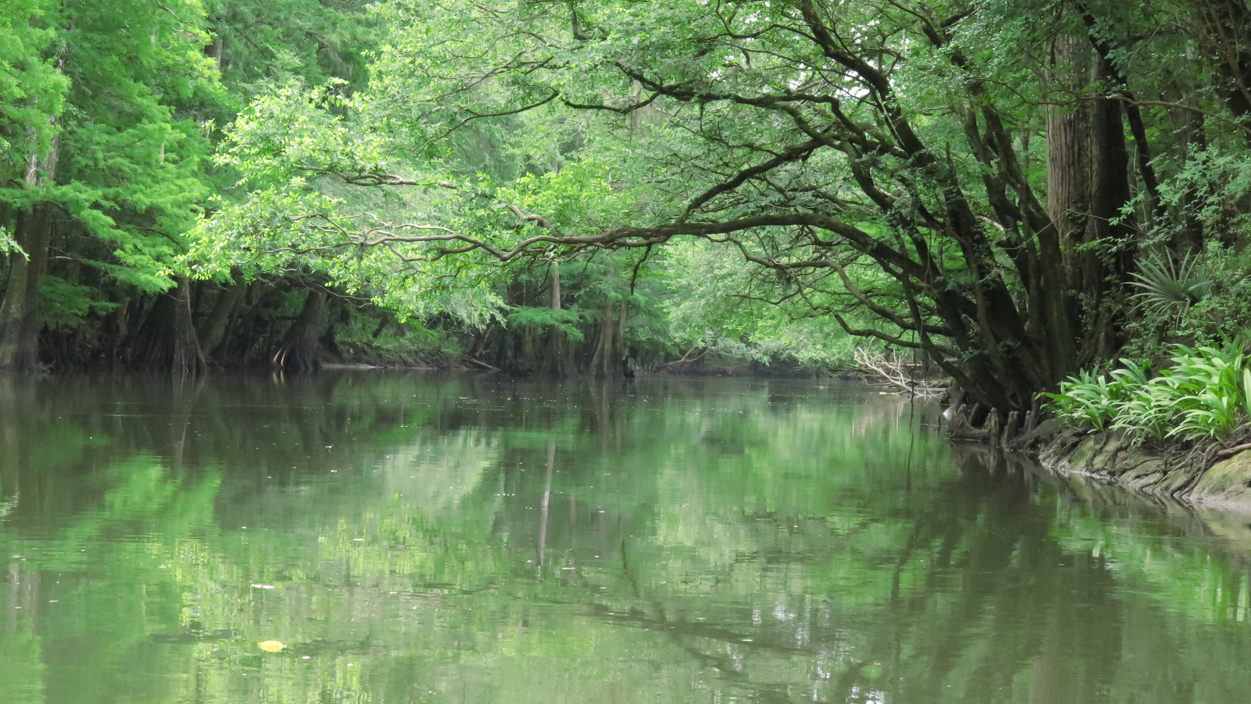
After paddling Florida rivers for more than five years, I have pretty much exhausted my list of rivers with outfitters located on or near them, leading me to revisit some previously-paddled waterways. This summer, I chose to paddle one of my favorites, the Chipola River in Marianna, Florida. The Chipola originates in Alabama and travels south close to 90 miles—with 51 miles being a designated Florida paddling trail. It passes through the Panhandle and eventually merges with the Apalachicola River which empties into the Gulf. It’s a beautiful river and one of my favorites.
I had paddled the Chipola about five years ago—and what a wonderful experience! I looked forward to paddling it again—rain or shine. My intention was to spend three days paddling different sections of the river. I wanted to re-paddle the Yancey Bridge to Magnolia Bridge trail on the first day (first paddled 7/17/12) and then paddle south of Magnolia Bridge to the Peacock Bridge on the second. On day three, I would paddle Spring Creek which flows into Chipola about two miles above the Magnolia Bridge. (Map, pages 2-3.)
It was spitting rain as Ricky shoved me off– just before 10:00. Twenty minutes later, I heard the first crack of thunder. I decided I would hold off the worry until lightning appeared—but briefly wondered if it would be better to be in the water or under the trees—my only choices—if it did. Heavy rains had turned the aqua blue water into a murky moss-colored waterway coddled by lush green trees. Birds chattered away in the woods as I paddled the dark waterway with no one else in sight; life couldn’t be better! About thirty minutes into my paddle, the steady rain gave way to a brief period of sunshine, giving me time to dry off before it began again.
There is something so peaceful and cleansing about paddling in the rain; there’s no time for other thought, just the mindful experience of listening to the sound of the rain hitting the water and trees. The rain didn’t bother me at all, although I did give myself a mental “high-five” for remembering to bring my rain jacket.
Beautiful Greens Reflect in the Water
Whether the skies are blue or gray, the entire paddle on the Chipola is a calendar-worthy experience. I passed limestone banks and cypress swamps with various shades of green reflected in the dark water. I spied great herons, ibis, and even a red-tailed hawk. I made it to the “ovens” (caverns) about an hour and a half into my paddle and stopped for a stretch. I took a peek into the dark caves but did not wander far inside not knowing what creatures might await me there. No doubt this is a common stop-off for many paddlers. I was disappointed to see the litter others had left.
Back on the waterway, I continued my journey. A gentle flow to the water kept me moving, and I came upon the spring to the left. Five years ago the water was clear, and I was able to take pictures of the spring under water. This time, the water was too murky and dark, and I couldn’t even make out the spring. It had begun to rain harder. I exited the spring just as an owl flew overhead.
It did begin to lightning as I neared the end of my trip nearly four hours later. As much as I loved the paddle, I was happy to arrive at my destination.