Determined to see some wildlife this time (other than birds), I began my hike in the afternoon and was on the trail at 1:20 pm. This time, I parked at the Cypress Boardwalk parking area, about seven miles inside Gate 1. I hiked just over a mile to loop 4 and the OTL Trail. (The OTL runs along the west side of loops 3 and 4 and then leaves the loops to head towards Corbett Wildlife Management Area.)
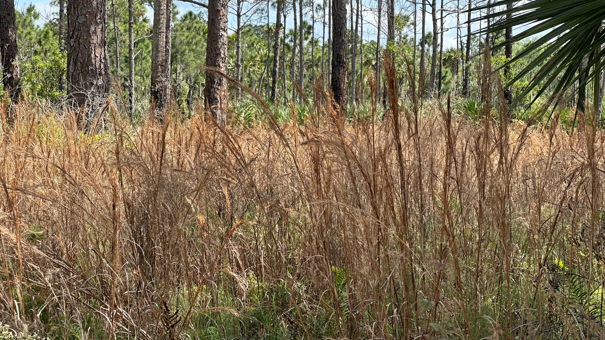
Tall Grasses Frame the Trail
The spring flowers were just beginning to bloom, and I found myself alone on the trail with the exception of the many birds, and towards the end, many wild boars! The sounder of boar I came upon were in various shades of brown, tan, and black and went about their business digging holes on the side of the trail as I passed.
I paused for a snack and a rest at a campsite at the southern end of the loop for about thirty minutes. The campsite had two picnic tables, two fire pits, several benches, and lots of room for tents. Tall pine shaded the area—a welcomed relief from the sun!
Dupuis Loop 4
My hike was over seven miles total, so the loop itself was about five miles. As I drove from the nature area and across the OTL trail, I was reminded how close I was to the lake. My next hike would be an out and back from Dupuis to Lake Okeechobee—about nine miles.
Every time I step onto a Florida trail, I wonder, “What will I see this time?”
I passed through part of the Loxahatchee Slough Loop Trail when I completed my third section of the Ocean to Lake (OTL) Trail. The Loxahatchee Slough is part of Palm Beach County’s protected natural areas which are maintained mostly by the Environmental Resources Management. How fortunate we are to have these natural protected areas. (For a list of Palm Beach County multi-use trails: https://discover.pbcgov.org/erm/Pages/JeagaWildways.aspx)
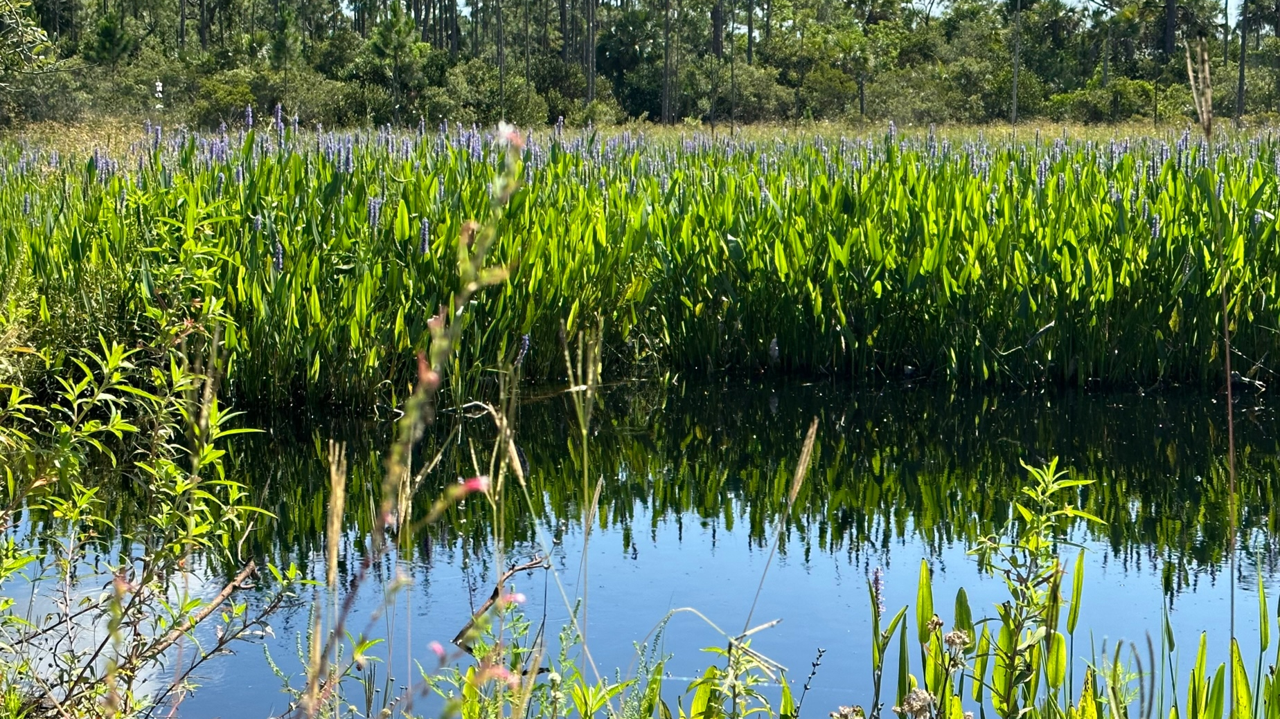
Flowers Decorate the Loxahatchee Trail
With easy parking at 11885 Beeline Highway, I arrived just as a 10K run completed. County staff, still on site from the run, showed me the trails on a map and explained trail conditions. Water had flooded a section of the last leg of the return on the Loxahatchee Slough Loop, so I opted for a longer hike on an extended loop to stay dry. I also included the out and back to the observation tower which I found was just steps away from the OTL trail section I had hiked from Riverbend Park to Beeline Highway. The same county staff member also hooked me up with a new trail app, Avenza Maps. This app displays the maps in pdf format but also shows your location on the map. I found this very helpful!
I began the trail by 9:45 a.m., hiking clockwise around the loop. Another hot Florida day—already! I stopped at the restroom about a half mile in (clean and roomy) and changed into my shorts, quite happy I remembered them this time. There was a bench just outside the restroom next to the water. This, and the picnic table at the tower, were the only rest spots on the trail. I would have welcomed a couple more benches—especially along the last section. Once again, I found myself sitting on the roadside in the shade of a pine tree for a snack and rest.
Water Along the Trail
With the exception of the blazing hot sun, the trail, a dirt road with lovely surroundings, was easy to hike. I passed sand pine, wax myrtle, saw palmetto, cabbage palms, tall grasses and remnants of spring flowers. With recent rains, water approached the trail on both sides. My only company were the Ibis and butterflies until about one mile from the finish when I passed a man headed in the opposite direction.
I enjoyed the beauty of my 5.5-mile hike, completing it in less than three hours with my two breaks. With the exception of the sounds coming from the Beeline Highway on the last portions of the trail, it was a quiet, peaceful hike.
I visited my trail sister, Robyn, in Orlando over the weekend for lunch and shopping. I met Robyn in Georgia last fall when we both signed up for a slackpacking trip and completed the first 52 miles of the Georgia Appalachian Trail. We have planned a camping/hiking trip to Georgia next fall—four days, three nights—to complete the Georgia AT and to get started in South Carolina.
Beautiful Trail at Lake Louisa State Park
We met at our favorite store, REI. Robyn is the camping guru, and she helped me gear up for our trip. After that, we relaxed over a delicious lunch and bottle of wine at a local restaurant to plan our trip.
Before I headed home the following morning, Robyn and I drove to Lake Louisa State Park, Robyn’s local state park. We hiked a couple short trails and Robyn showed me the two primitive camping sites she frequents. At $5 plus tax per person, per night, you can’t beat this for entertainment. I agree with the park’s introduction on their website: “A natural theme park awaits those with a hearty outdoor spirit. “
Cypress Knees Along the Trail
We hiked about three miles; however, the park has seven miles of paved roads and another twenty miles of unpaved multi-use trails that wind through cypress swamps, tall pines, and scrub forests. Included in the park are Lake Louisa, Hammond Lake, and Dixie Lake You can glamp, camp, or even rent a cabin. (trail map)
Lake Louisa at the State Park
Like many of the state parks, some areas showed evidence of a recent controlled burn with black charcoal markings on tree trunks. However, our surroundings were beautiful and quiet. You got to love Florida State Parks!