I successfully completed hiking the Ocean to Lake Trail by hiking the section from Powerline Grade to Loop Four of Dupuis (11.4 miles in and out). It seems like only yesterday that I started at Hobe Sound Beach, but it was nearly 2 years ago!
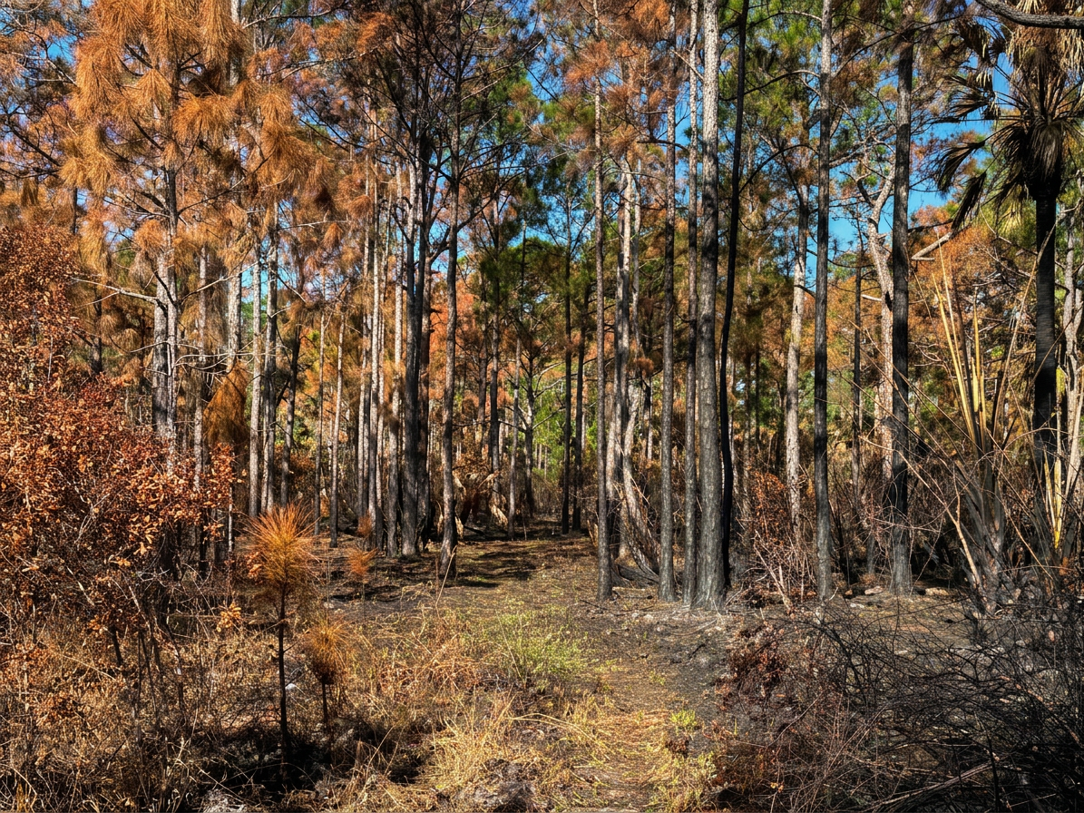
Heading Into the Pine Forest
The day was stunning, and the trail was in excellent condition. Beautiful fall shades of gold, orange, and brown surrounded me, and there was not another soul on the trail. A perfect day for a wilderness adventure.
The Browns and Golds of Fall
What a great experience it has been to hike the OTL Trail. Thank you to all the volunteers who keep our trails maintained throughout the year!
With all the heavy rains we had this summer, I expected a wet trail. However, I did not expect a day of water aerobics!
A Very Wet Hike Through Corbett
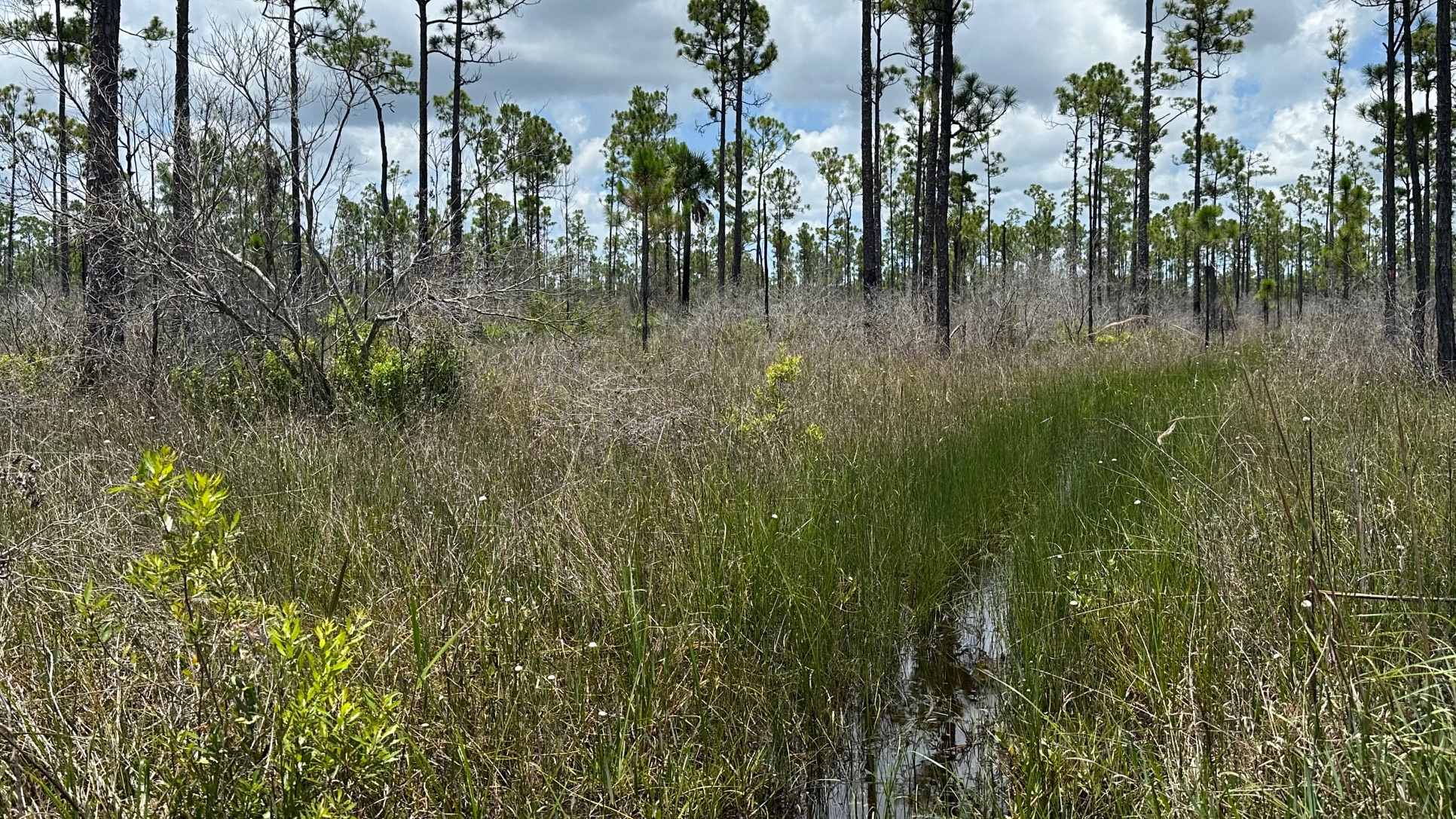
With two sections of the Ocean to Lake (OTL) Trail left to hike, I did not want to let a little rain get in my way. I began my hike on Powerline Road just south of where the OTL crosses it. I walked along the road, turned east onto the trail, stepped over a gate, and began my hike. The dry trail gave me hope, as I entered the pine forest.
However, very shortly after I began my hike, I came to water—and not the kind that I could walk around. So, I began sloshing, my snake radar on high alert for snakes and any other water-loving creatures.
Hopeful for a Dry Hike
Other than the noise I was making, my hike was quiet. Bromeliads and air plants clung to the cypress. Birds flew from tree to tree. I emerged from a cypress strand onto a short section of somewhat dry trail and completed a bug and critter check on my legs, trail runners, and arms. Clear so far!
I continued on the now narrow trail into a pine forest, (a bit overgrown, so don’t forget to spray your clothes). I crossed a buggy road or two and then I was back in the water. The tea-stained water was difficult to see through at times, and after a while, I stopped trying. I was making enough noise to scare away anything lurking beneath the surface (I hoped!).
Hopes for a Dry Trail–Dashed
I stepped onto dry trail the last half mile to the canal. I passed a couple medium sized hogs as I made a turn—one black, one brown. They scurried away when they saw me. I stopped under some pines just past the Little Gopher Canal for lunch and a break before heading back.
My four-mile hike back was hot, but I managed to find a couple shady dry spots to stop and rest. My average time was considerably longer than normal but the water aerobics had slowed me down. The trail was about 80% wet and the water rose anywhere between my ankles to my knees.
I have nearly completed my section hikes of the OTL. I have one section remaining—about six miles one way, so a twelve mile hike total.
I stepped onto the narrow trail ready to enter the pine forest. The temperature in my car as I parked showed 82 degrees, and my weather app predicted it to reach 90—which of course means that it will feel like 100 plus. Another hot Florida spring day on the OTL.
Narrow Winding Trail
It was quiet as I hiked along the winding trail. Although I heard lots of birds, the animals had opted to stay somewhere cooler–smart. Saw palmetto reflected silver in the hot sun and bromeliads clung to tall cypress trees. Everything was still.
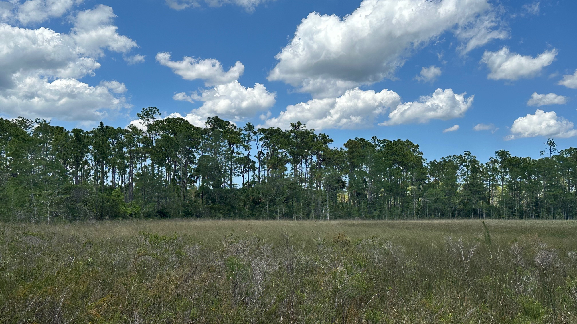
Hazy Day on the Savannah
I enjoyed this part of the OTL; there was something comfortable about the old buggy and forest roads I walked along. I hiked past the grassland/savannah which appeared hazy in heat. I came across very little water or hog destruction on the trail.
I made it as far as the canal, just past the Little Gopher Campsite. When I had problems finding the blazes to continue, I took it as a sign to turn around. I stopped at the campsite and lunched on the ground in the much-appreciated shade of the pines. The campsite had benches around the fire pit, but they were out in the hot sun–a much better choice on a cool day.
I returned to my car after an eight-mile hike, ready for the bumpy, dusty ride to the Corbett entrance. I’ve completed about 52 of the 62 miles of the OTL thus far, with about 10 left to go. I’m getting there!
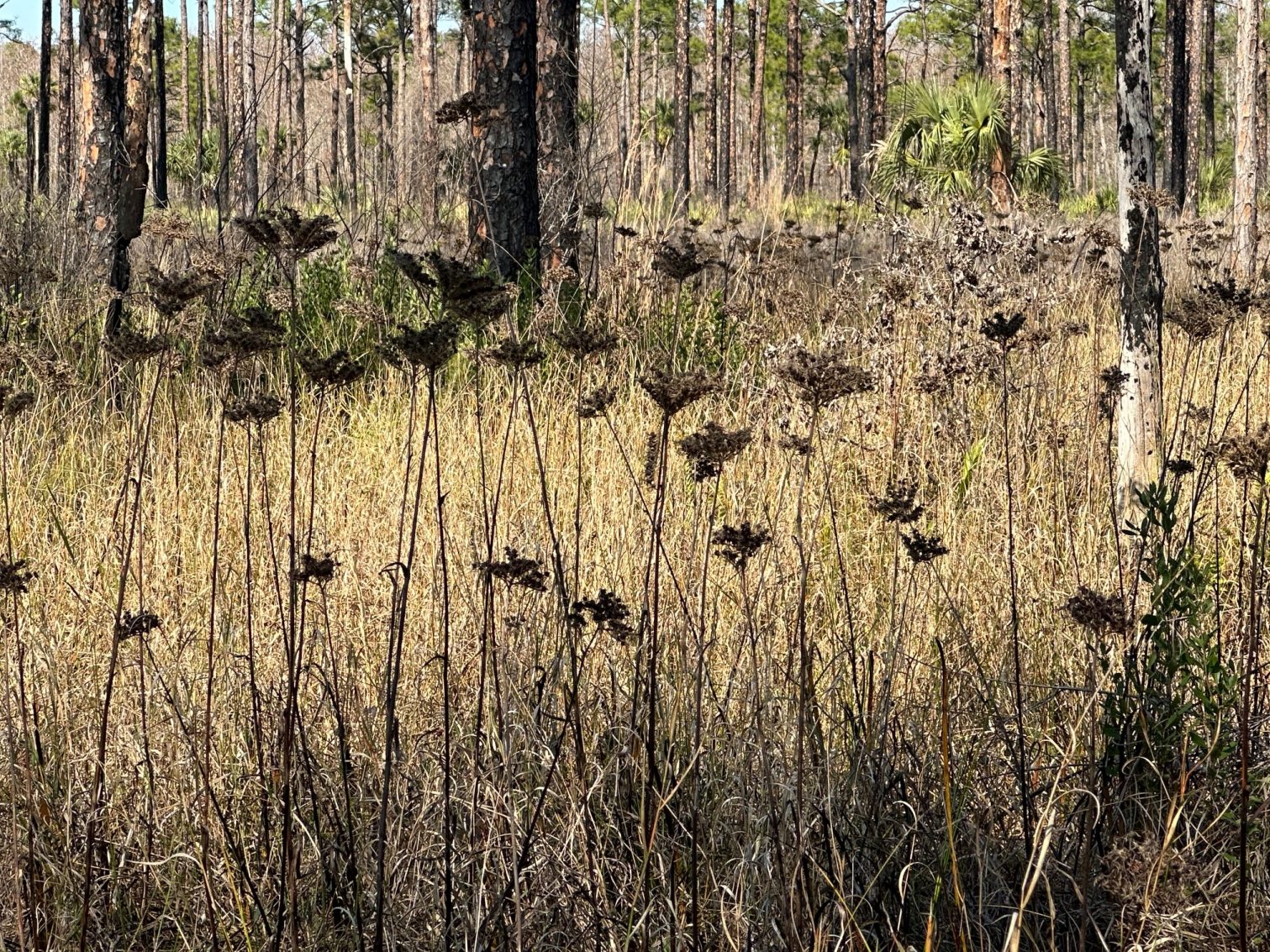
Another five miles completed! With less than fifteen miles remaining of the Ocean to Lake (OTL) Trail, it has become more difficult completing large sections at a time. For the remainder, I will need to hike out-and-backs.
Slash Pines Reaching to the Sky
On this day, I hiked ten miles total through the Corbett Wildlife Management Area —five miles out and five miles back. I parked on South Grade Road, a very dusty, bumpy road, and I headed east into the forest, immediately sensing something magical and mystical as I wove my way through the twists and the turns of the slash pine and cypress forest, the “Hole in the Wall.”
Far Out promised me that I’d be wading through water in this area, but the trail was dry (That was okay with me.). Birds called from the trees, and orange blazes, like breadcrumbs, led me in the right direction. I love shade. This was one of the prettier sections of the OTL Trail that I have hiked. Small green ferns sprouted from the recently-burned earth, colorful wildflowers stood out against tall green grasses, and bromeliads clung to cypress trees.
Spring Flowers Along the Trail
I took the recommended side trip to Bowman Island (also dry) and sat in the much talked about plastic chair for lunch, staying far away from the fire pit and all the hornets buzzing around it-eh. Back on the trail, I continued my hike towards the prairie (also dry).
The day was too hot for wildlife, and I was feeling the heat. I passed my mark from my previous hike, and turned around. I’m a snacker when I hike—dry apricots, banana chips, chick peas, cheese, and nuts. I always bring lots of water with me, but I could tell on this hike, I needed more electrolytes. With no bench in sight, I stopped for a break, settling on the ground, looking up into the tall pines shading me. Just what I needed!
Back at my car, with about fifty-two miles of the OTL completed, I began planning for my last two OTL hikes!
I had just over 20 miles remaining of the 62-mile Ocean to Lake Trail, and I have gotten to the point where I need to hike the dreaded out-and-back to complete the miles as there is a lack of Uber drivers in these remote areas for a drop off. So, I parked at the south entrance of the Corbett Wildlife Management Area and was on the trail shortly after 9:30. I had already hiked to the east from here, so on this day, I headed west, first on the dirt road and then following the trail into the woods.
Passing Through a Recent Burn Area
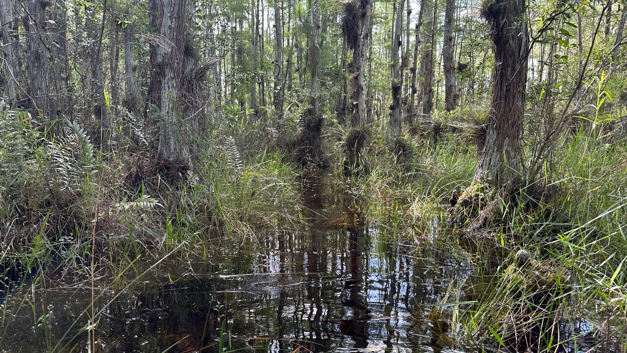
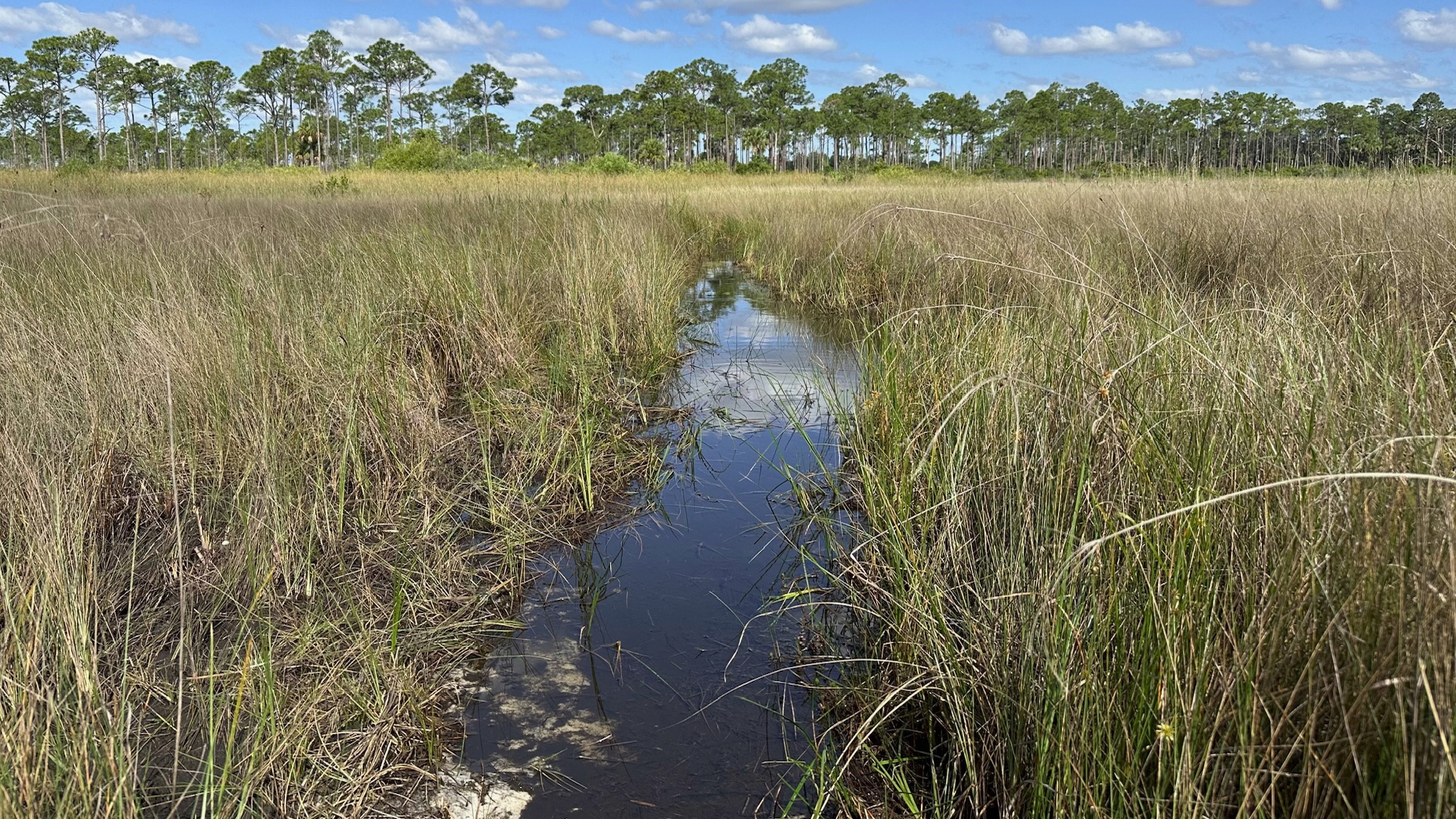
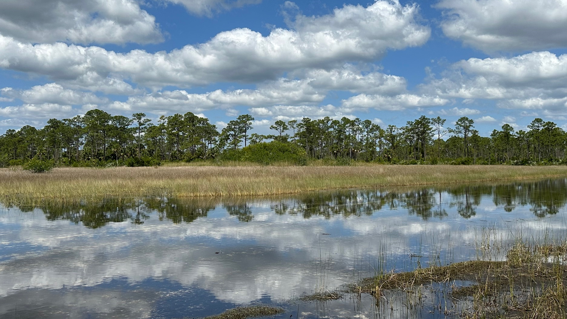
In the first mile, there was evidence of a recent prescribed burn—and then—Eyeglass Pond, the wetlands walk. (By the way, the bench before the pond is the only bench on this section of the trail.) I did see a sign for a wetlands bypass, and (briefly) considered taking it as I thought about the creepy crawlies in the water, but I needed to complete the OTL Trail, and I saw the orange blaze in the distance, right in the middle of the wetlands area. So, off I wet, sloshing in knee-high water, keeping an eye out for unwelcomed guests in the tall grasses on either side of me.
Crossing Eyeglass Pond
Regardless of the wet trail, I enjoyed this portion of the OTL. Tall, straight slash pines reached up to the sun, and reflected their beauty in the grassy wetlands surrounding them. I had to be careful not to lose a sneaker in the sometimes-deep mud, and there were several other areas where avoiding the water was not an option.
Painted Reflections in the Pond
I hiked to approximately 25.85 mm, 5.25 miles from the Corbett South Entrance, not quite to the junction with the Blue Trail to Bowman Island Camp. On the return, I did opt for the wetlands bypass—partly out of curiosity and partly to avoid the potential critters I somehow avoided on my hike west. Surprisingly, the bypass did not take me far out of the way.
I have 16.85 miles remaining to complete the OTL. For my next hike, I’ll leave my car at the South Grade Road and hike and out-and back to where I left off.
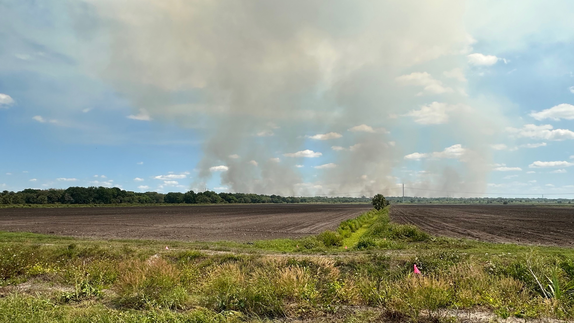
In retrospect. It would have been smart to park at Lake Okeechobee and hike to Dupuis WEA, but being so familiar with Dupuis, I didn’t even think of it until I was already on the trail, looking back at the smoke from the prescribed burn.
Prescribed Burn East of Dupuis WEA
I drove through Gate 1 at Dupuis WEA and shortly noted there was a controlled burn going on east of Dupuis. It appeared distant, so I parked on the west side of Dupuis Grade Road just south of where the OTL crosses over, and I headed to the trail.
With the prescribed burn to the east of me, I headed west and was on the trail by 11:30 a.m. I hiked 4.5 miles to the lake and back for a total of about 9 miles. The first mile took me through a lovely pine forest, and I expected (hoped) to see some wildlife that may have been fleeing from the burn. My hopes were dashed as the only wildlife I saw on the ground was one very large wild turkey.
About three quarters of the hike was along dirt roads—probably used mostly by the farmers. The last mile was a somewhat busy and very sandy/dusty road frequented by large trucks that sent clouds of dust and sand into the air and all over me.
OTL Ends Here–Lake Okeechobee
Although I did not enjoy the dust, I did enjoy hiking past the freshly plowed fields and new crops sprouting up; it felt very springlike. And the cows—I enjoyed our chat. (I love cows.) I arrived at Lake Okeechobee a bit dusty, but happy. I found a piece of shade next to the kiosk to sit (a bench or picnic table would be very nice here!) and have lunch before heading back.
By the time I returned to my car, the burn had moved westward. Driving the six to seven miles out on Dupuis Grade Road, parts of east side of the road were sizzling and swirls of smoke rose from the bushes. At one spot, a hot wind tunnel crossed the road in front of me.
Although this was not my favorite section of the trail, there were parts that were beautiful and certainly worth the hike.
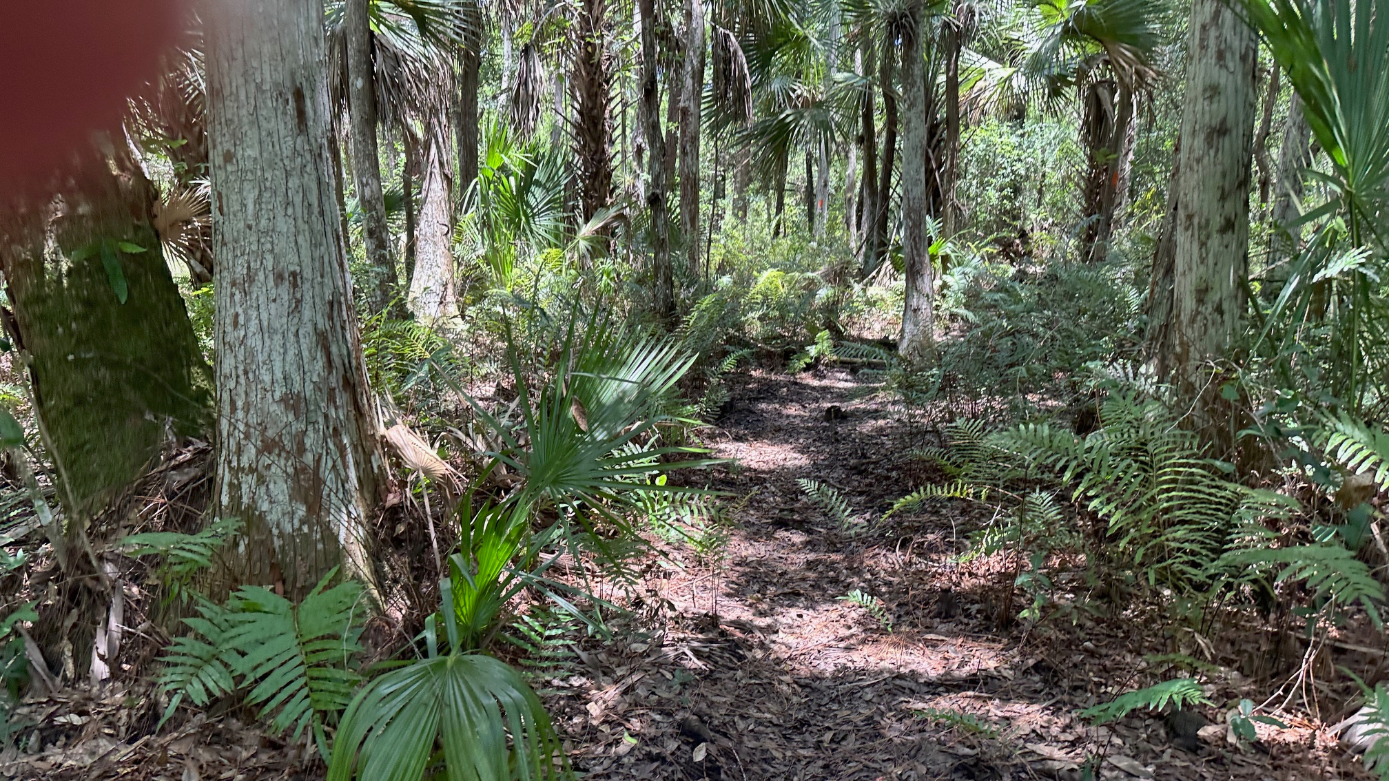
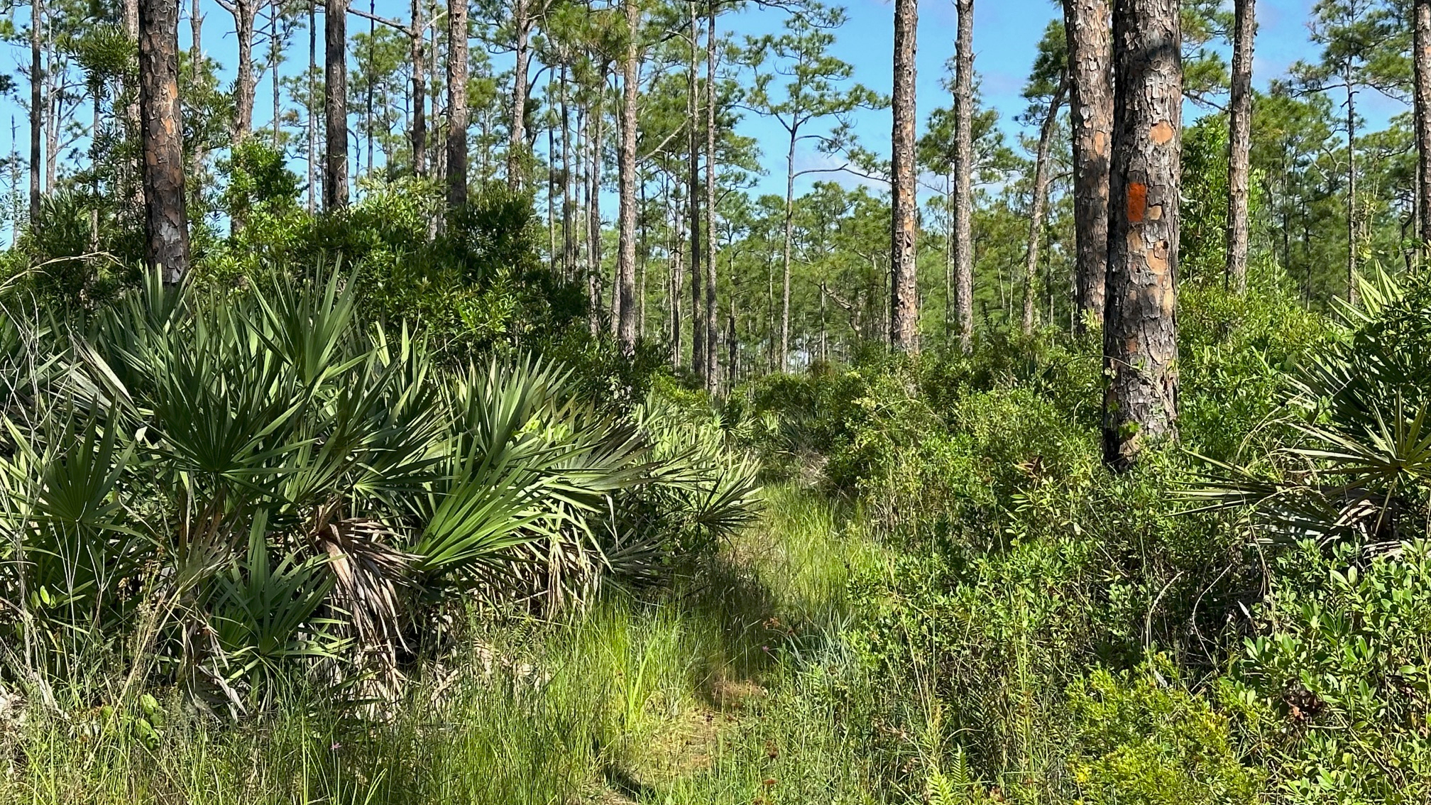
Determined to see some wildlife this time (other than birds), I began my hike in the afternoon and was on the trail at 1:20 pm. This time, I parked at the Cypress Boardwalk parking area, about seven miles inside Gate 1. I hiked just over a mile to loop 4 and the OTL Trail. (The OTL runs along the west side of loops 3 and 4 and then leaves the loops to head towards Corbett Wildlife Management Area.)
Tall Grasses Frame the Trail
The spring flowers were just beginning to bloom, and I found myself alone on the trail with the exception of the many birds, and towards the end, many wild boars! The sounder of boar I came upon were in various shades of brown, tan, and black and went about their business digging holes on the side of the trail as I passed.
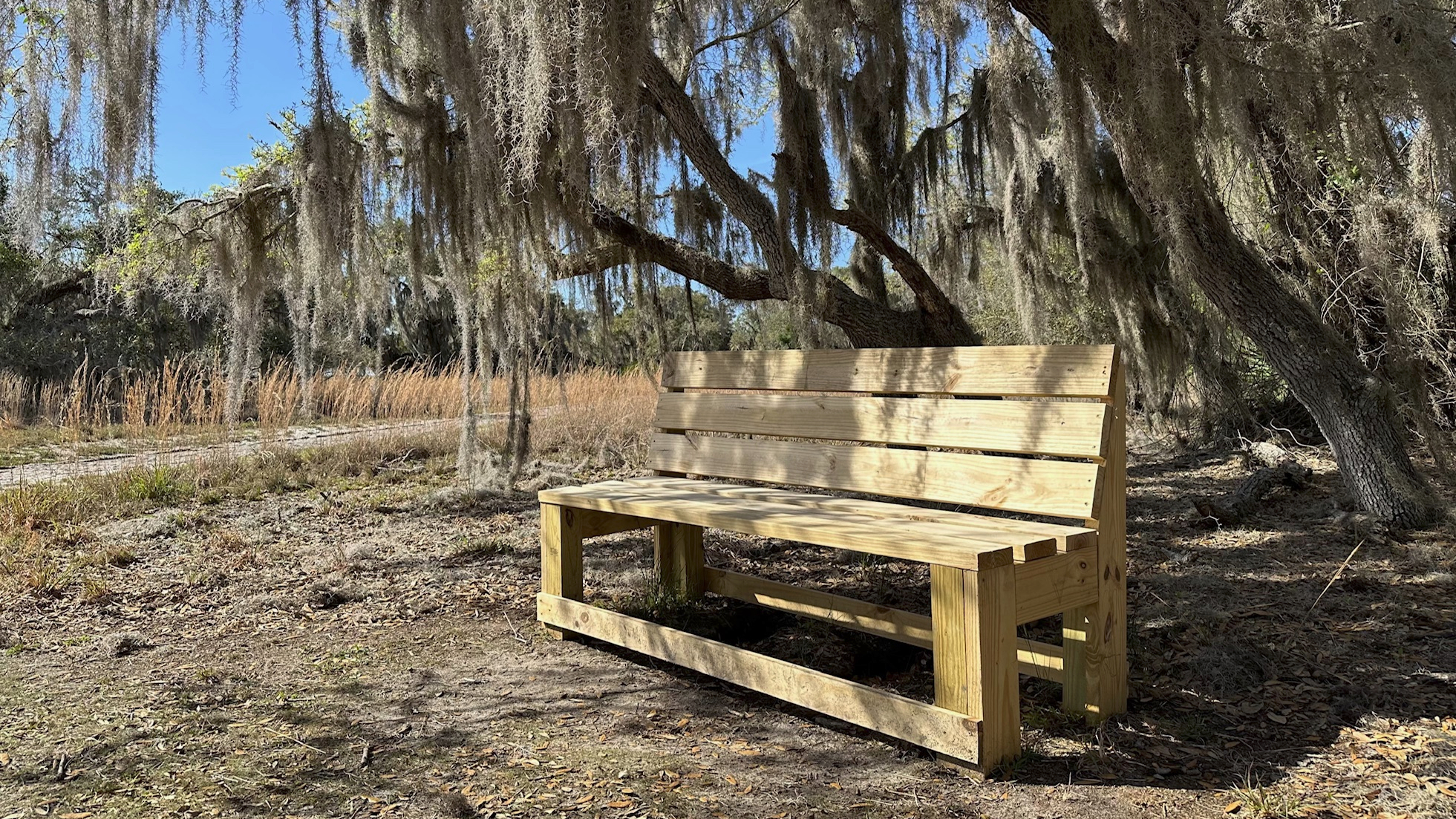
I paused for a snack and a rest at a campsite at the southern end of the loop for about thirty minutes. The campsite had two picnic tables, two fire pits, several benches, and lots of room for tents. Tall pine shaded the area—a welcomed relief from the sun!
Dupuis Loop 4
My hike was over seven miles total, so the loop itself was about five miles. As I drove from the nature area and across the OTL trail, I was reminded how close I was to the lake. My next hike would be an out and back from Dupuis to Lake Okeechobee—about nine miles.
I arrived at Lake Kissimmee State Park shortly after noon, stopping at the office to check into my site and get recommendations for hiking trails. I drove away with the park map loaded into my Avenza app. A small winding road took me through the park and finally to my campsite—one of two small sites—about three miles in. I set up my tent under the shade of live oaks and slash pines and headed out for my hike on the Kristen Jacobs Trail, the North Loop.
Tall Pines Along Kristen Jacobs Trail
Kristen Jacobs Trail (02/27/2024)
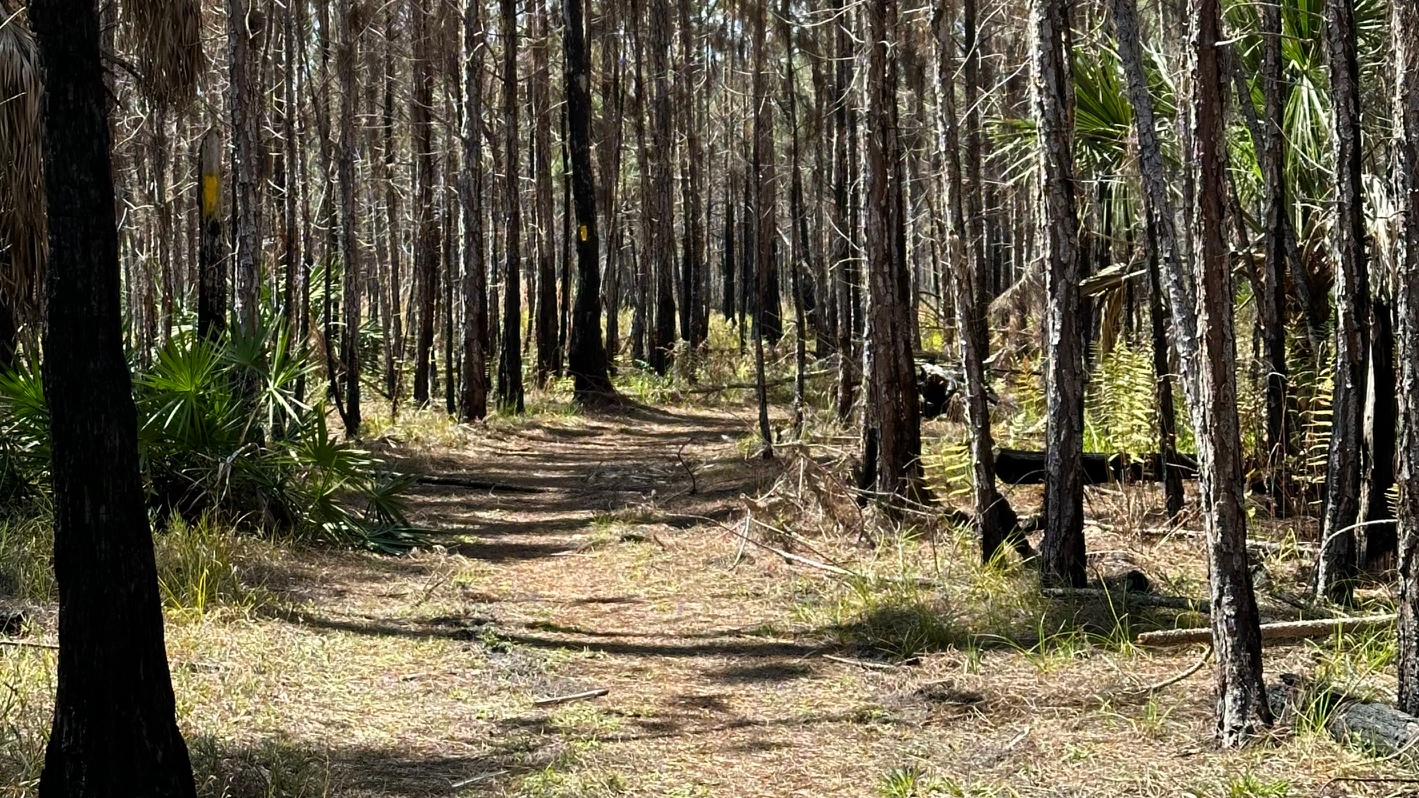
The 6.5-mile Kristen Jacobs Trail appeared well traveled, maintained, and blazed. Surprisingly, this looped trail, covered with fallen oak leaves and pine needles and landscaped with saw palmetto, cabbage palms, and tall straight pines, showed no signs of boar activity. What an easy hike!
A Shady Rest Along Gobbler Ridge Trail
I loved the pine forest! Prescribed burns had left the forest transparent with smaller pines sprouting up, now easily competing for sunlight and nourishment. Standing on the trail, I could see through the trees and felt I could camp safely at the primitive site.
A Campfire to Keep Me Warm
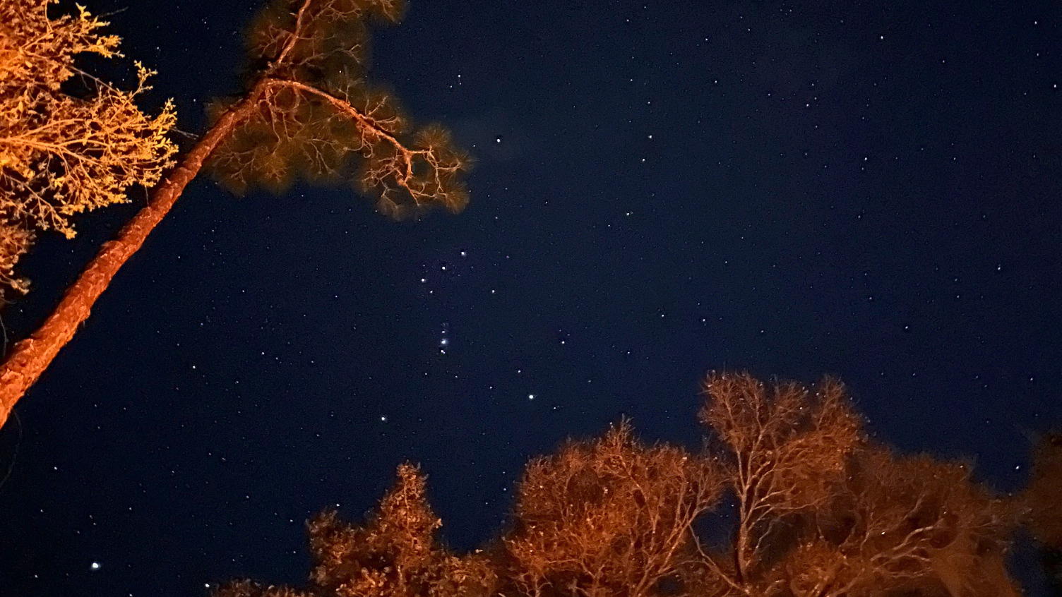
Back at camp, I started a fire and watched as the sky turned dark and the stars came out. I woke up to birds singing around my campsite.
Starry Night at Lake Kissimmee
Gobbler Ridge Trail (02/28/2024)
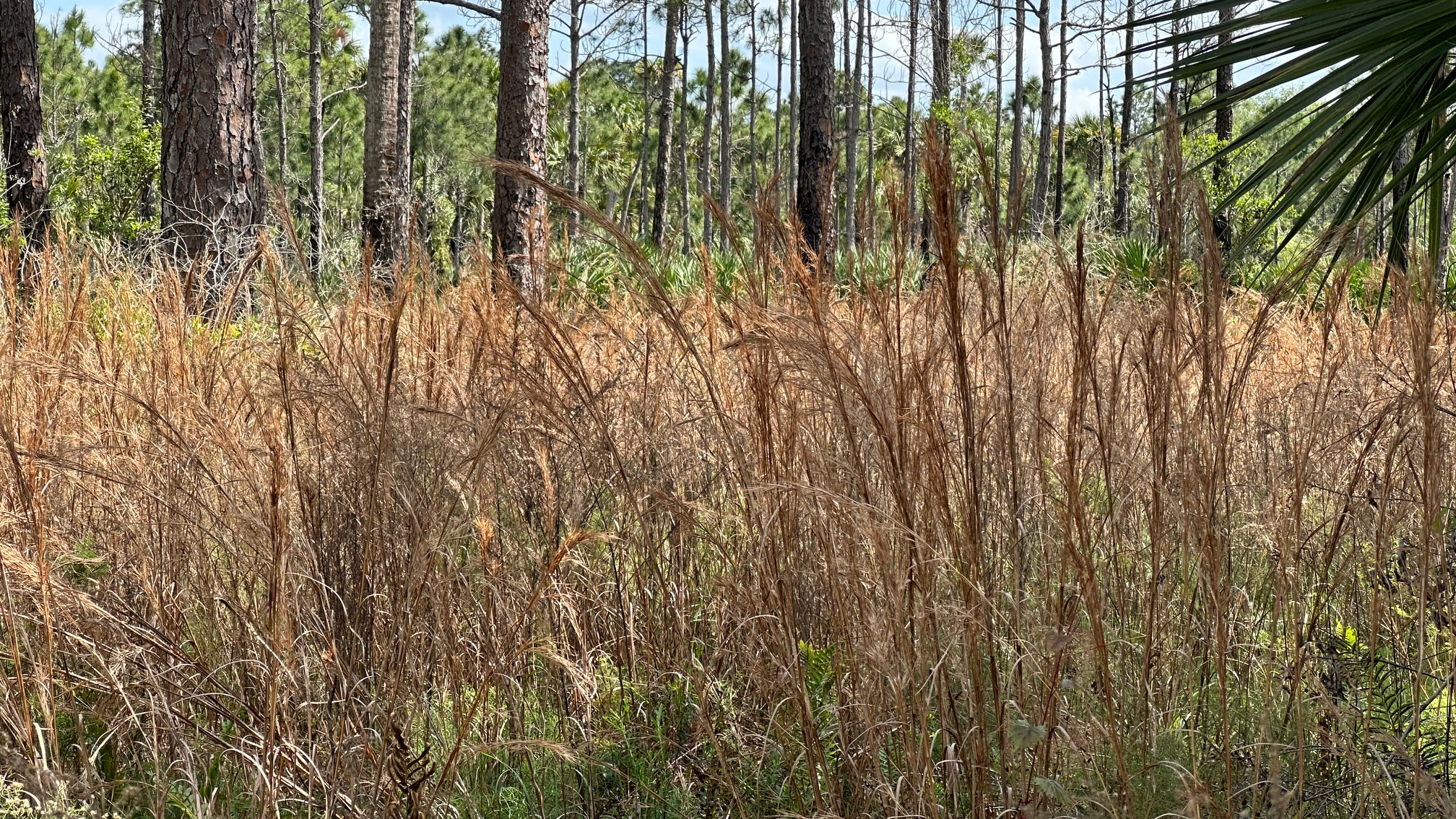
My first day at Lake Kissimmee State Park was all about the tall slash pines and a beautiful transparent forest. Day two, on the Gobbler Ridge Trail, it was all about the ancient live oaks dripping with Spanish moss and the golden prairie surrounding it.
The 2.5-mile trail began on concrete as I walked through the playground and past the lookout tower to get onto the dirt trail bordered by a prairie on one side and gorgeous ancient Southern Live Oaks on the other. After a bit, the trail turned to sand and traveled along Lake Kissimmee. I came across some water on the trail, but I easily walked around it.
This trail was great for walking/hiking, biking, and horses. I admit, I took longer than usual on this short trail, taking advantage of the brand-new benches to sit and reflect. Something about the beautiful golden grasses bending with a cool breeze invited me to linger. Back on the trail again, a bobcat ran across my path, in a hurry to get somewhere!
Departure
I stopped in the office when I left the park, and I chatted with Matthew, an inspiring biologist working on his second masters, about the trails. I asked him why the trails were so clear with no boar activity–this was unusual for any Florida trail. He explained that they do have a bad boar problem, but that they are on the trails daily keeping them clear. We talked about the pine trees and he explained the difference between long needle and slash pine, stepping outside to show me as well. What a great trip and wonderful state park! I would recommend this park to anyone and found the trails wide and safe enough (little or no water, no trail brush for ticks) to bring the kids.
The third loop—Happy Valentine’s Day to me! I had hiked the first two loops of the Dupuis Wildlife Management Area during the summer and fall of 2023, and I wanted to hike the last two before the hot summer weather and daily rainstorms arrived.
Saw Palmetto and Slash Pines Along the Trail
With help from some Facebook folks (Florida Trail Lox Chapter), I knew where to park to access loop 3. I arrived at 9:15 a.m. and parked west of the loop on the Grade Road accessed through Gate 1—just past where the OTL Trail crosses over the road. I hiked one mile to connect with loop 3.
What a gorgeous day! About 60 degrees with a slight breeze and a few clouds when I started on the trail, the weather couldn’t have been nicer. I was thrilled to see maintenance had been completed on the trail and all was dry. With the exception of some wild boar activity, it was an easy hike.
Tall Pines Silhouette the Sky
Alone on the trail, I enjoyed my surroundings of tall slash pine, vivid green saw palmetto, and wax myrtle. The birds kept me company—red shouldered hawks, red bellied woodpeckers, and cardinals. I appreciated the benches along the way—if only to use for a stretch. When I exited the trail onto the OTL trail, it surprised me how close I was to the lake, only 5.5 miles from where the OTL connects to Loop 3.
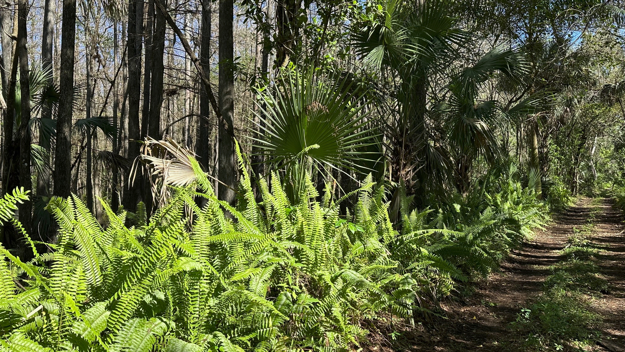
After a night spent camping at the Collier-Seminole State Park, I began my drive home, and I decided to fit in just one more hike. The Fakahatchee Strand Preserve State Park was not far away, with a website that claims it to be the largest state park in Florida with an “emphasis on the preservation of its natural character.” I did not want to miss this!
Ferns Add a Splash of Green Along the Trail
I turned off of State Road 29 and onto the Janes Memorial Scenic Drive, past the Visitor Center and restrooms which make up the “limited facilities” offered by this no frills park. The “Janes,” as the website warmly refers to this six-mile dusty road with holes and bumps that could easily complete with any city speed bumps, is the main access to the hiking trails. Driving down the road (slowly), it became clear that this park lived up to its goal to preserve its natural character, and it did not rely on RV campsites or children’s playgrounds to attract nature lovers. This park was big and wild!
I headed towards Gate 7, the West Main Tram Trail, a 4.5-mile out-and-back trail surrounded by swamp strands. The tram roads in the park are old logging roads built in the 1940s used to haul cypress logs from the swamp.
Between Me and My Car
Although very buggy (Those babies can bite through steel!), I enjoyed my shaded hike through this beautiful, wild country. Swamp strands to my right and left were filled with cabbage palms and bald cypress cloaked in orchids, bromeliads, and air plants. The saw palmetto and ferns along the sides added a dash of brilliant green to the landscape. An occasional orange tree appeared to be out of place.
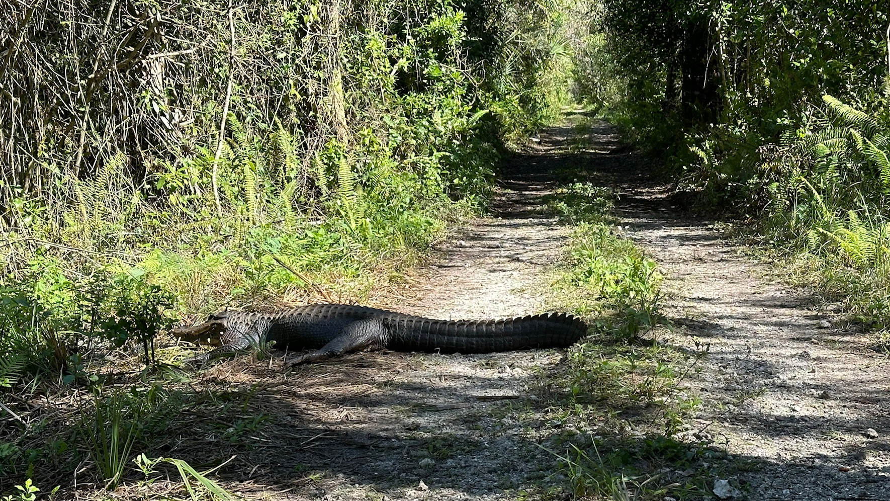
The skies and trees were alive with red-shouldered hawks, woodpeckers, and warblers. Ibis and herons waded in the water. Butterflies fluttered past me. Alligators sunned on the banks and rocks besides the trail, and yes, the mosquitos still bit me. Picnic benches invited hikers to pause and enjoy it all. On the return, about a half mile from my car, one gator had left his sunny rock and moved onto the trail. I spent fifteen minutes yelling and clapping my hands with no reaction from him. My “gator-gone” methods exhausted, I pulled out my phone and played Taylor Swift, Bad Blood, as loudly as I could. Slowly, the lazy alligator raised up and walked into the water. (Add that to your hiking list!)
I returned to my car and headed home, sorry I could not stay longer and hike another trail.