Feeds:
Posts
Comments

Posts Tagged ‘outdoors’

I stopped my car and read the sign at the entrance to the outfitter: Econfina Creek Canoe Livery “Go With The Flow.” I briefly reflected on the river-life metaphor as I drove down the driveway and parked.

Embracing Foliage on the Econfina Creek

I chose Econfina Creek as my second river to paddle in the Panhandle.  Huff describes the scenery as “superb,” with giant cypress that arch overhead.  Carter et al. claims that many consider the Econfina the “most beautiful and challenging stream in Florida.” It sounded like a waterway I needed to paddle.

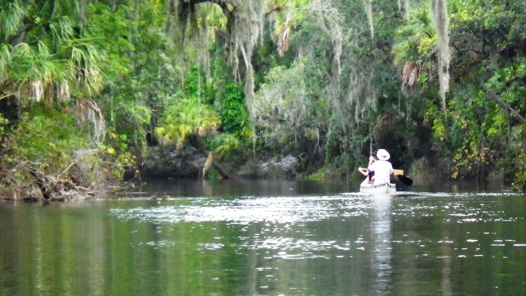
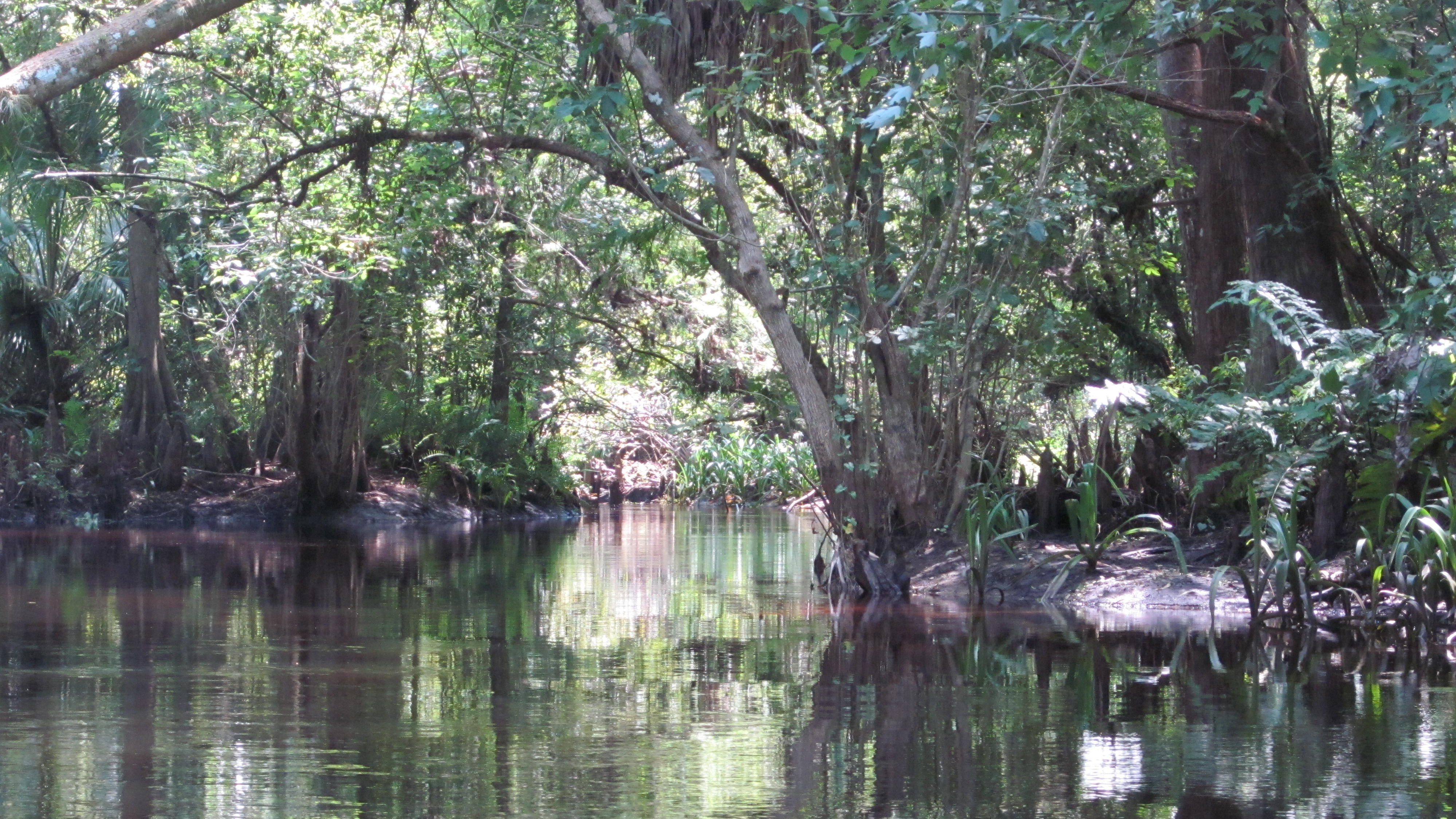
So, I selected my kayak from a generous inventory at the outfitter, and I put in right there at 10:30 a.m.—to be picked up at the end of my seven-mile trip at CR 388.  Although the water level seemed low, I paddled away on a strong steady current, through the twists and turns of the Econfina.

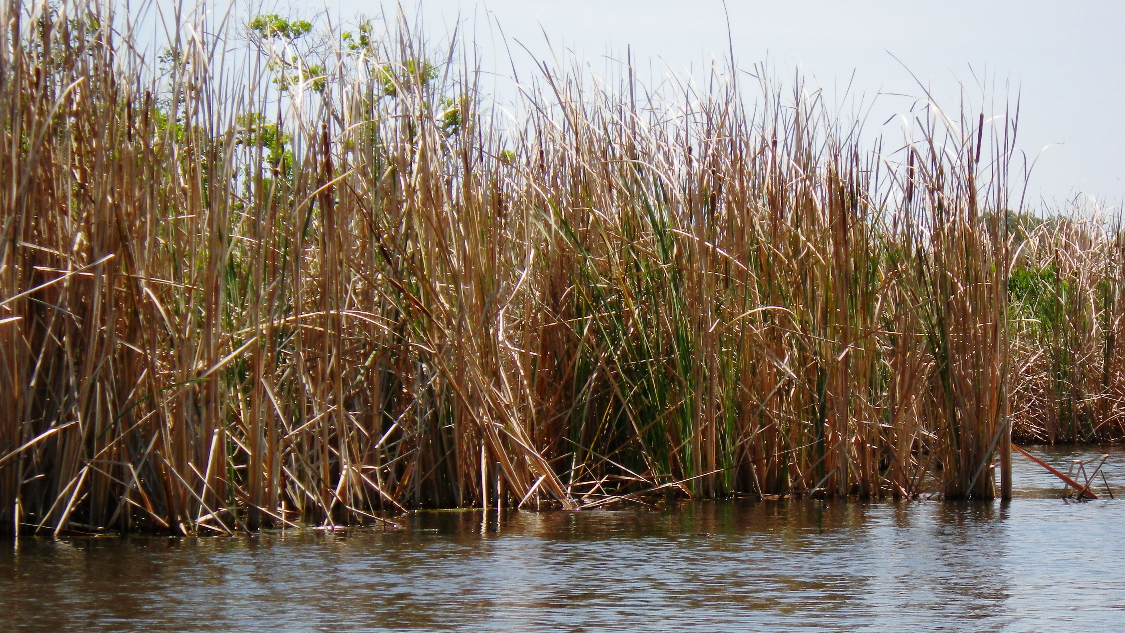
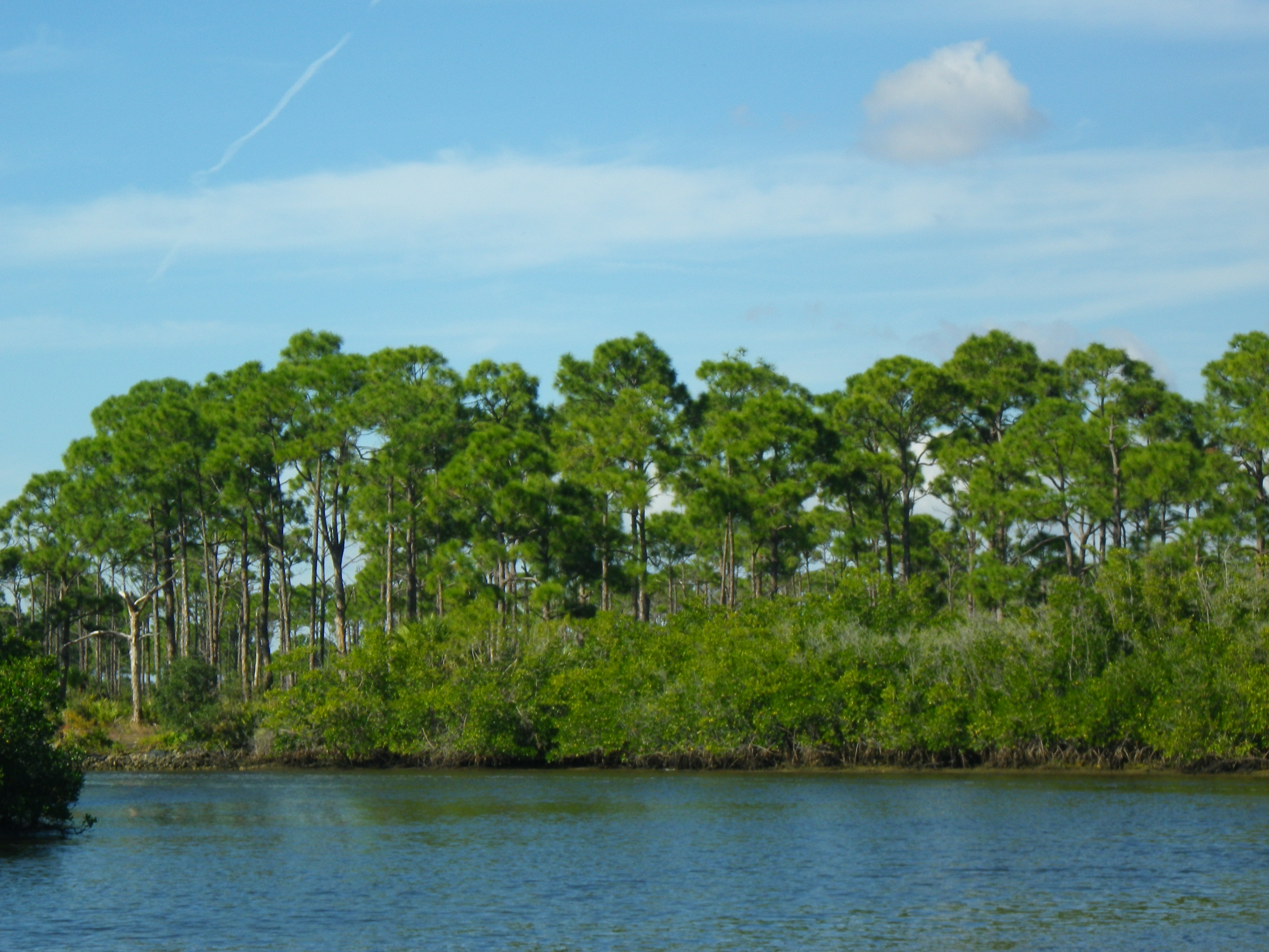
Econfina comes from a Muskogean Indian word meaning “natural bridge.” (Carter et al.) The Econfina Creek originates in the southwest corner of Jackson County, Florida, where a number of creeks add to the flow. Along the way, springs and runoff contribute even more until it finally discharges in Deer Pointe Lake in Bay County. (Boning). The upper portions of the creek run swiftly through limestone and high bluffs with a 7.9 gradient. A gradient 4 and lower banks on the lower portion where I paddled make for easier navigation.

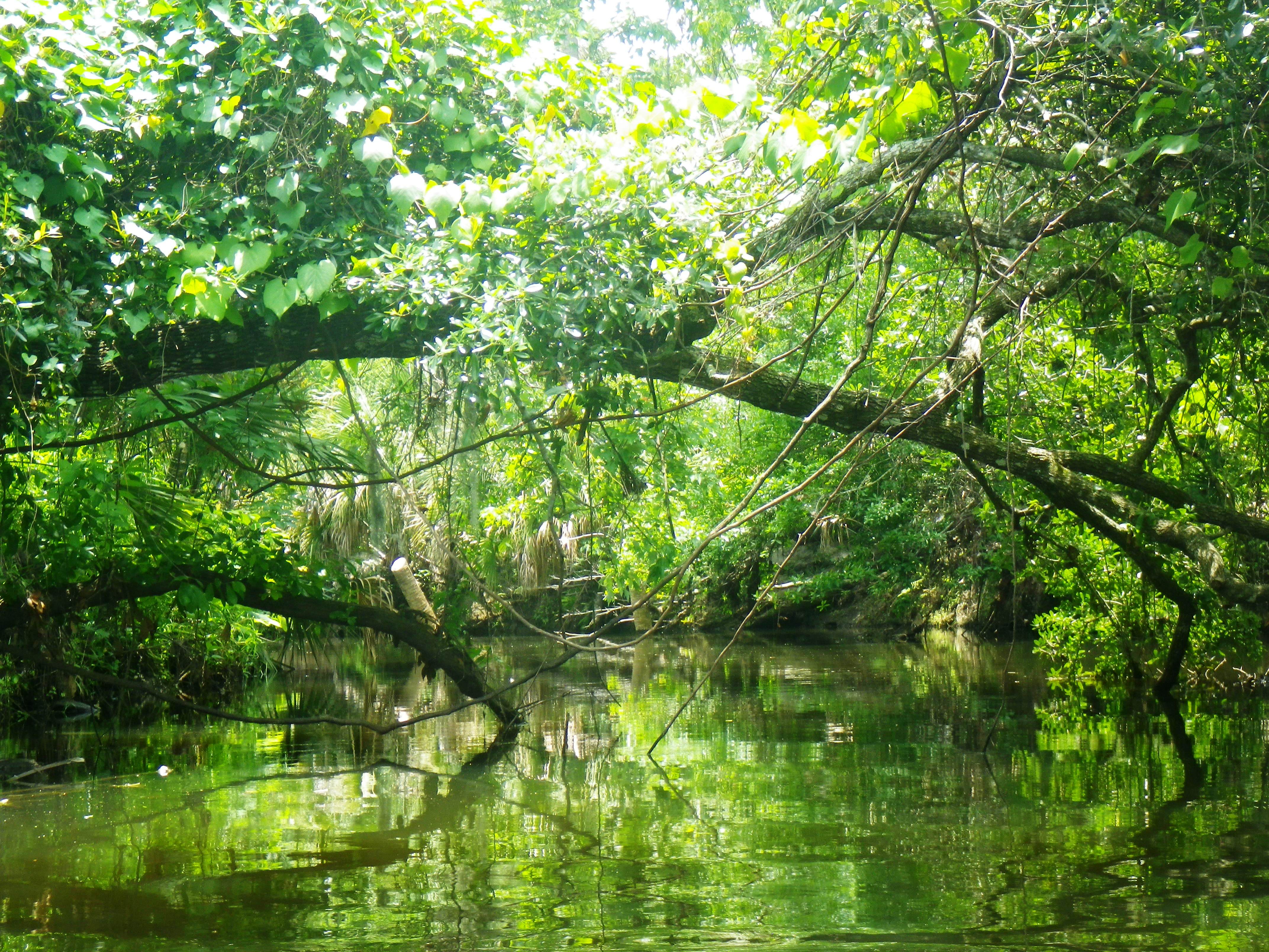
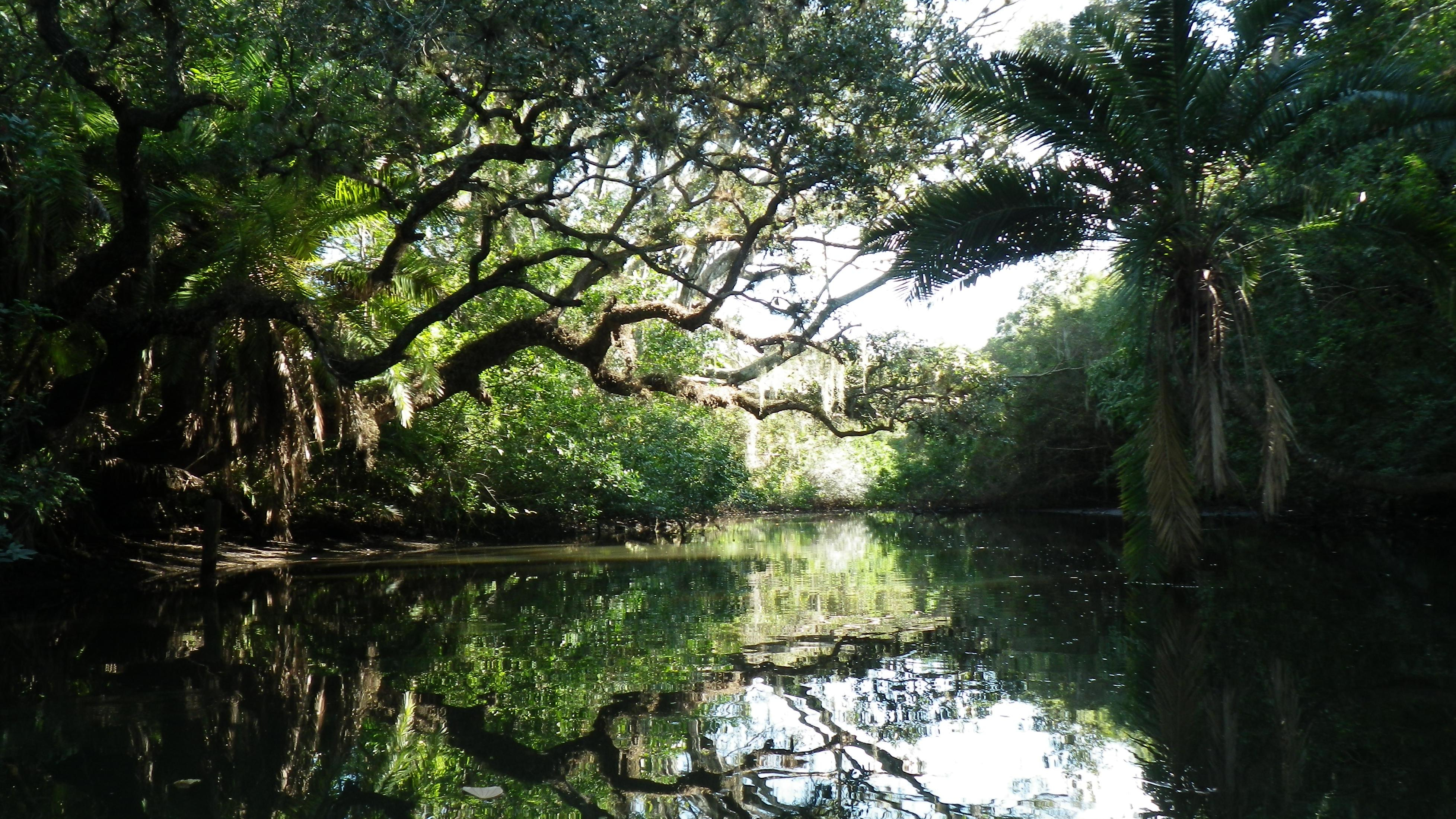
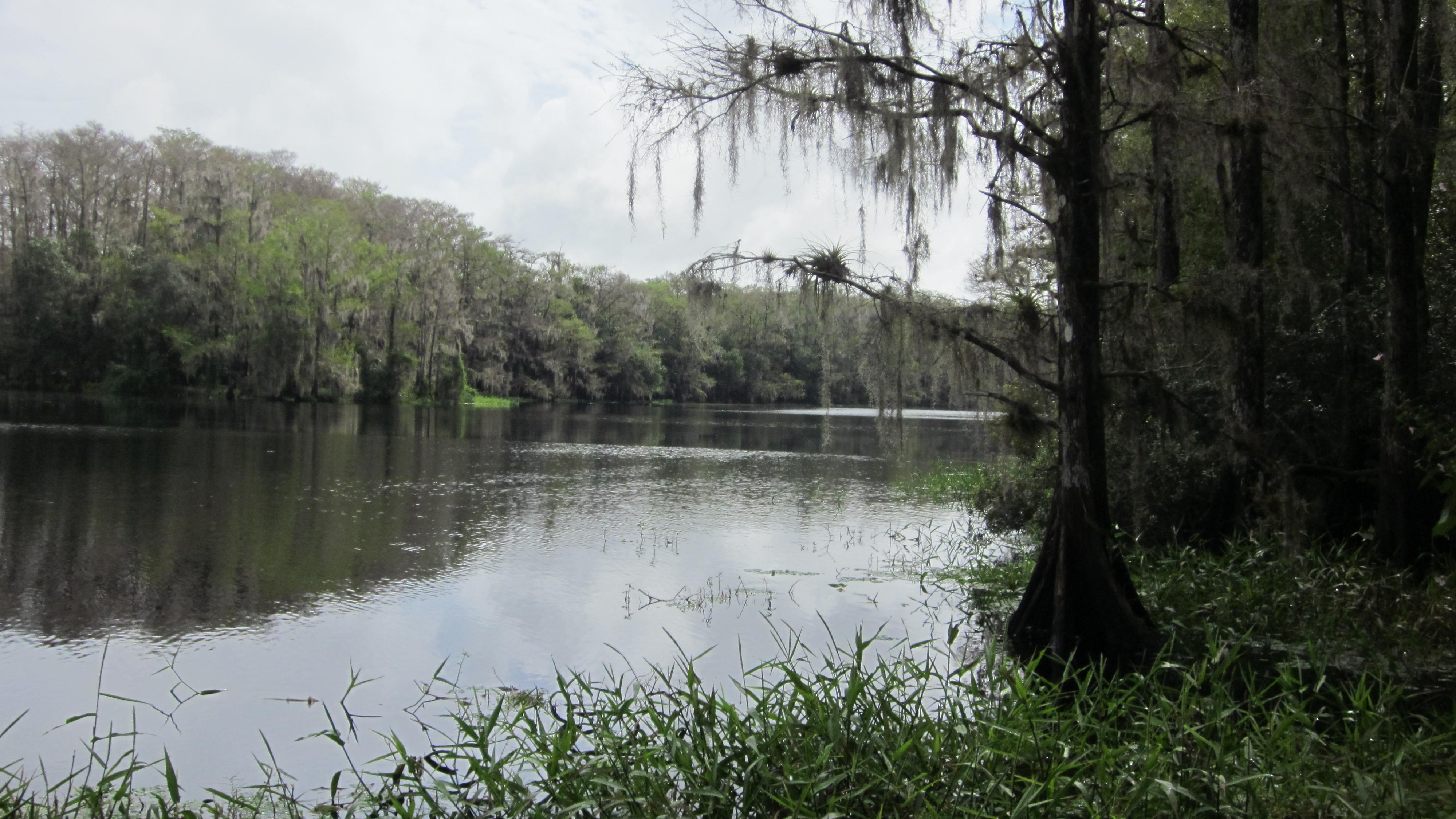
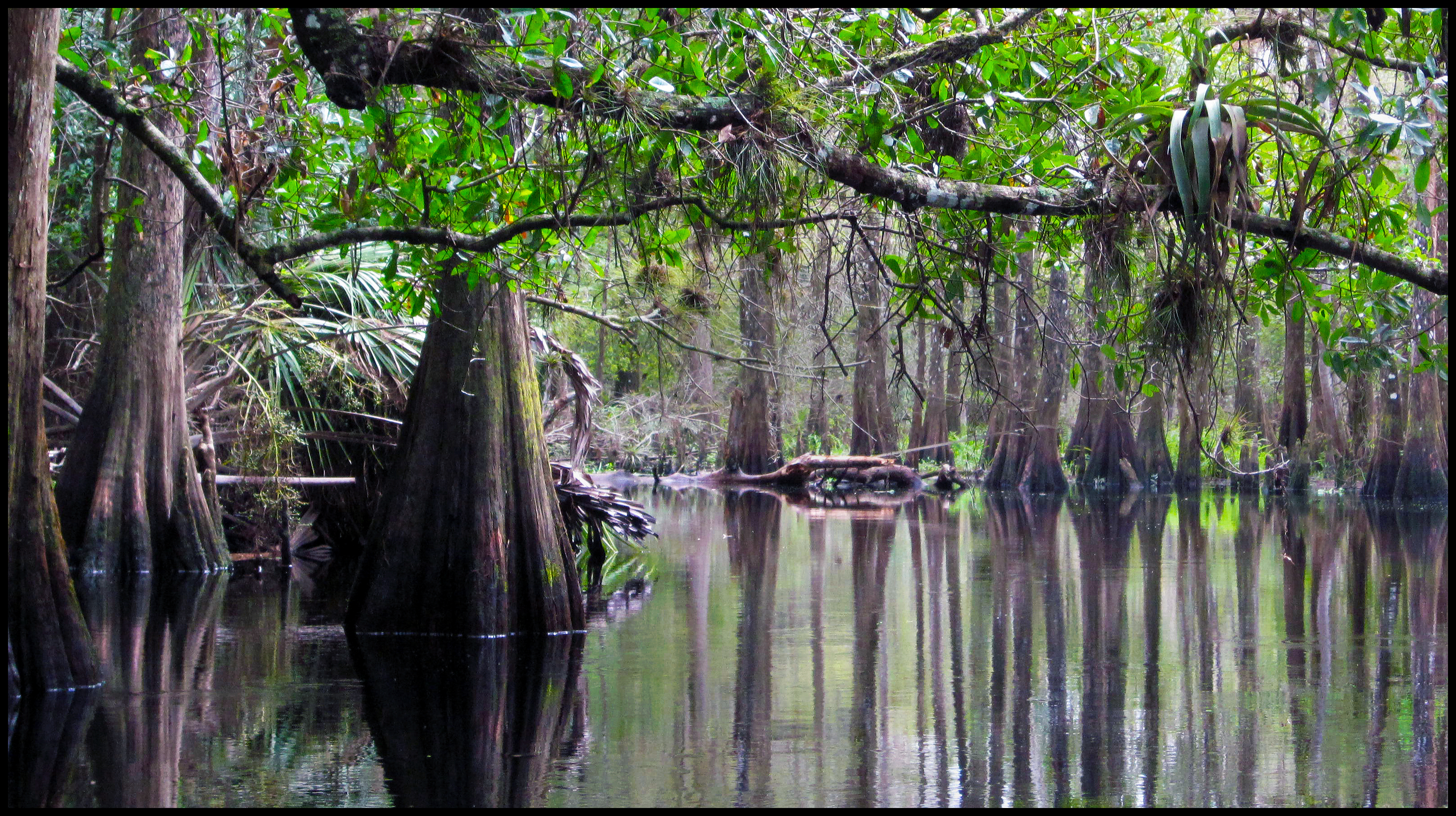
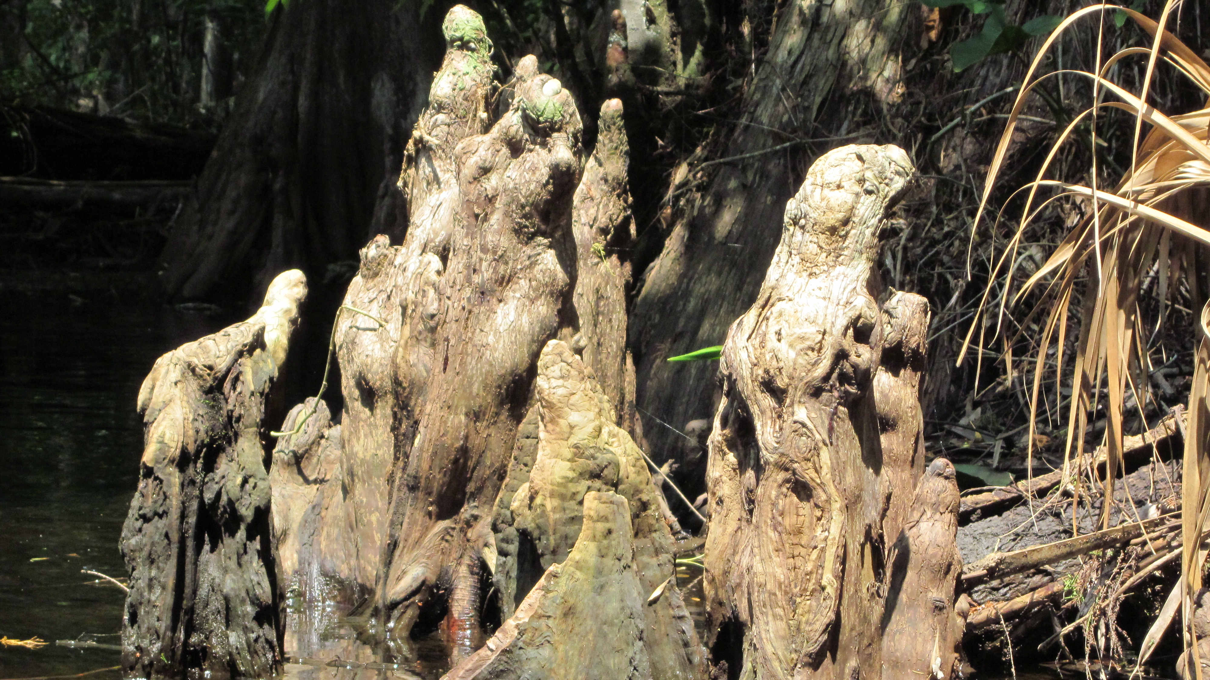
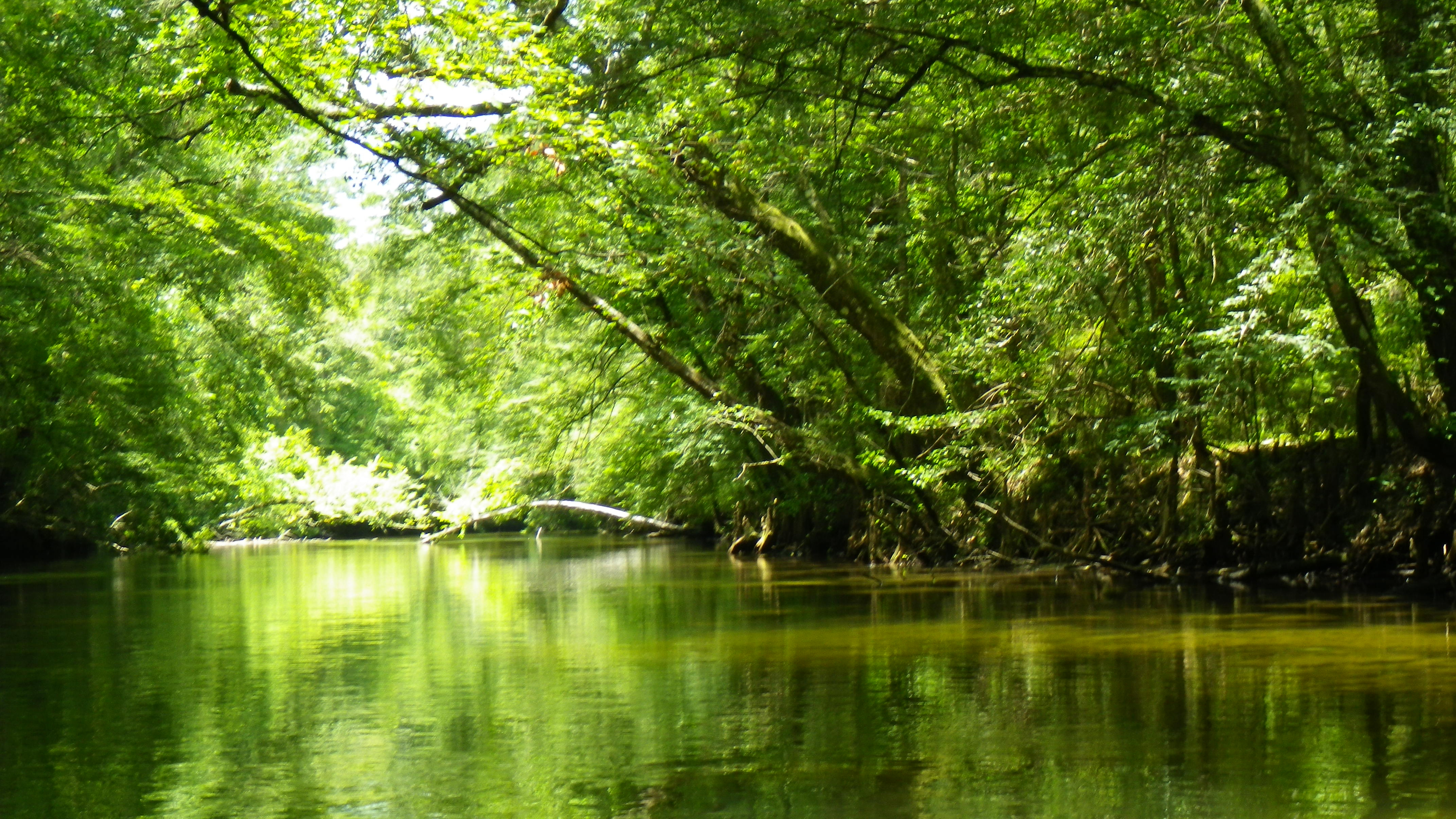
Huff’s description of the creek held true; tall, arching cypress, along with magnolia, several varieties of oaks (including Shumard oak and laurel oak) and pines, dogwood, and red maple embraced the waterway.  Similar to the Chipola River, the landscape varied with swampy wetlands on one side and high limestone banks/cliffs—these, dripping with lush ferns—on the other.  Lots of sandbars along the way made for an easy dip to cool off or pause for a snack.

Spring Along the Econfina Creek

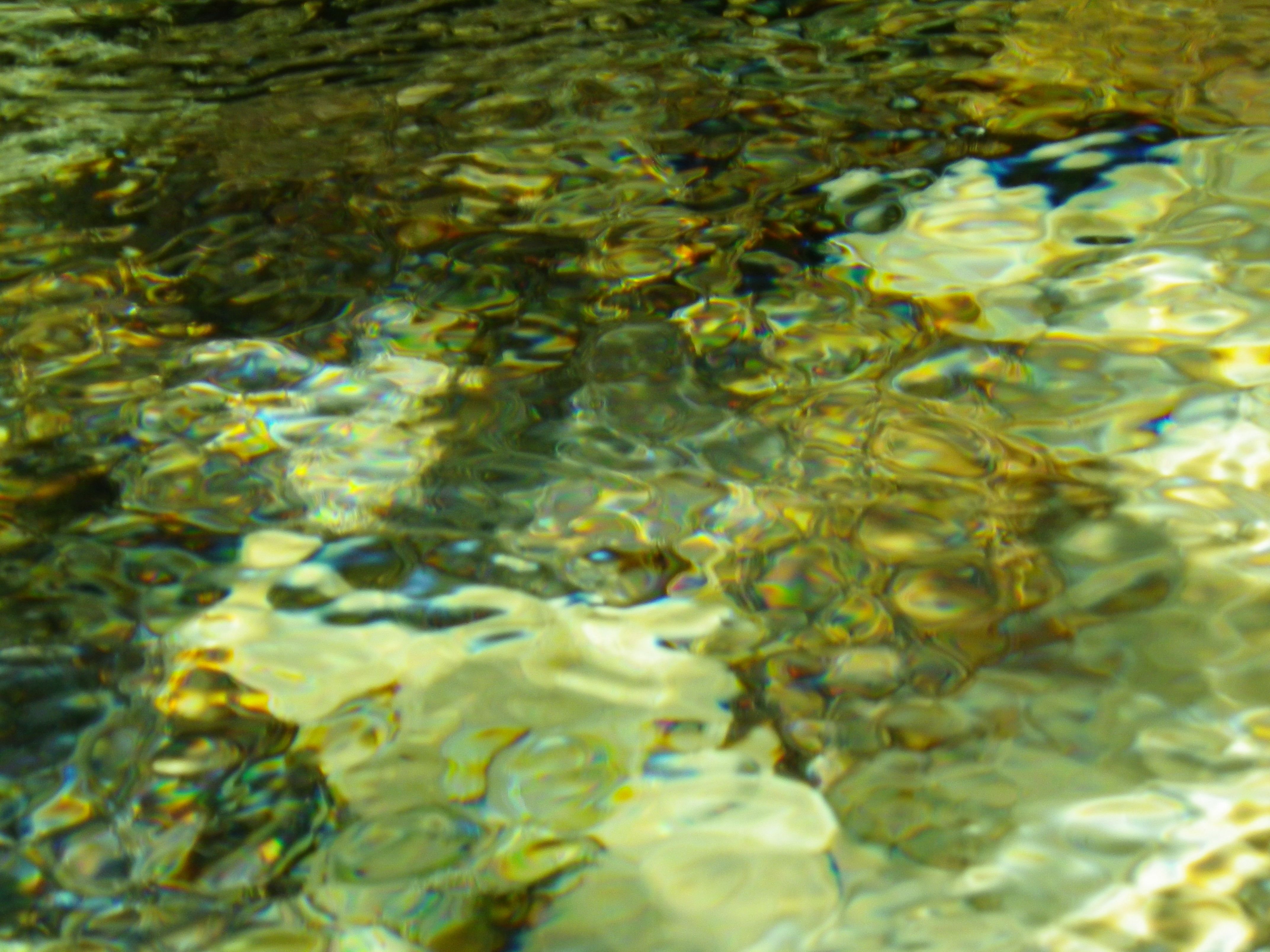
Some of the land around the creek is privately owned; however, the few houses that appeared seemed to blend in with the surroundings.  The Northwest Florida Water Management District has acquired about 14 miles along the creek and has built viewing structures so people can access the springs.  I paddled past several of these springs along the way.  At Pitt Spring, I met two local women, Gail and Rose, who came to cool off on a hot day. During our chat, they described the beauty of the creek when the dogwoods and azaleas bloom.  At Emerald Spring (the main source for Econfina Spring water), a young family snorkeled at the base of the 25-foot limestone bank to view the spring’s powerful flow.

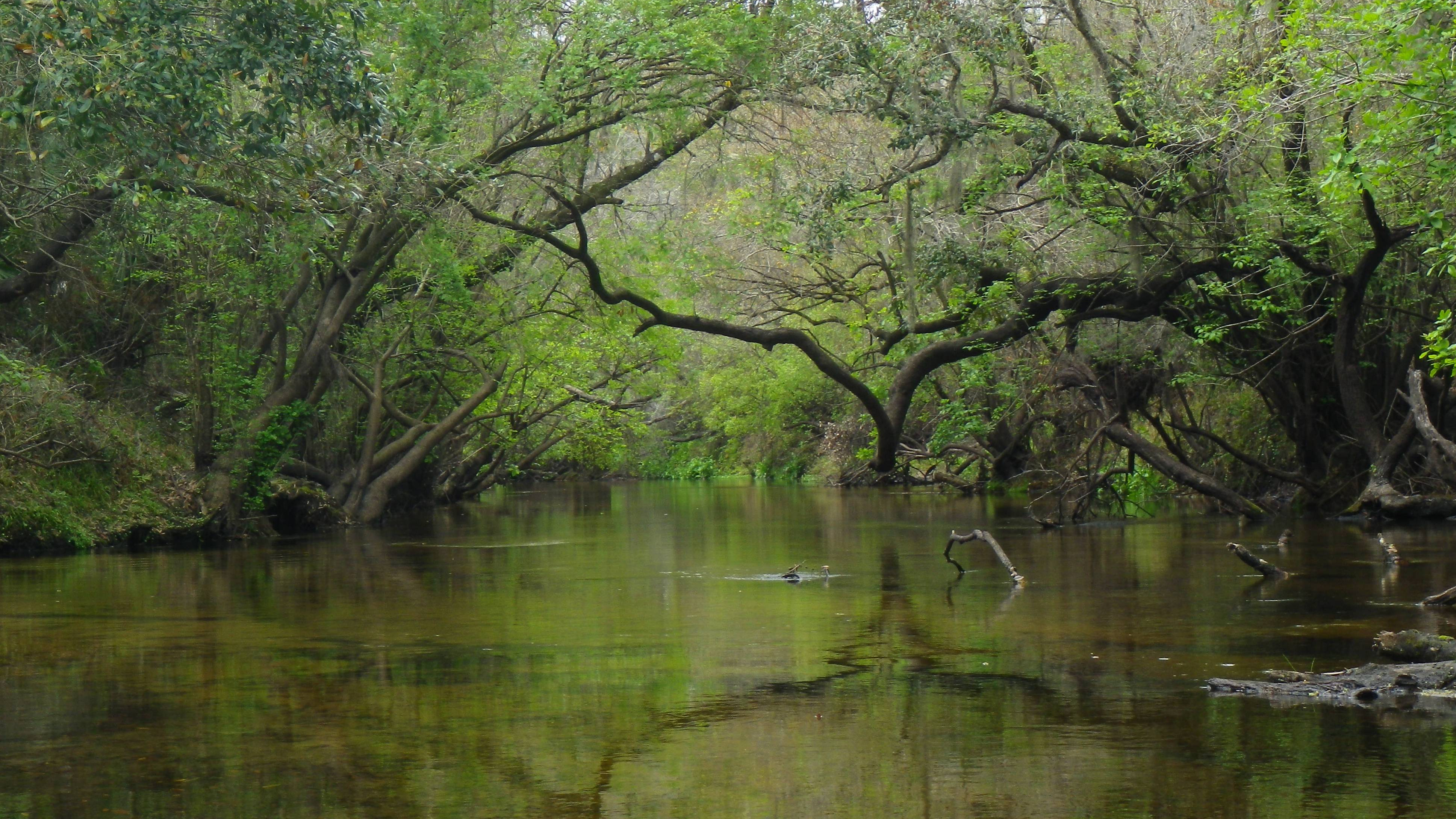
What a great place to be on a slow, lazy day! I hung my legs over the side of my vessel, dipped my feet in the clear, cool water and let the flow take me beneath the canopy, around the twists and turns of the river, returning to reality only momentarily to maneuver around a deadfall or a sharp corner.  I love vacation!

(Outfitter: Econfina Creek Canoe Livery. 5641A Porter Road, Youngstown, Florida. http://www.canoeeconfinacreek.net/. (850) 722-9032)

Read Full Post »

Afterwards, I questioned my determination to paddle the Manatee River during the hot summer months.  However, having run out of new rivers to paddle close to home, the Manatee seemed the obvious next choice.  In retrospect, it would have been a lovely paddle during the fall or spring months.

A Hot Paddle on the Manatee River

The Manatee River passes through Lake Manatee in Bradenton, and then continues on its westerly way to eventually empty into the Gulf—a 46-mile journey.  As it nears the Gulf, it widens and acquires estuarine qualities in the flora and fauna. The section closer to the lake—where I paddled—is the Upper Manatee River and is designated as a State Canoe Trail and Greenway.

Lake Manatee did not always exist. In the 1960s, officials built a dam on the river to create a reservoir for the surrounding areas—and thus created Lake Manatee. When Tropical Storm Debby came through mid-June of this year and dumped some much-needed rain on Florida,  the dam was opened wide to prevent flooding. The few paddlers who attempted the trip to the dam returned very quickly, unable to paddle against the strong current.

So, the river slowed down, and I rented a sit-on- top kayak at Ray’s Canoe Hideaway (well-hidden and very unpretentious). Ray’s sits on the river about 5.5 miles west of the lake.  My goal: to make it to the dam and back.

Along the way, I paddled past beautiful white sandbars that on a cooler day would have tempted me to stop and play.  High sandy banks with overhanging trees clinging to the sides showed wear and tear of storms past.  Oaks, cabbage palms, saw palmettos, slash pines, and pond apples edged the wide river but offered little shade.  The wildlife seemed to know to stay out of the sun.  I saw a blue heron, a turkey vulture, and one lowly turtle.  An occasional fish jumped around me, probably searching for a cooler spot in the water.

I turned on my camera, and it lit up with a warning, telling me that it was just too dang hot, and then it shut itself off.  My IPhone screamed TEMPERATURE! However, even in the heat, some found enjoyment on the river: a dad canoeing with his two young children (picture), a group of teenagers swinging on ropes and splashing in the cooler waters in a rare shady spot. One yakker even offered to share his cold beer with me.

I paddled against the current, light at first, but growing stronger as I neared the dam and Lake Manatee.   I made it about 3 miles up, just past the bridge and Rye Wilderness Park. The current was getting stronger, and my time on the river was running short.  I turned around and enjoyed the easy paddle back.

(Outfitter: Ray’s Canoe Hideaway on the Manatee River, 1247 Hagle Park Road, Bradenton, FL 34212. http://www.rayscanoehideaway.com/. (941) 747-3909 or (888) 57CANOE)

Read Full Post »

At last, the sun graced Southeast Florida for a day, so I took off from work and headed to Palm Bay for a paddle on Turkey Creek.  This is an out-and-back paddle, with a put in on either end.  I put in at the Palm Bay Marina on U.S 1.  My destination: Turkey Creek Sanctuary, a nature reserve run by the Audubon Society.

Marsh Grasses on Turkey Creek

I paddled away, passing the boats docked at the marina and the Palm Bay Estates—a small modular residential area. I paddled under the railroad trestle and into a series of braided channels. “Take the middle waterway,” the man at the marina had told me—and about the time I cursed myself for leaving the map on my car seat, I saw an aqua blue sign directing me.   I believe this is called “Willow Swamp,” perhaps after the Carolina Willows which adorn the banks.

I paddled upstream (west) against a current and a breeze, feeling guiltless for missing my morning workout. I spied a great egret peeping out through the tall marshy grasses and an osprey keeping watch from a high tree. Homes dotted the banks on the outside of the channels.

Just over a mile into my trip, a dolphin dipped into the dark waters in front of me, marking my passage into the sanctuary. Shortly thereafter, I paddled under the Port Malabar Bridge where the scenery changed.  The creek became a winding stream, shaded by oaks, maples, elms, and palms and embraced by various wetland scrub plants including leather ferns and swamp lilies.  Sand pines clutched high bluffs on the right as I paddled around a bend in the creek.

Pathway Through Turkey Creek Sanctuary

Mullet jumped around me, cooling me with their splashes.  Suddenly, a huge (yes, huge!) fish surged from the water–an Aquaman wanna-be–directly in front of me.  He did a little squiggle, and went straight back down, tail first.   He was a few feet long with a wide girth—I would not have been able to put my hands around him.  I’ve asked four people what it was and got four different answers—the best being a large bass.

With my meandering and a bit of chatting with other yakkers, it took me over an hour and a half to reach the sanctuary.  I paused at the sandy beach, stretched my legs and snacked on nuts and fruit.  I didn’t take the time to walk along the board walks and nature trails, but I understand they are lovely.

Before heading back, I took a quick paddle to the dam—less than 15 minutes upstream. I realized that the water pouring from the four large sections accounted for the stronger current as I neared the sanctuary beach earlier.

My outing was just over 4 miles, and with my leisurely paddle, it took me three hours.

(Outfitters: Palm Bay Marina, 4350 Dixie Highway, Palm Bay, FL 32905. https://www.palmbaymarina.com/. (321) 723-0851)

Read Full Post »

The more time I spend on Florida rivers, the more I’ve come to feel that the river cannot be rushed, that the longer the paddle, the better.  However, with this paddle, I discovered that when time does not allow for a long, leisurely paddle, a “quickie” paddle can still satisfy the senses—at least for the moment. 

The Picturesque Spruce Creek

My sister, Missy, and I paddled Spruce Creek in Port Orange on a Sunday morning in May.  Now, although my guidebooks recommend putting in at the eastern end of the creek, near Strickland Bay and Spruce Creek Park, we opted for a location closer to us, and we put in on the upper, western end, renting our tandem kayak from Cracker Creek Canoes in the privately-owned Spruce Creek Preserve.

Spruce Creek originates not far from this point, in the freshwaters of the cypress swamps.  To the west, there is less than a mile of waterway that can be navigated.  To the east, it’s less than 8 miles to Strickland Bay.  We didn’t want to miss the wild section of the river, so we began our paddle by heading west on the narrow, winding blackwater stream.   

It didn’t take long to realize why this little creek is both an Outstanding Florida Waterway and a Florida Designated Paddling Trail.  We gazed upon the picturesque creek, shaded by overhanging oaks, maples and cypress reflecting in the dark water.  On the left, high banks led up to wooded areas and one, maybe two homes tucked away.  To the right, the water spread out, seeping into the low cypress wetlands.  Deep in the woods, the birds called to each other from the trees.  

The further west we paddled, the more we had to skirt around or duck under fallen trees.  It took us less than 30 minutes to reach a point where the narrowing creek and downed trees forced us to turn around and paddle back east.  

Now, heading east, past our put in, the creek widened.   Two great blue herons greeted us, flying up the river.  A cormorant sat atop of a pole in the water, seemingly unbothered by the company.  Woodpeckers tapped away, busy at work on an overhanging tree.  We could see and hear the mullet jumping around us, close enough to get us wet as they flopped gracelessly out of the water.  We saw schools of them below us, swimming in the dark water.

If we had paddled further, we would have noticed even more of a change in the creek.  As it nears Strickland Bay, the creek and its surroundings become more estuarine with grass flats, salt marshes, and mangrove forests.  But, alas, our time was up!  We turned around and headed back to our put in.

(Outfitters: Cracker Creek Canoes, Port Orange, FL 32128. http://crackercreek.com/. (386) 304-0778)

Read Full Post »

On Monday morning, I headed to the Tomoka State Park in Ormond Beach to paddle the Tomoka River.  I had attempted to paddle this river twice before, but I could never find the outfitter in—the drats for not bringing my own kayak with me.  This time, I spoke to Billy by phone, and he was meeting me there.

The Tomoka River
The Tomoka River

The Tomoka, a state-designated Outstanding Florida Water, originates in a swampy area just southwest of Daytona.  It runs north, picking up waters from the Little Manatee River, Strickland Creek, and Thompson Creek, until it eventually merges with the Halifax River.  As it nears the Halifax, it becomes tidally influenced and takes on more estuarine characteristics.  (Boning)

I wasn’t certain that I would like the Tomoka. The state park “put in” sits at the northern end of the river, at the basin, right where the Tomoka connects to the Halifax River. The river is very wide here, so I knew it wasn’t going to be a sweet, canopied paddle.  However, even with the cool winds on this morning, I could feel the sun warm me through my jacket.  It was a beautiful day to paddle.

From the put in, I had a choice to either paddle south, make a loop that would include Strickland and Thompson Creeks, and return, or to paddle north toward the Halifax.  Although I liked the loop option (the river would be narrower), Billy suggested that with the winds and the movement of the current, I head north toward the Halifax.  So, I took his advice, and I put in, staying close to the shore, and after about 15 minutes of paddling, I took a couple smaller waterways that headed back into the state park.  These were both still pretty wide—60 feet or so—but I was sheltered some from the winds and could see both sides of the river.

It turned out to be a lovely day on the river.  Being Tuesday, the boat traffic was light; I saw only a couple small motorboats on the river.  Within the first five minutes of my paddle, a dolphin graced the water a short distance in front of me.  Fish jumped around me, taunting the few people casting lines from the shore.

The state park brags a bird paradise, and I did see quite a few: herons (great, green, blue, and tri-colored), egrets, osprey, pelicans, kingfishers, and black-necked stilts.  Heading into the waterways, tall salt grasses with a backdrop of cabbage palms and pines trimmed short sandy beaches.  It turned out to be a quiet, lazy day on the river.

I would return to the Tomoka, but I would paddle south and complete the loop to include Strickland and Thompson Creeks as well, or I might even try to put in at the FL 40 bridge and paddle north, provided, of course, I bring my own kayak.  Either way, it’s bound to be a great paddle!

(Outfitter: Tomoka Outpost Inside Tomoka State Park. https://www.tomokaoutpost.com/index.html. (386) 846-0982)

Read Full Post »

The fog had begun to lift, as the sun struggled to peak from the clouds.  A few sprinkles of rain tapped my windshield, as I pulled into the Canoe Outpost.  I didn’t know what to expect from this river, and I realized how much I loved the anticipation and the “not knowing.”

Low Waters on the Little Manatee

The Little Manatee River starts narrow and twisting somewhere around Fort Lonesome and Wimauma in Hillsborough County and widens as it travels west approximately 40 miles to the Tampa Bay.  A blackwater river, it is designated as an Outstanding Florida River.  The five miles between the Canoe Outpost and Little Manatee State Recreation Area is an official state canoe trail. (Carter et. al)

Rather than paddle from the Outpost to the Little Manatee River State Recreation Area, I chose to paddle the upper river, the 9-mile stretch between CR 579 and the Outpost.  Here, the river is narrow, canopied, less traveled, and wild.  This time of year, the water level is low, and as I gathered my supplies, the folks at the Outpost warned me to expect a portage or two.

I chatted with Mike from the Outpost as he drove me to my drop.  “You probably won’t see many gators, if any,” he said, “the poachers got most of them.”  Mike added that since this section of the river would be quiet (me, being his only drop so far), I may be treated to some wild hogs, deer, and bobcats along the way.  I appreciated the “heads up.”

I began my paddle west, sheltered by steep banks and wooded forest.  I could see the fish scurrying beneath me and could have easily touched the river’s sandy bottom with my hand—the water was that low.   A great blue heron flew up the river toward me, its wing span magnificent—what a sight.

About an hour into my paddle, alone on the river and lulled by the sweet harmony of the birds in the woods, I suddenly became alert when the bushes on both sides of the river came to life.  Wild hogs, first one large black one to my left, then more to my right, and for the next 10 minutes or so I paddled through the land of swine with hogs racing up the banks as I approached.  I spied a couple wild turkeys as they quickly bobbled away, as well.

The poachers had apparently been successful, as I saw only one small alligator.  However, the turtles appeared quite large and healthy!  I spotted ducks, herons, hawks, cardinals, and even a few red-bellied woodpeckers.

The low waters had created high steep banks in some places and low sandy beaches in others.  I scooted over sandbars and logs and under overhanging branches trying to avoid all the obstacles.  My mantra became, “I ain’t ‘fraid of no bugs” as I checked my hair and body each time I emerged from the branches.  (I read that during the rainy season, this water rises rapidly, and with all the obstructions in the water, one must be quick to make it through without mishap!)  Grapefruits, oranges and tangerines added a splash of unexpected color against the green and brown backdrop of oaks, willows, pines and cabbage palms.

For nearly four hours, I paddled past undeveloped landscape—with few reminders of civilization except the Florida Power plant just about halfway and the abandoned railroad trestle further along. Oh, and then, of course, there was the small group of four-wheeling, beer-drinking rednecks who greeted me just past the trestle.  Other than that, it was a fabulous, peaceful day on the river.

(Outfitter: Canoe Outpost. 18001 US 301 South, Wimauma, FL 33598. http://canoeoutpost.com/. (813) 634-2228)

Read Full Post »

New Years Day turned out to be a perfect day, bright and sunny, not too hot.  I paddled the Estero River in Fort Myers, expecting to see a different landscape, as this river has a tidal influence.  The river’s flow begins as trickles on the west side of the Corkscrew Swamp in Naples.  As it travels west, it picks up more water, and eventually empties into the Estero Bay. Only about six miles of this coastal river can be paddled. (Boning)

Up River on the Estero

I put in at Estero River Tackle and Canoe Outfitters off of South Tamiami Trail in Estero.  By the way, I have never seen such a huge selection of kayaks to rent and buy!  I opted for the upgraded hard plastic model that supposedly moves faster in the water.

Before heading west to the bay, I took a quick paddle up river, and was treated to a narrowed river shaded by draping oaks, cool and quiet.  Heading down river, toward the bay, the river widened and the landscape changed from draping oaks to mangroves and spartina grass.  The influence of the tidal changes became evident.

Within the first mile, I passed the Koreshan State Historic Site on the south side.  Shortly thereafter, civilization emerged, and I passed a trailer park and another small development on the north side.  Along the banks, small motor boats and pontoons were lined up at docks like trinkets on a necklace.

Admittedly, I was disappointed with the development along the river.  At the same time, I was intrigued by much of the flora that I typically did not see, and I found myself wishing I could identify more.  Although the mangrove swamps dominated the landscape as I neared the bay, I also saw various pines and palms, bamboo, leather ferns, sea grapes, and swamp lilies (not yet in bloom).

Mangrove Swamps along the Estero

I imagine that the traffic on the river—small motor boats, pontoons, jet skiers., and, of course, kayakers—kept the wildlife away.   I saw only a few birds—little blue herons, great blue herons, and swallow-tailed kites.  An osprey sat on top of his nest observing the buzz below.  Signs warned boaters to slow down for manatees, but they eluded me; I saw none.

It did get a little confusing close to the mouth of the river.  I headed down a couple small waterways only to find that they dead ended, and I had to turn around and come back.  One time, I paddled up to the bank and asked a homeowner which way to the bay!  I thought afterwards that it would have been wise to time my out and back with the tide and paddle this river on a quiet weekday.  This is a river where one should take his/her time and meander around the mangroves, observing the scenery and looking for wildlife.  Apparently, there is a lot of history in this area and some interesting sites at the river’s mouth and into the bay.  Orr and Carmichael report that there is a population of exotic squirrel monkeys along the river as well.

(Outfitters: Estero River Outfitters. 20991 South Tamiami Trail, Estero, FL 33928. https://www.esteroriveroutfitters.com/. (239) 992-4050)

Read Full Post »

It was 11/11/11, and with prophecies of both gloom and doom and enlightenment casting about, I opted for the spiritual enlightenment and headed for the Myakka River in Sarasota.

Gator on the Myakka River

The Myakka River is a brown water river that originates in Manatee County and travels southwest to eventually empty into the Gulf, a 66-mile journey.  In 1985, Florida designated 34 miles of the Myakka  a “Wild and Scenic River;”  14 of these miles pass through the Myakka River State Park, one of the more desirable and easily -accessed locations for kayaking and canoeing (Huff).

I arrived at the outpost in the Myakka State Park on this windy, chilly morning only to be told by RJ that they weren’t renting kayaks due to the weather.  You see, from this point on the south end of the Upper Myakka Lake, one would paddle south a few miles –with the current—and return north—against the current—and on this morning, against the wind.  In the end, I was able to convince RJ to rent me a kayak—knowing that I would pay an extra fee if he had to come get me.

Shortly after putting and beginning my paddle south, I portaged around a dam at the end of the lake.  I thought RJ had told me to portage right, but apparently, I thought wrong. To the right was “Gatorland”—seven or eight gators sunning on the river bank, surrounded by 30 or more vultures.  So, I was up and over to the left and on my way.

Tall grasses and low muddy banks flanked me right and left, as I paddled through this marshy, plain-like landscape, so unlike the canopied, winding Alafia and Hillsborough Rivers.  Further south, the landscape changed some, as cabbage palms and oaks appeared on one side, offering some shade, and sometimes, a break from the wind.

Huff cautions readers about the Myakka gators, no scaredy cats here!  These gators were more active and a bit more intimidating than those in other rivers, and when the river narrowed to 10 feet, having gators on both sides of me became…only a little uncomfortable.  They seemed curious, and often left the banks and slithered into the water as I neared, coming out to greet me, or so it seemed.   However, they always stayed a distance, perhaps swimming parallel to me or crossing in front of me and then disappearing below the surface.

The birds often amused me, like the happy cormorant that flapped his wings as his feet skipped across the water, a prized fish in his mouth.  Some amazed me, such as the great herons that first crouched and then pushed themselves into the air for flight and the large wood storks that somehow managed to look graceful gliding on the thermals. 

The Adorable Black-Necked Stilts

The banks were alive with the “hunk, hunk” of the ibises and the grunting of the roseate spoonbills and about 20 other birds including egrets (snowy, great), red-shouldered hawks, cormorants, anhingas, herons (great blue, great white, little blue, tricolor), wood storks, vultures, ospreys, and the adorable black-necked stilts.

I paddled to the first bridge and back…less than six miles.  With the wind and the current on my return (and pausing now and then for pictures), it took me four hours.  I passed only a few other kayakers along the way and a few gator spectators along the banks, and I walked away with some added serenity.   I’d love to return someday.  Then, I would put in at SR 72 and paddle south into the park wildness preserve to Lower Myakka Lake and the Deep Hole, a 150-foot deep sinkhole.

(Outfitter: Myakka Outpost in the Myakka River State Park. 13207 SR 72, Sarasota FL, 33241. https://myakkaoutpost.com/. (941) 923-1120)

Read Full Post »

Even the name sounds intriguing—Fisheating Creek.  The Seminoles called it Thlothlopopka-Hatchee, “the creek where fish are eaten” (Boning) long before it  was paddled for recreation.  I’ve wanted to kayak this creek for some time.  After  all, Carter et al. gives it an A+ for scenery; I knew it would be amazing.  However, I found that during the dry season, the water level was too low for paddling—unless of course, I didn’t mind carrying my kayak for much of the trip!  So, I waited for the rain, and then, I waited for the rain to stop. Finally, I decided to paddle Fisheating Creek, rain or shine.

The Shimmering Fisheating Creek

Originating in a swamp in Highlands County, Fisheating Creek flows south, then east, for 48 miles.  It passes through the cypress swamps, much within the state-owned Fisheating Creek Fish and Wildlife Management Area, and then this tea-colored creek eventually empties into Lake Okeechobee (Boning).

On this Sunday morning, I paddled with a new friend, Rick Murphy, who hails from the Hendry County area.  We rented kayaks from Fisheating Creek Outpost, and they dropped us at Burnt Bridge about 11:00.  We would have an 8-mile paddle downstream to the Outpost in Palmdale which would take us about four hours.

The sun had just peaked from beneath the clouds, promising us a good paddle.  The creek was wide at the put-in.  Tall cypress trimmed its edges—brown and bare this time of year—but cloaked in air plants and Spanish moss which shimmered silver in the sunlight.  During the four-hour trip, the sun was in and out as were our rain covers.  During the last 30 minutes of our paddle, the rain drenched us!

The creek and surrounding scenery awed us.   One moment we paddled in open waters, the creek, 40 feet or wider, and in the next moment, the dark waters took us swiftly, twisting and turning through the cypress swamp.

Wood storks and ibis dominated this Florida wonderland, but we also spotted various herons, blackbirds, vultures, anhingas, egrets, and even a turkey. We became accustomed to the alligators that often crossed in front of us or that sunned on the sand banks as we passed.

Cypress Reflections on Fisheating Creek

We owned the creek for nearly the entire paddle, and neither the occasional rain nor the humongous spider that slipped down my shirt as we put in dampened our spirits.  Fisheating Creek is an amazingly authentic, awe-inspiring Florida wilderness experience.

(Fisheating Creek Outpost. 7555 US Highway 27 North. Palmdale, FL 33944. https://fisheatingcreekoutpost.com/. (863) 675-5999)

Read Full Post »

Between the dry spell we had in Florida and my summer travels, I had not been on a river since the Hillsborough in May.  I had hopes of paddling Fisheating Creek next, and I was watching the water level.  Feeling a bit impatient, I took a quick trip back to the Loxachatchee in Jupiter, to try out another section.  Previously, I had paddled the Riverbend stretch of the river.  When I arrived this day, I found that the Jonathan Dickinson Park run would not open until the following week (The outfitters shuttle you from Jonathan Dickinson back to Riverbend Park.), so I opted for their most popular paddle, Cypress Canopy.

The Popular Cypress Canopy

My trip began at the Canoe Outfitters in the Park.  I entered the cypress swamp and paddled the twisted waterway to the I-95 overpass and returned, apparently only 3.5 miles.  (It took me 3.5 hours.)  Along the way, I passed many other paddlers, an occasional turtle sitting on a fallen log, a limpkin, and an alligator.  Although the birds shied away from the busy river, I could hear them in the trees and spotted an occasional heron and woodpecker in flight.

This stretch of the river has two small dams to navigate–either over or around.  I was able to paddle over each.  (For the larger one, several paddlers below me promised to catch my gear if I capsized.)  I learned that the secret to success was not to pause at the top but to pick up some speed and shoot straight through!

The moderately swift current made stopping for pictures difficult, although the scenery was well worth the challenge.  Beautiful bald cypress shaded the river in canopy, their knobby knees decorating the river banks like some kind of medieval-themed chess pieces.  Ferns hung over the banks, and swamp lillies poked their blooms from the brush.

Cypress Knees on the Loxahatchee River

Admittedly, I like the serenity of a quiet river, one with fewer people on it!  That’s when the wildlife comes out to play.  However, on this hot Saturday afternoon, I enjoyed watching families spend time together, two or three to a vessel, paddling one of Florida’s lovely rivers.

(Outfitter: Jupiter Outdoor Center. Riverbend Park. 9060 West Indiantown Road, Jupiter, FL 33478. https://www.jupiteroutdoorcenter.com/riverbend-park/rentals/. (561) 746-7053)

Read Full Post »

« Newer Posts - Older Posts »