Feeds:
Posts
Comments

Posts Tagged ‘outdoors’

I knew as I drove along the long dirt road in the midst of a prairie grassland from the entrance of the Kissimmee Prairie Preserve State Park to the office and campground that I was in for a peaceful experience with Nature. I stopped my car, rolled down my window, and listened. No sounds of traffic.  Perfect.

Where the Prairie Meets the Hammock

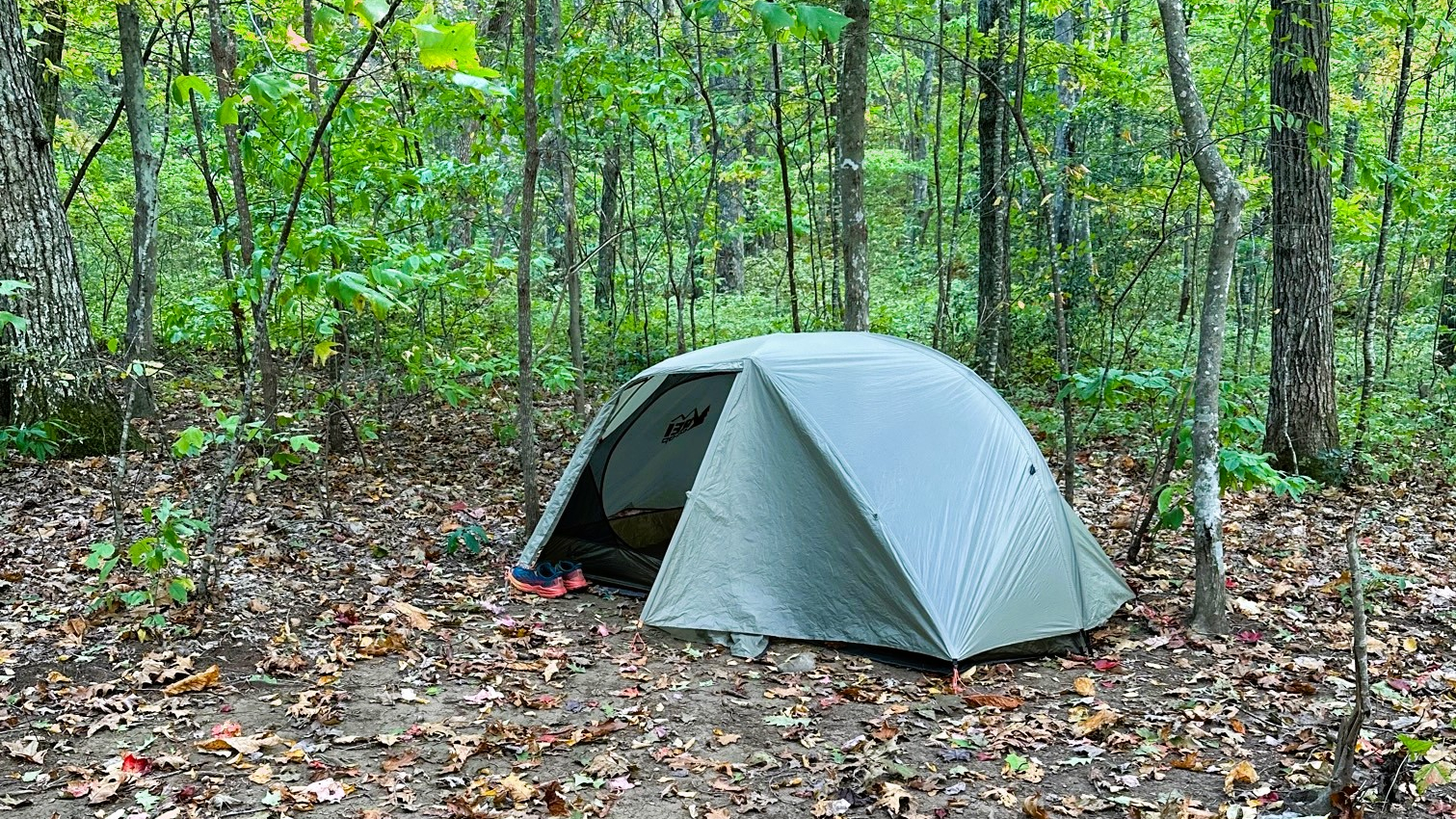
I arrived on Tuesday with a last minute reservation I was able to grab for just one night. My first stop was the park office where I checked in and checked out trails with a volunteer. My campground, the family campground, had only twenty sites, with several that looked out to the prairie. How beautiful!

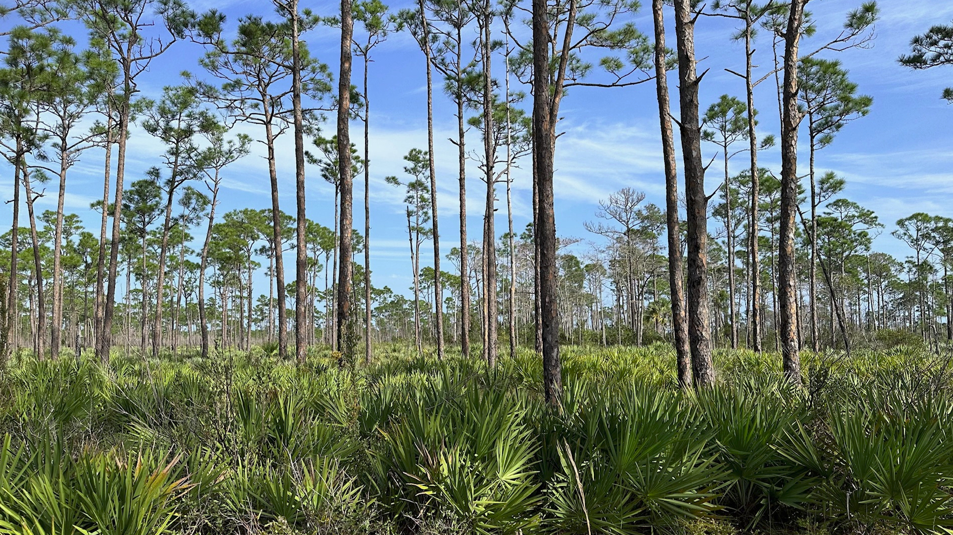
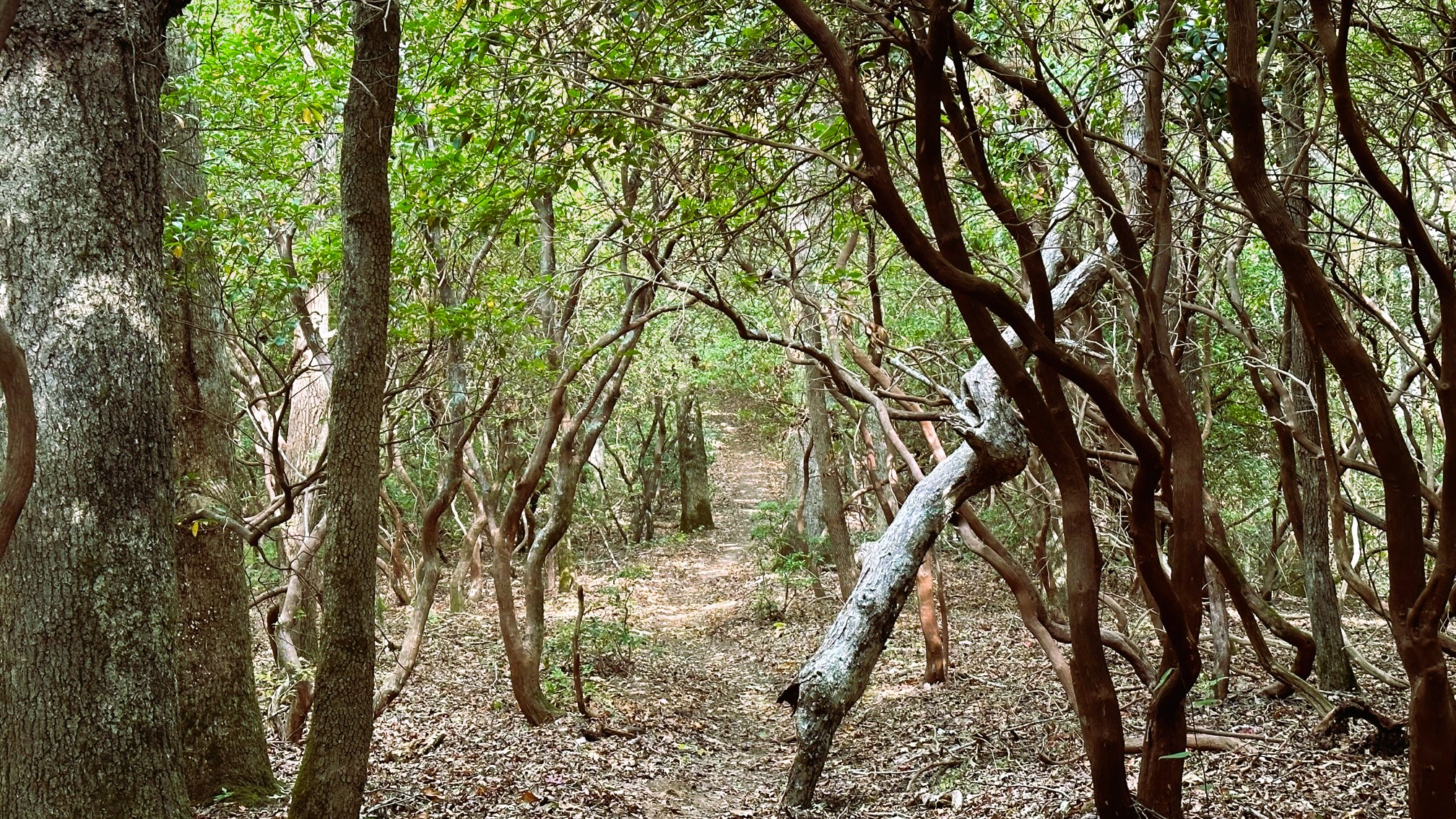
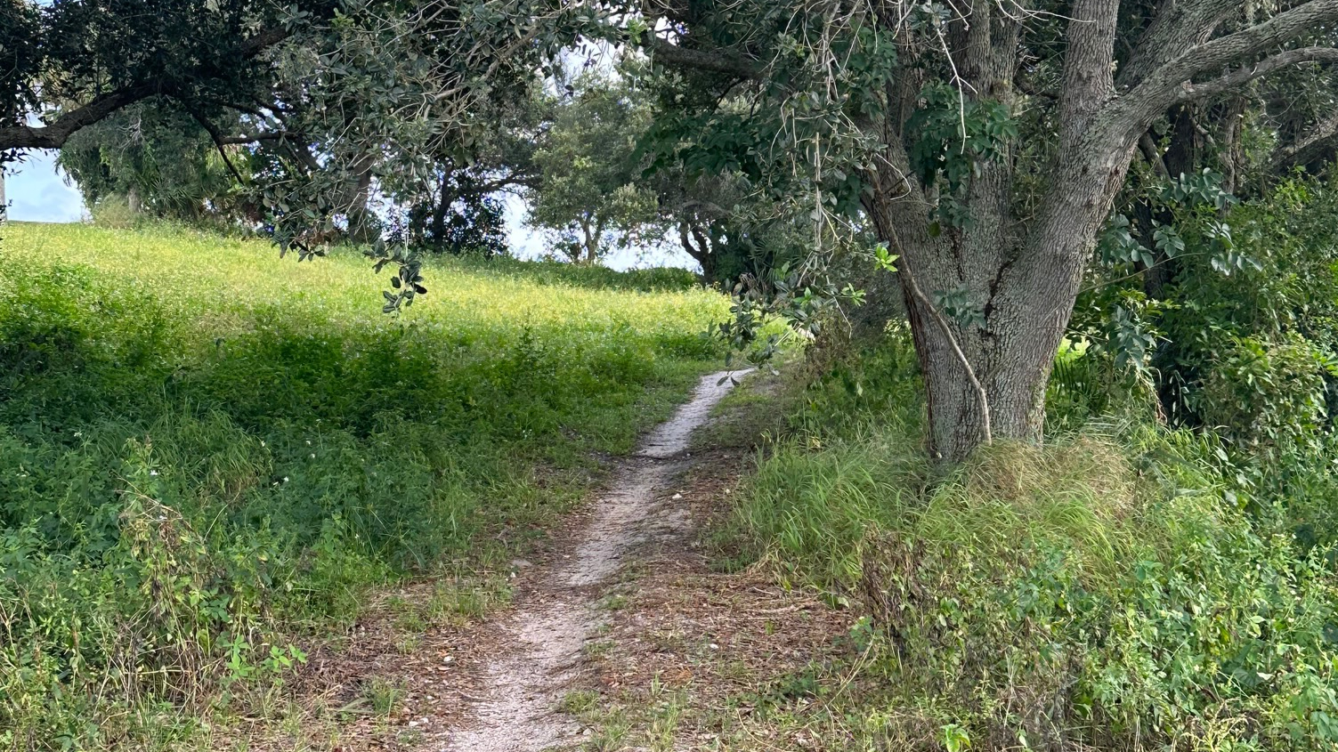
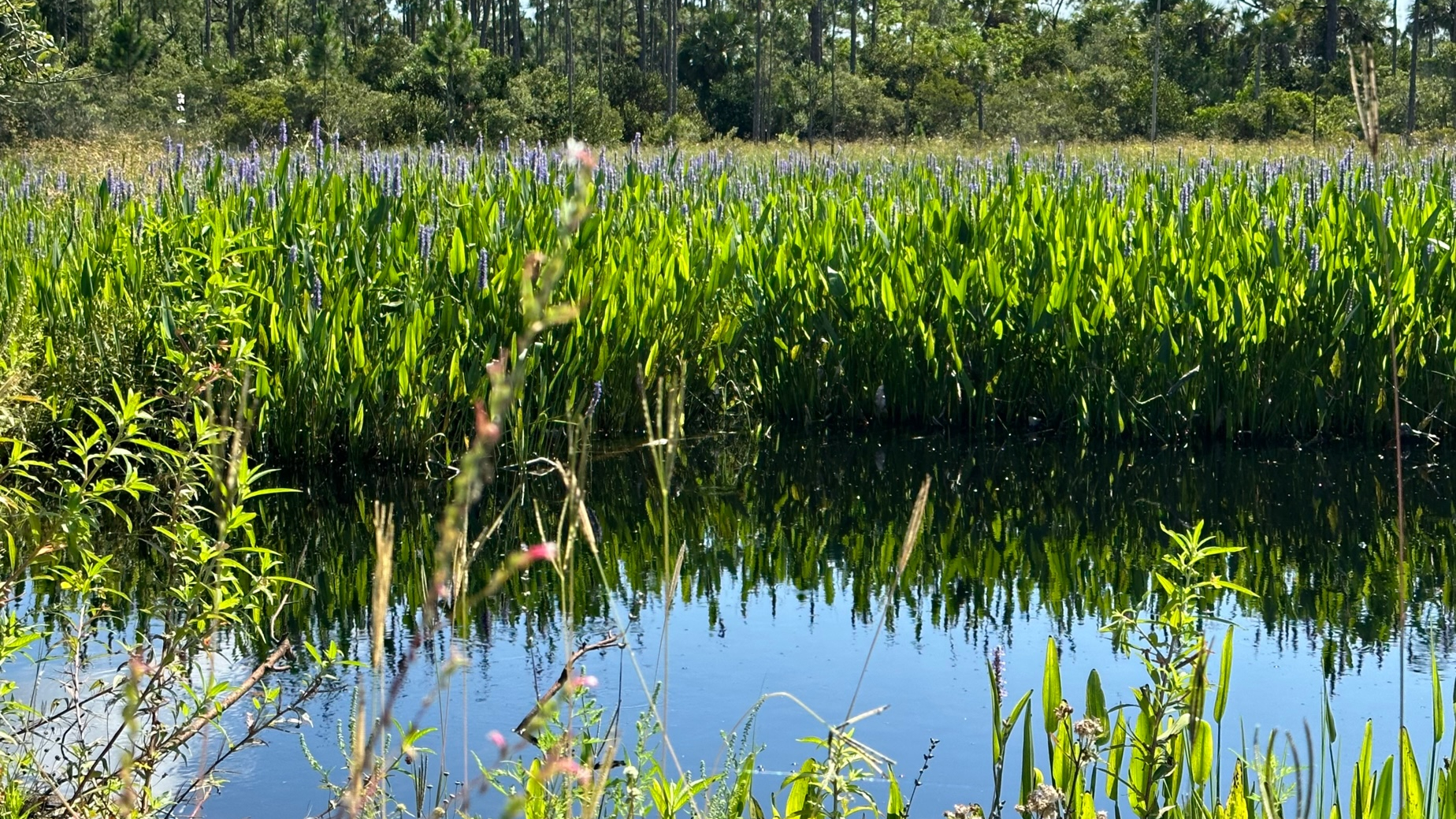
After setting up my tent, I started on the Prairie Loop Trail—a recommendation for an afternoon hike from the park volunteer. This trail, about 4.5 miles, was surrounded by live oak covered with moss, saw palmetto, wax myrtle, and tall prairie grasses blowing in the breeze. I returned to the office area a couple hours later to see deer and wild turkeys grazing in the tall grasses.

Sunrise on the Prairie

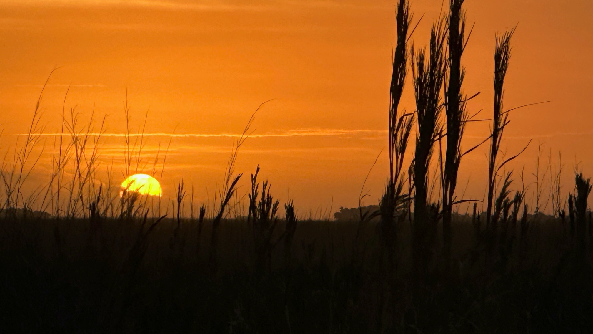
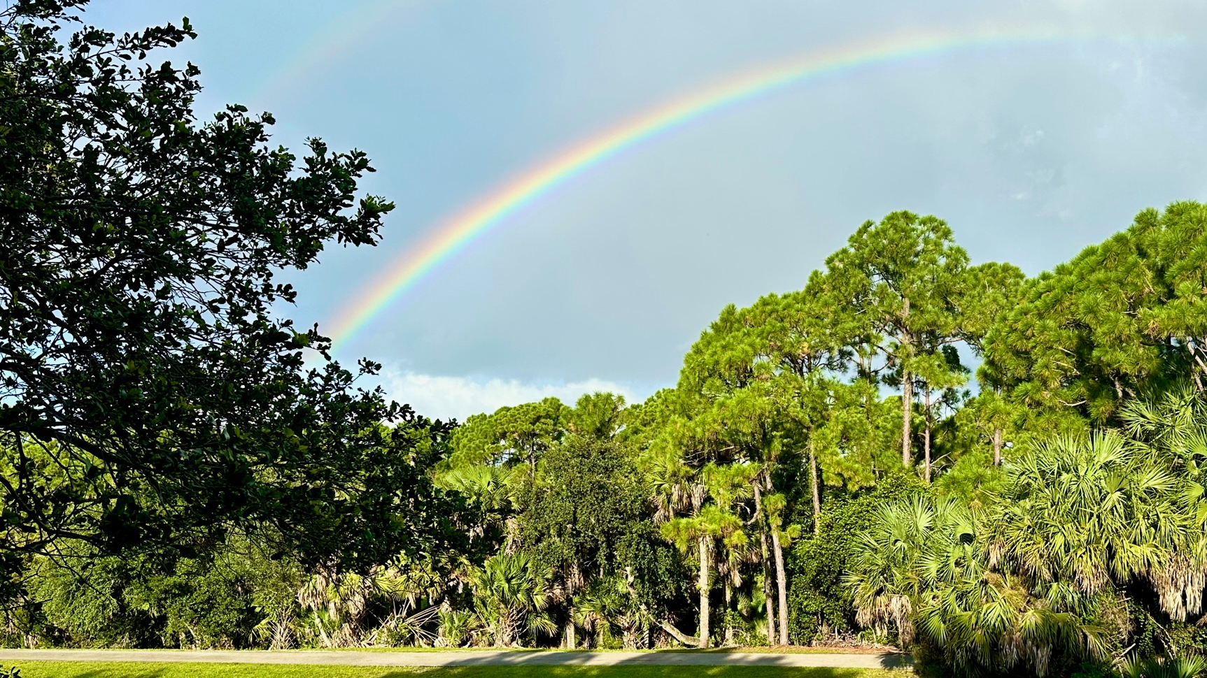
Evening in the campground was quiet and friendly. In need of a shower, I walked to the bathhouse, and was surprised to see how dark the campground had become when I stepped back out. I had looked forward to some fabulous star gazing, but unfortunately, the clouds kept the stars away. Once I snuggled into my sleeping bag, the nearly full moon appeared and lit up my tent. At 2:00 in the morning, I took a brief stroll through the campground, happy to see the stars had finally made it to the party. At 6:30, I rose to see the sunrise, nearly running into a deer on my way to my viewing spot. I watched as beautiful shades of red, orange, and yellow painted the sky while birds sang their morning songs.

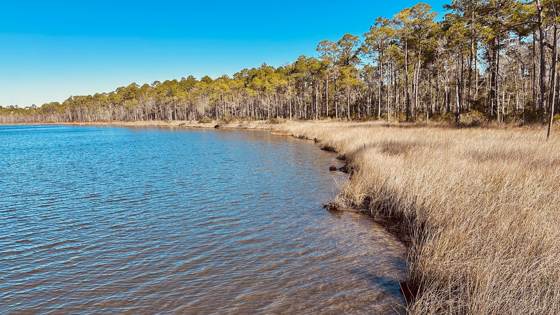
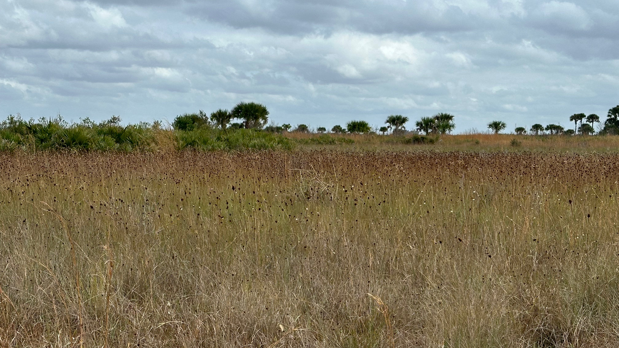
Before leaving on day two, I hiked through the Hammock Trail to the Kilpatrick Prairie Trail and back—about six miles (another recommendation from a park staff member). Such beautiful prairies! With no one on the trail, I enjoyed the peace and serenity that Nature offered. There were some wet areas on the trail, but they were easy to walk around. I passed a couple deer on the side of the trail—no fear, they hardly moved. On my return through the hammock, a small white boar scurried away.

Mother Nature Paints a Beautiful Picture

 My goal for this trip was to test out my new tent and stove and make certain I could keep a fire going. I made progress! I’ll work on the fire on my next trip. 🙂

(Kissimmee Prairie Preserve State Park. 33104 NW 192nd Ave, Okeechobee, FL 34972. (863) 462-5360. Website: https://www.floridastateparks.org/parks-and-trails/kissimmee-prairie-preserve-state-park).

Read Full Post »

Jonathan Dickinson State Park is my “go to” park, when I don’t have time to travel far. I returned to JD State Park to hike the 7.5 mile White Loop for my third state park in the new year. This is where I had spied the Florida Panther the previous New Year’s Day, and I hoped to see one again.

Saw Palmetto Among the Pines

I began my hike in a clockwise direction and made the same mistake I did the first time I hiked it. About one mile in, after going over the little bridge and around the water, I became overconfident being on the service road and missed the right turn onto a smaller trail. My AllTrails app gave me a “heads up” that I was off trail about a block later.

Sixty-five degrees with a slight breeze! Perfect hiking weather. For the remainder of the trail, I came upon water from time to time, but never to the point where it flowed into my shoes. I was thrilled to see they had built small boardwalks around the deeper water.

I love that this trail has a couple of rest spots with benches. The first is about 3.5 miles into the trail. I passed only a couple of hikers heading in the opposite direction as I, and I saw one hiker come off the OTL Trail in the distance (This distraction may have caused my missed trail.).

Loggerhead Shrike to Keep Me Company

The moist sand from a recent rain made for easy track identification—wild boar, raccoon, and then some I could not identify. The trail had very little boar activity until the last mile.

Only the birds kept me company—loggerhead shrike, red-shouldered hawk, yellow-rumped warbler. Alas, no panther to be seen.

Although there is next to no shade on this trail, it’s always a great trail to hike.

Read Full Post »

Among my goals for 2024, somewhere between “learning to cook a Mediterranean diet” and “complete the next thirty miles of the Appalachian Trail” is that to “visit at least ten Florida State Parks” this year.  So, after spending some time at Perdido Key State Park and to keep the momentum going, I drove to Tarkiln Bayou Preserve State Park in Pensacola. Access was easy with the parking lot just off the main road and an honor system entry fee.

Caramel Grasses on Tarkiln Bayou Trail

I began with the Tarkiln Bayou Trail, an out-and-back one-mile round trip with a scenic view of the Tarkiln Bayou bordered by beautiful tall grasses. This trail is ADA accessible with concrete walkways and long boardwalks leading to the bayou. Along the way, benches invited me to take an undeserved rest and scannable information signage filled me in on the surrounding flora.  

Autumn Colors Dress the Perdido Bay Trail

After completing the Tarkiln Bayou Trail, I increased my effort with the Perdido Bay Trail. This trail branches off at the beginning from Tarkiln Bayou Trail. My hike was about 6.5 miles, often shaded by oaks and pines. Although mostly a dirt trail, there were occasional portions filled in with large gravel, difficult to walk on. (On the return, I realized that thoughtful hikers had created small, grassy paths to bypass the gravel.) The loop portion of this trail borders along the Perdido Bay.

The cool weather made for perfect hiking. A very recent burn had caramelized the landscape in shades of orange, brown and black—perfect for a Halloween set. The lack of green vegetation did not keep the birds away. I spied many yellow wobblers, red belly woodpeckers, and even a bald eagle.

Map: https://www.floridastateparks.org/sites/default/files/media/file/tbp-brochure.pdf

(Tarkiln Bayou Preserve State Park. 2401 Bauer Road, Pensacola, FL 32507. Website: https://www.floridastateparks.org/parks-and-trails/tarkiln-bayou-preserve-state-park. (850) 492-1595.)

Read Full Post »

On my drive home from Alabama after visiting family for the New Year, I wanted to stop at a couple State Parks. I started with the most westerly and furthest away from my home—Perdido Key State Park, which according to the State Park website is a “favorite destination for swimmers and sunbathers” with “white sand beaches and rolling dunes covered with sea oats.”

Sea Oats on the Dunes

I knew that Hurricane Sally in 2020 had caused devastating damage to the park and forced it to close. I was thrilled to see that two of the three entrances—the middle and east entrances—were now open with beautiful new boardwalks at both entrances and a new restroom at the east entrance. Construction crews worked on the west entrance.

Although the beach and dune areas were closed to protect an “environmentally sensitive area,” it was a beautiful site from the boardwalk and an uplifting promise for a New Year of great beginnings.

New Boardwalks to the Beach

(Perdido Key State Park. 15301 Perdido Key Drive, Pensacola FL 32507. Website: https://www.floridastateparks.org/parks-and-trails/perdido-key-state-park. (850) 492-1595.)

Read Full Post »

Finally, some cooler hiking weather—sunny and 70 degrees with a light breeze! What could be better than that? I drove to Gate 2 at Dupuis Wildlife Management Area, and I stepped onto the trail at 9:00 a.m.—destination, Loop 2 this time.

Beautiful (but overgrown) Dupuis Trail

The first part of this hike was familiar to me—I had hiked Loop 1 this summer, and you have to hike most of Loop 1 to get to Loop 2. But wow! What an overgrown trail! I arrived at the picnic tables about 20 minutes later, and my legs were covered with burrs—so glad I wore pants. The grass was dewy, and the ground a bit damp.

Pretty Images on the Trail

At one point during the first mile, something quickly passed in front of me on the trail—about the size of a small to medium-sized dog, reddish brown in color. I have no clue what it was. Other than that, I came upon lots of turkeys, but no humans.

It was a beautiful day to be on the trail—regardless of its unkept state. (I saw on Facebook that volunteers worked on Loop 1 the very next day.) At times, it was difficult to find the trail, and I was happy I had apps to stay on track when the path was uncertain. Walking in tall grass with no path—accounts for the burrs and the tick that rode back home with me. 

Hog Heaven on Dupuis

Apparently, the wild boars have found a home and had spent much time digging up the trail. The torn-up ground made my hike more challenging at times. Lots of evidence, but not a boar in sight!

With a couple of breaks, I completed the 7.5 mile loop in four hours and arrived back at my car around 1:00.

Read Full Post »

A year of waiting and it finally arrived! Last fall, my trail sister, Robyn, and I vowed to return in 2023 to complete the Georgia Appalachian Trail. We had completed the first 52.5 miles as a slackpacking trip in the fall of 2022. This fall, we would hike 32.5 miles–Unicoi Gap to Deep Gap–in four days and three nights taking us into North Carolina.

A Glorious Day 1 on the Trail

Sunday night, we stayed at Hostel Around the Bend in Hiawassee, Georgia. Such a sweet hostel with great hosts (Gordon and Lisa), comfortable rooms, and a yummy breakfast (thank you, Nimrod!). Monday morning, they shuttled us to Unicoi Gap, and we were off to our adventure!

Before we left, we knew the issues with finding water on the trail and that many of the water sources–especially for our first two days–had dried up. This meant carrying more water to be safe. My pack already weighed in at 32.5 pounds without water. Carrying three liters of water added six more pounds. Ugh! Much more weight than I had counted on.

Our schedule for the four days looked like this:

Monday, October 9, 2023Unicoi Gap to Tray Mountain Shelter (5.7 miles)
Tuesday, October 10, 2023Tray Mountain Shelter to Deep Gap Shelter  (7.4 miles)
Wednesday, October 11, 2023Deep Gap Shelter to Plumochard Gap Shelter  (8.1 miles)
Thursday, October 12, 2023Plumochard Gap Shelter to Deep Gap Campsite (11.3 miles)
Hiking/Camping Schedule
First Night on the Trail

Four days and three nights on the trail. We hiked in Nature’s glory, watching as each day, the leaves changed just a little bit more. This was not just a walk in the woods! On day two, the wicked Kelly Knob challenged me, and I cursed her the entire climb! We camped at Deep Gap that evening, falling asleep to a symphony of animal sounds in the woods.

On day three we stopped at Dick’s Gap in the morning–which is .6 miles from the hostel. With more water available on the trail for the remainder of our hike, I lightened my load as much as I could and finished the hike with closer to 32 pounds on my back. (The hostel folks picked up a bag for me.) We camped at Plumorchard that night, listening to the rain hit our tents and the wild animals in the woods. We woke early and packed our wet tents in dim light and light rain to begin the last, and longest, part of our hike.

Going Through the Tunnels on Day 2

I won’t lie, I considered taking an easier route that last day. I was concerned that I would slow us down given the wet conditions and the 11.3 miles and steep climbs remaining. However, Robyn would not hear of it. Truly, many good hikers would have been happy to be rid of the slow poke and finish in better time. Not Robyn. So, I finished the hike as planned. That day, we climbed the longest and highest mountain of our hike as we crossed into North Carolina (more curses). We started at 3008 feet elevation leaving the campsite that morning and climbed to over 4600 feet elevation before we finished.

So, what’s next? I plan to continue the trail in the spring after the bubble has passed. I’ll pick up at Deep Gap Campsite and hope to hike a combination of day hikes and overnight hikes and see where it leads!

Read Full Post »

I am so excited about returning to the Appalachian Trail this fall to complete the Georgia section. Last fall, I tried a slackpacking trip and stayed at Above the Clouds Hostel to complete the first 52.5 miles, ending at Unicoi Gap. This fall, I will return with my friend and trail sister, Robyn, (trail name “Buster”) to complete Georgia and start into North Carolina—32.5 miles. The big difference is that this will be my very first time camping on the trail which also means carrying a heavier pack!

Rainbows Over Dyer Park

I have always worked out, and even with the heat and rain, I have gotten out on the (flat and wet) Florida trails this summer—typically with a pack weighing between 15 and 17 pounds. My goal for September is to increase my pack weight, moving to my larger pack, and to find some elevated trails for training. I planned to be ready! I found a local park—Dyer Park—with a 2.5 mile mountain bike trail with elevation I can use–it’s amazing what the county did with a dump site. During September, I will “hike” this trail a dozen times or so, increasing my pack weight to at least 25 pounds.

MBT at Dyer Park

Read Full Post »

After my experience navigating the Kitching Creek Loop, I needed to get back out there and try again. I had heard that the Dupuis Wildlife and Environmental Area was dry, and I was determined to get on the trail earlier in the day, before it got too hot. Although easy to find, it took an hour to drive to the location. I arrived around 8:30 a.m.—the only car in the small parking lot.

Grassy Path of the Dupuis Trail

I entered the trail at 8:45 a.m. under clear, hot skies. I opted for the shorter hike, Loop One, about 5.5 miles, and considering the heat, happy I did so. Shortly into my hike, I paused briefly at the picnic tables, taking in a few moments of shade before the next five miles. I enjoyed the well-marked grassy trail., and I did not see another soul in the three hours I hiked. Just the birds and me.

Green Pines on the Dupuis Trail

If fall ever arrives in Florida, I will return to Dupuis and hope to hike the longer loops.

A Promise of Shade

Read Full Post »

My AllTrails hates me.

The map at the kiosk showed the Kitching Creek Loop to be a one-hour walk with a thirty-minute hike along Wilson Creek to get there. I plugged the trail into my app, and four and a half hours after leaving my car in the parking lot, I arrived back to it. This hike—a definite do-over. Funny.

Scenic View from the Trail

It was hot as heck, and the mosquitos and horseflies feasted on me through the seat of my pants. I came across water on the trail pretty quickly, but I was able to get around it—at first. The more I walked, the more water there was and the more difficult it was to avoid. I passed over the Kitching Creek Bridge and the outlook—which was closed. At this point, the water became deeper and wider, and I concentrated more on getting around the water than where I was heading. I had gone a bit past my turn before my AllTrails suggested that I may have missed it. (“Oops! Did you get off the trail?”) By then, I was facing a shallow pond of water and decided to turn back anyway.

Deep Water on the Trail

Of course, no one else attempted this trail at this time of day. Even the animals and birds stayed away—with the exception of an ibis or two.  I headed back to my car with little guidance from my AllTrails guy—who seemed to think my hike was over and had already ended it.

Most of the Florida trails I’ve hiked have been well blazed. I had difficulty finding signs on this trail. I read that the trail was no longer maintained but did not see an explanation. I’m not certain that is true.

This trail is definitely a do-over—but I’ll wait until the trail is dry. 

A definite do-over!

Read Full Post »

Every time I step onto a Florida trail, I wonder, “What will I see this time?”

I passed through part of the Loxahatchee Slough Loop Trail when I completed my third section of the Ocean to Lake (OTL) Trail. The Loxahatchee Slough is part of Palm Beach County’s protected natural areas which are maintained mostly by the Environmental Resources Management. How fortunate we are to have these natural protected areas. (For a list of Palm Beach County multi-use trails: https://discover.pbcgov.org/erm/Pages/JeagaWildways.aspx)

Flowers Decorate the Loxahatchee Trail

With easy parking at 11885 Beeline Highway, I arrived just as a 10K run completed. County staff, still on site from the run, showed me the trails on a map and explained trail conditions. Water had flooded a section of the last leg of the return on the Loxahatchee Slough Loop, so I opted for a longer hike on an extended loop to stay dry. I also included the out and back to the observation tower which I found was just steps away from the OTL trail section I had hiked from Riverbend Park to Beeline Highway. The same county staff member also hooked me up with a new trail app, Avenza Maps. This app displays the maps in pdf format but also shows your location on the map. I found this very helpful!

I began the trail by 9:45 a.m., hiking clockwise around the loop. Another hot Florida day—already! I stopped at the restroom about a half mile in (clean and roomy) and changed into my shorts, quite happy I remembered them this time. There was a bench just outside the restroom next to the water. This, and the picnic table at the tower, were the only rest spots on the trail. I would have welcomed a couple more benches—especially along the last section. Once again, I found myself sitting on the roadside in the shade of a pine tree for a snack and rest.

Water Along the Trail

With the exception of the blazing hot sun, the trail, a dirt road with lovely surroundings, was easy to hike. I passed sand pine, wax myrtle, saw palmetto, cabbage palms, tall grasses and remnants of spring flowers. With recent rains, water approached the trail on both sides. My only company were the Ibis and butterflies until about one mile from the finish when I passed a man headed in the opposite direction.

I enjoyed the beauty of my 5.5-mile hike, completing it in less than three hours with my two breaks. With the exception of the sounds coming from the Beeline Highway on the last portions of the trail, it was a quiet, peaceful hike.

Beautiful Reflections on Loxahatchee Slough

(Loxahatchee Slough Natural Area. 11855 Beeline Highway Palm Beach Gardens, FL. https://discover.pbcgov.org/erm/NaturalAreas/Loxahatchee-Slough.aspx)

Read Full Post »

« Newer Posts - Older Posts »