Feeds:
Posts
Comments

Posts Tagged ‘kayaking’

I drove down a long leaf pine-lined country road to reach Adventures Unlimited, the outfitter for Coldwater Creek.  I felt “at camp” when I arrived.  Young boys directed me through a crowded parking lot.  Teens and families had lined up for the bus to the drop off.  Bold signs directed me up the stairs to the office, and more signs sent me out the back door and down to the storage area to pick out my life jacket and paddle.  It promised to be a busy day on the river!

Tea-Colored Coldwater Creek

Coldwater Creek originates in the Conecuh National Forest in Georgia.  Eighteen of its 28 miles are a state-designated paddling trail.  Its cool waters travel south through the Blackwater River State Forest and eventually join the Blackwater River as one of its major tributaries. (Carmichael)

I boarded the bus with about 10 others—all carrying coolers and other supplies for a fun day on the creek.  The Adventures Unlimited folks dropped us at their privately-owned property off Christmas Tree Road—giving us about a 7-mile paddle back to the outpost.

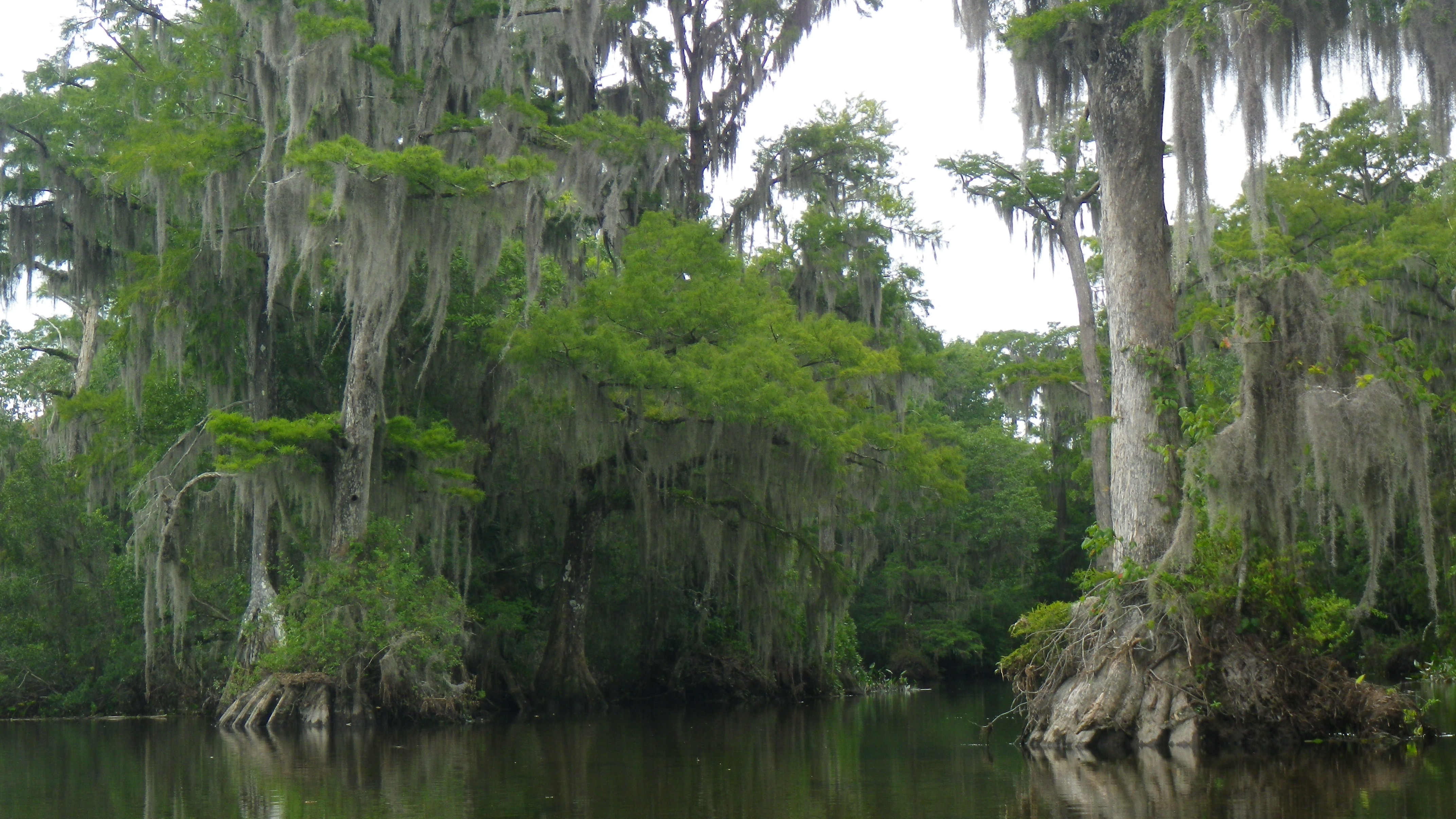
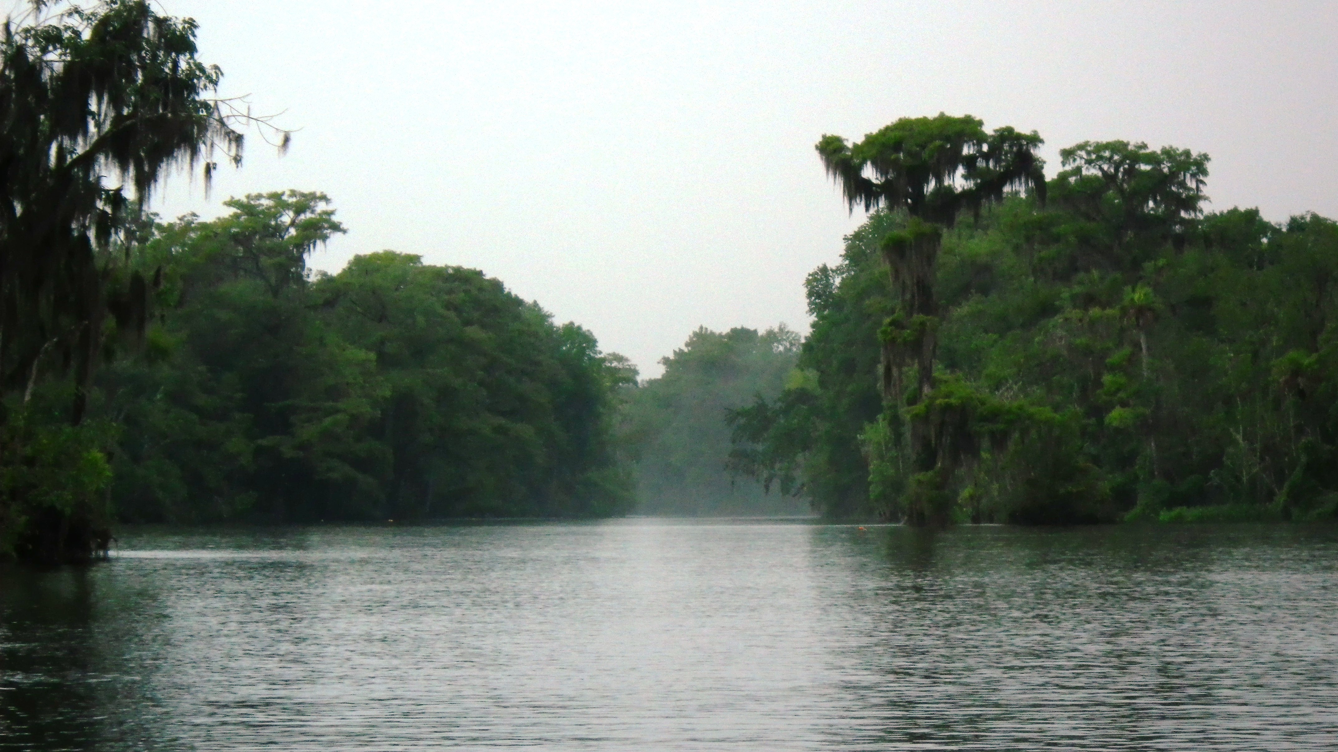
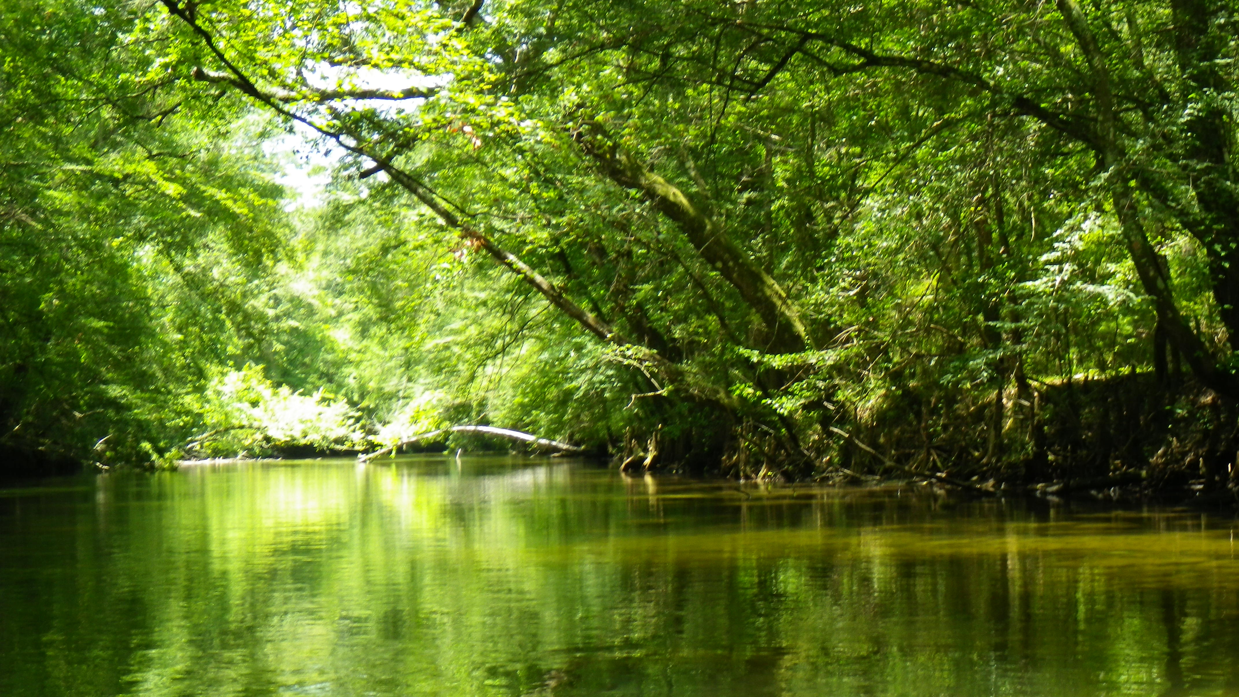
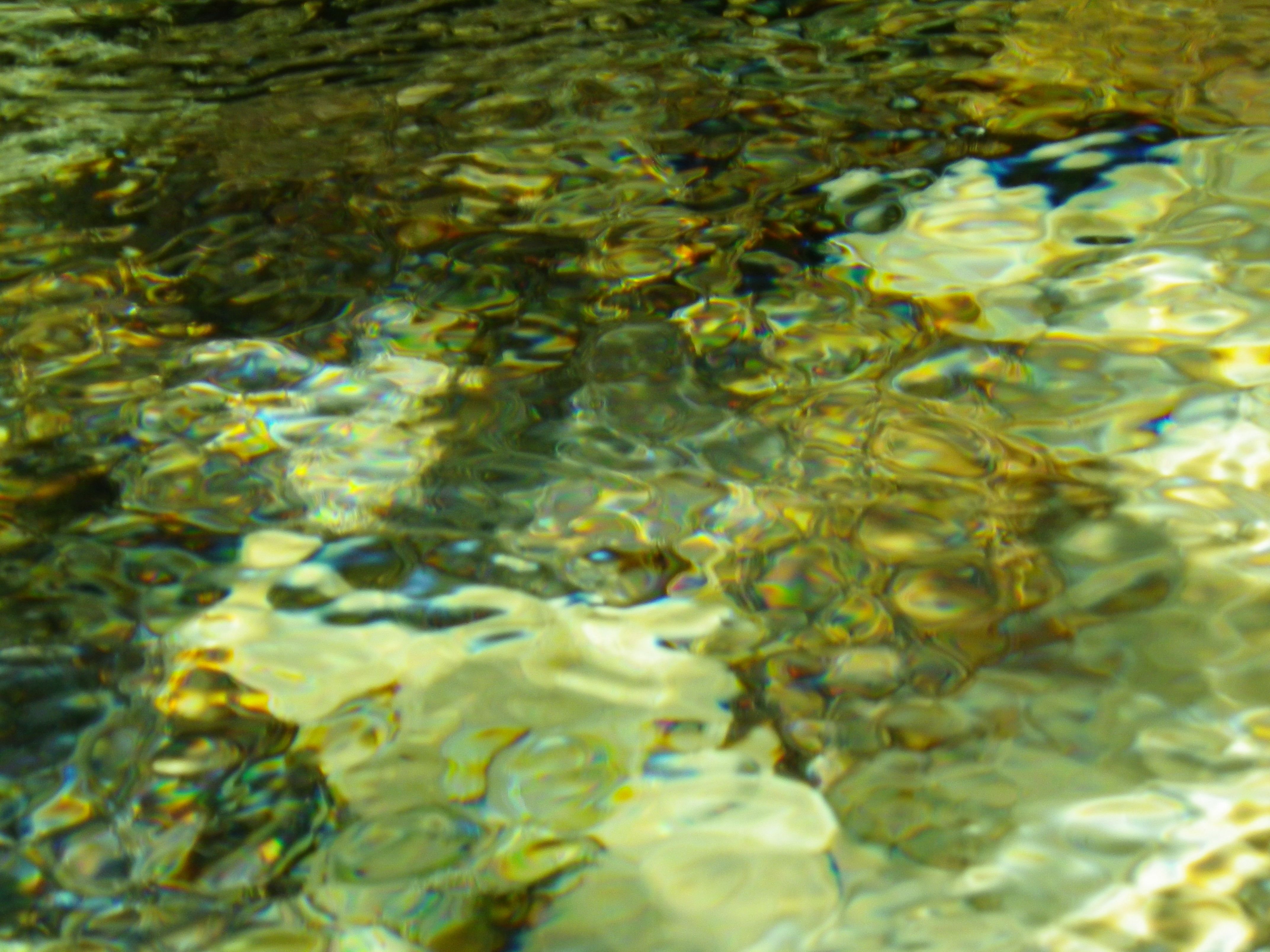
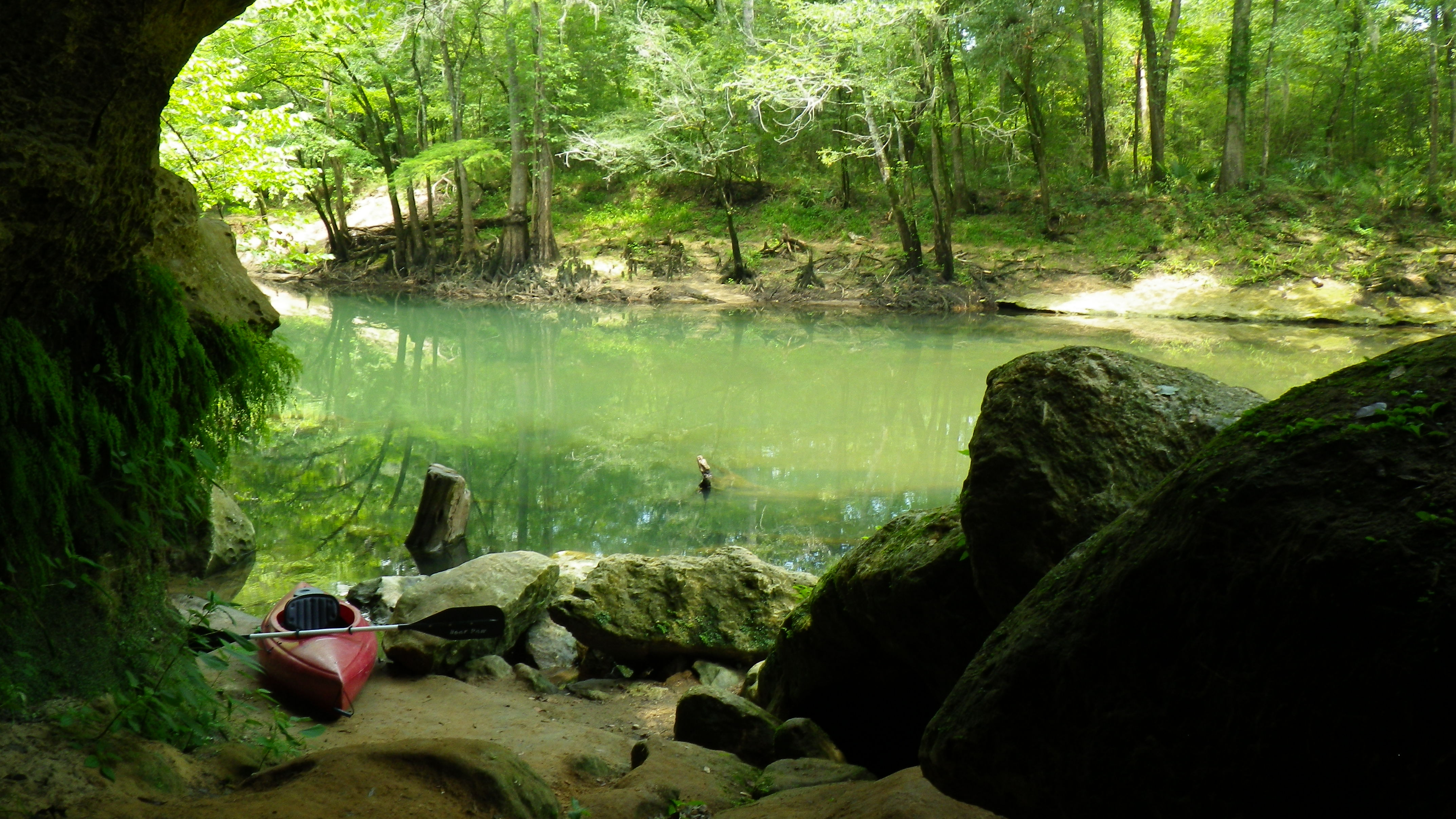
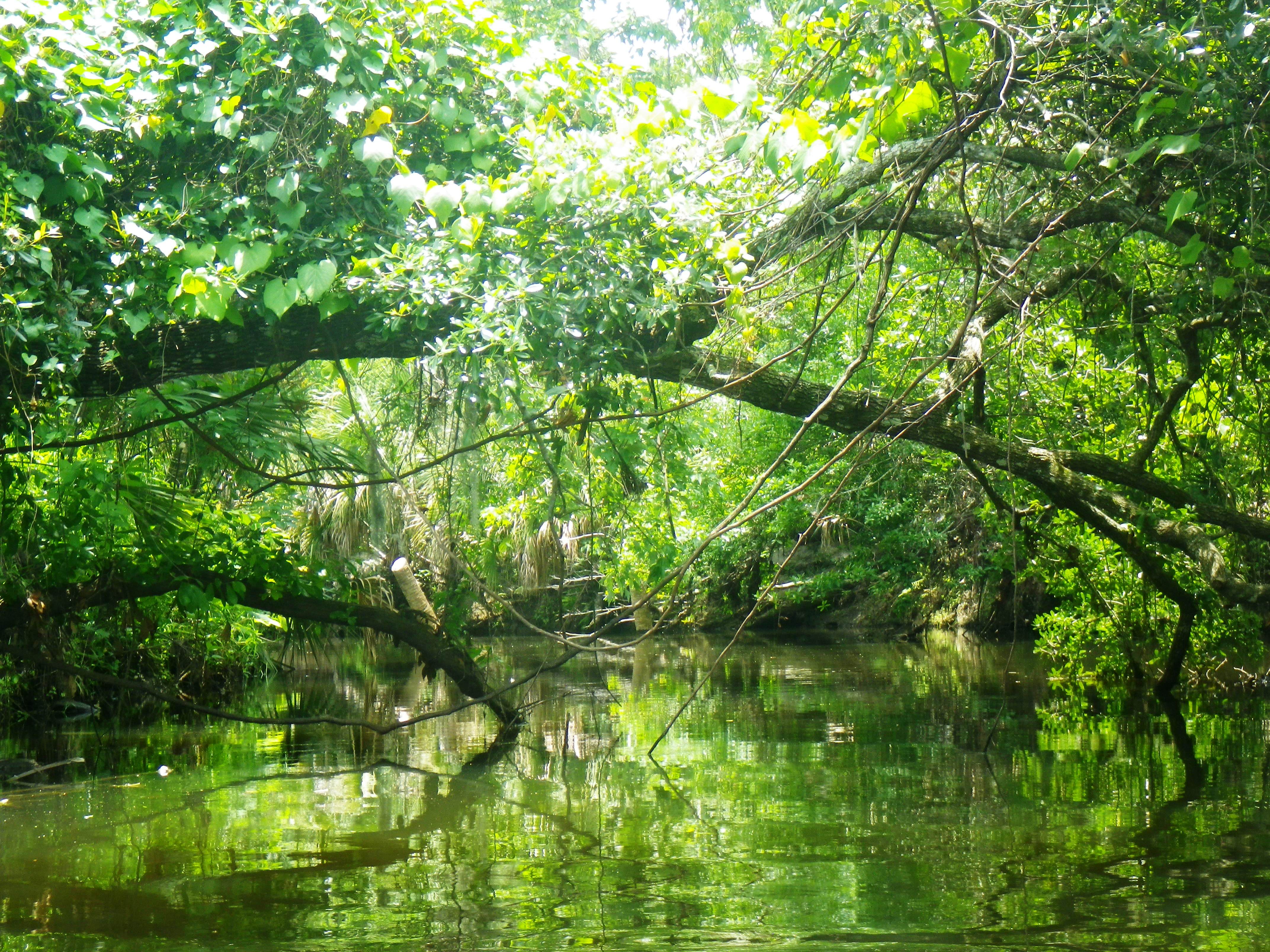
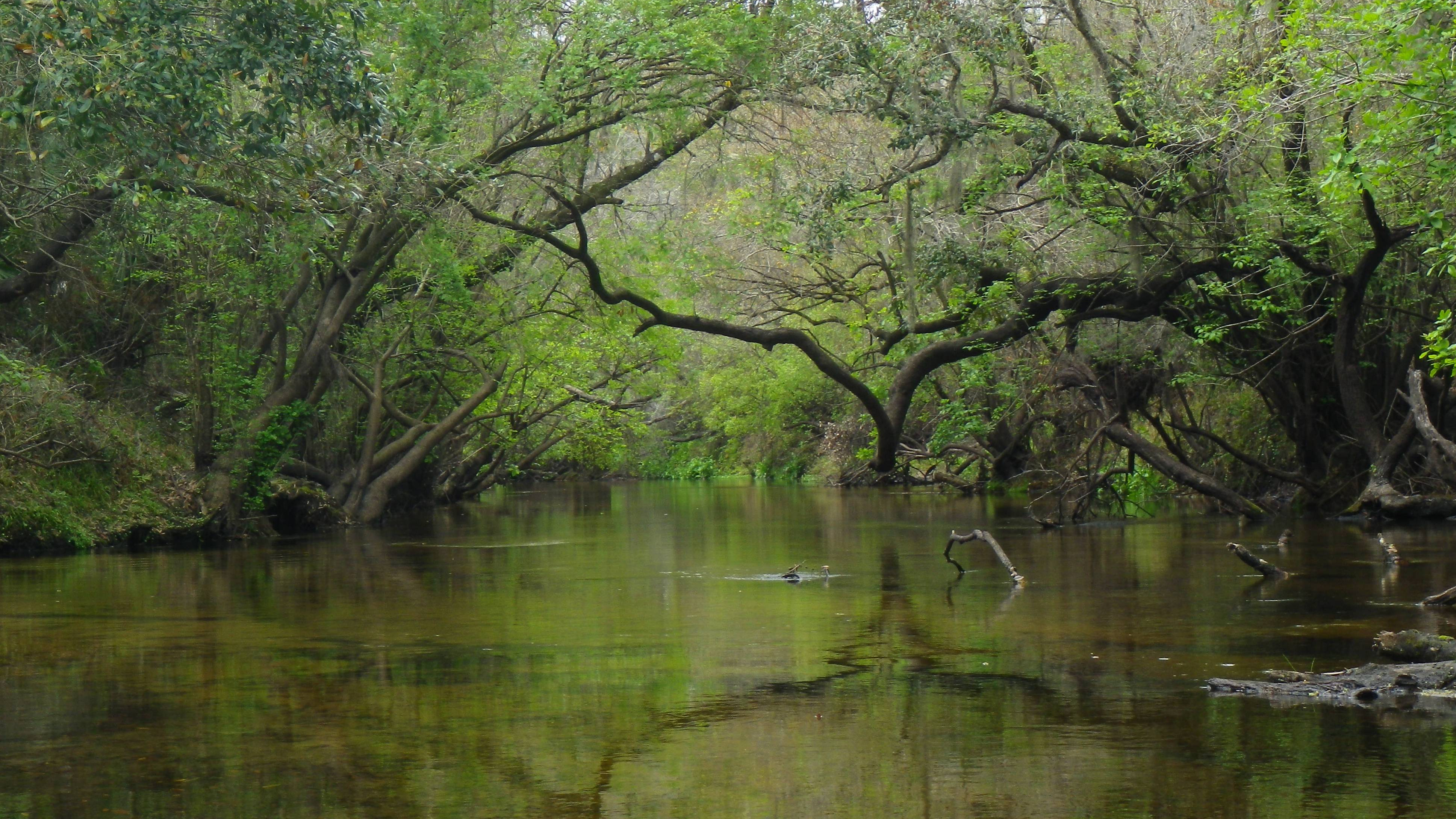
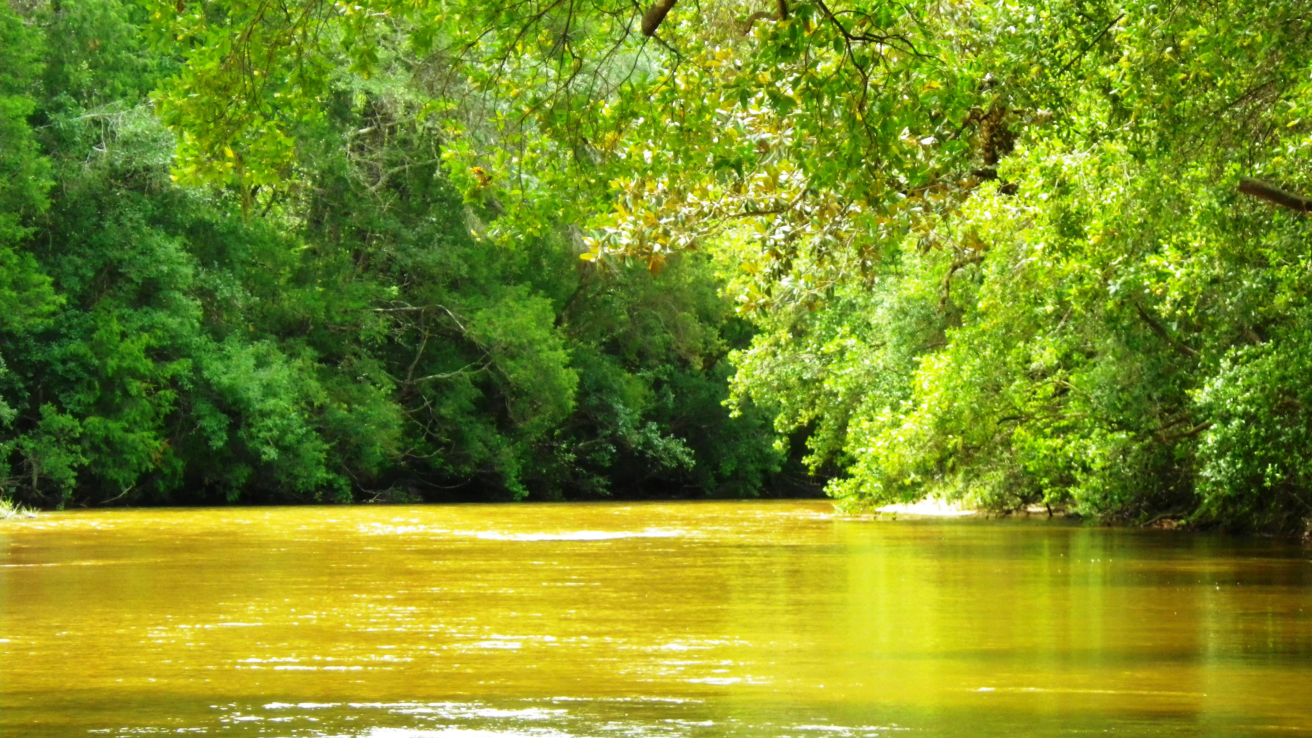
Paddling away from the put-in, I could see the sandy gravel bed of the creek through the shallow tea-colored water.  The sun shone hot, and I dangled my toes in the coolness beneath me, silently thanking the AU staff member who talked me into a sit-on-top kayak. Lush foliage surrounded me—tall long needle pines, oaks, and cypress.  A magnolia tree peaked out here and there.  I paddled around a bend in the creek and faced tall sandy bluffs. An “ahhh” moment.

However, soon enough, I realized the thing about paddling on the weekend—it’s not a serene, peaceful paddle and the only wildlife to be seen comes equipped with coolers.  Wide sandbars poked out into the creek, creating perfect nooks for family get-togethers. Children splashed in the water while their parents chatted and sipped cool drinks.  Tubers began to show up in large groups just past the Springfield Road put in—about four miles from my AU destination.  I quickly learned to maneuver around them, 20 or more at a time.

Shallow Waters of Coldwater Creek

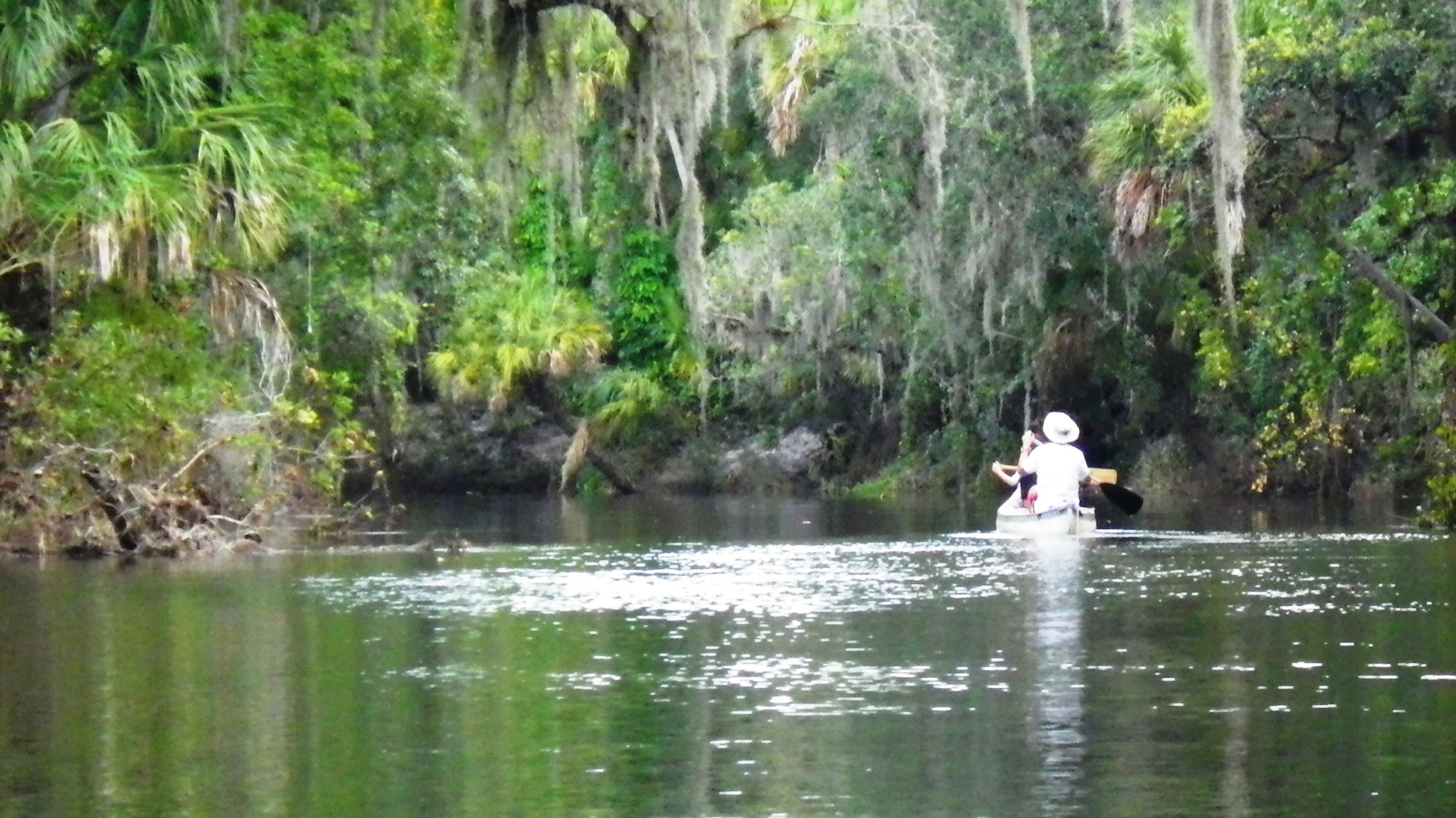
So many of these folks traveled by canoes, and with the loads they carried, I understood why.  However, the low water level meant frequent portages for canoers, no doubt.  Even in a kayak, dodging the deadfalls and scooting around the wide sandbars challenged me, and more than once I got out and dragged myself to deeper water.

But what a beautiful creek!  Paddling this gravel-lined waterway, I could feel the downhill flow (a 2.8 gradient), and I sometimes felt as if I was sliding down someone’s flooded country driveway.    As I neared the end, I took a sharp left at a fork in the creek, where, for just a few moments, the swift waters hastened my journey and then delivered me safely back to the main waterway—a fun ending to my day on the creek.

(Outfitter: Adventures Unlimited Outdoor Center. 8974 Tomahawk Landing Road, Milton, Florida. https://adventuresunlimited.com/. (850) 623-6197 or (800) 239-6864)

Read Full Post »

The Wakulla River surprised me—in a nice way. I knew enough about the river to know that it is wider and busier than most rivers I paddle, and I expected to see summer homes along the banks and boats in the water.  However, I did not expect the Wakulla to be charming and picturesque, with images that reminded me of a Highwaymen painting.

Places to Explore on the Wakulla River

The Wakulla River, both an Official Florida Canoe Trail and an Outstanding Florida Water, begins at the Wakulla Springs, one of the largest springs in the world.  It travels about nine miles until it meets up with St. Marks River, and then, just a few miles further downstream, it flows into the Gulf.  It’s not possible to paddle all the way up to the springs, as the river is fenced off at SR 365, three miles south of the springs.

Once privately owned, the land around the springs is now the site of a state-owned hotel and resort—the Edward Ball Wakulla Springs State Park and Lodge. Financier Edward Ball constructed the resort in 1937; the state purchased it in 1986.  (Florida State Parks)

I put in at the US 98 bridge at 10:45 a.m., renting a kayak from TnT Hide-a-Way. It was Thursday, and I hoped for a quiet morning on the river.  I paddled north against a light current, toward the spring.  This was an out-and-back paddle, my turnaround point being the bridge at SR 365, about a four- mile paddle each way.

Shortly into my trip up the river, I met Josh, a local out for a quick paddle before going to work.  Josh, with a passion for Florida outdoors, was scouting out landscapes to photograph.  We chatted for a bit, and then he paddled ahead while I continued to discover the river.

Tall, old cypress dripping with long tresses of Spanish moss graced the edges of the wide river.  The water spread deeply into marshy woodlands creating small waterways to explore.  Below me, hydrilla and eel grass swayed with the current. Locals dropped fishing lines from small boats and leaned back to wait.

As I paddled further, I passed small cypress islands that divided the wide river.  I spotted wood ducks in flight and wood duck boxes mounted on trees. Outside one of these islands I paused and watched three playful manatees as they surrounded me, blowing bubbles in the water like children in a bathtub.  After all the rivers I’ve paddled, this was my first manatee sighting!

After the Rain

I made it to the bridge by noon, greeted by loud rumbles and ominous skies to the north.  When it began to rain on my return, I took comfort in seeing other paddlers on the river with me, and when the skies opened up, I was happy to see Josh tucked away under a wooden dock. I joined him, and we lingered together for awhile like two kids huddled in a tiny tent, watching the rain. Then after donning my disposal raincoat—we made a Butch Cassidy break for it and paddled out into the downpour. I couldn’t see far, but how beautiful the river looked in the rain! As we neared the bridge, the rain slowed.  I looked back and took a picture just as the rain ended, and we paddled the last stretch.

(Outfitter: TnT Hide-a-Way. 6527 Coastal Highway, Crawfordville, Florida. https://tnthideaway.com/. (850) 925-6412)

Read Full Post »

I stopped my car and read the sign at the entrance to the outfitter: Econfina Creek Canoe Livery “Go With The Flow.” I briefly reflected on the river-life metaphor as I drove down the driveway and parked.

Embracing Foliage on the Econfina Creek

I chose Econfina Creek as my second river to paddle in the Panhandle.  Huff describes the scenery as “superb,” with giant cypress that arch overhead.  Carter et al. claims that many consider the Econfina the “most beautiful and challenging stream in Florida.” It sounded like a waterway I needed to paddle.

So, I selected my kayak from a generous inventory at the outfitter, and I put in right there at 10:30 a.m.—to be picked up at the end of my seven-mile trip at CR 388.  Although the water level seemed low, I paddled away on a strong steady current, through the twists and turns of the Econfina.

Econfina comes from a Muskogean Indian word meaning “natural bridge.” (Carter et al.) The Econfina Creek originates in the southwest corner of Jackson County, Florida, where a number of creeks add to the flow. Along the way, springs and runoff contribute even more until it finally discharges in Deer Pointe Lake in Bay County. (Boning). The upper portions of the creek run swiftly through limestone and high bluffs with a 7.9 gradient. A gradient 4 and lower banks on the lower portion where I paddled make for easier navigation.

Huff’s description of the creek held true; tall, arching cypress, along with magnolia, several varieties of oaks (including Shumard oak and laurel oak) and pines, dogwood, and red maple embraced the waterway.  Similar to the Chipola River, the landscape varied with swampy wetlands on one side and high limestone banks/cliffs—these, dripping with lush ferns—on the other.  Lots of sandbars along the way made for an easy dip to cool off or pause for a snack.

Spring Along the Econfina Creek

Some of the land around the creek is privately owned; however, the few houses that appeared seemed to blend in with the surroundings.  The Northwest Florida Water Management District has acquired about 14 miles along the creek and has built viewing structures so people can access the springs.  I paddled past several of these springs along the way.  At Pitt Spring, I met two local women, Gail and Rose, who came to cool off on a hot day. During our chat, they described the beauty of the creek when the dogwoods and azaleas bloom.  At Emerald Spring (the main source for Econfina Spring water), a young family snorkeled at the base of the 25-foot limestone bank to view the spring’s powerful flow.

What a great place to be on a slow, lazy day! I hung my legs over the side of my vessel, dipped my feet in the clear, cool water and let the flow take me beneath the canopy, around the twists and turns of the river, returning to reality only momentarily to maneuver around a deadfall or a sharp corner.  I love vacation!

(Outfitter: Econfina Creek Canoe Livery. 5641A Porter Road, Youngstown, Florida. http://www.canoeeconfinacreek.net/. (850) 722-9032)

Read Full Post »

Summer vacation, here at last!  I headed to the Panhandle to paddle a few rivers.  These would be my first in this area, and first up—the Chipola River.

I rented a kayak from Bear Paw Canoe Rental in Marianna—a local outfitter with a good selection of kayaks. The owner, Ricky, drove me just north of Marianna, to the put in at Yancy Bridge on FL 166. I began my peaceful paddle (9.8 miles) at 9:30 a.m., the only person on the river—what could be better?

The Caves on the Chipola River

The Chipola River, located in the Central Panhandle, starts north of the Alabama border.  It runs 80 plus miles to eventually merge with the Apalachicola River, close to the Gulf.  As it passes through the Florida Caverns State Park, the Chipola goes underground for awhile and then re-emerges.  Along its journey, various springs (over 60!) and creeks flow into it. (Boning) The Chipola is an Outstanding Florida Water, and 51 miles of it is a Florida Designated Paddling Trail.

Indeed outstanding, the Chipola did not disappoint me!  Almost immediately, a great horned owl flew over the river in front of me, landed on an overhanging branch, and watched as I floated beneath him.  Belted kingfishers and warblers darted here and there as ibis and herons chilled on the riverside.

Even with the recent rains, I could see the sandy bottom through the beautiful milky blue-green water, thick reeds and eel grass moving with the current.  I paddled the cool waterway shaded by thick foliage of oak (several varieties), cypress (draped in long tresses of moss), maple, magnolia, and dogwood, plus many others that I could not begin to identify. How strange not to spot a single cabbage palm!  The landscape varied with low swampy woodlands on the east side and limestone banks, bluffs, and caves on the west.

I did encounter one strange phenomenon—a constant humming coming from the woods for much of my paddle, perhaps some kind of insect. Ricky later suggested locusts.  (I believe the Florida version is called cicadas.)  Regardless, I imagined that a magical wood nymph, attempting to keep the river serene and peaceful, placed them there to help cover the sound of distant traffic sometimes present.

Just Along for the Ride

I stopped to climb and play when I reached the limestone caverns on the west bank—what a great spot for a picnic! However, I stayed close to the entrance of the caves, not wandering into the dark depths.  Further downriver, I followed a short spring run to my left and paddled around Dykes Springs, trying to capture the swirling blues and greens with my camera.  Back on the river, I paddled further and passed Spring Creek.

The thunder had already started, but I made it back to the outfitter at 1:30 p.m., just before the skies opened up and the thunder, lightning, hail, and rain began.

(Outfitter: Bear Paw Adventures. 2100 Bear Paw Lane, Marianna, Florida 32448. http://bearpawescape.com/. (850) 482-4948)

Read Full Post »

Afterwards, I questioned my determination to paddle the Manatee River during the hot summer months.  However, having run out of new rivers to paddle close to home, the Manatee seemed the obvious next choice.  In retrospect, it would have been a lovely paddle during the fall or spring months.

A Hot Paddle on the Manatee River

The Manatee River passes through Lake Manatee in Bradenton, and then continues on its westerly way to eventually empty into the Gulf—a 46-mile journey.  As it nears the Gulf, it widens and acquires estuarine qualities in the flora and fauna. The section closer to the lake—where I paddled—is the Upper Manatee River and is designated as a State Canoe Trail and Greenway.

Lake Manatee did not always exist. In the 1960s, officials built a dam on the river to create a reservoir for the surrounding areas—and thus created Lake Manatee. When Tropical Storm Debby came through mid-June of this year and dumped some much-needed rain on Florida,  the dam was opened wide to prevent flooding. The few paddlers who attempted the trip to the dam returned very quickly, unable to paddle against the strong current.

So, the river slowed down, and I rented a sit-on- top kayak at Ray’s Canoe Hideaway (well-hidden and very unpretentious). Ray’s sits on the river about 5.5 miles west of the lake.  My goal: to make it to the dam and back.

Along the way, I paddled past beautiful white sandbars that on a cooler day would have tempted me to stop and play.  High sandy banks with overhanging trees clinging to the sides showed wear and tear of storms past.  Oaks, cabbage palms, saw palmettos, slash pines, and pond apples edged the wide river but offered little shade.  The wildlife seemed to know to stay out of the sun.  I saw a blue heron, a turkey vulture, and one lowly turtle.  An occasional fish jumped around me, probably searching for a cooler spot in the water.

I turned on my camera, and it lit up with a warning, telling me that it was just too dang hot, and then it shut itself off.  My IPhone screamed TEMPERATURE! However, even in the heat, some found enjoyment on the river: a dad canoeing with his two young children (picture), a group of teenagers swinging on ropes and splashing in the cooler waters in a rare shady spot. One yakker even offered to share his cold beer with me.

I paddled against the current, light at first, but growing stronger as I neared the dam and Lake Manatee.   I made it about 3 miles up, just past the bridge and Rye Wilderness Park. The current was getting stronger, and my time on the river was running short.  I turned around and enjoyed the easy paddle back.

(Outfitter: Ray’s Canoe Hideaway on the Manatee River, 1247 Hagle Park Road, Bradenton, FL 34212. http://www.rayscanoehideaway.com/. (941) 747-3909 or (888) 57CANOE)

Read Full Post »

At last, the sun graced Southeast Florida for a day, so I took off from work and headed to Palm Bay for a paddle on Turkey Creek.  This is an out-and-back paddle, with a put in on either end.  I put in at the Palm Bay Marina on U.S 1.  My destination: Turkey Creek Sanctuary, a nature reserve run by the Audubon Society.

Marsh Grasses on Turkey Creek

I paddled away, passing the boats docked at the marina and the Palm Bay Estates—a small modular residential area. I paddled under the railroad trestle and into a series of braided channels. “Take the middle waterway,” the man at the marina had told me—and about the time I cursed myself for leaving the map on my car seat, I saw an aqua blue sign directing me.   I believe this is called “Willow Swamp,” perhaps after the Carolina Willows which adorn the banks.

I paddled upstream (west) against a current and a breeze, feeling guiltless for missing my morning workout. I spied a great egret peeping out through the tall marshy grasses and an osprey keeping watch from a high tree. Homes dotted the banks on the outside of the channels.

Just over a mile into my trip, a dolphin dipped into the dark waters in front of me, marking my passage into the sanctuary. Shortly thereafter, I paddled under the Port Malabar Bridge where the scenery changed.  The creek became a winding stream, shaded by oaks, maples, elms, and palms and embraced by various wetland scrub plants including leather ferns and swamp lilies.  Sand pines clutched high bluffs on the right as I paddled around a bend in the creek.

Pathway Through Turkey Creek Sanctuary

Mullet jumped around me, cooling me with their splashes.  Suddenly, a huge (yes, huge!) fish surged from the water–an Aquaman wanna-be–directly in front of me.  He did a little squiggle, and went straight back down, tail first.   He was a few feet long with a wide girth—I would not have been able to put my hands around him.  I’ve asked four people what it was and got four different answers—the best being a large bass.

With my meandering and a bit of chatting with other yakkers, it took me over an hour and a half to reach the sanctuary.  I paused at the sandy beach, stretched my legs and snacked on nuts and fruit.  I didn’t take the time to walk along the board walks and nature trails, but I understand they are lovely.

Before heading back, I took a quick paddle to the dam—less than 15 minutes upstream. I realized that the water pouring from the four large sections accounted for the stronger current as I neared the sanctuary beach earlier.

My outing was just over 4 miles, and with my leisurely paddle, it took me three hours.

(Outfitters: Palm Bay Marina, 4350 Dixie Highway, Palm Bay, FL 32905. https://www.palmbaymarina.com/. (321) 723-0851)

Read Full Post »

The more time I spend on Florida rivers, the more I’ve come to feel that the river cannot be rushed, that the longer the paddle, the better.  However, with this paddle, I discovered that when time does not allow for a long, leisurely paddle, a “quickie” paddle can still satisfy the senses—at least for the moment. 

The Picturesque Spruce Creek

My sister, Missy, and I paddled Spruce Creek in Port Orange on a Sunday morning in May.  Now, although my guidebooks recommend putting in at the eastern end of the creek, near Strickland Bay and Spruce Creek Park, we opted for a location closer to us, and we put in on the upper, western end, renting our tandem kayak from Cracker Creek Canoes in the privately-owned Spruce Creek Preserve.

Spruce Creek originates not far from this point, in the freshwaters of the cypress swamps.  To the west, there is less than a mile of waterway that can be navigated.  To the east, it’s less than 8 miles to Strickland Bay.  We didn’t want to miss the wild section of the river, so we began our paddle by heading west on the narrow, winding blackwater stream.   

It didn’t take long to realize why this little creek is both an Outstanding Florida Waterway and a Florida Designated Paddling Trail.  We gazed upon the picturesque creek, shaded by overhanging oaks, maples and cypress reflecting in the dark water.  On the left, high banks led up to wooded areas and one, maybe two homes tucked away.  To the right, the water spread out, seeping into the low cypress wetlands.  Deep in the woods, the birds called to each other from the trees.  

The further west we paddled, the more we had to skirt around or duck under fallen trees.  It took us less than 30 minutes to reach a point where the narrowing creek and downed trees forced us to turn around and paddle back east.  

Now, heading east, past our put in, the creek widened.   Two great blue herons greeted us, flying up the river.  A cormorant sat atop of a pole in the water, seemingly unbothered by the company.  Woodpeckers tapped away, busy at work on an overhanging tree.  We could see and hear the mullet jumping around us, close enough to get us wet as they flopped gracelessly out of the water.  We saw schools of them below us, swimming in the dark water.

If we had paddled further, we would have noticed even more of a change in the creek.  As it nears Strickland Bay, the creek and its surroundings become more estuarine with grass flats, salt marshes, and mangrove forests.  But, alas, our time was up!  We turned around and headed back to our put in.

(Outfitters: Cracker Creek Canoes, Port Orange, FL 32128. http://crackercreek.com/. (386) 304-0778)

Read Full Post »

What a wonderful St. Patrick’s Day paddle! I kayaked Arbuckle Creek with a friend, Rick Murphy. (Rick paddled Fisheating Creek with me as well.) We paddled from the boat ramp in Avon Park on Arbuckle Road, north to Lake Arbuckle and then back, about five miles total. What a sweet river! I had read that it can get congested with vegetation in a couple spots when the water level is low, but we had no problems getting through.

The Enchanting Arbuckle Creek

Arbuckle Creek is a 23-mile blackwater creek that runs from Lake Arbuckle in Avon south to Lake Istokpoga in Sebring. Arbuckle State Park fishing and campgrounds border parts of the upper river with the U.S Airforce Base (which we never saw from the river) along the east side of the river. My guidebooks describe the 2.5-mile stretch from the Avon Park boat ramp to Lake Arbuckle as the most scenic, so I called the Sebring Kayak Tours (the only outpost I could find in the area) and made arrangements to meet up with Nelson. There isn’t an outpost on this creek, and Nelson was nice enough drop two kayaks at the boat ramp, so we didn’t have to pick up the kayaks in Sebring.

For the first two hours, we paddled north on the narrow creek, against a light current. It was a perfect day, sunny and warm but cool in the shade. Spring had sprung on the creek! The Cyprus, dressed once again in their greens (just in time for St. Patty’s), cast beautiful reflections on the water while cypress knees clustered like crowds of little people gathering for a parade. Oaks and red maples seemed to embrace the narrow, twisting creek, with a magical sense of a fairy tale. Lilies and irises were just beginning to bloom.

When we reached Lake Arbuckle, we stretched and snacked on nuts and fruit and watched a silly sandhill crane family grassing. The trip back, a breeze now with the current, treated us to a new perspective of the creek with great herons lifting off from the bushes and lots of baby alligators. These alligators ranged from one to three feet long, and at one point, we passed through a pool where little eyes poked out of the water around us—perhaps eight or ten sets. We kept watch for momma gators, but never spotted any.

The river had a lazy feel. We passed a few men fishing from the shore or from small, quiet boats and watched as one man pulled in a nice-sized catfish. Birds called to each other from the trees: ospreys, great herons, ibises, limpkins, great egrets, kingfishers, and hawks. Beautiful dragonflies and damselflies hitched rides on our yaks as we paddled.

Arbuckle Creek made my list of “awe” some Florida waterways. It captured me from its first twist and turn with its mystical charm; it took my breath away!

(Outfitter: Sebring Kayak Tours. https://visitsebring.com/partners/sebring-kayak-tours/ (863) 202-0815)

Read Full Post »

On Monday morning, I headed to the Tomoka State Park in Ormond Beach to paddle the Tomoka River.  I had attempted to paddle this river twice before, but I could never find the outfitter in—the drats for not bringing my own kayak with me.  This time, I spoke to Billy by phone, and he was meeting me there.

The Tomoka River
The Tomoka River

The Tomoka, a state-designated Outstanding Florida Water, originates in a swampy area just southwest of Daytona.  It runs north, picking up waters from the Little Manatee River, Strickland Creek, and Thompson Creek, until it eventually merges with the Halifax River.  As it nears the Halifax, it becomes tidally influenced and takes on more estuarine characteristics.  (Boning)

I wasn’t certain that I would like the Tomoka. The state park “put in” sits at the northern end of the river, at the basin, right where the Tomoka connects to the Halifax River. The river is very wide here, so I knew it wasn’t going to be a sweet, canopied paddle.  However, even with the cool winds on this morning, I could feel the sun warm me through my jacket.  It was a beautiful day to paddle.

From the put in, I had a choice to either paddle south, make a loop that would include Strickland and Thompson Creeks, and return, or to paddle north toward the Halifax.  Although I liked the loop option (the river would be narrower), Billy suggested that with the winds and the movement of the current, I head north toward the Halifax.  So, I took his advice, and I put in, staying close to the shore, and after about 15 minutes of paddling, I took a couple smaller waterways that headed back into the state park.  These were both still pretty wide—60 feet or so—but I was sheltered some from the winds and could see both sides of the river.

It turned out to be a lovely day on the river.  Being Tuesday, the boat traffic was light; I saw only a couple small motorboats on the river.  Within the first five minutes of my paddle, a dolphin graced the water a short distance in front of me.  Fish jumped around me, taunting the few people casting lines from the shore.

The state park brags a bird paradise, and I did see quite a few: herons (great, green, blue, and tri-colored), egrets, osprey, pelicans, kingfishers, and black-necked stilts.  Heading into the waterways, tall salt grasses with a backdrop of cabbage palms and pines trimmed short sandy beaches.  It turned out to be a quiet, lazy day on the river.

I would return to the Tomoka, but I would paddle south and complete the loop to include Strickland and Thompson Creeks as well, or I might even try to put in at the FL 40 bridge and paddle north, provided, of course, I bring my own kayak.  Either way, it’s bound to be a great paddle!

(Outfitter: Tomoka Outpost Inside Tomoka State Park. https://www.tomokaoutpost.com/index.html. (386) 846-0982)

Read Full Post »

The fog had begun to lift, as the sun struggled to peak from the clouds.  A few sprinkles of rain tapped my windshield, as I pulled into the Canoe Outpost.  I didn’t know what to expect from this river, and I realized how much I loved the anticipation and the “not knowing.”

Low Waters on the Little Manatee

The Little Manatee River starts narrow and twisting somewhere around Fort Lonesome and Wimauma in Hillsborough County and widens as it travels west approximately 40 miles to the Tampa Bay.  A blackwater river, it is designated as an Outstanding Florida River.  The five miles between the Canoe Outpost and Little Manatee State Recreation Area is an official state canoe trail. (Carter et. al)

Rather than paddle from the Outpost to the Little Manatee River State Recreation Area, I chose to paddle the upper river, the 9-mile stretch between CR 579 and the Outpost.  Here, the river is narrow, canopied, less traveled, and wild.  This time of year, the water level is low, and as I gathered my supplies, the folks at the Outpost warned me to expect a portage or two.

I chatted with Mike from the Outpost as he drove me to my drop.  “You probably won’t see many gators, if any,” he said, “the poachers got most of them.”  Mike added that since this section of the river would be quiet (me, being his only drop so far), I may be treated to some wild hogs, deer, and bobcats along the way.  I appreciated the “heads up.”

I began my paddle west, sheltered by steep banks and wooded forest.  I could see the fish scurrying beneath me and could have easily touched the river’s sandy bottom with my hand—the water was that low.   A great blue heron flew up the river toward me, its wing span magnificent—what a sight.

About an hour into my paddle, alone on the river and lulled by the sweet harmony of the birds in the woods, I suddenly became alert when the bushes on both sides of the river came to life.  Wild hogs, first one large black one to my left, then more to my right, and for the next 10 minutes or so I paddled through the land of swine with hogs racing up the banks as I approached.  I spied a couple wild turkeys as they quickly bobbled away, as well.

The poachers had apparently been successful, as I saw only one small alligator.  However, the turtles appeared quite large and healthy!  I spotted ducks, herons, hawks, cardinals, and even a few red-bellied woodpeckers.

The low waters had created high steep banks in some places and low sandy beaches in others.  I scooted over sandbars and logs and under overhanging branches trying to avoid all the obstacles.  My mantra became, “I ain’t ‘fraid of no bugs” as I checked my hair and body each time I emerged from the branches.  (I read that during the rainy season, this water rises rapidly, and with all the obstructions in the water, one must be quick to make it through without mishap!)  Grapefruits, oranges and tangerines added a splash of unexpected color against the green and brown backdrop of oaks, willows, pines and cabbage palms.

For nearly four hours, I paddled past undeveloped landscape—with few reminders of civilization except the Florida Power plant just about halfway and the abandoned railroad trestle further along. Oh, and then, of course, there was the small group of four-wheeling, beer-drinking rednecks who greeted me just past the trestle.  Other than that, it was a fabulous, peaceful day on the river.

(Outfitter: Canoe Outpost. 18001 US 301 South, Wimauma, FL 33598. http://canoeoutpost.com/. (813) 634-2228)

Read Full Post »

« Newer Posts - Older Posts »