Feeds:
Posts
Comments

Posts Tagged ‘kayaking’

The Steinhatchee River had been on my list of rivers to paddle for some time, so I was happy to make the five-hour drive.  My attempt to paddle it last year had been throttled due to heavy rains that resulted in closed access at the Falls. Apparently, the waters had gotten so high and so fast that the paddle from the Falls to town, which typically takes about three hours, had some locals back in town in less than two!

High Waters at the Steinhatchee Falls

So, wisely, this year, I called the State prior to making the journey to confirm that there would be access. (Florida Water Commission, 904-359-3883) I later discovered that the Suwannee River Water Management District has a great website that monitors water levels and closings.

The Steinhatchee River (Native Americans named it “esteen hatchee” which means“river of man”) originates in Mallory Swamp in Lafayette County, and as it travels southwest to eventually empty into Deadman’s Bay, it picks up water from various springs (including Steinhatchee Springs) and creeks along the way. At one point—at US 19—it even goes underground when it flows into a sink, and it re-emerges about a half mile later—a couple miles above the Falls.

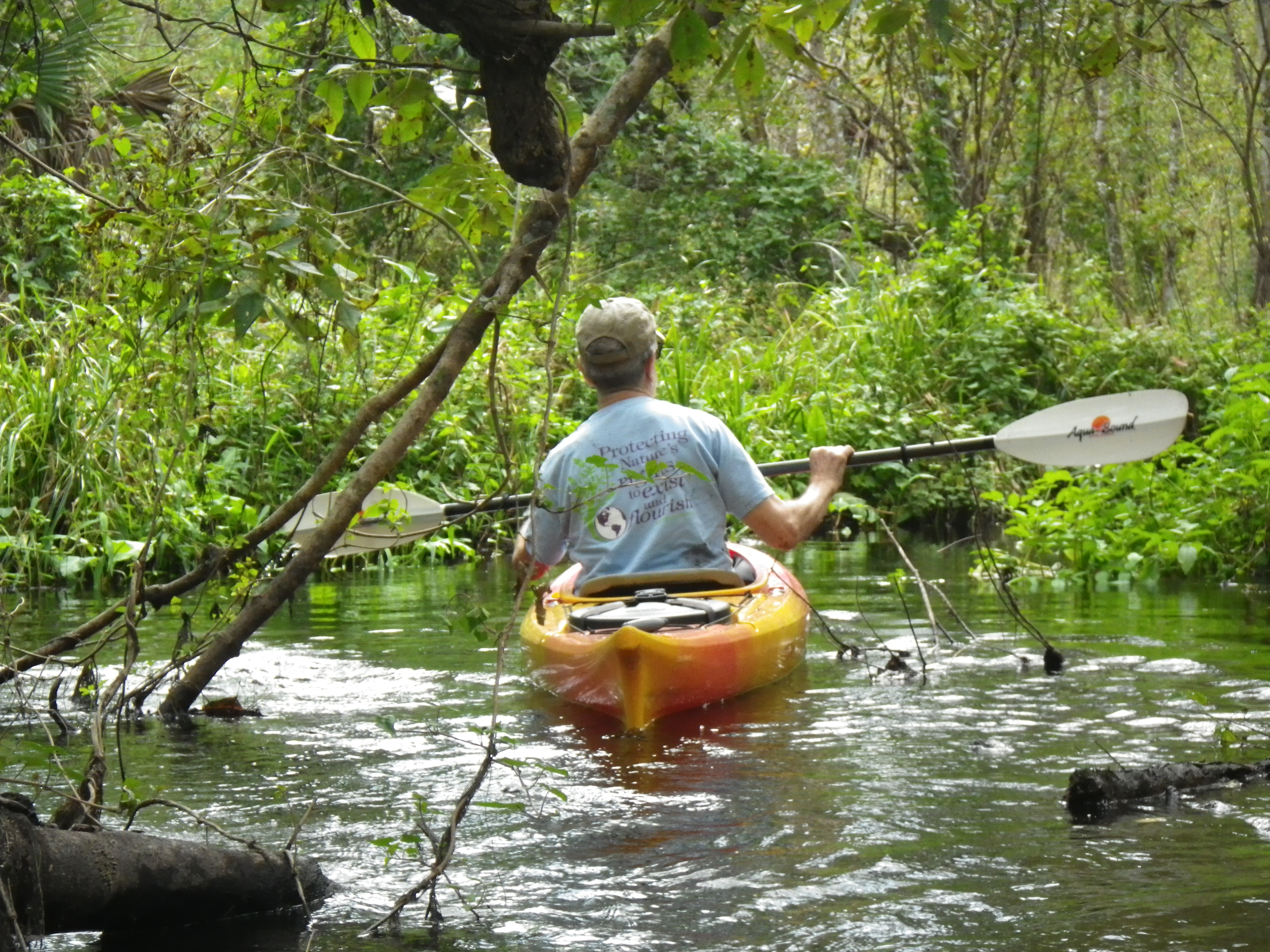
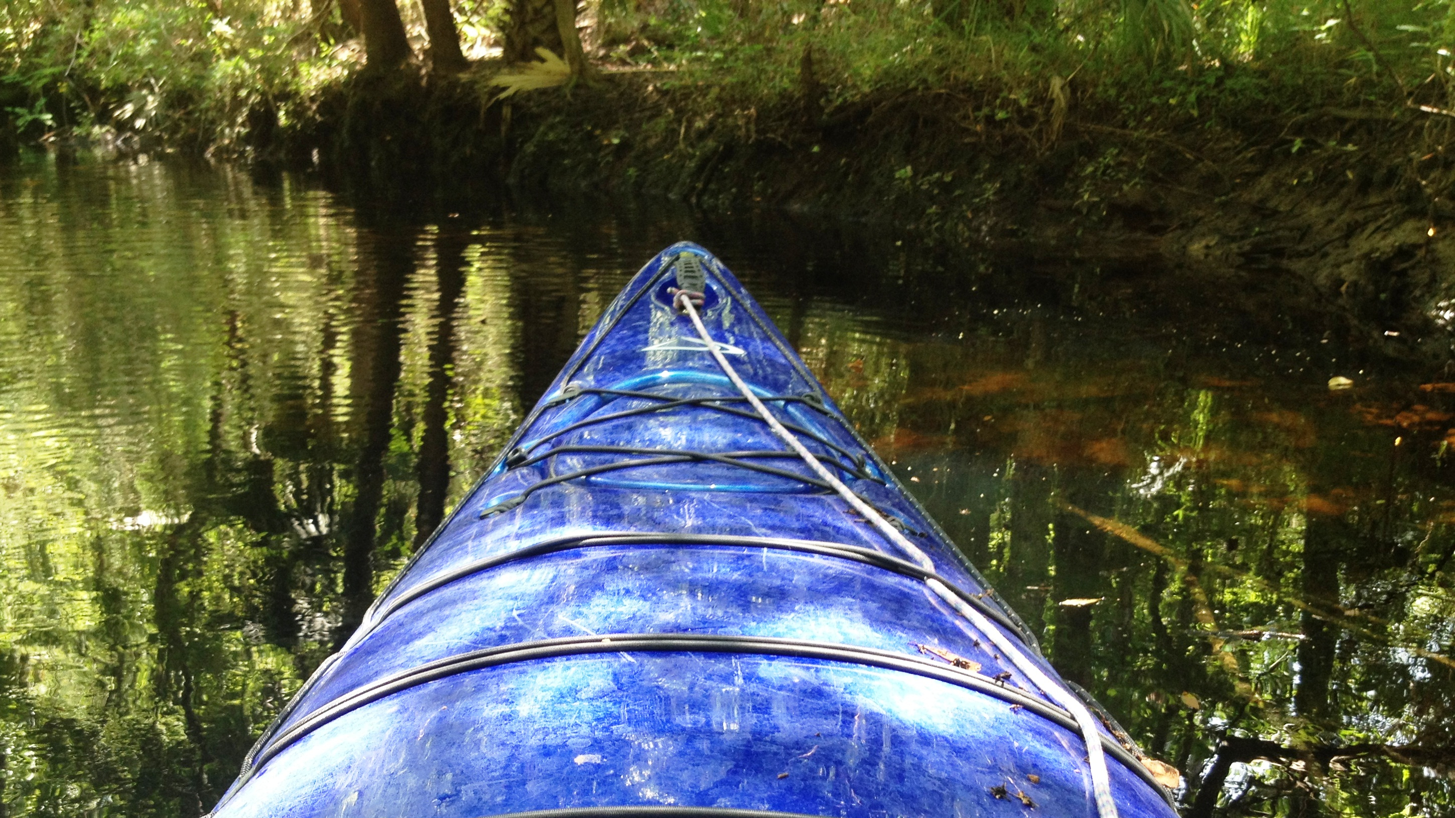
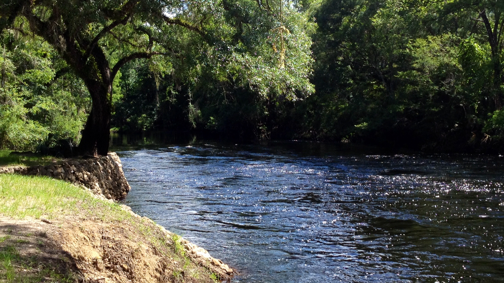
I planned my paddle for a weekday to avoid the weekend crowds, and the folks at Steinhatchee Landings Resort dropped me at the access in the Steinhatchee Falls Park. I put in on the west side of what would have been the Steinhatchee Falls—if the water level had been lower. Only little bubbles atop the water hinted at the 1-3 foot limestone drop now hidden under high waters. Suspecting that the river might be fast, I busied myself strapping everything down in my kayak. Next to me, a young local couple prepped to drop lines from their flat bottom boat. Watching as I loaded my kayak, the woman twanged “You paddling alone?” When I nodded, she added, “What if you flip? Who will help you?” I quickly double checked my straps.

Limestone Banks Etched by Moving Waters

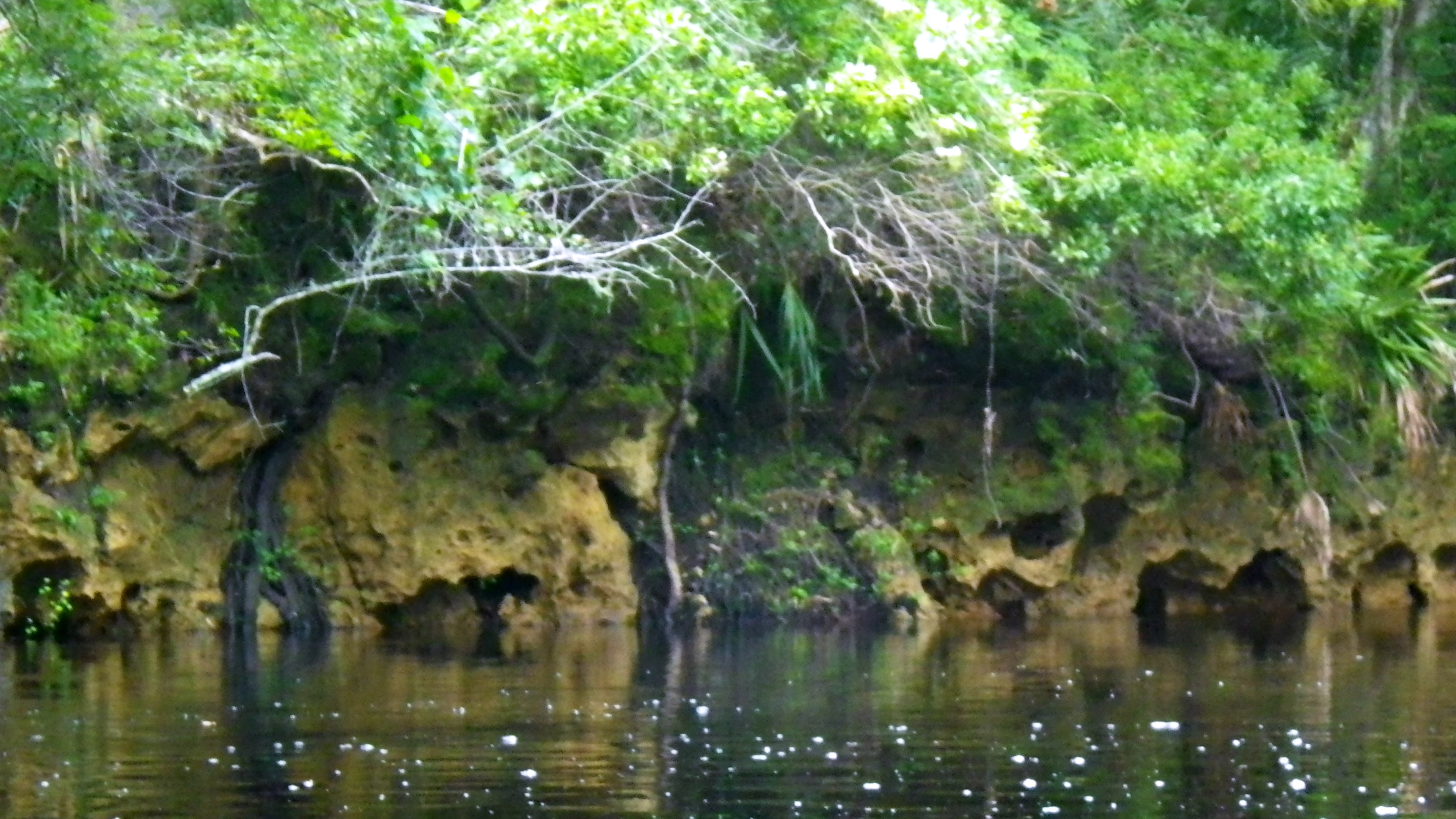
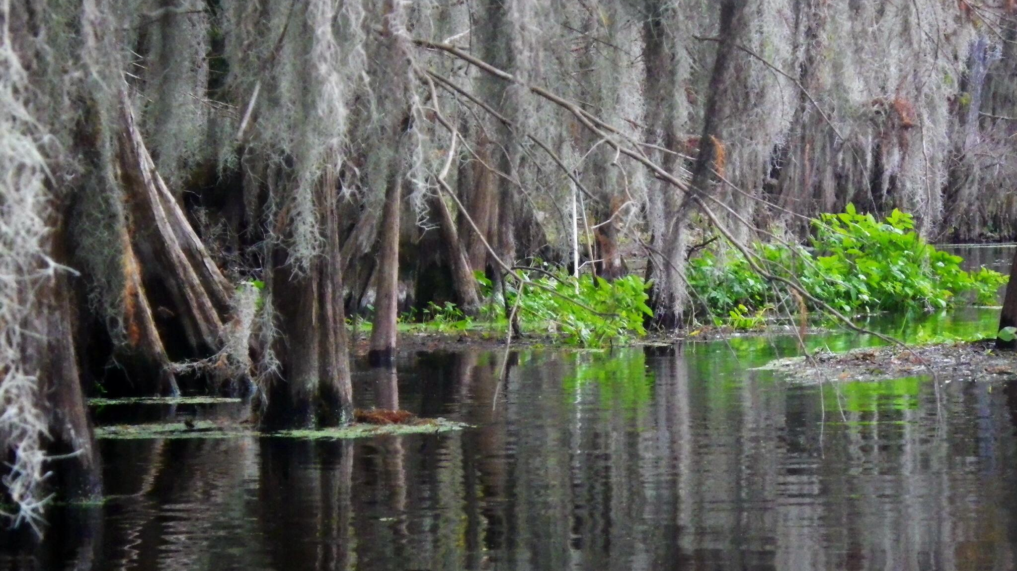
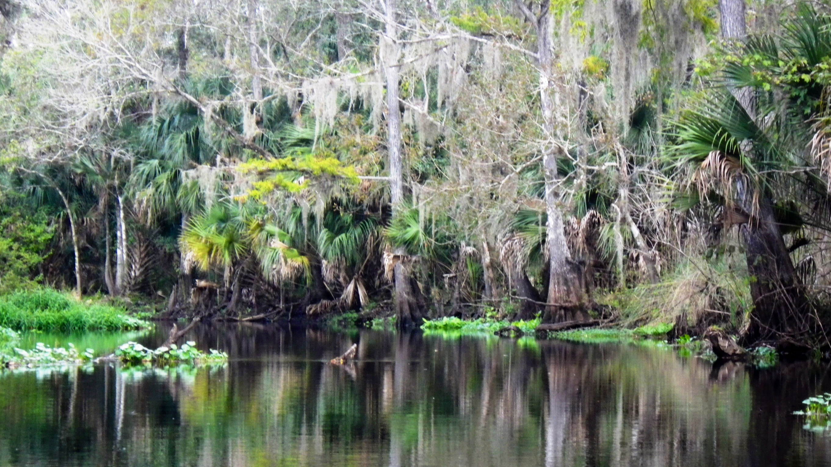
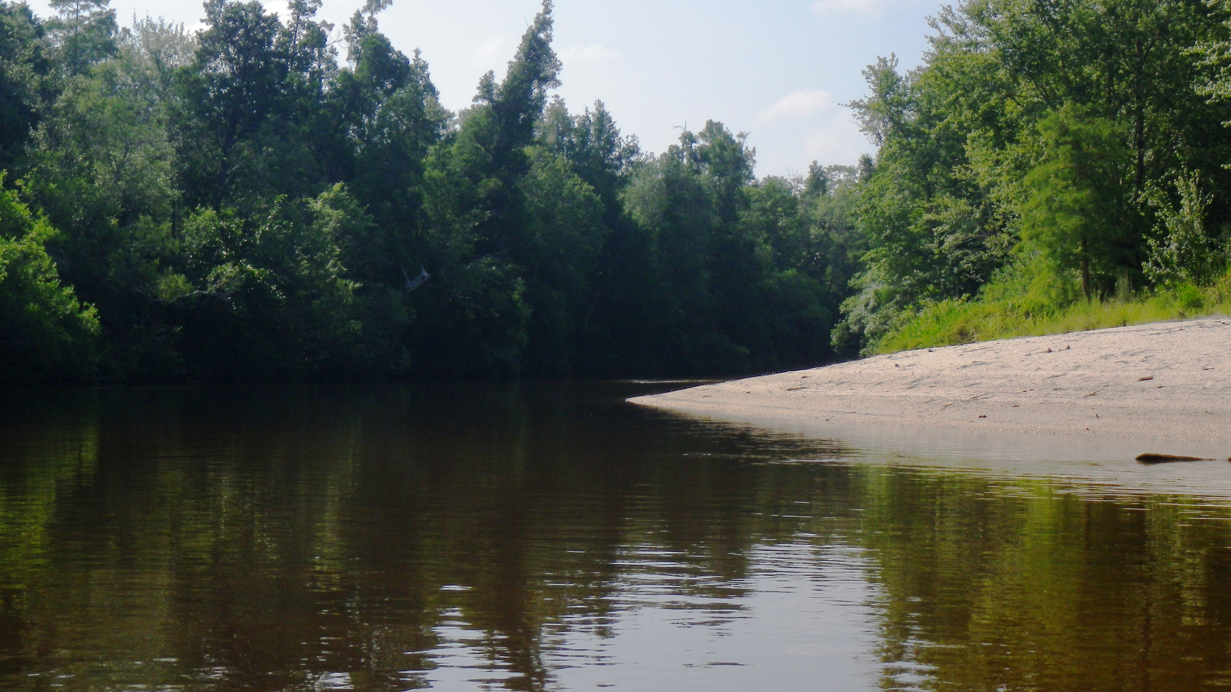
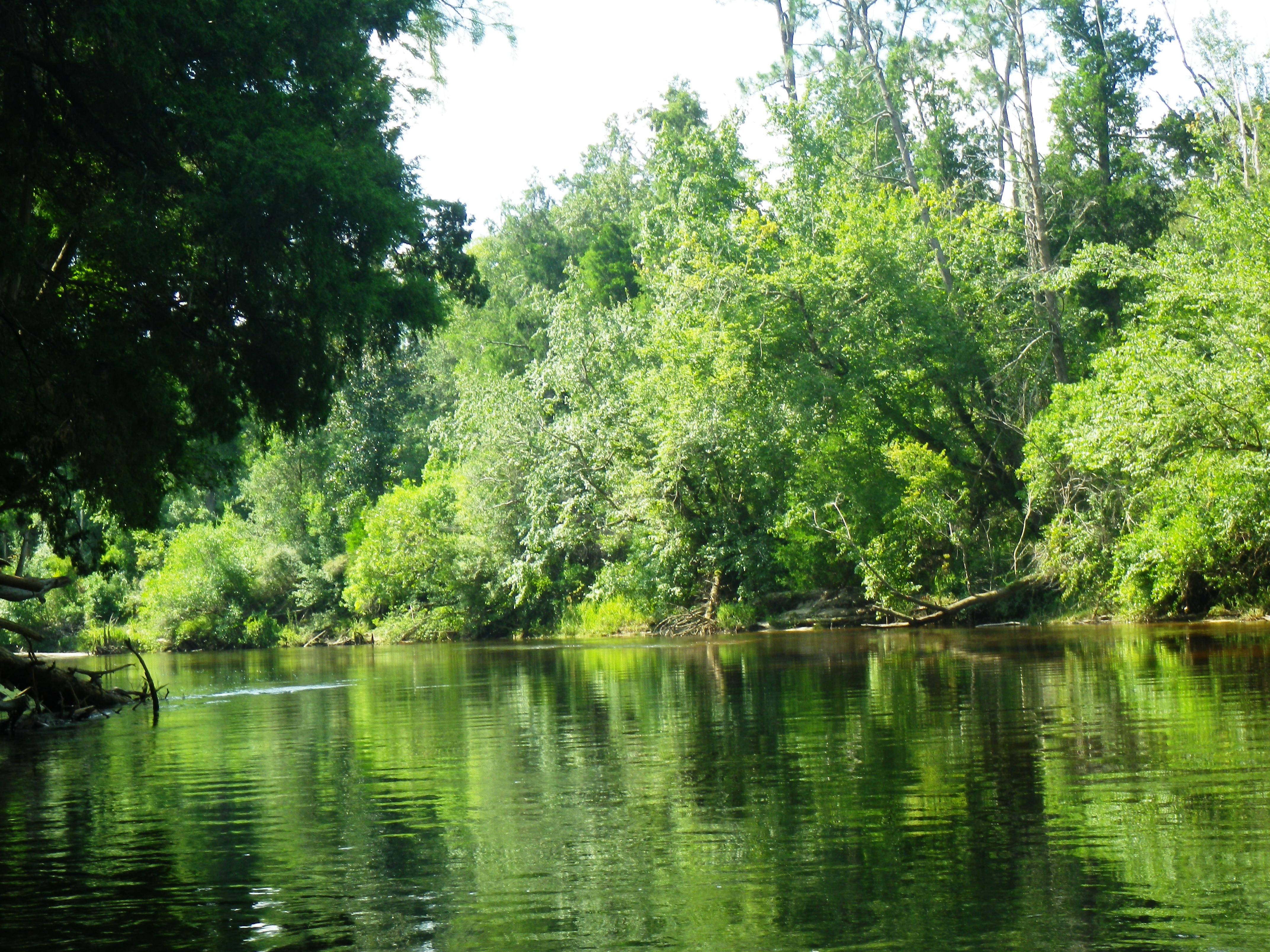
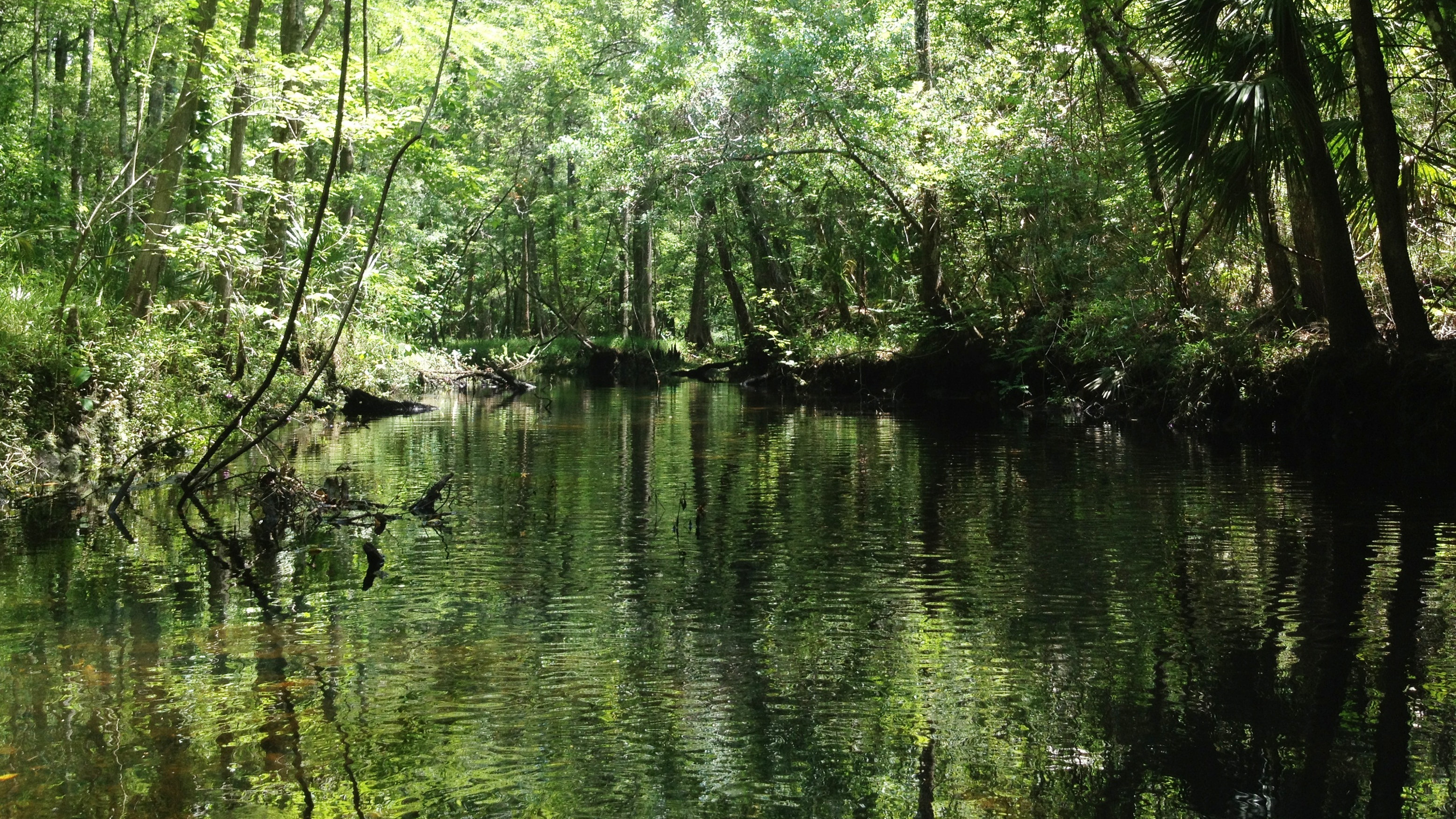
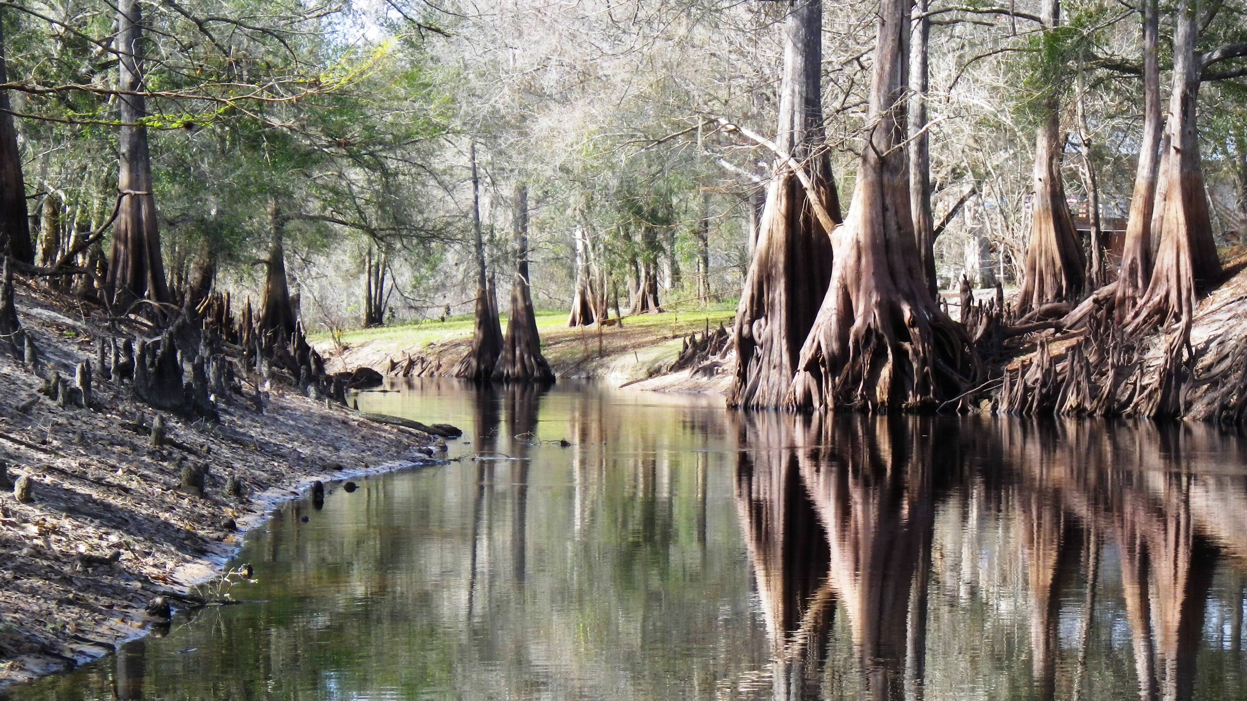
I climbed in my kayak and paddled away from the shore, relishing the peaceful tranquility the river always brings. For the first hour or so, I paddled a quiet, wild river, cypress and oaks providing me with refreshing shade. Limestone ledges hung over the water, etched by the water movement over many years. Large roots like long arms reached out from low banks and curved down towards the water. Birds called to each other from the woods, preferring its cool darkness to the hot sun. I hung my feet over the sides of the kayak and let them dangle in the cool, dark waters.

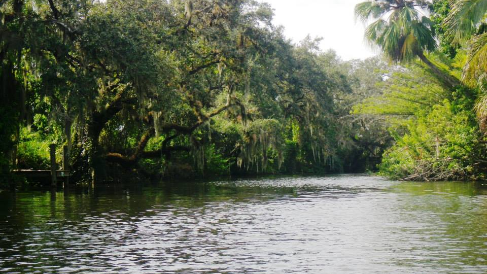
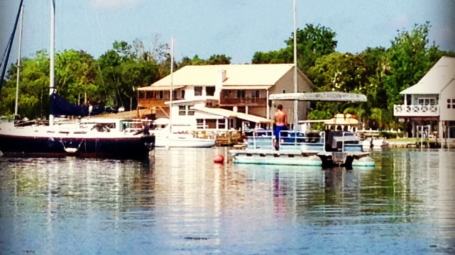
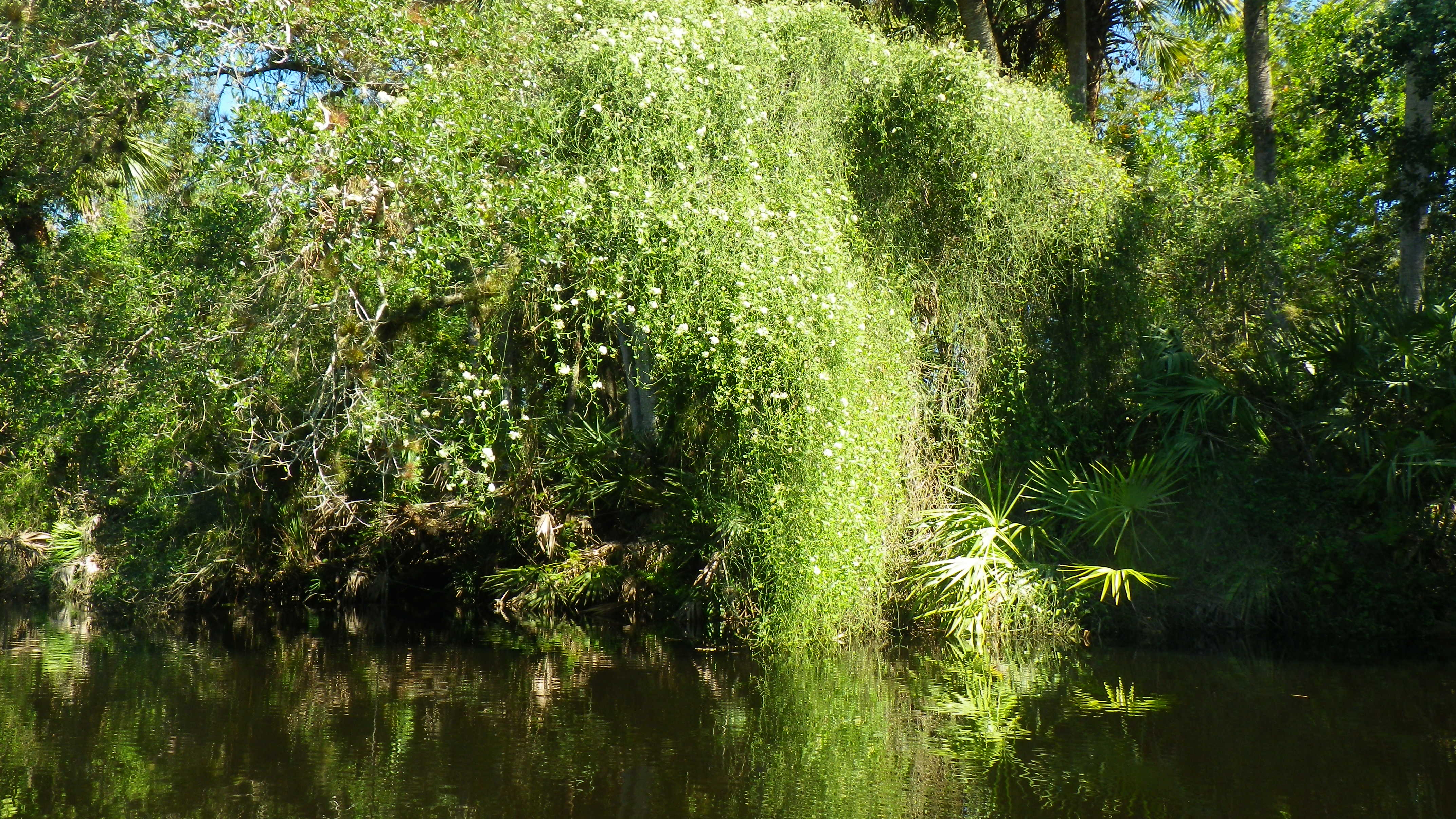
Midway through my paddle, the landscape began to change as old wood-framed cottages appeared, mostly on the north bank. Just as I spotted my first “watch for manatee” sign, the river took on an estuarine quality, and was now bordered by lilies, tall sea grasses, leather ferns, and sea grapes. This wider river offered little shade for a summertime paddle. As I neared the Landings Resort, more private residences, docks and marinas appeared on the banks.

In the end, I managed to stay upright throughout the seven-mile paddle; the river really wasn’t all that fast. It took me just over three hours with a couple short side trips on small creeks that entered the river. I made it back long before the rains came.

(Steinhatchee Landing Resort. Highway 51 North. Steinhatchee, Fl. 32359. (352) 498-3513.)

Read Full Post »

I stood at the water’s edge of Katie’s Landing State Park with my paddle buddy, Bill Belleville, looking across the Wekiva River, so glad I had remembered to bring my rain jacket. The wind had picked up, and the cloudy sky promised rain sometime soon. For the first time this season, I felt a chill in the air—the kind that nips your nose and makes you think about hot cocoa and fireplaces. Brrr…

Splashes of Color on the Wekiva

The Wekiva is one of only two National Wild and Scenic Rivers in Florida. (Loxahatchee is the other.)  Twenty-seven miles of this waterway is also a Florida Designated Paddling Trail. Three years ago, I paddled the Upper Wekiva with my sister, Michele.  On this day, Bill and I planned to paddle the Lower Wekiva.

So, we put in, trying to keep our feet dry, and paddled away from the shore, crossing the river. Bill wanted to show me around a little island in the river, but we had to push and pull our way through the thick pennywort to get there.  Amazing how the winter brings a completely different kind of beauty to the rivers.  The gray sky darkened the water, creating an eeriness as I looked at the eel grass waving from the river bed below us.  The cypress, bared of their foliage, draped themselves in silvery moss shawls.  Green ferns and tall grasses, along with yellow-flowered spadderdock lilies, added splashes of color to the wintry brown and gray landscape.

We didn’t really believe we would make it the eight miles to the St. Johns and eight miles back, but we did think we might make it to the point where the Blackwater Creek empties into the Wekiva.  We paddled northward to the Lower Wekiva (the Wekiva flows north, so the lower is the north and the upper is the south), enjoying the scenic shoreline and feeling blessed to be there.

A Posturing Wood Stork
A Wood Stork Poses for Us

Of all the rivers I’ve paddled, the Hillsborough River gets the prize for having the most birds.  However, after this paddle, I would give Wekiva the prize for the most variety.  Great blue herons waded through the tall grasses, little disturbed by our presence. A wood stork seemed as curious about us as we were about him, turning on his branch, moving this way and that, so we could see him from various angles.  We spied egrets, ibis, anhingas, moorhens, and even a red shouldered hawk and a pileated woodpecker.  Tiny warblers filled the trees as we paddled beneath them. I felt a bit like a “nature voyeur,” peeking in Mother Nature’s windows, quietly watching her do those things she does when we humans aren’t around.

Of course, we didn’t make it to the St. Johns—or the Blackwater for that matter.  And the rain did come (thank you, handy rain jacket).  So, we turned around after a couple of hours and headed back to Katie’s Landing, still chatting about all we had seen.

Read Full Post »

We had driven through the gates of the Seminole State Forest just ten minutes earlier and were bouncing along the dusty road in Bill’s SUV, kayaks on the hood. As we chatted about the last time we paddled Blackwater, and we took in our surroundings, Bill brought his car to a sudden halt. A diamondback rattler lay curled on the road in front of us. I dove for my camera on the back seat, but missed the shot; the snake had slithered away.

Browned Cypress on the Blackwater Creek

I was thrilled to be returning to Blackwater Creek with Bill Belleville (Florida writer, filmmaker, nature lover); it had been over two years since our last paddle—way too long! We put in at the same spot as last time, the bridge in the Seminole State Forest. However, this time, we chose the upper river and paddled towards the creek’s source, Lake Norris. Two years ago, we had paddled the lower section towards the Wekiva River.

The coolness in the breeze signaled fall had arrived at last; the sun peaked from behind the clouds.  What a gorgeous day! We paddled away from the Sand Road launch against a slight current. Leaves fell from the trees, dancing, twirling on their way to the creek’s surface.  For the next few hours, we explored the beautiful, twisted Blackwater Creek, catching a glimpse of the natural Florida, quiet and serene.

Bill Masters the Deadfall Shuffle

Bill had predicted that we would be challenged with many deadfalls as the upper creek is not kept clear—and we were. However, by the end of our paddle, I believe we had both mastered the deadfall shuffle and the forest limbo! Any challenge we faced was well worth it; we watched as bees and butterflies paid homage to a beautiful, blooming Carolina astor and hawks coasted on the vents above us. Browned cypress added fall décor to our surroundings of tall pines, oaks and palmetto palms; water lines on their trunks marked the higher summer levels.

We paddled our way through Pennywort and Pickerelweed, and I had to laugh when I spied a rafter of turkeys running on the forest floor deeper into the trees—I could see their heads bobbing up and down; my first thought was “little forest people.”  We paddled under flocks of ibises sitting on branches overhanging the creek. They seemed to be enjoying the waterway as much as Bill and I.

An hour into our paddle, Bill and I took a waterway to the left where there seemed to be a strong current. We were surprised to make it another hour upstream, and decided it was time to turn around. With the current, we made it back to our launch in an hour.

Some consider snakes an ominous sign…you know, the serpent in the garden. For us, I prefer to think of our snake as a symbol of renewal and life…a signpost in the middle of the road screaming, “beautiful Florida nature up ahead!”

Read Full Post »

I paddled away from the bank of the Caloosahatchee River Regional Park, maneuvering around the cow lilies and into the wide river. A bird called out from a large oak behind me. The sky was clear, and I could just feel a touch of fall in the air. I loved this—Friday morning, and no one else in sight on the river.

An Oxbow on the Caloosahatchee

Named for the Calusa Tribe that inhabited the area (500 to 1700 A.D.) and traveled the river long ago, Caloosahatchee means, “river of the Calusa.”   At that time, this much shallower river originated from sawgrass meadows west of Lake Okeechobee, and the Calusas traveled it in dugout cypress canoes. (How cool is that!) However, the Disston Canal was constructed in the 1880s, connecting it to the lake, and then dredging began in order to straighten and deepen the river. Today, this river (C-43 Canal) runs about 76 miles from Lake Okeechobee to the San Carlos Bay. (Boning) Of course, we are well aware of the issues with the water quality this fall due to the discharge of fresh water from Lake Okeechobee!

I paddled west toward my destination, Hickey’s Creek, briefly wondering who Hickey was. I admired the tall pines, palmetto palms, and oaks dripping with moss on the north side of the river. On the south side, homes, often with comfy wrap-around porches, sat on spacious properties. Parts of the banks had been kept wild with tall grasses and leather ferns. I passed two oxbows, leftovers from the original winding river, and took the curved route to the left of the tiny islands.

Into the Hickey Creek Mitigation Park

Forty-five minutes into my westward paddle, I made a left before the house with the windmill and entered Hickey’s Creek—a much narrower and more shaded waterway—and part of the State-designated paddling trail. An hour later, I reached the Hickey Creek Mitigation Park and stopped for a stretch. When I continued my paddle into the park area, the homes disappeared, and the river narrowed. At times, I wasn’t certain I had taken the right path, and I longed for breadcrumbs or some other such marker to put down so I could find my way back!  However, the paddle was quiet and serene, and the herons, limpkins, and egrets seemed to not be disturbed with my presence.

Thirty minutes later, I turned around and headed back. The wind had picked up, and when I reached the Caloosahatchee, I had to put some muscle in my paddle. However, in less than an hour, I had reached my put in location.

(Outfitter: Caloosahatchee Regional Park. 19130 North River Road, Alva, Florida 33920.  (239) 694-0398)

Read Full Post »

I began “Day 2”of my summer vacation with a paddle on the Blackwater River in Milton, Florida. I rented a sit-on-top kayak from the Blackwater Canoe Rental and selected the 11-mile paddle from the Bryant Bridge (north of Milton) to Deaton Bridge. The outfitter dropped me at 9:30 a.m. along with three folks from Alabama.

Dark Waters of the Blackwater River

Boning claims that the Blackwater is among the most pristine of Florida’s rivers. Blackwater comes from the Choctaw word “Oka Lusa” which means “water black.”  At lower levels, the river is tannin-colored (rusty looking in the lowest spots) but turns black at deeper levels.  The Blackwater River begins its journey in the Conecuh National Forest in Southern Alabama.  It flows about 56 miles south, then west, on its way to the Blackwater Bay. When it reaches Florida, it passes through the Blackwater River State Forest.  The Blackwater River is an Outstanding Florida Water; thirty-one miles are Designated Florida Paddling Trail as well.

So, I paddled away on the tannin-colored water under clear, sunny sky, waving goodbye to the folks from Alabama who had been nice enough to invite me to join them. I took in the scenery and sighed—to my right, a high sandy bank, etched throughout the years by the twists and turns of the river, topped by tall, straight pines.

For over two hours, I paddled in silence, little sign of life. A couple lazy hawks flew overhead, and then I saw low-flying aircraft from the nearby Eglin Airforce Base—a strange reality check. Briefly, my mind flitted to a scene from the African Queen, but then they were gone, and I melted back into my seat and took in my surroundings: white cedar, cypress, water oak, pine, wax myrtle, and magnolia.

The river offered an occasional shady spot and a light breeze, only minimal relief from the sun. The sides of the river alternated with white sandbars on one side and sandy banks on the other—similar to the Perdido. High waters and storms had scooped out the banks, leaving tree roots exposed. A sandbar beckoned me; I stopped for a quick stretch and a dip to cool off.

Occasional Shade on the Blackwater

About 2.5 hours into my paddle, tubers appeared in their blue, green, pink, and yellow tubes, decorating the white sandbars like sprinkles on a cake. My spiritual retreat ended, as I paddled past wading sunbathers and sandbars adorned with umbrellas and coolers. Teenagers stood on high banks while from the water below, others dared them to jump.  I couldn’t watch.

Four hours after my put in, I passed under the Deaton Bridge, and pulled my kayak out of the water. My outfitter connection awaited me there.

(Blackwater Canoe Rental. 6974 Deaton Bridge Road, Milton, Florida. https://www.blackwatercanoe.com/. (850) 623-0235  or (800) 967-6789)

Read Full Post »

Vacation time had arrived at last, and this summer, I planned to return to the Panhandle for three paddles. It was long overdue—I had originally scheduled it for July, but I fractured my wrist (handstands) and had to delay my trip. My cast came off Friday, two days before I left for the Panhandle.  I figured a few days of paddling would be good therapy.

I chose the most westerly river I could for my first paddle: the Perdido River. In Spanish, Perdido means, “lost” or “lost river.” If you look at the map, the Perdido River draws the north-south boundary between Florida and Alabama, and there is so much history here as the Spanish, British, French, and of course, United States, struggled to gain possession of these lands. (Boning) The Perdido originates in Alabama and travels about 58 miles from Alabama to Perdido Bay—which is part of the Gulf.  It includes nine miles of Florida Designated Paddling Trail from Barrineau Park to Adventures on Perdido. The Perdido is also an Outstanding Florida Water.

Adventures on Perdido (formerly part of Adventures Unlimited) is the only outfitter on the river.  Linda and Dave are the owners; theirs is a small mom and pop outfitter in the middle of nowhere. They have enough canoes to meet the needs for busloads of vacationers, but I found the choice of kayaks limited. A sit-on-top would have been nice under the hot sun (and Linda’s recommendation), but theirs were too small to hold my cooler and supplies, so I opted for a sit inside. As it turned out, it had wacky tracking, and whenever I stopped paddling, the kayak turned right–a bit like that crazy cart I sometimes get at Publix.

At 9:30 a.m., Dave dropped me at the Perdido River Wildlife Management Area access, just south of Barrineau Park.  From here, I paddled south with Alabama on my right and Florida on my left—how cool is that? I spent the next three hours alone on the tea-colored waterway under the hot August sun.  The wide river (often about 50 feet wide) and tall palms, cedar and cypress offered little shade! I made do with the sit inside kayak and flung my legs over the sides—not very ladylike, but it was very relaxing and much cooler with my feet dipped in the water.

A Peaceful Perdido River

The river was quiet—no people, no animals, no gators or snakes. Three hawks flew overhead and disappeared. I took in the beautiful white sandbars and the high sandy banks while I snacked on trail mix and fruit. However, as beautiful as these all were, the condition of the river was disappointing. Dead wood in the water collected trash all along the river—reminders of inconsiderate humans. Although the Perdido Wildlife Management Area includes 15 miles of frontage on the river, portions are also owned by individuals (evidenced by many plastic chairs on sandbars) and gun clubs. I wondered who was responsible for keeping it clean.  This river had so much potential, but it seemed neglected.

Truthfully, I can’t say that Perdido makes my “top ten” list. However, is there anything better than to paddle down any Florida river in the midst of nature?

(Adventures on Perdido. 160 River Annex Road, Cantonment, Florida. https://adventuresperdidoriver.com/. (850) 968-5529 or (888) 863-1364)

Read Full Post »

Admittedly, my favorite rivers are remote, narrow, and twisted with a lush green canopy, lots of wildlife, and little human life.

However, a girl can enjoy an occasional frolic in a busy setting from time to time…right?  I had just paddled Waccasassa the day before, and this Saturday in May, I would paddle my 30th river (Yippee!).  I knew that Crystal River would be busy, but I expected it to be fun as well.

A Hot, Lazy Day on Crystal River

About 30 springs in and around King’s Bay make up the headwaters of Crystal River. The springs keep the Bay to a refreshing 72 degrees and a prime spot for the manatees during the colder months—however, not so many manatees hang around in these warmer months. Crystal River runs about 7 miles westward from the Bay before it empties into the Gulf of Mexico. (Boning)

So, mid-morning, I rented a sit-on-top kayak from Birds Underwater, planning to dip my feet in the cool water while paddling under a very hot sun.  I paddled away from the dock, hugging the shoreline, and took in my surroundings.  Sailboats and pontoon boats anchored around the Bay, painted a beautiful picture of a lazy afternoon on the water. Boats loaded with manatee-seekers and scuba divers coasted by.  Ahead of me, a parade of paddlers in their colorful kayaks paddled away.

I paddled towards the Three Sisters Springs, watching a couple dolphins frolicking in the water to my right.  The birds splashed around me, seemingly accustomed to the hub-bub: osprey, pelicans, cormorants, and ducks.  After I passed under a bridge, the Crystal River National Wildlife Refuge appeared to my left while private residences lined the canals to my right.  I followed the colorful kayak parade to the Three Sisters Springs, entering what could have been a themed swimming pool at Disney.  Paddlers sat atop trees that had fallen across the crystal clear water while others sunbathed on their kayaks. I half expected to see a mechanized mermaid arise from the water singing an enchanting song about life under the sea. I slid from my kayak into the chilly (eek!) water and spent some time cooling off.

Before returning to the outfitter that afternoon, I took a paddle around the tall grasses of Buzzard Island. I did see one manatee lifting its snout out of the water as paddlers looked on. As I neared the outfitter, I could hear music coming from Crackers Bar, Grill, and Tiki. A cold beer was beginning to sound darn good!

Now that I’ve become somewhat familiar with King’s Bay, on a return trip I would like to paddle across the Bay and down the river. Although the river is not narrow and twisted, Huff claims that it is wild and natural—except for the occasional passing motor boat, that is.

(Outfitter: Bird’s Underwater Inc., 320 NW Hwy 19, Crystal River, FL. https://www.birdsunderwater.com/. (352) 563-2763)

Read Full Post »

An hour and a half up the river, and I found myself stuck on a log, disappointed that my swift paddle maneuver didn’t work, after all.  It was close to low tide, and even if I could get over the log, chances are, it would be more difficult on the return! I could see the narrow, twisted river in front of me, beckoning, and I hated that I couldn’t go further.  Below me, I peered through the clear, cool water, too deep for me to stand in to hoist the kayak over the log…not that I’d want to stand in the river after seeing the huge gator a while ago.

Stuck on a Log–Waccasassa River

It had been months since I had been on a river—not since the holiday break in December. I’ve been working my way up the west coast of Florida on my paddling trips. In December, I paddled the Withlacoochee River (south), and I loved it, so when we started our four-day work week at the college in May,  I headed back to that area to paddle a couple more—beginning with the Waccasassa River.

The funny thing about the Waccasassa (besides saying the name) is that few people in the area seem to know where the heck the river is located.  However, it wasn’t difficult to find; the put in is a few miles south of US 19 on CR 326—the intersection a straight shot north of Crystal River—about 29 miles. CR 326 dead ends at the Waccasassa River Park.

The Waccasassa—named by the Seminoles—means “there are cows.” The river runs about 29 miles from its source at the Blue Spring west of Bronson to the Gulf. Along the way, it picks up waters (and some of its dark color) from a swampy area, the Waccasassa Flats in Devil’s Hammock.  As it travels southwest, the Wekiva River, Otter Creek, and Cow Creek add to its flow. (Boning)

So, I arrived at the park and hauled the kayak off the top of my car, put in at the boat ramp and paddled east, away from the bay. A few folks, probably locals, sat along the banks in old lawn chairs, their fishing lines in the water. It seemed a familiar and comfortable spot for them.  I gave a wave and a “phew, hot morning!” as I passed.  I looked forward to the shade of the river.

Twenty minutes later, I reached the fork in the river. To the left, the Waccasassa, to the right, the Wekiva. I stayed on the Waccasassa.  Just as I entered the wilderness, a huge gator took a running leap from the low bank and belly flopped into the river to my left (at least this is how I imagined it based on the loud sound he made).  Satisfied that he got my attention, he swam out to greet me.  I chatted only briefly with him before I paddled swiftly away, watching my back to make certain he didn’t follow.

Once I passed under CR 326 bridge, the distant boat noises I had heard earlier disappeared. The river narrowed, and I moved through the dark water—scooting around the many downed trees. As I paddled east, the water seemed to become clearer, and soon I could see mosses growing on logs below me.

The Natural Beauty of the Waccasassa River

I loved this–alone on the river, surrounded by low banks adorned with cypress, cabbage palm, pine, maple, oak, and Florida willow. Much of the property along the river is state-owned with no development.  I paddled quietly, listening to the noisy cawing and chirping going on in the trees.  I saw ducks, herons, swallow-tailed kites, ospreys, ibises, and an occasional turkey moving clumsily from tree to tree.

Fish jumped around me, and crabs scurried up the banks as I paddled past. The banks held colorful reminders of springtime—patches of white, purple and yellow flowers brightened my journey. The Waccasassa is not a designated Florida Paddling Trail—which may be why I now found myself stuck on this log. However, with its natural beauty and peaceful tranquility, it was a pleasure to paddle. I finally wriggled my kayak free of the log, and headed back to the park.

(Outfitter: Crystal River Kayak Company. 1332 SE Highway 19, Crystal River, Florida. https://crystalriverkayakcompany.com/. (352) 795-2255.)

Read Full Post »

I stood in the close quarters of the tiny outfitter’s office with Jackie, the owner. “We have alligators and snakes here, just so you know,” she warned me, and then she demonstrated how to remove a snake from a paddle. Truthfully, alligators don’t bother me, but I’ve yet to encounter a snake in a Florida river—strange as that might seem after 28 rivers paddled. So, I listened and asked questions (“What kind of snakes?” “How big are they?”), secretly hoping that the cold weather would keep the snakes away.

The Withlacoochee River. It sure is a mouthful to say. It’s a Native American term that means, “little big water” or “crooked river.”  I understood, once I paddled it. During the drier season, when the water is low, the “small” river twists and turns through sometimes high banks. However, when the rains come, the water flows high and into the woods so that the banks disappear and the river appears “big.” Paddling in the dry season, I could see how the high waters had left their marks on the trees.The Withlacoochee originates in the Green Swamp, along with the Peace, Hillsborough, and Ocklawaha rivers—a few of my favorites.  It travels west, then north, then west again, and it finally empties into the Gulf. It is an Outstanding Florida Water and is more than 140 miles long. Eighty-three miles is also a designated Florida Paddling Trail.

To get to the drop off, Jackie and I drove through the Richloam Wildlife Management Area in the Withlacoochee State Forest, scooting over on the dirt road to let hunters pass in their dusty pickups, hound dogs barking in cages in the back. If it had been later in the year, during the rainy season, I would have started my paddle several miles deeper into the Green Swamp at “High Bluff,” welcoming the extra couple hours of serenity and nature.  However, during the dry season, that portion of the river becomes puddles in places and requires a lot of portaging, so Jackie dropped me at the Lacoochee Park put in. From here, I had several miles to paddle back to the outfitter located on SR 575 and another five miles to the Sawmill residences where Jackie would pick me up.

I had layered up for a cool day of paddling—in the 60s when I began—brrr!  I had added the “required” orange vest (to ensure I would not be mistaken for a deer or hog by the hunters). The crisp air felt good as I paddled the quiet river. For nearly two hours, only the screeches of the occasional red-shoulder hawk broke the silence.

The Withlacoochee Dressed in Browns and Grays

Earlier, Jackie had described the beautiful colors of the river in the springtime; however, even in its neutral shades of brown and gray, the river was beautiful—like an old photograph. Naked brown cypress clung to the banks while live oaks and red maples added bits of green and red to the landscape. Cypress knees stretched to the sky as if in prayer—how appropriate for this ethereal habitat!  Young ibis in various shades of white and brown, stood sentinel atop of the brown river banks while vultures cast ominous shadows on the river, perhaps circling a carcass hunters left behind.  Black-crowned night herons, great herons, anhingas and egrets seemed to enjoy the river’s tranquility, watching quietly as I passed.

Shortly before I paddled under SR 575, I saw the first house.  After that, old wooden framed houses popped up on the banks here and there, and folks were out fishing. The low water created light turbulence in the water in some areas which made paddling fun.  In one spot, I struggled to get my kayak through overgrown vegetation and fallen trees, but I managed to do it without stepping into the dark water and muck.

Indeed, the cool weather had kept the critters away—no snakes or alligators on this trip!  However, the Withlacoochee is definitely a river I’ll return to when the water is higher and the banks are green. I imagine I will see an entirely different river at that time.

(Outfitter: Withlacoochee River Canoe Rental. 39847 SR 575, Dade City/Lacoochee, Florida. (352) 583-4778)

Read Full Post »

Standing on the dock, looking down at the small, winding river, my thoughts drifted to childhood images of summers in Vermont, fishing from the banks of Joe’s Brook with my siblings. We would sit amongst the tall grasses—in the middle of nowhere—where we had moments ago caught grasshoppers and dug for worms to use for bait.  I love small rivers like this, the kind that twist and turn with banks dripping with foliage, trees casting shade for paddlers.

Blooming Vines on the Sebastian River

A funny thing about this river, the Sebastian, it seems no one agrees on what to call it. My guidebooks call it Sebastian River, Sebastian Creek, and St. Sebastian River.  At first I thought they all referred to different waterways, and I nearly passed this one up. So glad, I didn’t!

So, I rented my kayak from All About Kayaks—right across from Wimbrow Park, just off Airport Road, in Sebastian, Florida.  Steve drove me to my put in on the South Prong of the Sebastian—off Fellsmere Road (CR 512), giving me a three-hour paddle north to Wimbrow Park, about 4.5 miles. I would paddle the South prong which flows south to north and eventually meets up with the North Prong and empties into the Indian River.

I put in under a beautiful clear sky, the crisp air and tinges of orange and gold along the river’s edge signaling that fall had finally arrived.  I paddled away from the dock on the dark, cool water, already captivated by this charming river.  I pushed aside branches to get through here and there and took in the uncoiffed landscape— tall grasses, leather ferns, oaks, cabbage palms, pines, and saw palmetto—all crowding the river—and blooming vines pouring off trees like waterfalls.

Paddling north, the St. Sebastian River State Buffer Preserve appears on the left, so it was on the east side where the houses popped up—usually not disturbing the serene surroundings, at least in the beginning. More than once I headed down a branch of the waterway, only to find that it dead-ended, and I had to turn back.

For nearly two hours, I paddled a narrow river where nature reigned.  My paddle was peaceful, serene, and fragrant. Water seeped into the woods over the low banks; occasional sand bluffs appeared on the west side of the river.

The country charm eventually gave way to a more estuarine quality as the river widened…and then, a dolphin slid in and out of the water in front of me.  I continued to enjoy the solitude of the river and the fish that jumped around me—sometimes near misses to my vessel.  Lazy turtles sunned themselves on fallen logs as great blue herons lifted themselves into the air. Before long, I spied colorful skydivers floating on the air currents in the distance—much the way the osprey floated.  Wimbrow Park was just ahead.

(Outfitter: About Kayaks (Steve). 25 Airport Drive West, Sebastian, FL 32958. https://www.aboutkayaks.net/. (772) 589-3469)

Read Full Post »

« Newer Posts - Older Posts »